Jay Cooke State Park is one of the crown jewels of the state park system
within the state of Minnesota. The land around the park was acquired by
the Great Northern Power Company around 1900 as part of a project to build
a major hydroelectric project on the Saint Louis River. After the project
was completed, the Saint Louis Power Company donated 2,350 acres of land,
nearly four square miles, to be developed as a park.
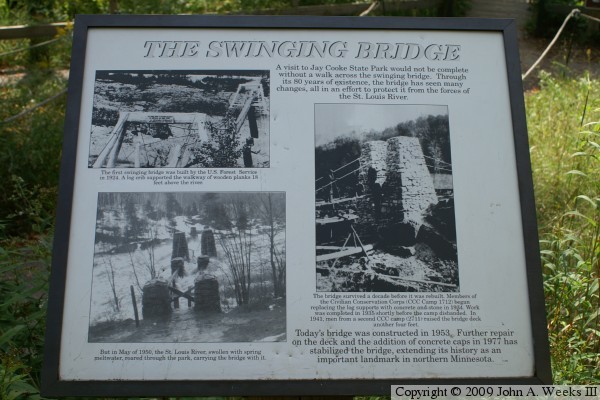
The US Forest Service built the first facilities at the park, including the
first Swinging Bridge in 1924. This structure featured piers built on wood
cribs, and used large timber A-frames to support the suspension cable. The
bridge was at the same location as the current bridge, but was only 18 feet
above the water.
The Civilian Conservation Corps, one of the depression era recovery agencies,
established a camp at the park in 1933 and continued to develop the
facilities. They rebuilt the abutments and bridge towers with concrete and
stone in 1934. A follow-on CCC camp further modified the bridge, raising it
four feet in 1941. This bridge lasted until May of 1950, when it was washed
out by an unusually high spring flood.
The Swinging Bridge featured here was built in 1953, using the 1934 stone and
concrete bridge abutments and towers. The new bridge was an additional two
feet higher, putting it 24 feet above the normal river level. The bridge has
since been modified several times, notably in 1977 when the concrete caps
were built on top of the bridge towers.
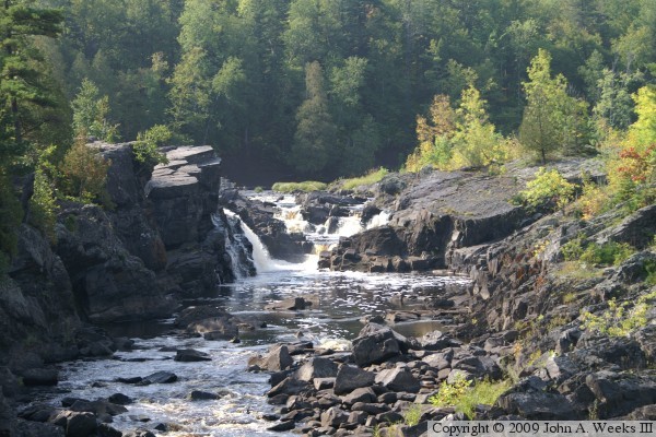
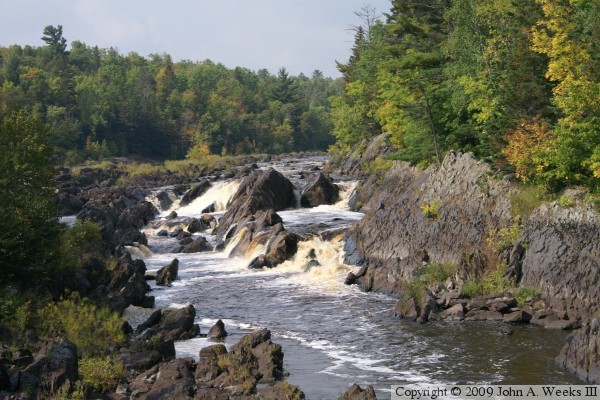
As the photos below suggest, the Swinging Bridge offers spectacular views of
the Saint Louis River as it flows down the rock cascades on the bluffs along
Lake Superior, falling some 577 feet between Dunlap Island in Cloquet and
Saint Louis Bay. There are a number of locations in Jay Cooke State Park
to see the river cascades, but most visitors to the park generally start at
the Swinging Bridge. Note that any use of park facilities requires the
purchase of a state park sticker. A $5 day pass is available at the park
headquarters building at the head of the trail leading to the Swinging Bridge.
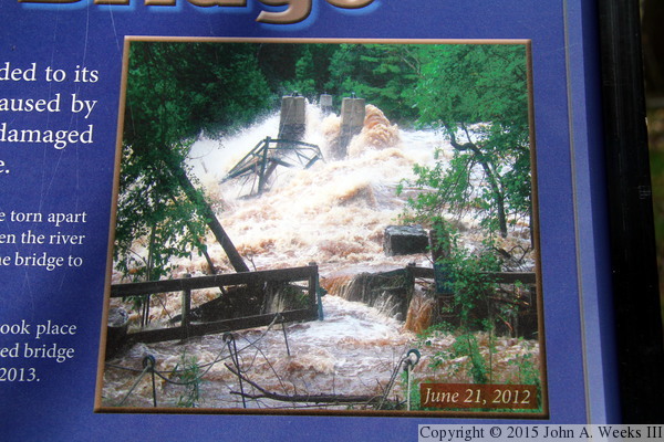
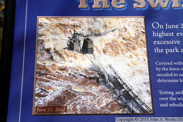
Disaster struck the Duluth area in late June, 2012. A week of rain saturated
the ground. Then a slow moving storm stalled over the Twin Ports area and
dumped in excess of 11 inches of rain on the evening of June 19, 2012 and
June 20, 2012. The ground could not absorb any more water, so it ran off
into rivers and streams very quickly creating a flash flood of historic
proportions. The Thomson Dam overtopped sending flood waters into the
city of Thomson, severely damaging the Munger Trail, and causing serious
damage to Jay Cooke State Park. The Forbay Canal failed causing the
Saint Louis River to carve a new river channel through the park just
below the Visitor Center. Once the hydro project was shut down, the
flood water was diverted into the main river channel causing it to rise
to its highest level in recorded history. The water was 5 feet over the
top of the Swinging Bridge. While the main span held, the deck was
mostly gone, the rock towers were damaged, and the approach span was
mangled. The bridge was a total loss. It was replaced with a new structure
using the repaired rock towers, opening on November 1, 2013.
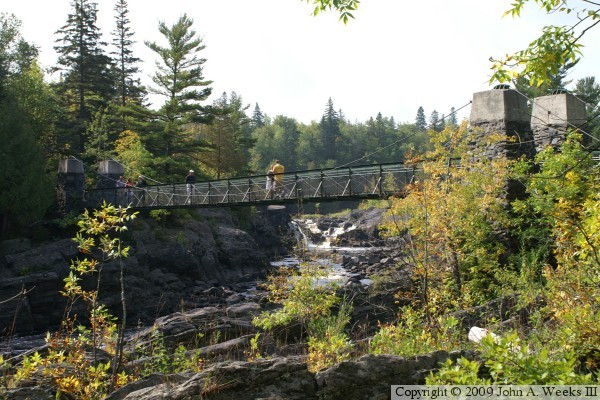
The photo above is looking upstream to the southwest towards the east face
of the Swinging Bridge from the north bank of the Saint Louis River. The
photo below is looking northeast towards the upstream west face of the
structure. The bright summer sun is lighting up the north side of the
river, leaving the south side in a dark shadow.
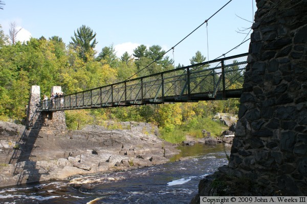
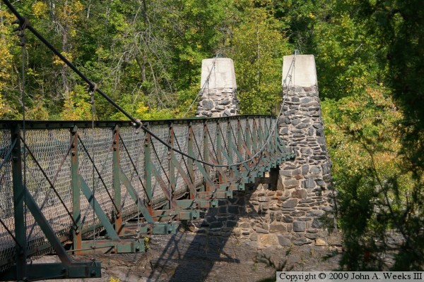
These two photos are looking north along the outside of the east face of the
Swinging Bridge. The photo above is showing the entire span, while the photo
below is a little closer view of the bridge abutment and towers on the north
side of the river.
These two photos are views looking upstream from the bridge deck. The photo
above is the southern of two channels that converge just upstream of the
bridge, while the photo below is the northern channel.
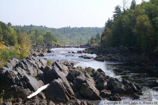
The photo above is looking downstream to the east from the bridge deck. The
river is at elevation 895 at this location, meaning that it has already
dropped 284 feet from the average water level at Dunlap Island in Cloquet,
but still has 293 feet to fall before reaching the level of Lake Superior.
That makes this the halfway point of the cascade down the bluffs. The photo
below is looking south down the length of the bridge deck.
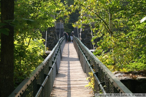
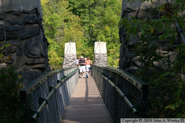
The photo above, and the three that follow show a typical crossing walking
north across the bridge. The photo above is the south bridge portal, showing
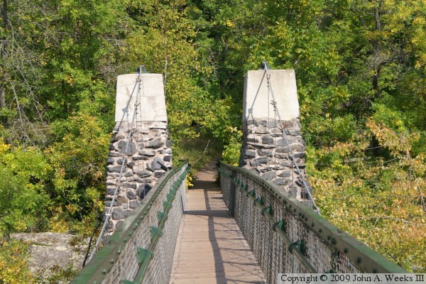
the bridge towers and the cable anchors. The photo below is looking north
between the south bridge towers down the length of the bridge deck.
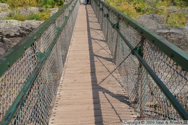
The photo above is a view of the north bridge towers as seen from mid-span.
The photo below is a close view of the wooden bridge deck and the bridge
railings.
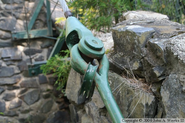
The photo above is a close view of the cable attachment at the southwest
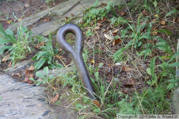
corner of the bridge. The photo below is an old anchor rod that is not
currently in use. This might be from an older set of cables that have since
been replaced, or it might be from a previous swinging bridge.
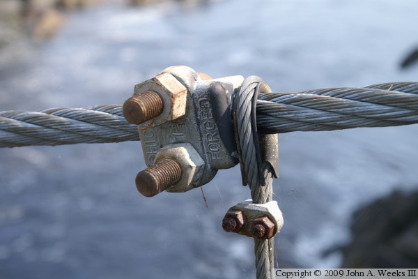
The photo above is a detail view of the cable attachment for one of the
vertical suspension cables. The cable is simply looped over the main
bridge suspension cable, and then a retainer is bolted to the main
suspension cable to keep the vertical cable from sliding out of place.
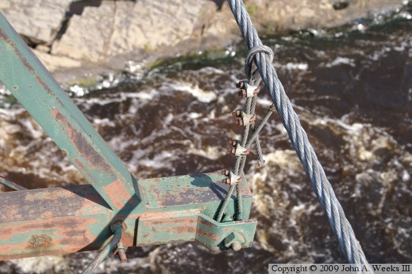
The photo below is a vertical cable near the center of the bridge. It
doesn't have a retainer due to the main cable being nearly horizontal at
this location.
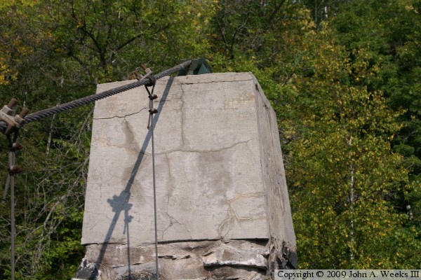
The photo above is the northwest bridge tower where the main suspension
cable loops over the tower and connects to an anchor rod on the far side
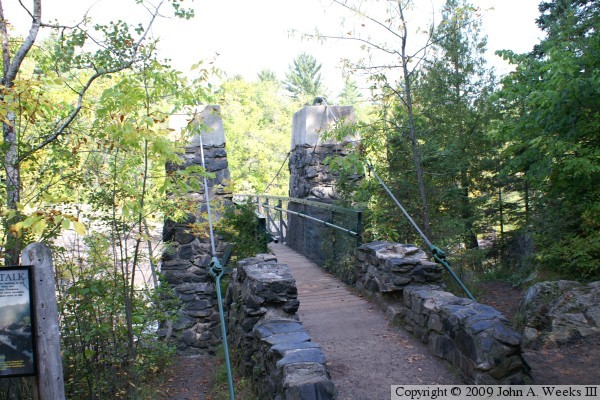
of the tower. The photo below is a guide sign located on the north side
of the Saint Louis River on the trail leading to the bridge.
These two photos are of an interpretative sign posted near the site of
the destroyed Swinging Bridge to tell the story of the flood and how it
impacted Jay Cooke State Park. The photo above is looking west across
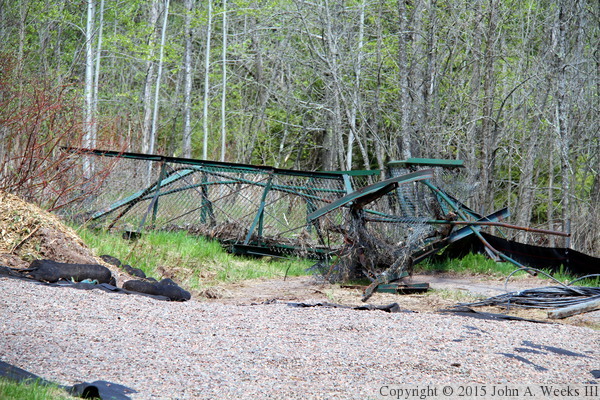
the Saint Louis River channel, while the photo below is view of the east
end of the bridge. The approach span is mangled, but still attached
to the upstream bridge tower.
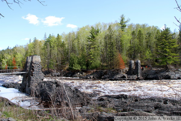
The photo below is looking downstream from the east river bank. The
remains of the main span had been removed when this was taken in June,
2013. Note the rocks missing in the closest bridge tower. These towers
took a tremendous beating from the raging flood water and the debris
that it carried. It is amazing how well they stood up. The photo below
is the remains of the approach span that was on the east end of the
structure. It was mangled but remained attached to a bridge tower.