| Highways, Byways, And Bridge Photography |
Willard Munger Trail Canal Bridge
Saint Louis River Trail Crossing
Thomson, MN
|
• Structure ID: |
N/A |
|
• Location: |
River Mile 28.0 (Approximate) |
|
• River Elevation: |
1,051 Feet |
|
• Trail: |
Willard Munger State Trail |
|
• Bridge Type: |
Steel Pony Plate Girder |
|
• Bridge Length: |
85 Feet, 85 Foot Longest Span |
|
• Bridge Width: |
12 Feet, 1 Track |
|
• Navigation Channel Width: |
Non-Navigable |
|
• Height Above Water: |
5 Feet |
|
• Date Built: |
1907 |
The railroad between Carlton and Duluth was built in the late 1860s by the
Lake Superior & Duluth Railroad. That line passed through Thomson, but
ran along the north and east bank of the Saint Louis River. The Lake
Superior & Duluth Railroad became the Saint Paul & Duluth Railroad
in 1877, and was later purchased by the Northern Pacific Railway in 1900.
The Thomson Dam was built in early 1900s, with the main dam structure being
completed in 1906. At the time the dam was being built, the Northern Pacific
decided to rebuild the Carlton to Duluth segment on an alignment that was a
little further north. The path ran east out of Thomson, past the present day
Spirit Mountain Ski Area, and rejoined the existing line near the present day
Lake Superior Zoo. The new route passed over the Forbay Canal on the east
end of Thomson. The Forbay Canal carries water from the Thomson Dam Gate
House to an intake structure 2 miles east of town. From there, the water
flowed another mile down the bluffs through large penstock pipes and into
the Thomson Power House before exiting back into the Saint Louis River.
The Carlton to Duluth rail line was abandoned shortly after the Northern
Pacific became part of the Burlington Northern Railroad in 1970. The rail
line was acquired by the state of Minnesota, and the Department of Natural
Resources converted the right-of-way to the Willard Munger State Trail
in the 1980s and 1990s. The Willard Munger State Trail runs from Hinkley
to Duluth, connecting to many other trails along the way. It is reported
to be one of the longest paved bicycle trails in the nation.
The Willard Munger State Trail is named after Willard M. Munger, Sr., one
of the longest serving members of the Minnesota House of Representations.
He served from 1955 to 1965, when he left office to unsuccessfully run for US
Senate. Munger returned to the House in 1967, and served until his death
in July of 1999. Munger was known as a very strong environmentalist. He
almost single handedly lead the effort to clean up the Saint Louis River,
which was little more than an industrial sewer by the 1960s. His opposition
to Reserve Mining Company dumping taconite tailings into Lake Superior
resulted in Munger's hotel, the Willard Munger Inn, being attacked by thugs
who smashed the coffee shop using sledge hammers. It was only
natural that the state trail along the old Northern Pacific line was named
after Munger, a project that he was able to see completed before he was
struck down by cancer.
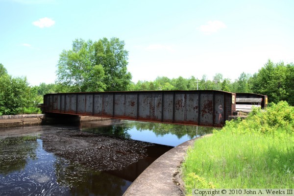
The photo above is a view of the north face of the Willard Munger Train Canal
Bridge as seen from the west bank of the canal just upstream of the bridge.
The canal flows between concrete retaining walls at the bridge site, making
for a convenient way to get close to the edge of the canal for this view.
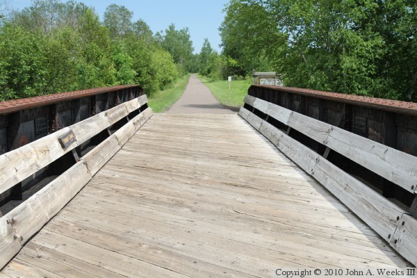
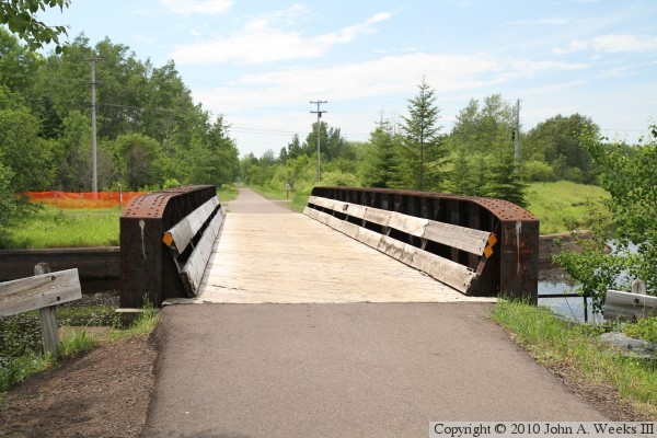
The photo above is looking east down the length of the bridge deck. The
photo below is a similar view looking east from mid-span. The wood deck
and wood side rails were added when the bridge was converted to trail usage.
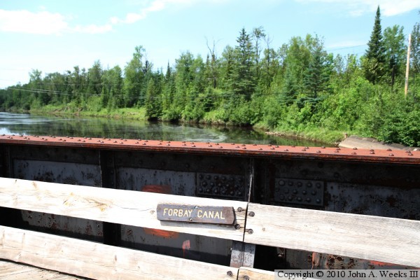
The photo above is a close view of the bridge railing on the upstream north
side of the bridge. The photo below is looking west down the length of the
bridge deck from the east side of the canal. The parking area along highway
MN-210, the nearest to the bridge, is one mile west of the canal. The trail
is level and paved, making for a relatively easy hike.
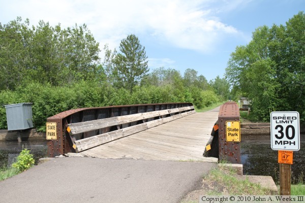
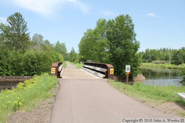
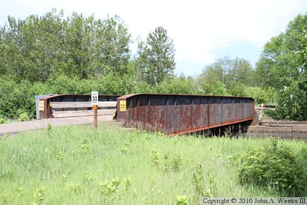
The photo above is a view from the southwest corner of the bridge. The speed
limit sign is for bicycles. The smaller orange sign denotes this trail as
northbound Corridor 47. The sign lists both the MN state Department of
Natural Resources, who manages the trail, and MnUSA, the Minnesota United
Snowmobilers Association. MnUSA started signing trails with designation
numbers similar to the highway numbering system to help promote more long
distance travel by snowmobiles. The photo above is the south side of the
former railroad bridge as seen from the west bank of the canal just downstream
of the structure.
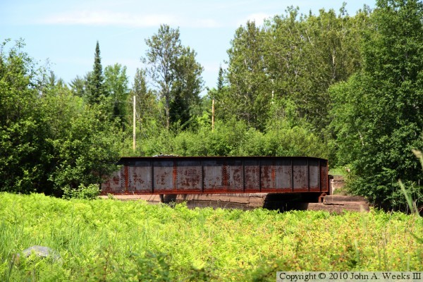
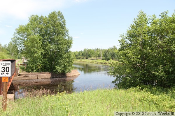
The photo above is looking upstream from the south bank of the Forbay Canal
towards the south face of the canal bridge. The canal makes a 45-degree turn
to the east after passing under the bridge. The photo below is a view looking
towards the southwest corner of the bridge.
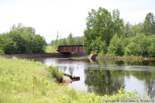
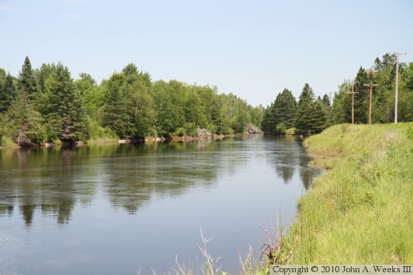
The photo above is looking downstream towards the east from the west end of
the Willard Munger Trail Canal Bridge. This view shows the turn to the
east made by the canal after passing under the bridge. The photo below is
another view looking downstream towards the east along the south bank of
the canal.
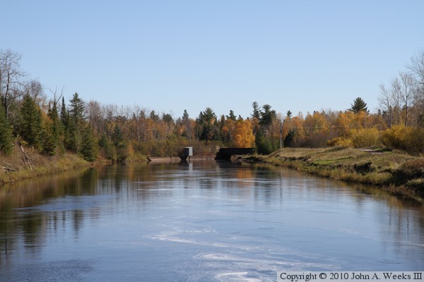
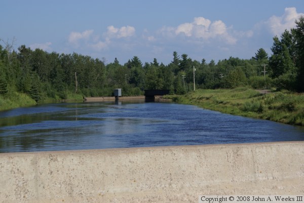
These two photos are looking southeast down the center of the canal towards
the Willard Munger Trail Canal Bridge from the deck of the nearby Thomson
Road Bridge. The photo above is an autumn view, while the photo below is
from mid-summer.
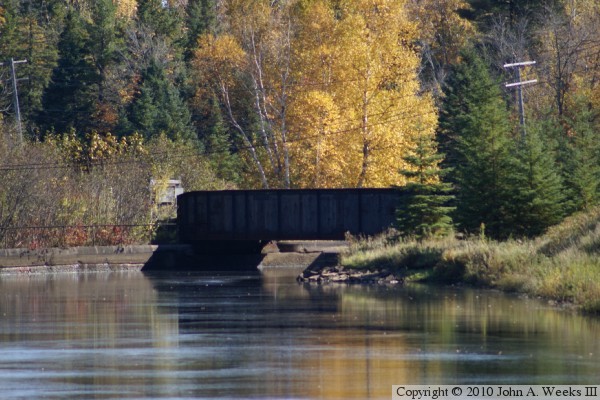
The photo above is a telephoto view of the bridge site as seen from the
Thomson Road Bridge 1,050 feet upstream. The bridge is very dark compared
with the background, so it is hard to see any details without overexposing
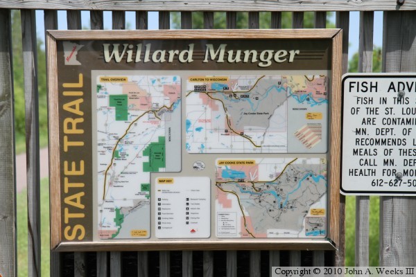
the photo. The photo below is the information sign posted on the Munger
Trail just east of the canal bridge.
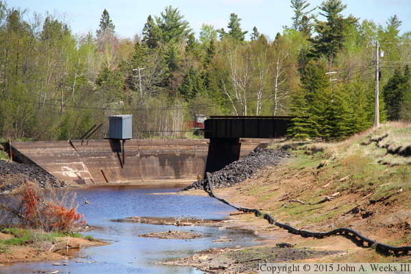
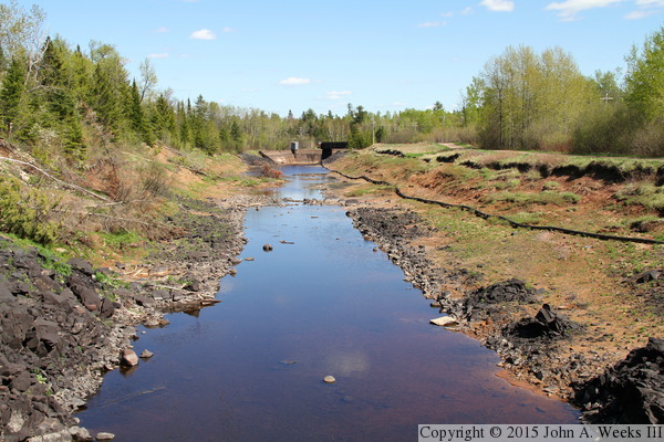
A storm of historic proportions hit the Duluth area on June 19-20, 2012,
dropping 11 inches in some areas. The Thomson Dam overtopped resulting in
a large flow of water to surge down the Forbay Canal, blowing out the
side of the canal and creating a new river channel through Jay Cooke
State Park. The canal was drained and left in a dewatered state as repairs
took over two years to complete. The photo above is the curve in the canal
as it approaches the Munger Canal Bridge, while the photo below is a view
looking towards the canal bridge from the nearby Thomson Road Bridge.
|
