| Highways, Byways, And Bridge Photography |
Willard Munger Trail Bridge
Saint Louis River Trail Crossing
Thomson, MN
|
• Structure ID: |
N/A |
|
• Location: |
River Mile 29.0 |
|
• River Elevation: |
991 Feet |
|
• Trail: |
Willard Munger State Trail |
|
• Bridge Type: |
Steel Through Truss (Pratt Style, Pin-Connected) |
|
• Bridge Length: |
150 Feet (Estimated), 150 Foot Longest Span (Estimated) |
|
• Bridge Width: |
12 Feet (Estimated), 1 Track (Prior To Conversion) |
|
• Navigation Channel Width: |
Non-Navigable |
|
• Height Above Water: |
88 Feet |
|
• Date Built: |
1906 |
This story starts in Sandusky, Ohio, in 1821. How do we get from Ohio in 1821
to this old railroad bridge in 2009? Well, we start by going to Philadelphia.
Financier Jay Cooke was born in Sandusky, Ohio, on August 10, 1821. Cooke's
father was a prominent attorney and a Congressman. Cooke used this wealth
and connections to successfully build a fortune as the Jay Cooke and Company.
Cooke founded a private bank in Philadelphia in 1861. When the Civil War broke
out, he arranged financing for many war projects, including a large loan for
the state of Pennsylvania.
As the Civil War progressed, Cooke became interested in railroads. Cooke
established the Lake Superior & Duluth Railroad in 1863. While
construction was slow during the war, the rail line was completed between
Carlton and Duluth in 1870. The original line ran through Thomson, along
the north and east side of the Saint Louis River, through Fond du Lac, and
into the west end of Duluth.
Cooke became fascinated with Duluth. He had a vision that a northern railroad
would connect Duluth to the Pacific Ocean, allowing cargo to connect through
the Great Lakes to European markets. He saw Duluth as being the next great
American city. He was so sure of this vision that he bet his fortune on the
Northern Pacific Railway. Unfortunately, Cooke was caught short during the
Panic of 1873, and he ended up bankrupt.
The Lake Superior & Duluth Railroad became the Saint Paul & Duluth
Railroad in 1877, eventually connecting the Twin Cities to the Twin Ports
via Hinkley. The Northern Pacific Railway purchased the Saint Paul &
Duluth Railroad in 1900. The steep grade between Thomson and Fond du Lac
was increasingly impractical, so the Northern Pacific Railway rebuilt the
line between Carlton and Duluth a little further north and east, coming
down the bluffs between the current day Spirit Mountain Ski Hill and the
Lake Superior Zoo. This 1906 project coincided with the construction of
the Thomson Dam. The new route ran east and west through Thomson just
south of present day MN-210 and Thomson Road. The rail line crossed the
Saint Louis River about 1,200 feet south of the Thomson Dam using a 150-foot
long steel truss bridge.
Known as the ‘Skally Line’, the Northern Pacific Railway mainline
between Saint Paul and Duluth was an important rail connection. It featured
passenger traffic until 1930. The line did suffer from competition given
the large number of railroad links between the Twin Cities and the Twin Ports.
In fact, at one time, there were 11 different railroads with passenger depots
in Duluth. Traffic declined after World War II. This forced the Great
Northern and Northern Pacific to merge, which they did with the Chicago,
Burlington, and Quincy in 1970 to form the Burlington Northern. The BN had
two lines running from the Twin Cities to Duluth that were almost parallel
for much of that distance, so the Northern Pacific route was abandoned in
the 1970s. The right-of-way between Hinkley and Duluth became the Willard
Munger State Trail.
What happened to Jay Cooke? He had repaid his debts by 1880. He invested
in a silver mine in Utah, which struck it big. Cooke again became very
wealthy. Some people simply have the golden touch. Cooke's legacy here
in Minnesota is the Jay Cooke State Park. Cooke was an avid outdoor sportsman
who lobbied for the creation of national parks. It is fitting that Cooke is
honored by having his name attached to the crown jewel of the Minnesota state
park system.
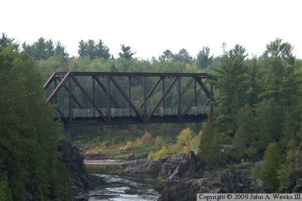
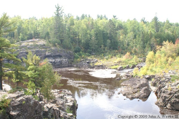
The photo above is looking downstream to the south towards the Willard Munger
Trail Bridge over the Saint Louis River. The vantage point is along a
difficult trail over the rocks along the east bank of the river heading south
from the University of Minnesota Duluth Outpost parking lot and passing under
the highway MN-210 bridge. While the trail is a challenge, the views are
worth the effort.
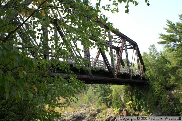
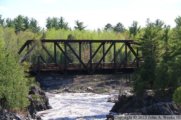
These two photos are views of the north side of the truss structure as seen
from the edge of the cliffs at each end of the bridge. The photo below is
looking west from the east side of the river, while the photo below is
looking east from the west side of the river. The trees make it impossible
to see the entire bridge from these vantage points, and the cliffs make it
dangerous to attempt any more adventurous shots.
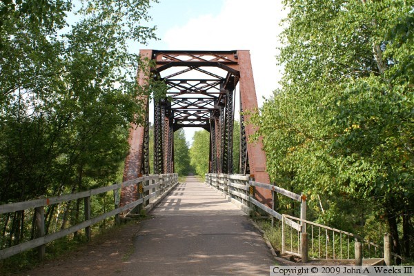
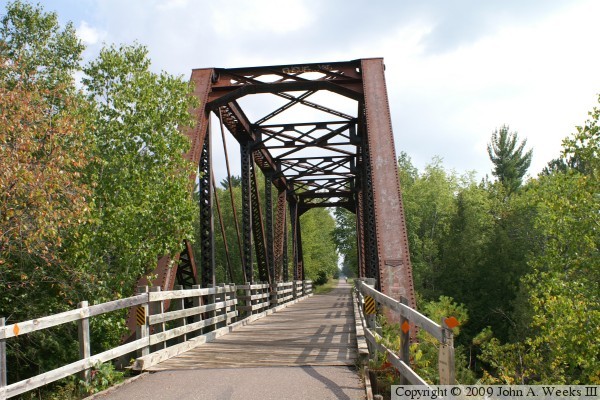
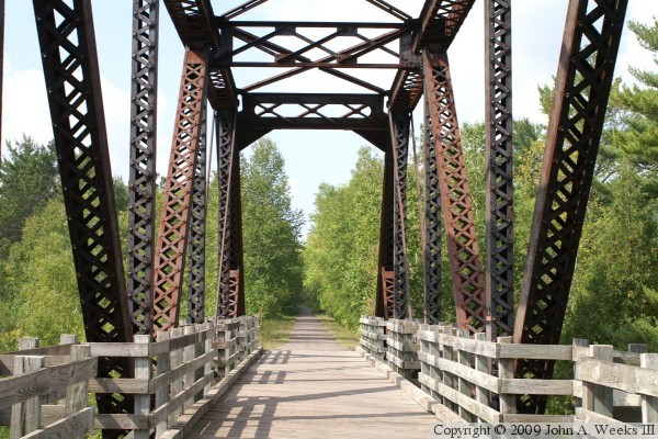
These two photos are views looking down the bridge deck through the bridge
truss structure. The photo above is west down the center of the bridge,
while the photo below is looking east from the west end of the bridge.
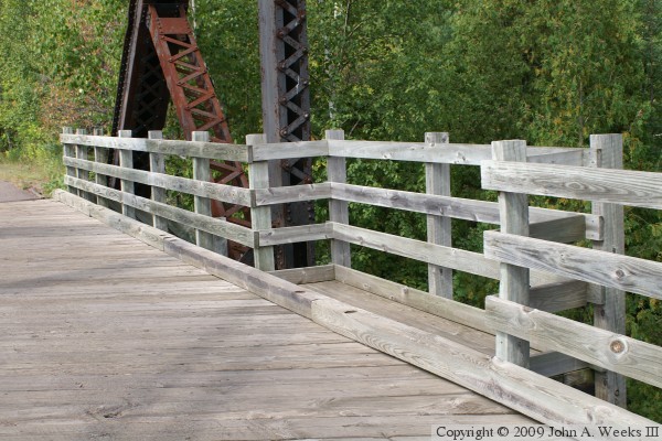
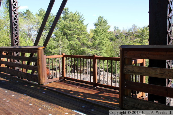
The photo above is looking west down the Willard Munger Trail from midspan
of the truss structure. The wooden deck and railings were added as part of
the conversion from railroad to state trail. The photo below is a closer
view of one of the observation bump-outs on the bridge deck.
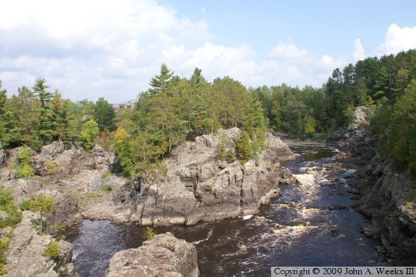
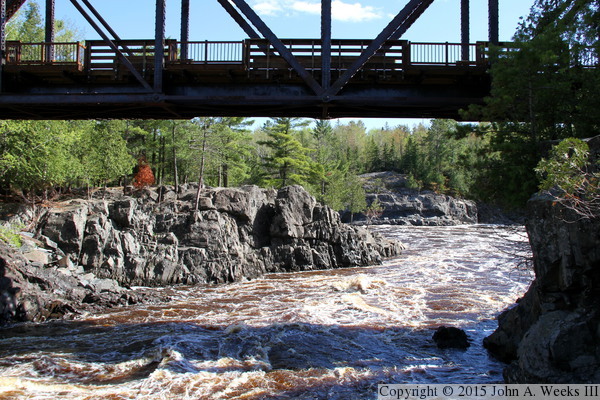
The photo above is looking upstream to the north from the bridge deck.
The river falls 449 feet between the outflow of the Thomson Dam and Lake
Superior, creating a spectacular series of cascades along the way. One
can see the high water marks on the rocks showing where river levels were
prior to much of the Saint Louis River being diverted into the Forbay Canal
and the Thomson Energy Project power house. The photo below is looking
downstream from the bridge deck into the bright mid-day sun.
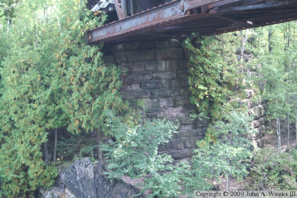
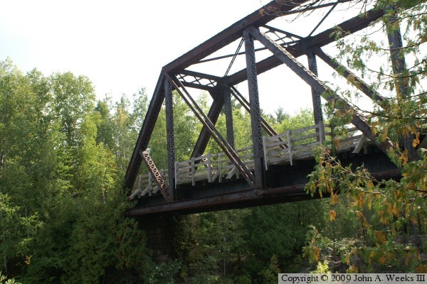
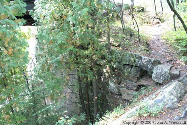
The photo above is the bridge abutment at the east end of the work. The
stonework dates this bridge to a pre-WWII structure. Concrete would have
been used increasingly throughout the 1920s and 1930s. The photo below is
a view of stonework and drainage at the north west corner of the structure.
Trees growing out of the stonework is not good for the long term health of
the structure since it can move the stones and collapse the wall.
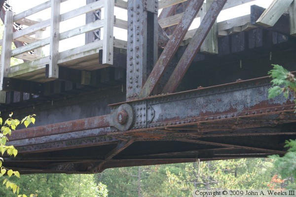
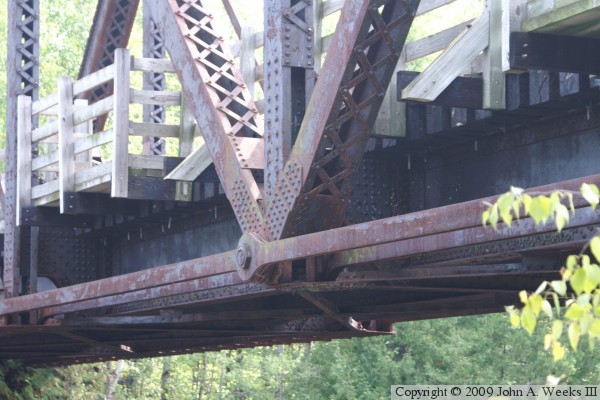
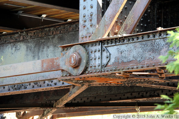
These two photos are details of the steel construction of the bridge truss.
This is a pin-connected bridge, meaning that welds and gusset plates were not
used to join the beams. Rather, the beams are held in place by steel pins
and tie bars. These two photos are examples of two pin connections, the
photo above near the west end of the bridge, and the photo below at the center
of the bridge span.
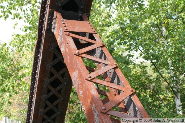
The photo above is an example of a steel beam in the trusswork above the
bridge deck. This style of using crisscross tab joining two paralleled
U-channel members is a classic feature of bridge built around 1900. Steel
was expensive and labor was cheap, so it made for an ideal solution.
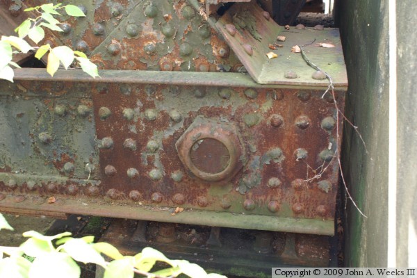
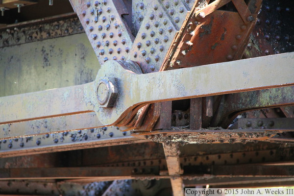
The photo below is a pin connection at the northwest corner of the bridge.
The rivets are used to attach plate-doublers to the steel, increasing the
strength of the beam where the pin goes through the beam. The large nut on
the end of the pin keeps the pin from sliding sideways out of the hole as
the bridge flexes during heat and cool cycles each day.
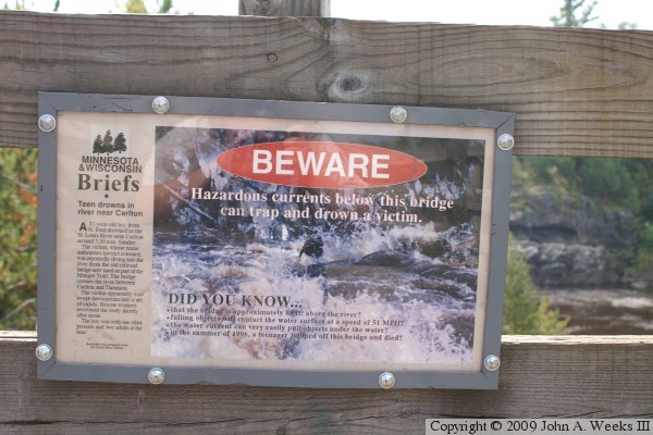
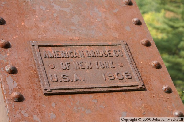
The photo above is a sign warning visitors to beware of the river currents,
which have trapped and drowned a number of people over the years. The photo
below is the bridge plate.
A flash flood of historic proportions hit the Duluth area in June, 2012,
resulting in serious damage to the Thomson Hydro Project. As a result,
the entire flow of the Saint Louis River was diverted down the old
river channel under the Munger Trail Bridge. These views are looking
south towards the upstream side of the structure in the summer of 2013.
The photo above is looking downstream from an overlook on the east bank
of the Saint Louis River. The photo below is taken from the west side of
the river just upstream of the bridge.
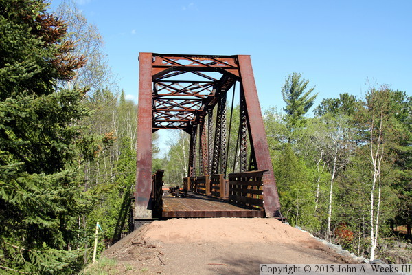
The Munger Trail was heavily damaged in the 2012 flood. There were
washouts, culvert failures, landslides, and places were the pavement
was lifted and moved by the water. Once the landslides were stabilized
and the washouts filled, the trail had to be regraded and paved. At
the same time, the deck and rails were replaced on the Munger Trail
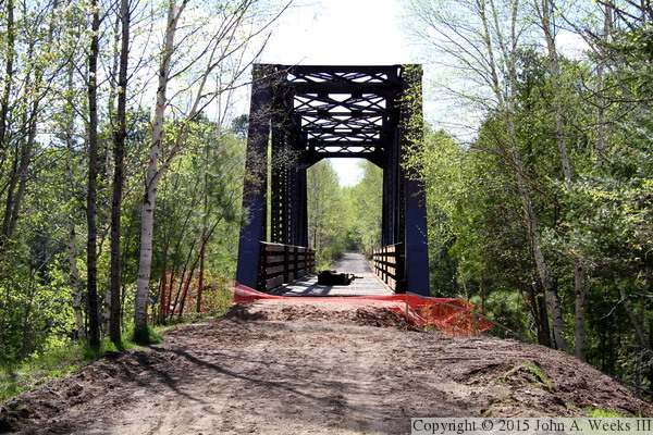
Bridge. The photo above is the east end of the structure, while the
photo below is the west portal.
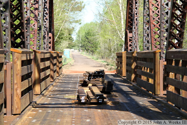
The photo above is the new bridge deck that was installed in 2013.
The photo below shows the new railing, which is much sturdier than
the railing that it replaced.
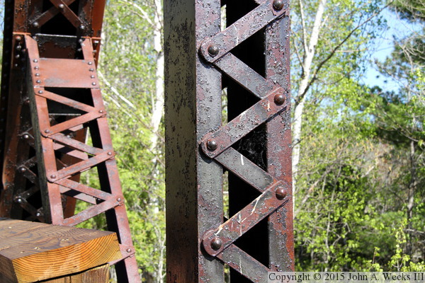
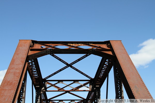
The photo above is a detail view of one of the bridge columns. I am
fascinated at how much work must have gone into building these columns
in this manner with the uncountable number of tabs and rivets that
went into each frame member. This must have been built in an era when
labor was cheaper than materials. The photo below is the steelwork at
the top of the west bridge portal.
While I was under the bridge to get a photo of the river as it heads
downstream beyond the bridge, I decided to get a few shots of the
pin connections. Pin connected bridges were commonly built between 1885
and 1915. They had the benefit of using less material compared to fixed
connections, and they could be erected very quickly (a matter of days
once the falsework was in place). They have two key disadvantages in
that the pin becomes a key failure point and that the pins are
impossible to inspect. These two photos are views of two different
pin connections on the upstream side of the structure.
|
