| Highways, Byways, And Bridge Photography |
Forbay Canal
Saint Louis River Water Project
Thomson, MN
|
• Location: |
River Miles 26 To 29 |
|
• Canal Length: |
2.0 Miles |
|
• Canal Width: |
Varies, 75 Feet To 115 Feet On Average |
|
• River Elevation (Entrance): |
1,051 Feet |
|
• River Elevation (Exit): |
1,050 Feet |
|
• Date Built: |
1907 |
The Forbay Canal is part of the giant Thomson Hydro Project located
between River Miles 24 and 30. The canal was built to move water from
Thomson Reservoir near the top of the bluffs down to the Thomson Power
Plant which is near the bottom of the bluffs. Having the reservoir
dam and the hydro power plant located in two different locations is an
unusual configuration. The advantage is that much more hydro power can
be generated due to the water not losing energy as it cascades down toward
the bottom of the bluffs. The disadvantage is that the spectacular
rapids and waterfalls on the river channel see only a fraction of their
historic water volume.
The canal starts at the southeast corner of the Thomson Reservoir. There
is a head house that blocks the reservoir and contains the valves and
controls that regulate the amount of water flowing into the canal. The
canal is 2 miles long overall. The first 1,500 feet of the canal between
the head house and the Thomson Road Bridge were blasted out of rock. The
next 2000 feet from the road bridge to just past the Munger Trail Bridge
was excavated. The next 3,500 feet followed an old stream bed, while
the final 3,500 feet used the existing Forbay Lake. The canal ends
at an intake building. Here, water from the canal flows through another
set of valves and into three large pipes. The pipes run down the steepest
part of the bluff, ending at the bottom in a pair of large surge tanks.
Water flows from the surge tanks through the power plant and exits back
into the Saint Louis River.
The Thomson Dam pool is at 1,069 feet above sea level. Lake Superior is
at 602 feet above sea level. This leaves a potential drop of 467 feet
for generating hydro power. The canal leaves the reservoir at 1,051
feet and enters the intake at 1,050 feet. The river level is at 680
feet. This means that the actual hydro power realized is from a drop
of 370 feet. The Fond du Lac dam just downstream picks up another 78
feet of the drop, which means that 448 feet of the 467 feet of hydro
potential is used. There are also three more dams upstream of the
Thomson Hydro Project that captures another 79 feet of hydro potential.
The Forbay Canal runs 2 miles, and the water pipes are another mile,
for a total distance of 3 miles. This Saint Louis River channel takes
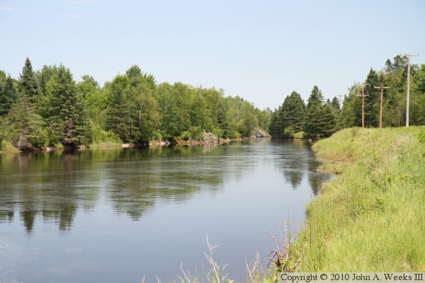
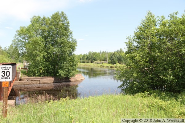
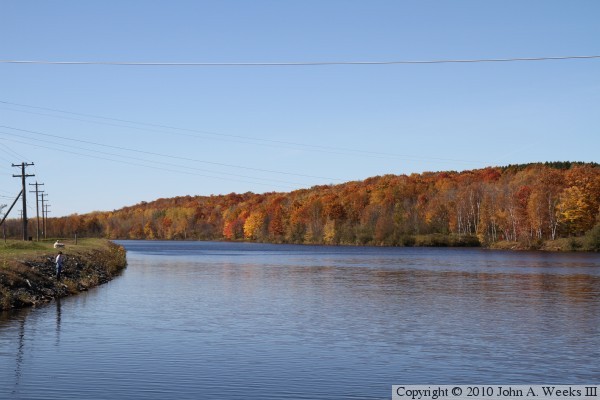
5 miles to cover this same distance. The photo above is a typical section
of the Forbay Canal, located just downstream from the Willard Munger Trail
Canal Bridge, as seen from the south shore of the canal looking northeast.
A storm of historic proportions hit the Duluth area on June 19-20, 2012,
dropping 11 inches of rain in some areas. The Thomson Dam overtopped
causing extensive flooding in the city of Thomson. Large amounts of debris
fouled the gates at the gate house and intake house resulting in extensive
damage to the structures. The power plant flooded causing a need to shut
down the turbines, and the water damaged much of the electrical equipment.
Later, the south wall of the Forbay Canal failed, causing the lake to
drain cutting a new river channel through Jay Cooke State Park. This
resulted in a long section of highway MN-210 washing out. In addition,
MN-210 was washed out near the Fond du Lac Dam and in front of the
Thomson Dam. It took two years of work to bring the first generator
back on line (unit #6), and considerable work remains to be completed
as this update was written in late 2015. A few photos of the flood
aftermath are included below.
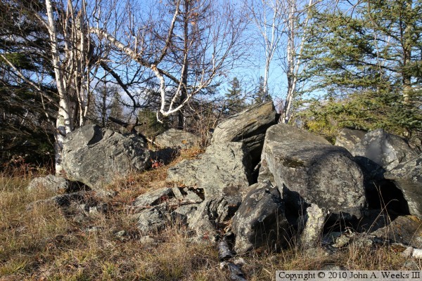
The photo above is a rock pile located on the south side of the canal near
the Thomson Dam Gate House. This section of canal just downstream of the Gate
House was blasted from rock known as slate and greywacke. The rock that was
blasted out of the canal was simply piled up on the south bank of the canal.
The rock formed from mud and sand beds in an ancient sea about 1.9-billion
years ago. The rock was later uplifted causing it to fold and fracture,
resulting in long rock ridges that are exposed at the surface through the
Thomson Reservoir and Jay Cooke State Park area. The photo below is the Gate
House as seen from the reservoir side of the structure.
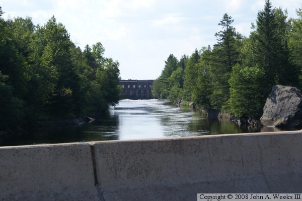
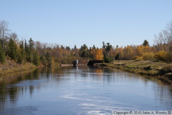
These two photos are views looking upstream towards the Thomson Dam Gate House
from the Thomson Road Bridge. The photo above is from early autumn just as
the trees were turning colors, while the photo below is from summer. The
Gate House is located 1,550 feet northwest of the bridge.
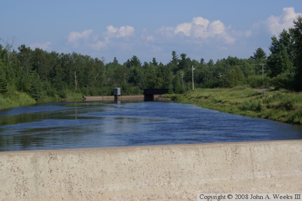
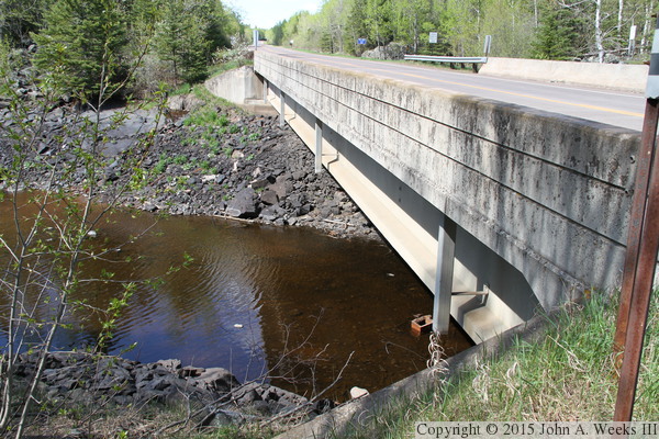
These two photos are looking downstream towards the old railroad bridge that
carries the Munger Trail over the Forbay Canal. The photo above is an
autumn view, while the photo below is from early summer. The bridge is about
1,100 feet from this vantage point.
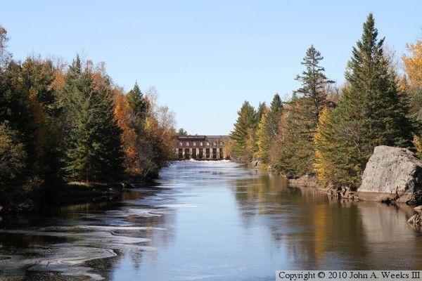
The photo above is looking downstream from the west end of the Munger Trail
bridge over the Forbay Canal as the canal makes a turn to the east. This
is the only significant direction change for the canal. The photo below
is looking upstream from the Thomson Dam Intake at the far east end of the
canal. The canal flows through an old lake at this point, resulting in
the canal being over 400 feet wide in places. That is in contrast to a
spot that is only 28 feet wide less than a mile upstream of this spot.
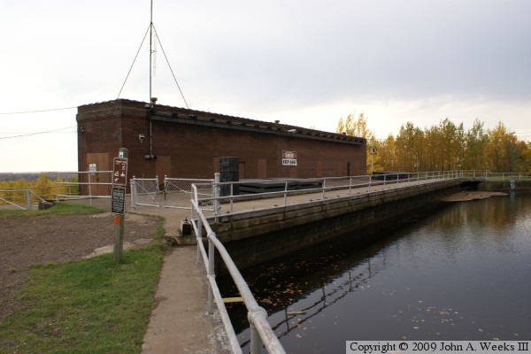
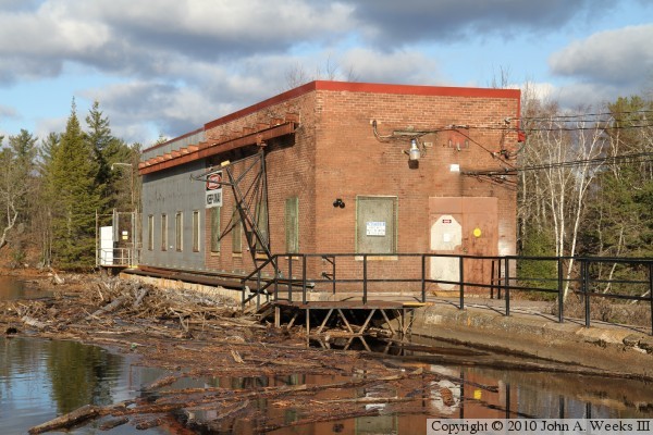
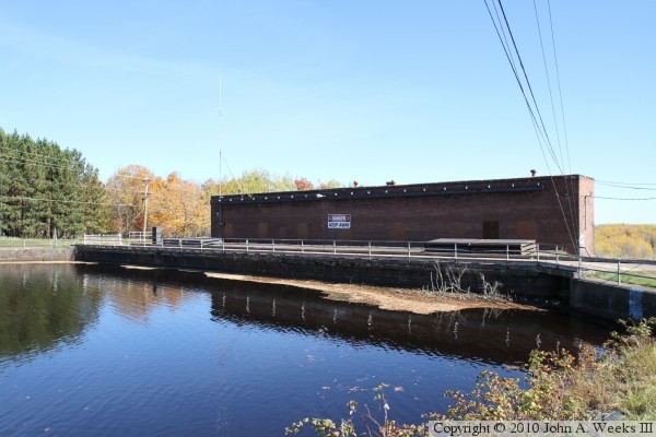
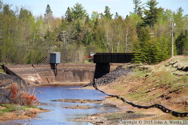
These two photos are views of the upstream side of the Thomson Dam Intake
at the east end of the Forbay Canal. The water flows into large penstock
pipes to carry it down the 370 foot drop into the power plant. The photo
above is the north side of the channel, while the photo below is the south
side of the canal. The Lake Superior Hiking Trail crosses the canal over
this structure and follows the south shore of the canal.
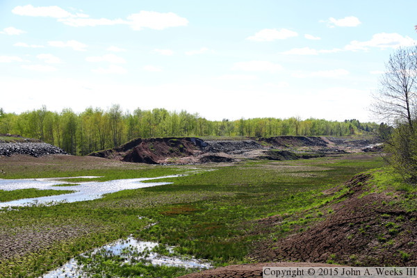
These two photos, and the six that follow, are views of the Forbay Canal
after the 2012 flood. They were taken in the summer of 2013 when repair
work was just starting to get underway (the complexity required design
time and lead time to start the manufacture of custom parts). The photo
above is the downstream side of the gate house (Upper Intake) at the
start of the canal. The photo below is the first half mile of the
canal between the gate house and Thomson Road.
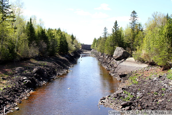
The photo above is the nearly dry canal as it passes under the Thomson
Road Bridge. The photo below is looking downstream from the Thomson
Road Bridge towards the Munger Canal Bridge.
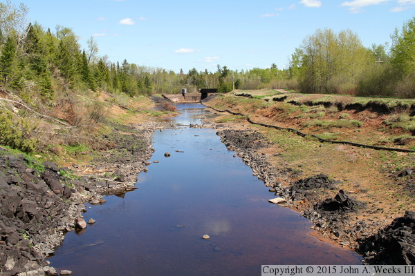
The photo above is the canal as it makes a turn towards the east with the
Munger Canal Bridge in the background. The pipe on the right side of the
canal is a telecommunications cable that runs from the dam structure
down to the control room in the power plant. The photo below is the
blowout in the south bank of the canal. There are several landslides on
the far side of the canal wall, plus a smaller breach just upstream of
the main breach.
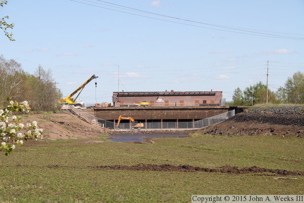
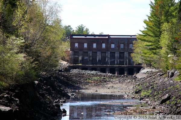
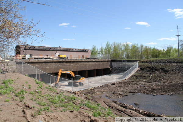
These two photos are views of the Intake house (Lower Intake). The photo
above is looking downstream from inside the canal. The photo below is
a view from the north bank of the canal. Crews had to get heavy equipment
into the lower level to remove debris, and then the gate valves had to
be replaced due to damage from the debris.
|
