| Highways, Byways, And Bridge Photography |
John A. Blatnik Bridge
I-535 Saint Louis River Highway Crossing
Duluth, MN
|
• Structure ID: |
NBI 9030 |
|
• Location: |
River Mile 5.5 |
|
• River Elevation: |
602 Feet |
|
• Highways: |
I-535, US-53 |
|
• Daily Traffic Count: |
28,000 (2004) |
|
• Bridge Type: |
Steel Truss Arch Suspended Deck |
|
• Bridge Length: |
7,980 Feet, 575 Foot Longest Span (Estimated) |
|
• Bridge Width: |
59 Feet, 4 Lanes |
|
• Navigation Channel Width: |
480 Feet |
|
• Height Above Water: |
123 Feet |
|
• Date Built: |
Opened December 2, 1961, Reconstructed 1993 |
The I-535 High Bridge opened to traffic on December 2, 1961, replacing
the Interstate Bridge. At just shy of 8,000 feet, this was the longest
bridge in Minnesota when it opened. If you include the overland approaches,
the overall bridge length is 10,775 feet. The bridge has since been renamed
after John A. Blatnik, a champion of the High Bridge project.
A need for a new Duluth harbor crossing was seen as early as 1930. Local
officials lobbied for a new bridge. Another concept that was put forward
was a plan for a tunnel under the harbor, much like the I-10 George Wallace
Tunnel in Mobile, Alabama. Between the depression and World War II, these
proposals remained unfunded. The bridge issue surfaced again in the
mid-1950s. This time, money was available though the Interstate Highway
program. The route was designated I-535. Construction began in the late
1950s, with a grand opening in late 1961. The Interstate Bridge, located
below and slightly east of the High Bridge, closed within a year of the
opening of the new I-535 High Bridge.
The bridge was officially named after John A. Blatnik on September 24, 1971.
Blatnik was born on the Iron Range. He served as state Senator from 1940
to 1944 and also served in the US Army Air Force. After WWII, Blatnik
served in the US House of Representatives from 1947 to 1975. Blatnik also
was a champion of the Saint Lawrence Seaway project.
Major reconstruction of the Blatnik bridge occurred in 1992 and 1993. The
bulk of the work was to widen the bridges to add room to the shoulders, and to
install a center divider. There was also a three year project to paint
the bridge from end to end.
While Minnesota has one entry in the National Bridge Inventory for the
Blatnik Bridge, Wisconsin maintains 5 entries as follows:
NBI #B16000500050000, 2,241 Feet, Girder Span, Crosses WI-35.
NBI #B16000500020000, 697 Feet, Girder Span, Crosses Howards Pocket.
NBI #B16000500030000, 1,884 Feet, Girder Span, Crosses Soo Line Railroad.
NBI #B16000500010000, 1,140 Feet, Arch Span, Crosses Saint Louis Bay.
NBI #B16000500040000, 2,022 Feet, Girder Span, Crosses Garfield Ave.
If you add up these spans, you get 10,225 feet. This is 2,245 feet longer
than what Minnesota reports in their NBI entry. Minnesota apparently does
not count the bridge sections that cross WI-35 on the Superior end of the
bridge. It is also possible that Minnesota recognizes a different northern
endpoint for the bridge. As evidence, a photo below shows that there is
landfill between the Blatnik Bridge and the Garfield Avenue Bridge. If
Wisconsin considers the Garfield Avenue interchange to be part of the
Blatnik Bridge, that could account for the 2,245 foot discrepancy.
In early 2008, the Minnesota state Department of Transportation started a
program to inspect and audit all truss bridges in Minnesota. On
May 6, 2008, MN-DOT announced that they discovered that structural load
calculations had not been run on the Blatnik bridge when it was modified
in the early 1990s. They were concerned that the bridge might be unsafe
given that a similar situation lead to the collapse of the I-35W bridge in
Minneapolis. Once these calculations were completed, it was discovered that
16 critical gusset plates did not have a sufficient safety margin when
the extra weight of the additional two inch depth of concrete was added to the
bridge deck. As a result, two lanes of the bridge were closed, and remained
closed until the bridge could be repaired. It turns out that the fix was
relatively straight forward. The biggest trick would be rigging the access
and bringing in equipment to locations so high over the water. In all, 16
gusset plates were strengthened by adding angle iron strengtheners or plate
doublers. The project was completed later that summer.
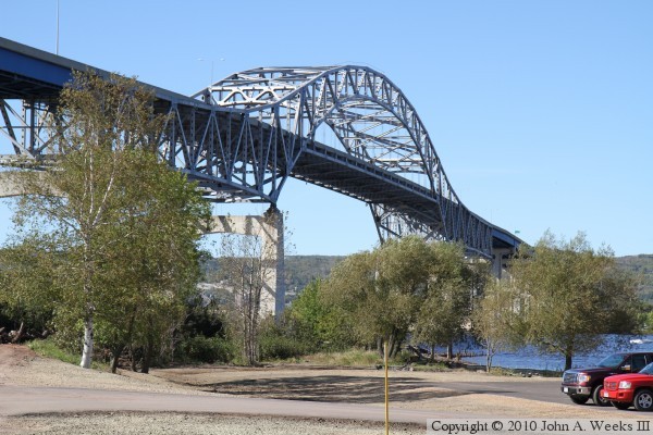
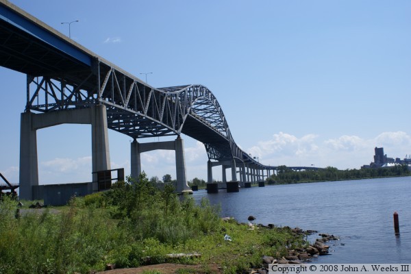
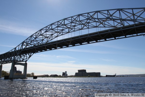
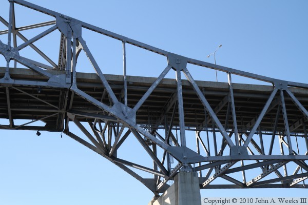
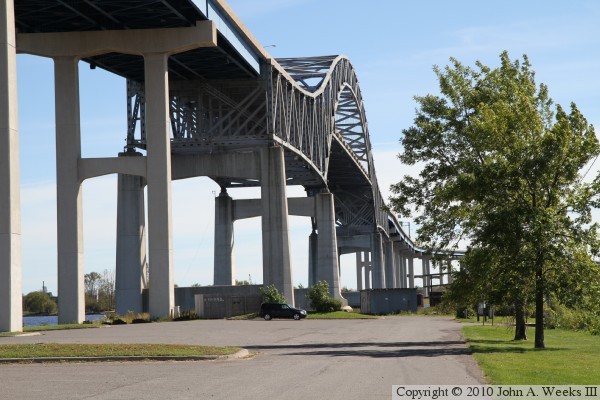
The photo above is the east face of the main truss span of the Blatnik Bridge
as seen from the north end of Connor's Point in Superior, Wisconsin. The tip
of Connor's Point is posted for No Trespassing, so it wasn't possible to get
to the northern tip of the island. If you look closely between the vehicles
and the yellow post, you can see a line of pilings leading into the water
just under one of the trees. Those are the remains of the southern end of
the Interstate Bridge, which once carried trains and traffic across a swing
bridge between Duluth and Superior.
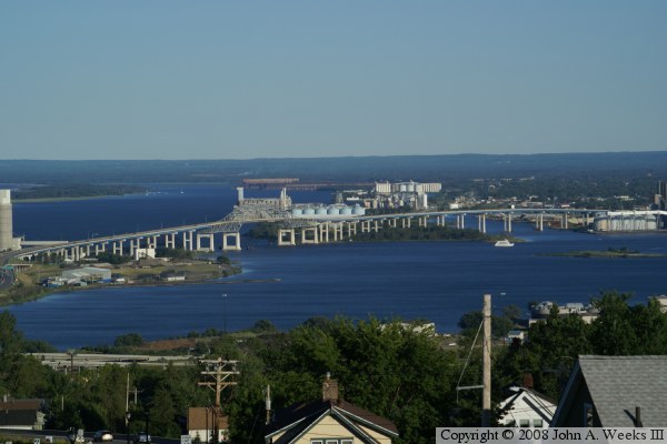
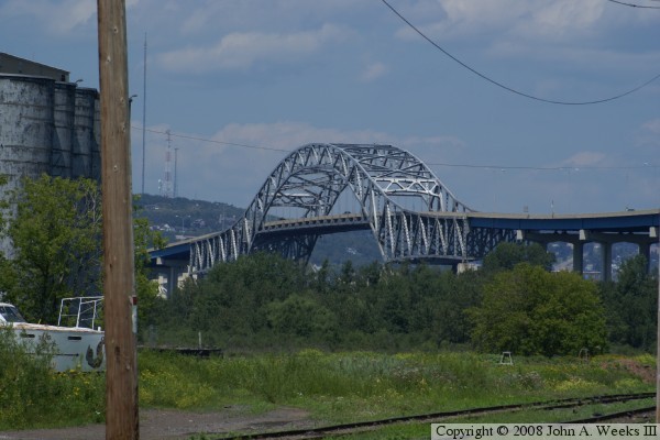
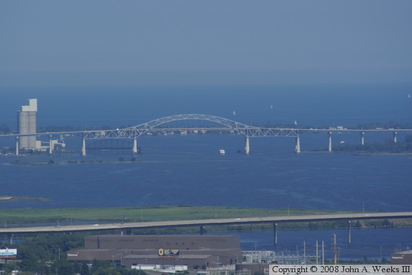
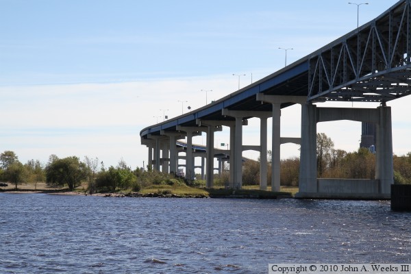
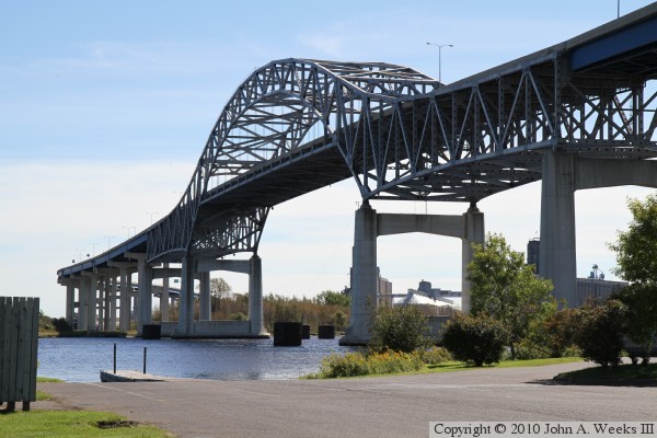
These two photos are views of the Blatnik Bridge taken from an overpass on
US-53 high up on Miller Hill. The photo above is a close-up view of the main
truss span, while the photo below is an overview of the entire bridge.
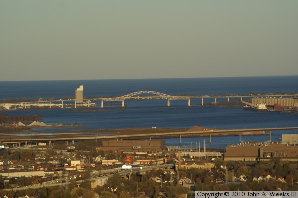
These two photos are views from the Thompson Hill rest area on I-35, 5-1/4
miles west of the bridge site. These are late evening photos taken in
low light just as the sun was setting behind the bluffs. While shadows
were already creeping across the city, the bridge structure was still
lit up with the last rays of sunlight before darkness.
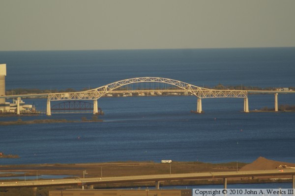
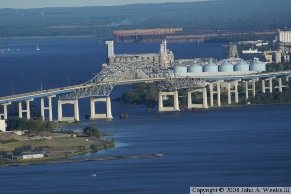
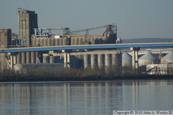
The photo above is looking north towards Duluth from the Harvest States
grain elevator. It is amazing that there are relatively few locations
to get a good unobstructed view of such a large structure. The photo
below shows the Blatnik Bridge looking southbound from the Garfield
Avenue exit ramp.
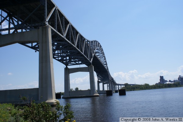
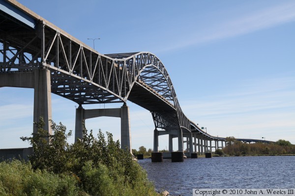
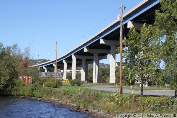
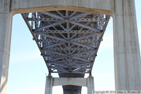
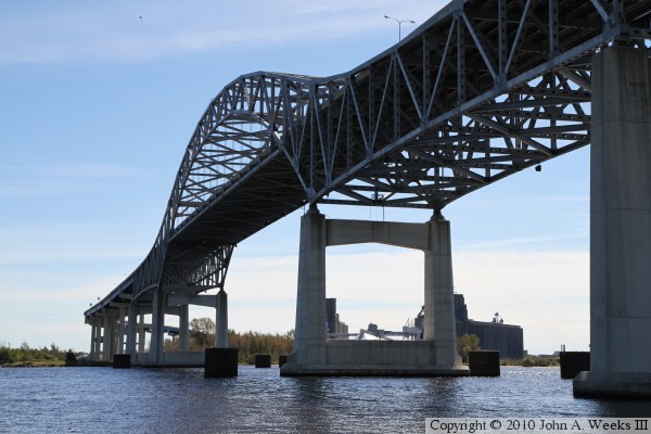
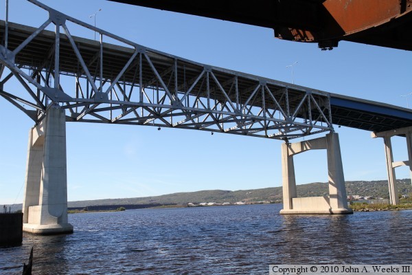
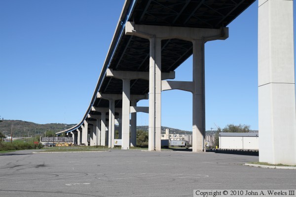
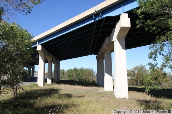
Two views of the main span from slightly different angles. These photos
were taken from the DNR boat launch parking lot that sits directly under
the north end of the structure. Notice that the truss section not only
includes the main arch, but that the truss also extends back one span on
each side of the main span. This is in contrast to the more modern Bong
Bridge just upstream where the arch structure only covers the main span.
Also notice the horizontal lines in the concrete on the piers. It appears
that the piers may be made out of segments that were precast and installed
in this location as part of assembly. Using such a strategy would have
vastly shortened the time required to build the bridge.
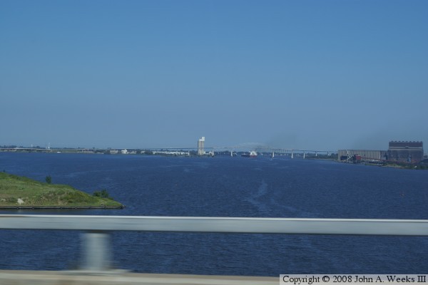
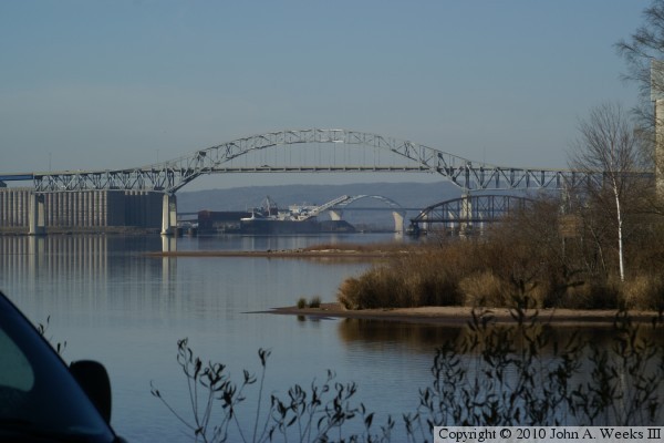
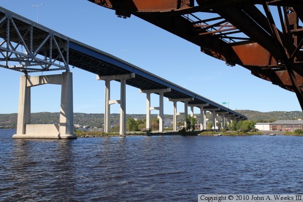
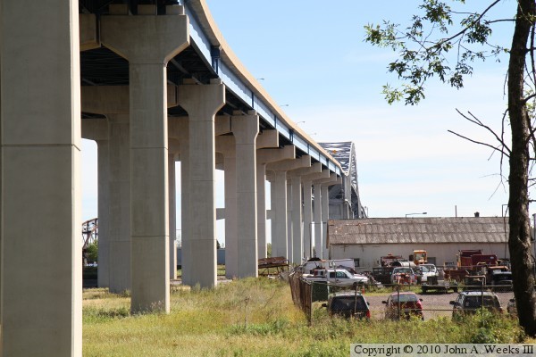
Here are two photos taken from a distance, each showing a large portion
of the bridge. The above photo was taken from the Bong Bridge by pointing
a camera out of the passenger window of my truck. One can see a large
ship passing under the main span. The large Harvest States elevator
complex is on the right side of the photo. The photo below was shot
from Thompson's Hill near the I-35 Rest Stop.
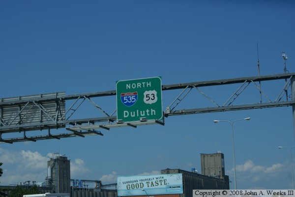
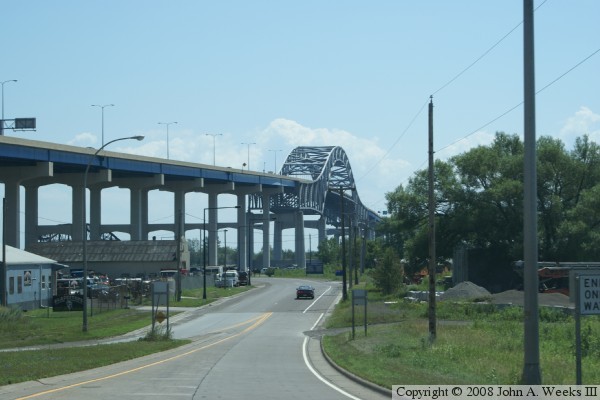
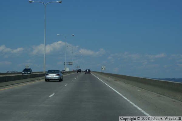
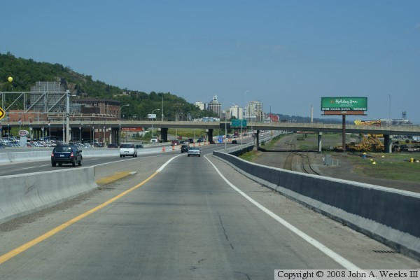
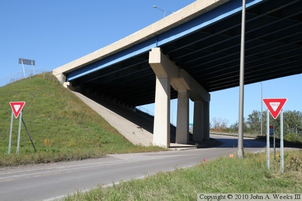
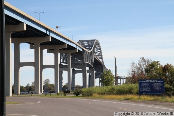
The remaining photos are of a typical crossing from Superior to Duluth.
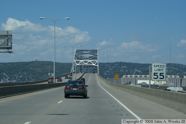
The photo above is the big green sign at the start of the bridge,
indicating the start of Interstate 535. The grain elevator complex
is the Harvest States Cooperative facility. Below is the initial upward
climb from ground level to about the 90 foot level. It feels very much
like the initial climb on a roller coaster. The speed limit is 55 MPH,
which was raised from 45 MPH after the major rebuild in the early 1990s.
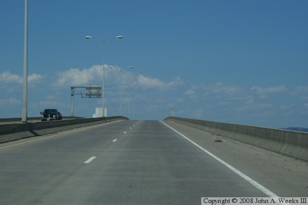
The photo above is reaching the top of initial climb. The photo
below is the causeway turn over Howards Bay. Duluth can be seen
in the background, and Minnesota Point is off to the right.
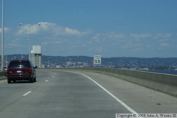
These two photos show the trip across Howard's Bay towards the final
climb to the 125-foot level for them main span. The Cargill grain
elevators are visible to the right of the highway. In addition,
the General Mills elevator is visible in the distance on the photo
below (below the yellow highway sign).
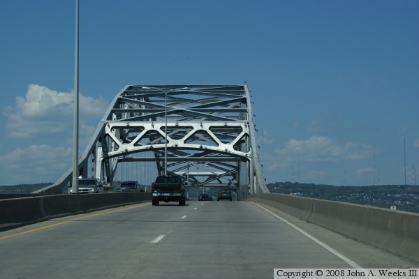
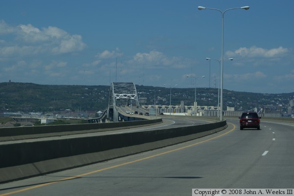
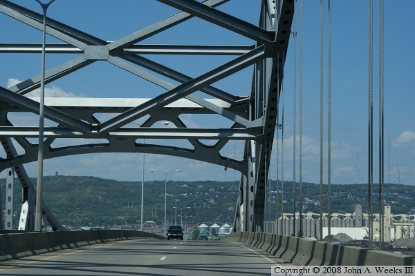
In these two photos, we cross into the main arch section, then pass
through the arch. The suspension cables that holds up the roadway
are clearly visible on the right side of the photos. The cables
are installed in groups of four.
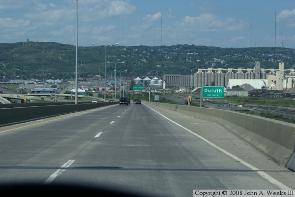
After passing though the arch, we start downhill into Duluth. This gives
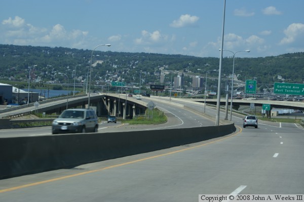
us a better view of the Duluth side of the harbor. The photo below shows
the Garfield Avenue interchange. This is the only exit on I-535, and
it provides access to the Duluth harbor waterfront and to the park under
the Blatnik Bridge. That park includes the surviving section of the old
Interstate Bridge.
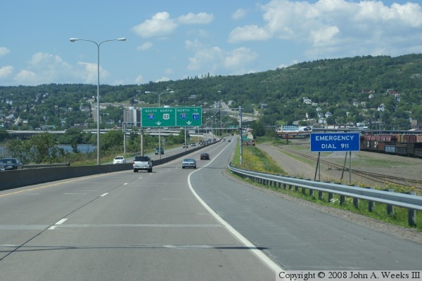
Back on flat land, we are rapidly facing the choice of heading north on
I-35 towards downtown Duluth, south on I-35, or staying on US-53 to
go up Miller Hill towards the mall and airport area on top of the bluffs.
The rail yard to the right is one of the many BNSF rail yards in the Twin
Ports area. The photo below shows the Minnesota state line sign. While
most states use steel signs for the state line, both Minnesota and
Wisconsin put up monuments at the state line.
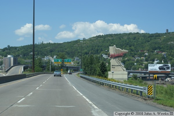
In the photo above, we take the I-35 north option towards downtown Duluth.
Enger Tower can be seen on the top of the bluff. Enger Tower was built
during the depression as a tourist attraction. The base of the tower sits
531 feet above the Lake Superior water level.
The photo below is merging onto I-35 heading northbound. I-35 was put
though in the early and mid-1980s. The section at the far end of the
photo running to Lake Street opened in 1986. The final sections past
downtown opened in the early 1990s. The section in this photo is built
on an old railroad switching yard. The state funded part of the building
of the Pokegama Rail Yard in Superior in order to get the lakefront
land to build I-35.
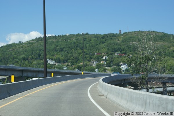
These two photos are looking east towards the Blatnik Bridge on an early
but cold autumn morning. The vantage point is looking between homes on the
west side of Minnesota Point. The photo above is the main bridge truss span
at the entrance to the inner harbor. The remaining span of the Interstate
Bridge is visible on the right side of the navigation channel, while the Bong
Bridge is visible in the distance. The photo below is the steel girder spans
that cross the Howards Bay channel. The Harvest States elevator complex is
located just behind the bridge, while the taller General Mills elevator
complex is located a half mile to the west of the bridge.
These two photos are views from a boat dock located just to the east of the
public boat landing parking area on Rice's Point. The photo above is looking
south along the west face of the Blatnik Bridge, while the photo above is
looking north along the west side of the approach spans.
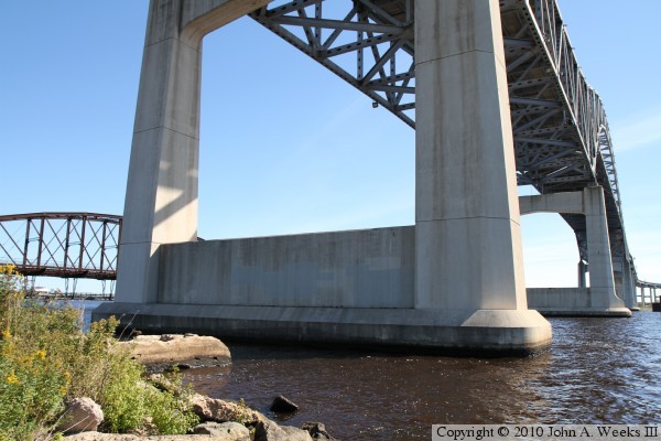
The photo below is the northernmost of the four main span bridge piers. The
segmented construction of the piers is easily visible in this view. The photo
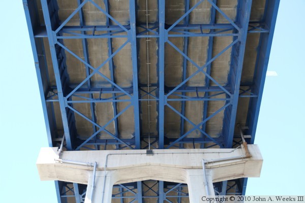
below is looking straight up at the underside of a steel girder bridge span.
The steel girder spans were freshly sand blasted and painted in this view
from the summer of 2010.
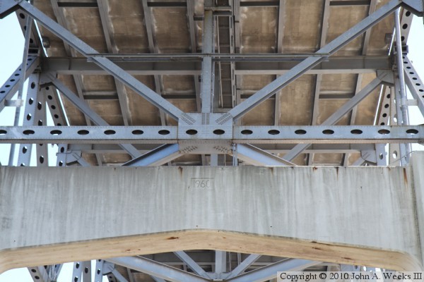
The photo above is looking up at the top of the northernmost main bridge pier.
Note the 1960 date formed in the concrete. The photo below is the underside
of the northern span of the large steel truss section of the bridge.
These two photos, and the five that follow, are views looking west from the
remaining truss span of the Interstate Bridge. The photo above is the main
navigation channel crossing, while the photo below are the steel girder
spans leading to and crossing Howards Bay. Both photos are looking into
the bright midday sun.
The photo above is looking west into the midday sun towards the main span
of the Blatnik Bridge. The photo below is a close view of the northern
transition from the truss span to the arch truss span. Note the gap in the
steel between the two section of the bridge. The entire main arch hangs
from two pin connections at each end of the bridge, with the truss spans at
each end of the bridge acting as a cantilever. Note that some of the gusset
plates are freshly painted. Those plates had extra steel plate doublers
attached in the repairs in 2008.
The photo above is the northern of the three truss spans that comprise the
main navigation channel crossing. The photo below is the approach spans
at the north end of the bridge. The orange steel in the foreground are
remains of the old Interstate Bridge.
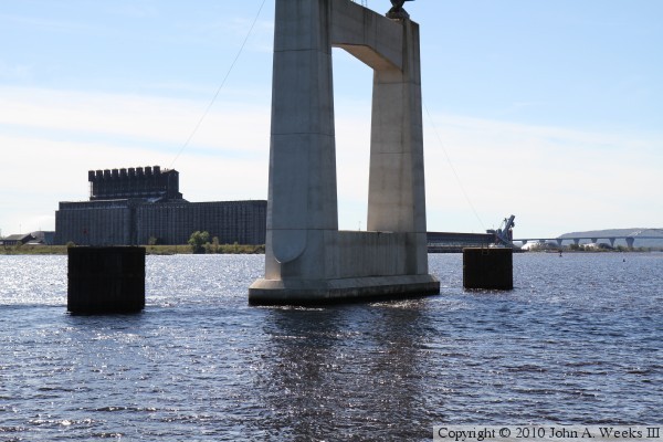
The photo above is the main bridge pier on the north side of the navigation
channel. Note the large steel dolphins that protect this bridge pier. The
need for these dolphins were pointed out after a ship struck and collapsed
the Sunshine Skyway Bridge in Tampa in 1980. The photo below is a marker
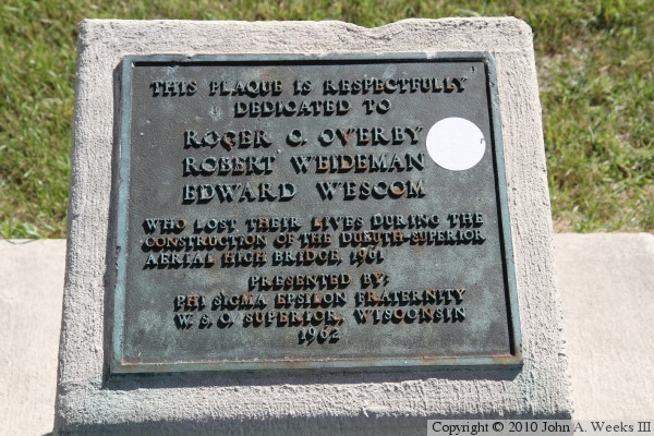
located under the north end of the bridge near the parking area for the public
boat landing.
The photo above is looking south along the east face of the Blatnik Bridge
from the public boat landing at the southern tip of Rice's Point. The
photo below is looking along the west face of the approach spans, also from
the parking area of the public boat landing.
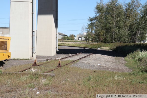
The photo above is the northern bridge abutment. The roadway running under
the bridge is northbound Garfield Avenue, which splits and runs on both sides
of the bridge abutment. The photo below is the third bridge span from the
north abutment. The piers are aligned at an angle in order to run parallel
to the railroad track that once passed under the Blatnik Bridge at this
location. That railroad track was the approach to the Saint Louis Bay Bridge,
a railroad crossing that featured two swing spans.
The photo above is looking south along the west face of the Blatnik Bridge
from the locate of the photo above where the approach track to the old
Saint Louis Bay Bridge once passed under the Blatnik Bridge. The photo
below is where another railroad track passes under the Blatnik Bridge,
located just north of the UPS facility on Rice's Point. This track once
fed a small rail yard on the west side of the point.
These photos are two more views of the west face of the Blatnik Bridge as
seen from the southern tip of Rice's Point. The photo above was taken from
the edge of Garfield Avenue, while the photo below is a view from the entrance
to the boat landing parking lot. I was nearly able to get this photo without
any cars or people in the frame. Unfortunately, some bridge photographer
had to park his blue Chevrolet HHR in the way. That would have been me.
While I wish I had parked my car somewhere else, and I was apparently too lazy
to go move it, it does serve as a good comparison to show just how massive
this structure is.
|
