The McKinley Bridge was originally opened only to rail traffic. It was
built with two tracks running through the superstructure. Auto traffic
was added during the 1930s by hanging a single lane roadway off of each
side of the bridge. Rail traffic slowed down in the 1960s. At that time,
one rail track was removed, and two lanes were installed inside the
bridge superstructure. One lane ended up being shared between vehicle
traffic and trains. Rail traffic ended in 1987. The remaining rail line
was eventually paved over.
With 4 lanes open to traffic, the McKinley bridge became a major river
crossing. It was damaged during the 1993 flood, but opened again a few
weeks later.
Time treated the McKinley Bridge badly. It was never the money maker that
it was intended to be. The City of Venice, Illinois, fell behind on
payments, and debt began to accumulate. The City Of Saint Louis eventually
presented the City of Venice with a bill for back taxes on the Missouri
side of the river crossing. Venice could not pay. The state of Illinois
had pledged money for some critical repairs, but was unable to transfer
that money to the City of Venice with the tax bill hanging over its head.
This was the final straw for the McKinley, and it closed in October 2001.
After sitting idle for a while, an agreement was reached between the two
states and two cities. Work began in 2004 to refurbish the main bridge
into a modern 2 lane highway, and replace the approaches on each end.
Work is progressing, despite a few minor setbacks, and the bridge is now
slated to open in the summer of 2007 as a free bridge. In addition, the
newly rebuilt structure will feature a region trail crossing hung off of
one side of the bridge. The Illinois cities of Granite City, Madison, and
Venice are anxiously awaiting the new bridge to open. They expect the
traffic flow to help revitalize their downtowns, spur development, and
increase the value of their housing stock.
The rebuilt bridge finally opened to pedestrian and bicycle traffic
on November 17, 2007. Automobile traffic followed one month later
starting on December 17, 2007. The bridge is set up with two lane
two-way traffic through the truss spans, a service road on the north
side of the truss spans, and a regional trail on the south side of the
truss spans. A park and regional trail connection has been developed
on the Illinois side of the bridge. The regional trail connection on
the Saint Louis side was still under construction in the summer of 2008.
- Click here to view a bridge crossing from east to west.
- Click here to view a bridge crossing from west to east.
The bridge is named McKinley Bridge after William McKinley. Not the
former President, but rather, the President of the Illinois Electric
Traction Association, the builders of the bridge. The McKinley Bridge
carried the US-66 designation from 1926 to 1928. It was designated
Optional US-66 from 1929 to 1937.
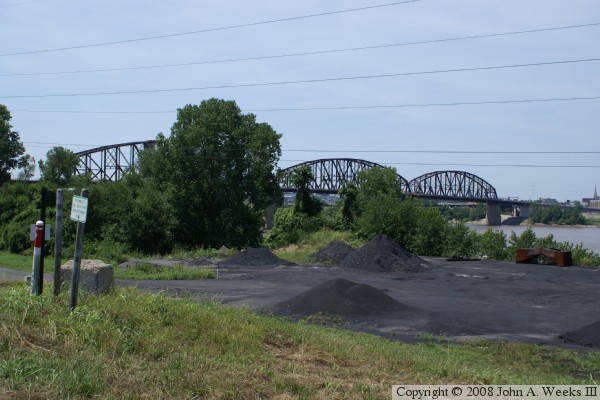
This bridge can be hard to photograph due to a lack of access to the
riverfront on either side of the river. Despite presenting over 50
photographs here, I am still looking to take that definitive profile
shot of the main spans with no obstructions. The photo at the top
shows the view from Saint Louis, with a scrap yard in the way. The
view below is from the Illinois side, where trees line the riverbank.
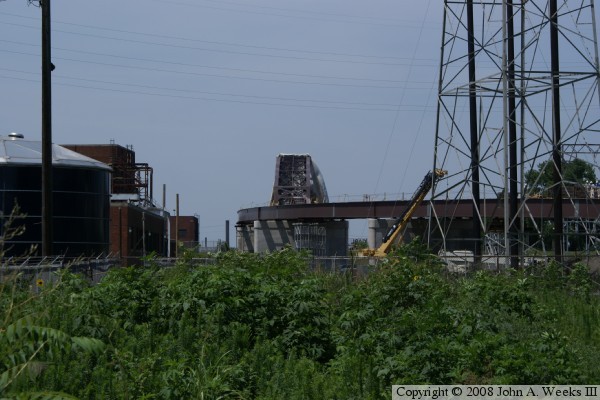
The photo above is a closer view of the main truss span on the Saint Louis
side. The rail line makes a sharp corner and turns south along the river.
The old highway deck curved to the south, then went west over to I-70.
The new highway deck runs straight west from the bridge, directly to I-70.
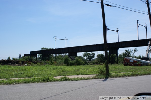
The photo below is is a view of the elevated rail track on the Saint Louis
side of the crossing. The track forms a ramp about a mile long, which
kept the grade to an acceptable level for trains. This was once an
electrified line. The overhead power supports are being maintained in
the conversion to a regional trail for use as sign carriers. Notice
that there are patches on the concrete piers to fix deteriorated support
columns.
The photo above shows the new approach being built on the Illinois side.
The rail line and the automobile ramps were removed, and a modern highway
bridge is being installed to join the bridge to highway 3. The photo below
shows some of the remaining railroad trestle that has not been demolished
yet.
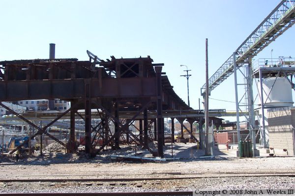
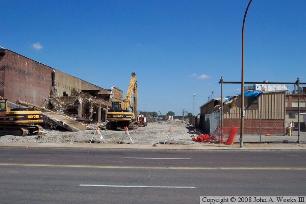
The photo above shows the trestle work where a rail line and the automobile
deck joined up on the Saint Louis side of the bridge. This is located about
three-fourths of a mile from the river. The photo below is a view across
the street where the rail trestle has already been removed. Notice the
damage to the steel building in the foreground, the building with the blue
tarp on the roof. While tearing down the trestle, one of the backhoes
fell from the trestle and landed on this building. No one was hurt, but
the building was not intended to be part of the demolition.
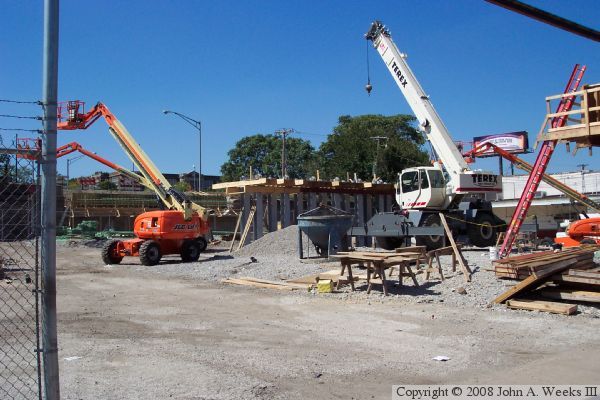
These two photos show piling work underway. The upper photo shows a
relatively short piling in the center of the photo. Workers are putting
wood forms on the top of the piling in preparation for pouring the concrete
pile cap that will support the bridge girders. In the photo below, the
pilings are in the background. They are much taller since this location
is much closer to the bridge.
The photo above is the approach to the bridge on the Illinois side. This
was the location of the toll booths. The concrete was removed and the
roadway was rebuilt on the same grade for the refurbished bridge.
The photo below is a view of the pilings and girders that support the
new bridge on the Saint Louis side just as the automobile deck meets the
new bridge. The structure on the far right is the old rail line that
is being converted into a walking and bicycle trail.
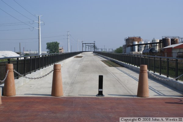
These two photos are a view of the old rail line on the Saint Louis side
of the crossing, which has now been converted into a regional trail.
The old electrical support towers are now being used to hang banners.
This is still a very industrial area. There are rail lines on both
sides of the trail, the river flood wall is just beyond the edge of the
view, and roads into this area are very rough.
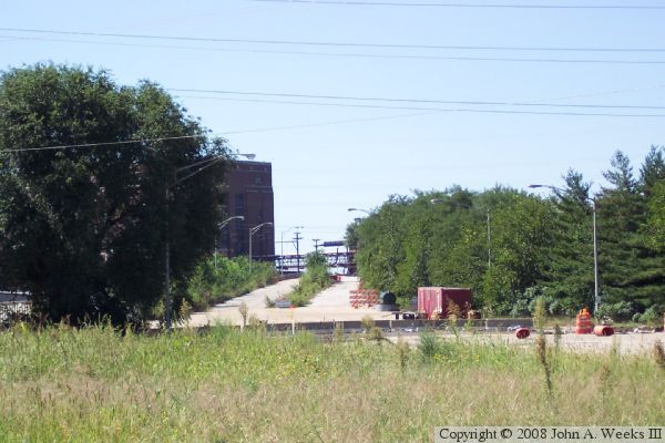
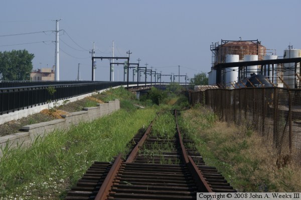
The photo above is looking north up the length of the former rail line
that is now a regional trail. The photo below is a view along the
river side of the old rail line. The construction work is not completed
in this area. There is no parking yet, and there are sections of rail
track scattered and piled up in several areas. I was nervous enough
being in this area during the daytime that I would not suggest being
here after dark. That situation will improve over time as Saint Louis
slowly starts to take back its riverfront.