Current Weather Conditions
John A. Weeks III
Saturday, July 27, 2024, 2:23:12 AM CDT
Home Photo Tours Rail Fan 12 Easy Steps
Aviation Spacecraft Highways & Bridges About The Author
 
Google Search
Maps   Groups   Images   Search
 
  Home
  • 12 Easy Steps
  • Aviation
  • Spacecraft
  • Highways & Bridges
    » Bridge Photography
      - MSP River Bridges
      - C & D Canal
      - Illinois River
      - Minnehaha Creek
      - Minnesota River
      - Mississippi River
        › Lake Itasca Area
        › Bemidji Area
        › Cass Lake - Ball Club
        › Grand Rapids Area
        › Blackberry - Crosby
        › Brainerd Lakes Area
        › Little Falls Area
        › St. Cloud Area
        › North Metro Area
        › Port Of Minneapolis
        › St. Anthony Falls Area
        › Mississippi Rvr Gorge
        › St. Paul Area
        › S St. Paul - Hastings
        › Red Wing - Winona
        › La Crosse Area
        › Lansing - Clinton
        › Quad Cities Area
        › Muscatine - Louisiana
        › St. Louis Area
          · Clark Superbridge
          · Melvin Price L&D
          · Chain Of Rocks Canal
          · New Chain Of Rocks
          · Double Chain Bridge
          · Chain Of Rocks Br
          · Single Chain Bridge
          · Water Intake Houses
          · Dam #27
          · Lock #27
          · Merchants Bridge
          · McKinley Bridge
          · McKinley Br (EB)
          · McKinley Br (WB)
          · Ronald W Reagan Br
          · Martin Luther King
          · Eads Bridge
          · Poplar Street Br
          · Gen D MacArthur Br
          · Jefferson Barracks Br
        › Chester - Cairo
        › Miss - Tenn - Ark
        › Ark - Miss - Louisiana
        › Louisiana Structures
      - Missouri River
      - St. Croix River
      - St. Louis River
      - Wisconsin River
      - Best Miss River Photos
      - Cable Stayed Bridges
      - McGilvray Road Bridges
      - I-35W Bridge Disaster
      - Miscellaneous Bridges
      - Madison County Bridges
      - Hist Br Weekend 2013
    » Road Geek Topics
  • Photo Tours
  • Rail Fan
  • About The Author
 
Site Search By JRank
Highways, Byways, And Bridge Photography
Jefferson Barracks Bridge
I-255 Mississippi River Crossing At Saint Louis
Saint Louis, Missouri

Jefferson Barracks Bridge

Eastbound Span
• Structure ID: NBI 000067001903168 (IL).
• Length: 4,018 Feet Overall, 910 Foot Main Span.
• Width: 51 Feet, 3 Lanes.
• Date Built: Opened July 1990.
 
Westbound Span
• Structure ID: NBI 000067002017321 (IL), 1541 (MO).
• Length: 4,004 Feet Overall, 910 Foot Main Span.
• Width: 51 Feet, 3 Lanes.
• Date Built: Opened September 30, 1983.
 
Statistics Common To Both Spans
• Location: River Mile 168.6.
• River Elevation: 381 Feet.
• Highway: I-255.
• Daily Traffic Count: 27,450 (2003).
• Bridge Type: Steel Arch Suspended Deck.
• Navigation Channel Width: 850 Feet Wide.
• Height Above Water: 88 Feet.
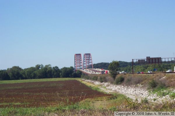
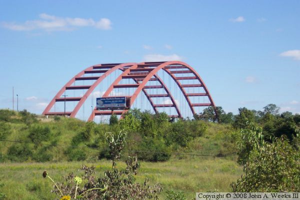
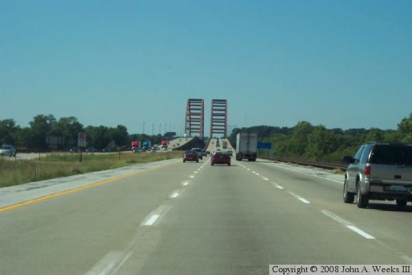
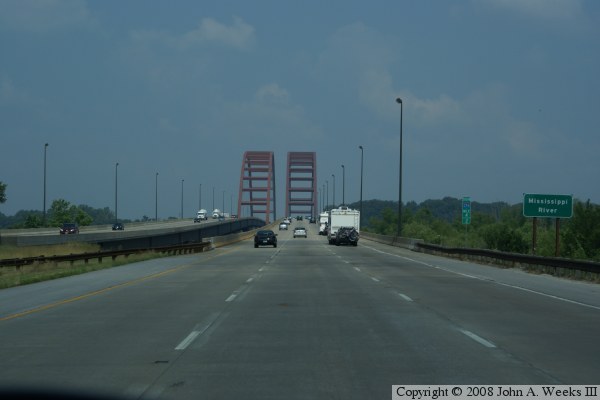
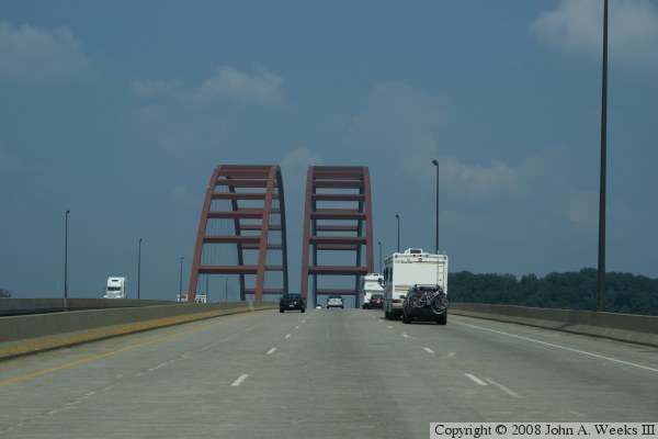
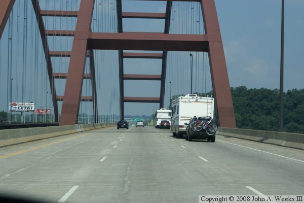
This bridge appears to be the mother of all steel arch bridges. The arches are 910 feet long, and they tower 182 feet above the roadway. There is unfortunately no easy way to get a profile photo of the bridge without trespassing, but these photos still show the huge size of the arches.

US-50 once crossed at this location via a steel truss through deck bridge. The first span of the I-255 bridge was completed in late 1983. The plan was to remove the old US-50 bridge, then build a second arch span identical to the first. Unfortunately, a crane accident resulted in a section of the arch for the second bridge being dropped into the river. That delayed the opening of the south span until 1992. An earlier accident delayed the opening of the first span when a cofferdam failed, and washed out a work trestle.

The bridge is named for the nearby US Army Jefferson Barracks, the major training base for the Army Of The West from 1826 through the Civil War.

Jefferson Barracks Bridge

The very top photo was taken from the levee on the Illinois side of the river. The two photos are taken from the last exits before crossing the river. The shot two photos above was taken from an overpass on the Illinois side. The shot directly above was taken from the roadway leading to the quarry on the Missouri side of the river.

The next five photos show a typical crossing of the Jefferson Barracks Bridge from the Illinois side heading west into Missouri.


Jefferson Barracks Bridge

Made With Macintosh
Authored by John A. Weeks III, Copyright © 1996—2016, all rights reserved.
For further information, contact: john@johnweeks.com