Current Weather Conditions
John A. Weeks III
Saturday, July 27, 2024, 7:59:01 AM CDT
Home Photo Tours Rail Fan 12 Easy Steps
Aviation Spacecraft Highways & Bridges About The Author
 
Google Search
Maps   Groups   Images   Search
 
  Home
  • 12 Easy Steps
  • Aviation
  • Spacecraft
  • Highways & Bridges
    » Bridge Photography
      - MSP River Bridges
      - C & D Canal
      - Illinois River
      - Minnehaha Creek
      - Minnesota River
      - Mississippi River
        › Lake Itasca Area
        › Bemidji Area
        › Cass Lake - Ball Club
        › Grand Rapids Area
        › Blackberry - Crosby
        › Brainerd Lakes Area
        › Little Falls Area
        › St. Cloud Area
        › North Metro Area
        › Port Of Minneapolis
        › St. Anthony Falls Area
        › Mississippi Rvr Gorge
        › St. Paul Area
        › S St. Paul - Hastings
        › Red Wing - Winona
        › La Crosse Area
        › Lansing - Clinton
        › Quad Cities Area
        › Muscatine - Louisiana
        › St. Louis Area
          · Clark Superbridge
          · Melvin Price L&D
          · Chain Of Rocks Canal
          · New Chain Of Rocks
          · Double Chain Bridge
          · Chain Of Rocks Br
          · Single Chain Bridge
          · Water Intake Houses
          · Dam #27
          · Lock #27
          · Merchants Bridge
          · McKinley Bridge
          · McKinley Br (EB)
          · McKinley Br (WB)
          · Ronald W Reagan Br
          · Martin Luther King
          · Eads Bridge
          · Poplar Street Br
          · Gen D MacArthur Br
          · Jefferson Barracks Br
        › Chester - Cairo
        › Miss - Tenn - Ark
        › Ark - Miss - Louisiana
        › Louisiana Structures
      - Missouri River
      - St. Croix River
      - St. Louis River
      - Wisconsin River
      - Best Miss River Photos
      - Cable Stayed Bridges
      - McGilvray Road Bridges
      - I-35W Bridge Disaster
      - Miscellaneous Bridges
      - Madison County Bridges
      - Hist Br Weekend 2013
    » Road Geek Topics
  • Photo Tours
  • Rail Fan
  • About The Author
 
Site Search By JRank
Highways, Byways, And Bridge Photography
General Douglas MacArthur Bridge
Mississippi River Railroad Crossing At Saint Louis
Saint Louis, Missouri

MacArthur Bridge

• Structure ID:
• Location: River Mile 179.0.
• River Elevation: 384 Feet.
• Railroad: Terminal Railroad Association.
• Daily Traffic Count: 20 Trains Per Day (Estimated).
• Bridge Type: Steel Through Deck Truss.
• Length: 18,261 Feet Overall,
9,785 Foot Roadway,
677 Foot Main Span.
• Width: 2 Tracks (Lower), 30 Foot Roadway (Upper).
• Navigation Channel Width: 647 Feet.
• Height Above Water: 108 Feet.
• Date Built: Opened 1912 (Walkway), 1917 (Roadway), 1928 (Trains).
At the turn of the century, Saint Louis had two bridges over the Mississippi River, the Eads and the Merchants. Both were owned by the Terminal Railroad Association, a group that owned much of the rail infrastructure in the Saint Louis area. The TRRA took advantage of this monopoly by charging what were considered to be excessive tolls. The issue came to a head when Saint Louis hosted the 1904 World's Fair. The city decided to build a public bridge over the Mississippi to break the monopoly.

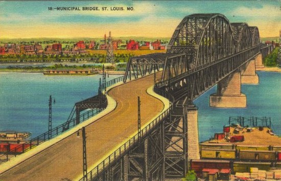
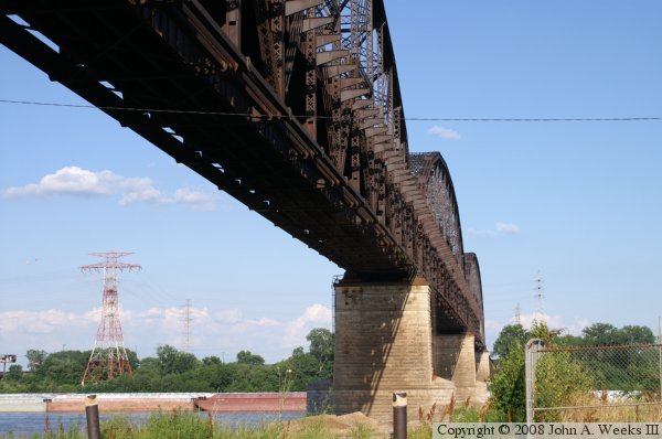
Work began on the Saint Louis Municipal Bridge in 1909. Piers were built, and steel was ordered. The three main steel spans were in place by 1912. At that time, funding ran out, and three successive bonding issues failed to pass during elections. As a result, the bridge sat without the approaches being built. The only part that was finished was the 6-foot wide walkway, which hung off the downstream side of the structure (it has since been removed, but the brackets that supported the walkway are still in place and visible in one of the photos below). Several hundred people a day crossed the bridge on foot. Funding kicked in again after several years, and the roadway on the upper deck was competed. Now known as the Free Bridge, it opened to auto traffic in 1917. The city and the TRRA were still feuding, so the TRRA put a de facto boycott on the bridge. It was not until 1928 that an agreement was reached, and trains started to use the lower deck. The bridge was in full operation by 1931.

Despite being a city owned "Free Bridge", a small toll was added in 1932. The money was used for depression relief. The bridge was renamed the General Douglas MacArthur Bridge in 1942 after the famous general. The bridge was designated as the route for US-66 from 1929 to 1935, having taken over that role from the McKinley Bridge, and then giving it up to the Chain Of Rocks Bridge. It was designated City US-66 from 1936 to 1955.

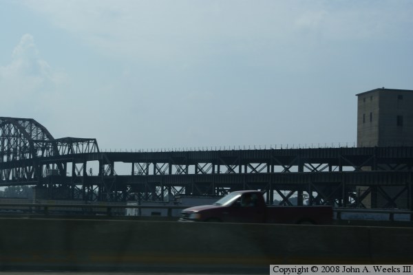
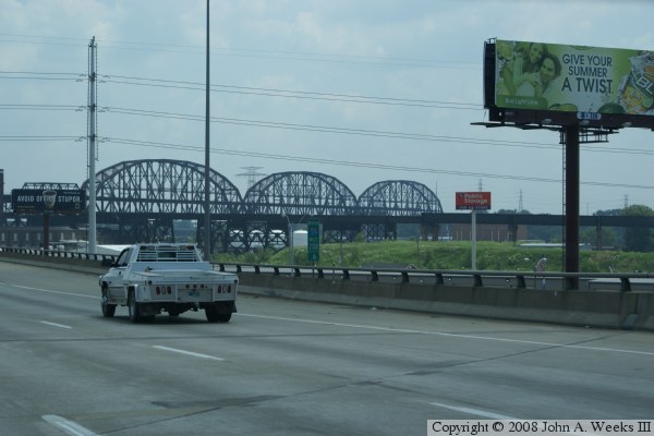
By 1981, the upper deck roadway had deteriorated to the point that it had to be closed. Later, a section of the upper deck was removed for safety reasons. The roadway remains closed today, with the approaches on the Illinois side being long bypassed by the tangle of freeways and ramps in the area. In 2006, more work was being done to the roadway, perhaps the remainder is being removed.

The City of Saint Louis is not interested in running railroad bridges, so in 1989, the MacArthur and Eads bridges were swapped between the city and the TRRA. The idea was that the TRRA would run the MacArthur as a railroad bridge, while the city would rebuild and operate the dual use Eads bridge.

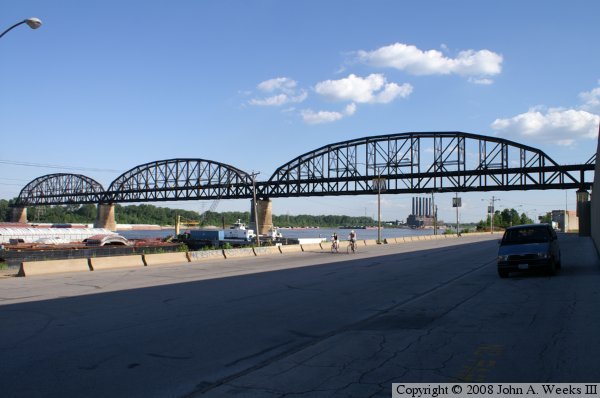
The photo above is looking south along Leonor K. Sullivan Blvd, which runs along the riverfront in front of the Gateway Arch. The image below is a vintage postcard featuring the bridge when it was known as the Municipal Bridge prior to 1942. Given that the upper deck is in use in this postcard, it is probably an early 1930's view.


MacArthur Bridge
MacArthur Bridge
MacArthur Bridge
MacArthur Bridge
MacArthur Bridge
MacArthur Bridge
MacArthur Bridge

Made With Macintosh
Authored by John A. Weeks III, Copyright © 1996—2016, all rights reserved.
For further information, contact: john@johnweeks.com