Current Weather Conditions
John A. Weeks III
Friday, May 3, 2024, 6:02:49 AM CDT
Home Photo Tours Rail Fan 12 Easy Steps
Aviation Spacecraft Highways & Bridges About The Author
 
Google Search
Maps   Groups   Images   Search
 
  Home
  • 12 Easy Steps
  • Aviation
  • Spacecraft
  • Highways & Bridges
    » Bridge Photography
      - MSP River Bridges
      - C & D Canal
      - Illinois River
      - Minnehaha Creek
      - Minnesota River
      - Mississippi River
        › Lake Itasca Area
        › Bemidji Area
        › Cass Lake - Ball Club
        › Grand Rapids Area
        › Blackberry - Crosby
        › Brainerd Lakes Area
        › Little Falls Area
        › St. Cloud Area
        › North Metro Area
        › Port Of Minneapolis
        › St. Anthony Falls Area
        › Mississippi Rvr Gorge
        › St. Paul Area
        › S St. Paul - Hastings
        › Red Wing - Winona
        › La Crosse Area
        › Lansing - Clinton
        › Quad Cities Area
        › Muscatine - Louisiana
          · Lock & Dam #16
          · Norbert F. Beckey Br
          · Lock & Dam #17
          · Keithsburg RR Br
          · Lock & Dam #18
          · Great River Bridge
          · Burlington RR Br
          · Ft Madison/Niota Br
          · Des Moines Rpds Can
          · Lock & Dam #19
          · Keokuk Municipal Br
          · Keokuk-Hamilton Br
          · Lock & Dam #20
          · Quincy Rail Br
          · Quincy Bay Rail Br
          · Quinsippi Island Br
          · The Pier Restaurant
          · Quincy Bayview Br
          · Quincy Soldier's Mem
          · Lock & Dam #21
          · Wabash Bridge
          · Mark Twain Mem Br
          · Lock & Dam #22
          · Champ Clark Bridge
          · Louisiana RR Br
          · Lock & Dam #24
          · Lock & Dam #25
          · Sandy Slough Bridge
        › St. Louis Area
        › Chester - Cairo
        › Miss - Tenn - Ark
        › Ark - Miss - Louisiana
        › Louisiana Structures
      - Missouri River
      - St. Croix River
      - St. Louis River
      - Wisconsin River
      - Best Miss River Photos
      - Cable Stayed Bridges
      - McGilvray Road Bridges
      - I-35W Bridge Disaster
      - Miscellaneous Bridges
      - Madison County Bridges
      - Hist Br Weekend 2013
    » Road Geek Topics
  • Photo Tours
  • Rail Fan
  • About The Author
 
Site Search By JRank
Highways, Byways, And Bridge Photography
Lock & Dam #21
Mississippi River Lock & Dam
Quincy, Illinois

Lock & Dam #21

• Structure: Lock & Dam #21.
• Location: River Mile 324.9.
• Dam Width: 3,240 Feet Overall, 1,363 Foot Main Structure.
• River Elevation (Pool): 470 Feet.
• River Elevation (Outflow): 462 Feet.
• Water Fall: 9.5 Feet.
• Annual Lock Traffic: 3,202 Vessels, 27,123,000 Tons (2005).
• Date Opened: 1938.
These photos show Lock & Dam #21, just south of the city of Quincy, Illinois, on an unusually warm foggy winter day just prior to a major snowstorm. The main dam structure crosses about half the width of the river, with an earth embankment crossing the remaining 1,875 feet.

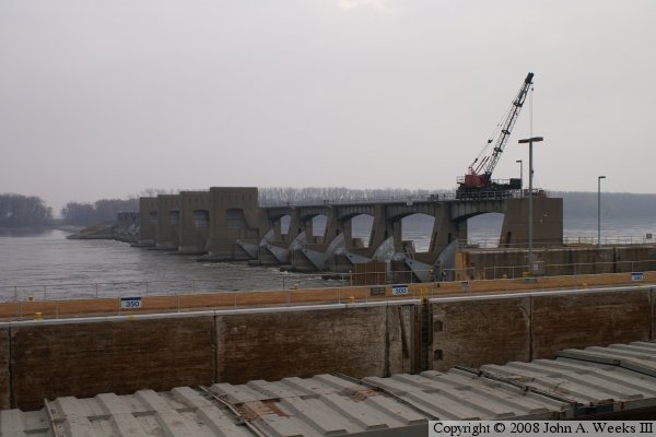
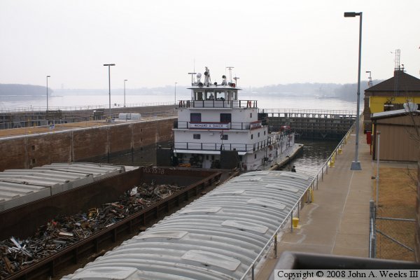
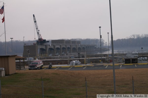
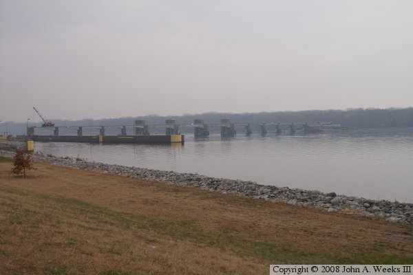
These photos show a tow of barges being locked through southbound. Like most of the Mississippi River locks, the 600 foot long lock is too short to accommodate modern tows, so the barge tow has to be broken into two sections. The upper photo shows the front group of barges tied up to the lock wall, while the third photo shows the rear group of barges being lowered in the lock. Once the lock has drained, the tow will exit, and the two sections will be joined up again for the trip to Lock & Dam #20.


Lock & Dam #21
Lock & Dam #21
Lock & Dam #21
Lock & Dam #21

Made With Macintosh
Authored by John A. Weeks III, Copyright © 1996—2016, all rights reserved.
For further information, contact: john@johnweeks.com