Current Weather Conditions
John A. Weeks III
Saturday, July 27, 2024, 2:35:09 AM CDT
Home Photo Tours Rail Fan 12 Easy Steps
Aviation Spacecraft Highways & Bridges About The Author
 
Google Search
Maps   Groups   Images   Search
 
  Home
  • 12 Easy Steps
  • Aviation
  • Spacecraft
  • Highways & Bridges
    » Bridge Photography
      - MSP River Bridges
      - C & D Canal
      - Illinois River
      - Minnehaha Creek
      - Minnesota River
      - Mississippi River
        › Lake Itasca Area
        › Bemidji Area
        › Cass Lake - Ball Club
        › Grand Rapids Area
        › Blackberry - Crosby
        › Brainerd Lakes Area
        › Little Falls Area
          · Pink Bridge Ruins
          · MN-115 Bridge
          · US-10 Br (Main Ch)
          · US 10 Br (Back Ch)
          · BNSF Little Falls (N)
          · Broadway Bridge
          · Little Falls Ped Br
          · Little Falls Dam
          · Little Falls Mill Ruins
          · BNSF Little Falls (S)
          · Blanchard Hydro Stn
          · Soo Line Trail Bridge
          · Morrison Co Hwy 26
          · Btn & Strns Hwy 2
        › St. Cloud Area
        › North Metro Area
        › Port Of Minneapolis
        › St. Anthony Falls Area
        › Mississippi Rvr Gorge
        › St. Paul Area
        › S St. Paul - Hastings
        › Red Wing - Winona
        › La Crosse Area
        › Lansing - Clinton
        › Quad Cities Area
        › Muscatine - Louisiana
        › St. Louis Area
        › Chester - Cairo
        › Miss - Tenn - Ark
        › Ark - Miss - Louisiana
        › Louisiana Structures
      - Missouri River
      - St. Croix River
      - St. Louis River
      - Wisconsin River
      - Best Miss River Photos
      - Cable Stayed Bridges
      - McGilvray Road Bridges
      - I-35W Bridge Disaster
      - Miscellaneous Bridges
      - Madison County Bridges
      - Hist Br Weekend 2013
    » Road Geek Topics
  • Photo Tours
  • Rail Fan
  • About The Author
 
Site Search By JRank
Highways, Byways, And Bridge Photography
Broadway Bridge
MN-27 Mississippi River Highway Crossing
Little Falls, MN

MN State Highway 27

• Structure ID: NBI 5907
• Location: River Mile 965.4
• River Elevation: 1,107 Feet
• County: Morrison
• Highway: MN Highway 27, Broadway Avenue
• Daily Traffic Count: 13,500 (2004)
• Bridge Type: Steel Girder
• Bridge Length: 546 Feet
• Bridge Width: 52 Feet, 4 Lanes
• Height Above Water: 8 Feet
• Date Built: 1941, Rebuilt 1983
The Broadway Bridge over the Mississippi River is the only highway river crossing in the city of Little Falls. There is another bridge just north of town that carries the US-10 freeway bypass around Little Falls. Both bridges are steel girder bridges, and both are built very low to the water.

While the US-10 bridge is the first bridge to be built at its location, the bridge carrying MN-27 across the Mississippi River in downtown Little Falls has a very long history. According to Mary Costello (Climbing The Mississippi River Bridge By Bridge, Volume 2), the first bridge in the area was built in 1857 on top of the Little Falls Dam. That dam failed in the spring flood in 1859. The west span of that bridge remained in operation for 8 more years until it too was destroyed. A ferry crossed the river until 1884, when an iron truss bridge was completed. That bridge was in place until 1902, when it was moved upstream to the tiny town of Fort Ripley. It was in use at that location until 1947 when it was destroyed by an ice jam. The 1902 span was built out of wood and steel served until 1940, when it was removed to make way for the construction of the current bridge. A temporary trestle was in place for about a year between the removal of the 1902 span, and the opening of the current 1941 bridge.

The people of Little Falls are once again looking to build a new bridge over the Mississippi River. The current bridge is often backed up by heavy rail traffic on the BNSF mainline at west end of the bridge. A proposed replacement bridge would cross over the railroad tracks, eliminating the grade level rail crossing.

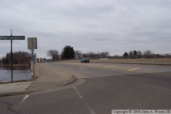
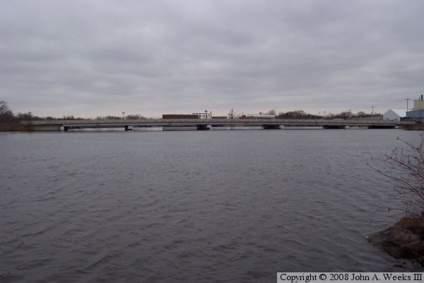
The photo above is a view from a city street on the east river bank located just downriver from the structure. The photo above is looking east down the length of the traffic deck from the northwest corner of the bridge.


MN State Highway 27
MN State Highway 27
The photo above is a view of the bridge from the riverside park located on the west bank of the river north of the river crossing. The photo below is a profile view of the bridge from the same park as seen from further upriver.

MN State Highway 27

Made With Macintosh
Authored by John A. Weeks III, Copyright © 1996—2016, all rights reserved.
For further information, contact: john@johnweeks.com