Current Weather Conditions
John A. Weeks III
Thursday, March 18, 2010, 2:38:49 AM CDT
Home 12 Easy Steps Random Topics About The Author Portal
Aviation Spacecraft Highways & Bridges Photo Tours Rail Fan

Google Search

 Maps  Groups
 Images  Search
  Home
  • 12 Easy Steps
  • Aviation
  • Spacecraft
  • Highways & Bridges
    » Bridge Photography
      - MSP River Bridges
      - Illinois River
      - Minnesota River
      - Mississippi River
        › Lake Itasca Area
        › Bemidji Area
        › Cass Lake - Ball Club
        › Grand Rapids Area
        › Blackberry - Crosby
        › Brainerd Lakes Area
        › Little Falls Area
          · Pink Bridge Ruins
          · MN-115 Bridge
          · US-10 Br (Main Ch)
          · US 10 Br (Back Ch)
          · BNSF Little Falls (N)
          · Broadway Bridge
          · Little Falls Ped Br
          · Little Falls Dam
          · Little Falls Ruins
          · BNSF Little Falls (S)
          · Blanchard Dam
          · Soo Line Bridge
          · Morrison Co Hwy 26
          · Btn & Strns Hwy 2
        › St. Cloud Area
        › North Metro Area
        › Port Of Minneapolis
        › St. Anthony Falls Area
        › Mississippi Rvr Gorge
        › St. Paul Area
        › S St. Paul - Hastings
        › Red Wing - Winona
        › La Crosse Area
        › Lansing - Clinton
        › Quad Cities Area
        › Muscatine - Louisiana
        › St. Louis Area
        › Chester - Cairo
        › Miss - Tenn - Ark
        › Ark - Miss - Louisiana
        › Louisiana Structures
      - Missouri River
      - St. Croix River
      - St. Louis River
      - Wisconsin River
      - Cable Stayed Bridges
      - McGilvray Road
      - I-35W Bridge Disaster
      - Miscellaneous Bridges
    » Road Geek Topics
  • Random Topics
  • Photo Tours
  • Rail Fan
  • About The Author
  • John's Portal
 
Site Search By JRank
Highways, Byways, And Bridge Photography
US Highway 10 — Back Channel
Mississippi River Highway Crossing
Little Falls, MN

US Highway 10 Back Channel Bridge

• Structure ID: NBI 49020
• Location: River Mile 967.2
• River Elevation: 1,107 Feet
• County: Morrison
• Highway: US Highway 10
• Daily Traffic Count: 10,200 (2004)
• Bridge Type: Precast Concrete Girder
• Bridge Length: 80 Feet, 80 Foot Longest Span
• Bridge Width: 82 Feet, 4 Lanes
• Height Above Water: 7 Feet
• Date Built: 1973
The US-10 bridge is part of a 4-lane bypass around Little Falls. The issue is not that Little Falls is such a large city that it needs a freeway bypass, but rather, Little Falls in centrally located for people traveling in a number of different directions, and the bypass keeps the through traffic off of the quiet city streets.

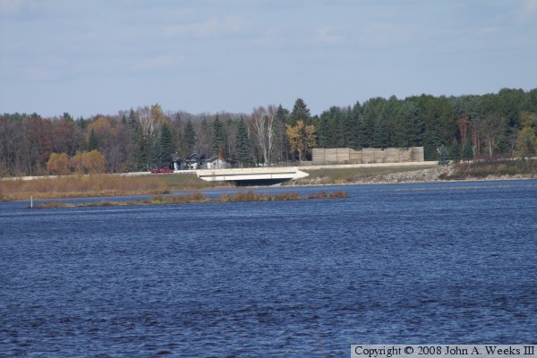
The main channel bridge, just a few hundred feet north on US-10, is nearly 1,000 feet long. Not so for this little back channel structure. It is only 80 feet long. While the main bridge has a number of piers and spans, this little back channel bridge crosses this branch of the Mississippi River in a single leap. It is interesting that the main channel bridge has steel girders, but this small back channel bridge has concrete girders. One would think that the bridge builders would have just ordered up 80 more feet of steel and called it good.

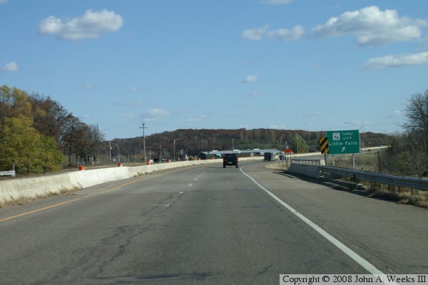
A Mississippi River crossing that is made up of two or more bridges in series is not all that unusual, at least not on the Upper Mississippi River, but this is the only such example north of Red Wing, Minnesota.
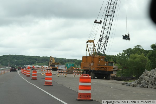

US Highway 10 Back Channel Bridge
The photo above is a view crossing the bridge heading westbound. The main channel structure is located just up the highway in this photo. The photo below is a view crossing the bridge heading eastbound. The photo at the top of the page is a telephoto view of the bridge looking north from a vantage point about one-half mile downstream.

US Highway 10 Back Channel Bridge

Made With Macintosh
Authored by John A. Weeks III, Copyright © 1996—2010, all rights reserved.
For further information, contact: john@johnweeks.com