Current Weather Conditions
John A. Weeks III
Friday, July 26, 2024, 11:38:33 PM CDT
Home Photo Tours Rail Fan 12 Easy Steps
Aviation Spacecraft Highways & Bridges About The Author
 
Google Search
Maps   Groups   Images   Search
 
  Home
  • 12 Easy Steps
  • Aviation
  • Spacecraft
  • Highways & Bridges
    » Bridge Photography
      - MSP River Bridges
      - C & D Canal
      - Illinois River
      - Minnehaha Creek
      - Minnesota River
      - Mississippi River
        › Lake Itasca Area
        › Bemidji Area
        › Cass Lake - Ball Club
        › Grand Rapids Area
        › Blackberry - Crosby
        › Brainerd Lakes Area
        › Little Falls Area
          · Pink Bridge Ruins
          · MN-115 Bridge
          · US-10 Br (Main Ch)
          · US 10 Br (Back Ch)
          · BNSF Little Falls (N)
          · Broadway Bridge
          · Little Falls Ped Br
          · Little Falls Dam
          · Little Falls Mill Ruins
          · BNSF Little Falls (S)
          · Blanchard Hydro Stn
          · Soo Line Trail Bridge
          · Morrison Co Hwy 26
          · Btn & Strns Hwy 2
        › St. Cloud Area
        › North Metro Area
        › Port Of Minneapolis
        › St. Anthony Falls Area
        › Mississippi Rvr Gorge
        › St. Paul Area
        › S St. Paul - Hastings
        › Red Wing - Winona
        › La Crosse Area
        › Lansing - Clinton
        › Quad Cities Area
        › Muscatine - Louisiana
        › St. Louis Area
        › Chester - Cairo
        › Miss - Tenn - Ark
        › Ark - Miss - Louisiana
        › Louisiana Structures
      - Missouri River
      - St. Croix River
      - St. Louis River
      - Wisconsin River
      - Best Miss River Photos
      - Cable Stayed Bridges
      - McGilvray Road Bridges
      - I-35W Bridge Disaster
      - Miscellaneous Bridges
      - Madison County Bridges
      - Hist Br Weekend 2013
    » Road Geek Topics
  • Photo Tours
  • Rail Fan
  • About The Author
 
Site Search By JRank
Highways, Byways, And Bridge Photography
US Highway 10 — Main Channel
Mississippi River Highway Crossing
Little Falls, MN

US Highway 10

• Structure ID: NBI 49010
• Location: River Mile 967.2
• River Elevation: 1,107 Feet
• County: Morrison
• Highway: US Highway 10
• Daily Traffic Count: 10,200 (2004)
• Bridge Type: Steel Girder
• Bridge Length: 997 Feet, 153 Foot Longest Span
• Bridge Width: 82 Feet, 4 Lanes
• Height Above Water: 7 Feet
• Date Built: 1973
The US-10 bridge is part of a 4-lane bypass around Little Falls. The issue is not that Little Falls is such a large city that it needs a freeway bypass, but rather, Little Falls in centrally located for people traveling in a number of different directions, and the bypass keeps the through traffic off of the quiet city streets.

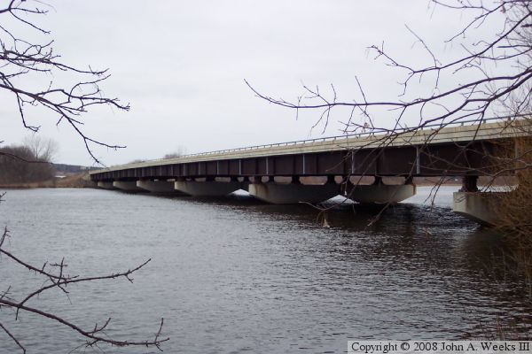
Similar to the highway bridge just downstream in downtown Little Falls, this bridge is a steel girder bridge with concrete piers and a concrete deck. Also like the downtown Little Falls bridge, this bridge is built very low and near to the water. There is just enough clearance for canoes to pass under the steel girders. In contrast to other bridges in the Mississippi River Headwaters region, this the only location north of Red Wing, Minnesota, where there is more than one bridge in series as part of the river crossing.

This bridge turned out to be a bit more difficult than average to photograph. The freeway bypass was put through an area where there were no roads. As a result, I had to scout around a bit, and finally located riverfront homes where I could sneak in telephoto shots of the bridge. The photo above is an example of a view from the backyard of a local resident who allowed me to walk across their property.


US Highway 10
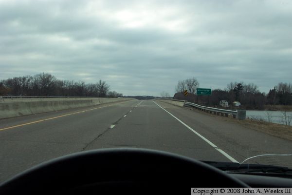
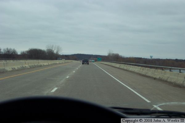
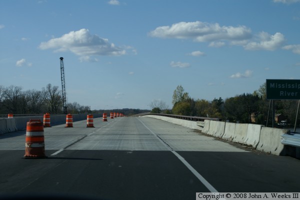
These two photos are views crossing the river on a somewhat gloomy spring morning. The photo below is a view crossing westbound, while the photo below is a view crossing eastbound.

US Highway 10
US Highway 10
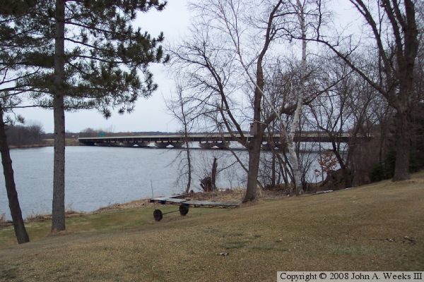
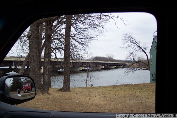
These two photos are views of the bridge as seen looking through back yards of houses located on the east shore of the river. The photo above is a view from south of the bridge, while the photo below is a view from north of the bridge.

US Highway 10
US Highway 10
These two photos are views of the bridge while it was being redecked during the summer of 2007. The photo above is a view crossing to the west. The photo below is a view crossing to the east.

US Highway 10

Made With Macintosh
Authored by John A. Weeks III, Copyright © 1996—2016, all rights reserved.
For further information, contact: john@johnweeks.com