| Highways, Byways, And Bridge Photography |
Soo Line Trail Bridge
Mississippi River Trail Crossing
Royalton, MN
|
• Structure ID: |
NBI 49553 |
|
• Location: |
River Mile 1003.6 |
|
• River Elevation: |
1,036 Feet |
|
• County: |
Morrison |
|
• Bridge Type: |
Steel Deck Truss |
|
• Bridge Length: |
650 Feet, 103 Foot Longest Span |
|
• Bridge Width: |
12 Feet (Formerly 1 Track) |
|
• Height Above Water: |
30 Feet (To Low Steel) |
|
• Date Built: |
Opened 1909, Converted To Trail 2007 |
The Soo Line Railroad built this bridge in 1909 as part of its
Brooten Line. That line ran from west central Minnesota into Duluth.
In its day, it was a heavily used route that transported farm goods
to the harbor facilities in the Twin Ports (Duluth and Superior).
The Brooten route was shut down in 1990, and the rail line was
abandoned in 1993.
The railroad right-of-way was purchased by the State of Minnesota, and the
Soo Line South Trail was established. The trail started near Duluth,
and has been extended southwest over time. The section that contained
this river crossing was a gap in the trail as of 2005 when the upper
set of photos was taken. That gap was filled when this bridge was converted
to a pedestrian river crossing, and the new Soo Line Trail Bridge was formally
opened in May of 2007. The Soo Line South Trail is now open from the Lake
Wobegon Trail near Albany, MN, all the way to the Twin Ports.
There are a number of good vantage points to see both the Soo Line Trail
Bridge and the Blanchard Dam. The best views are from the bridge deck. You
can access the trail from the Great River Road on the west side of the river,
or a parking area along highway US-10 a few miles to the east of the bridge.
In addition, there are three parking areas provided by Minnesota Power. One
is on the west end of the dam, which allows you to walk down to the river
level on the upstream side of the bridge. The second is the public water
access on the east end of the dam. The third is the shore fishing area,
which is downstream of the bridge on the east side of the river. The shore
fishing area gives you excellent access to the riverbank, which offers
excellent views with the sun to your back for photography. The Soo Line Trail
Bridge is an excellent day-trip destination where you can spend several hours
visiting these vantage points and taking in the sights.

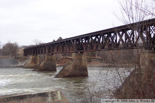
The photo above is a view of the south face of the bridge as seen from
the southwest corner of the structure. The photo below is a view of the
bridge deck looking east from the west end of the structure. The photo
at the top of the page is a view of the north face of the bridge as seen
from near the river water level from the west side of the Blanchard Dam.
The photo above is a view from 2005 prior to the bridge being converted
to pedestrian use. The photo below is a view from the summer of 2007
of the north face of the bridge as seen from the nearby Blanchard Dam.
Note the large wings on the piers. These wings were built to deflect
ice jams that would build up in front of the bridge prior to the
Blanchard Dam being constructed.
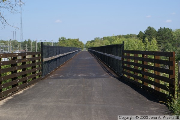
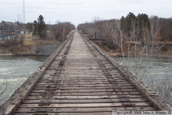
These two photos are views looking east down the length of the bridge deck.
The photo above is the east approach to the bridge, while the photo below
is a view from half-way across the bridge. The new deck and railings were
added as part of the rails-to-trails conversion.

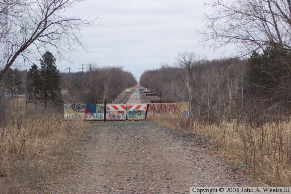
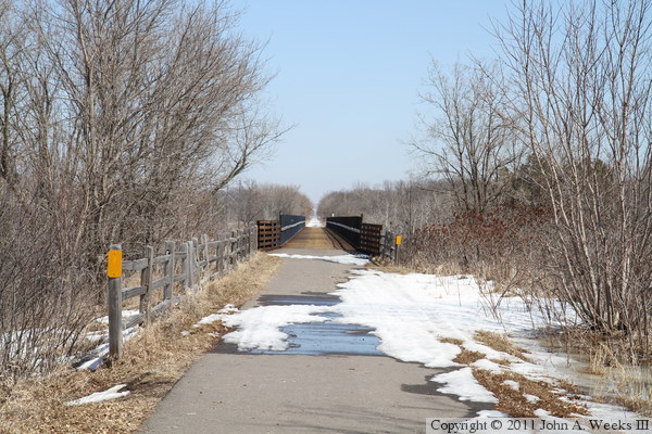
These two photos, and the 22 that follow, are views from early April, 2011,
just as the last of the winter snow was melting. The photo above is looking
east down the trail from County Highway 224, which carries the Great River
Road along the west side of the Mississippi River. The photo below is
looking east down the length of the bridge deck. The trail on the west
side of the bridge was nearly clear of snow, but the trail on the east
side of the river was mostly snow covered, likely due to the trail being
shaded by the forest.

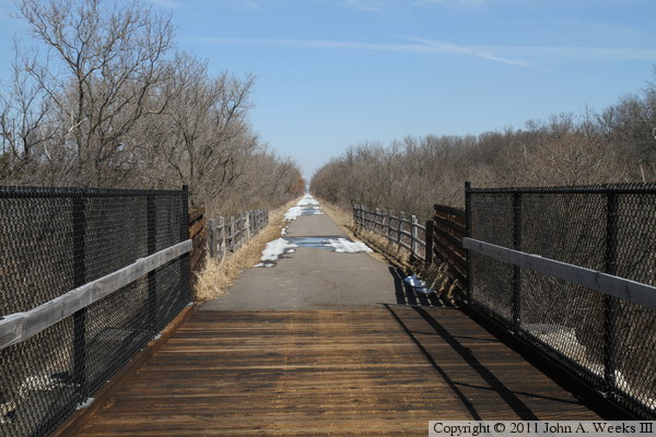
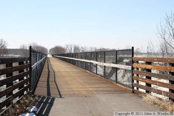
The photo above is looking east down the length of the bridge deck. The
photo below is also looking east, but from near the east end of the bridge.
The Soo Line Trail extends all the way to Duluth and Superior area, 150
miles to the northeast.
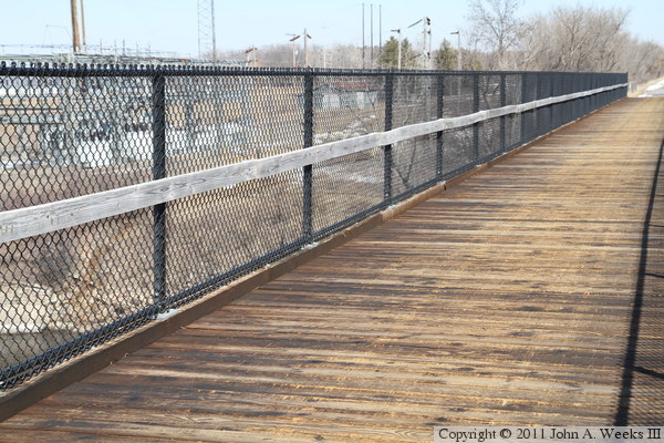
The photo above is a close view of the bridge deck and railings. Treated
wood was put down over the railroad ties to provide a smooth deck free of
any gaps between the ties. The railings are fabricated from chain link fence.
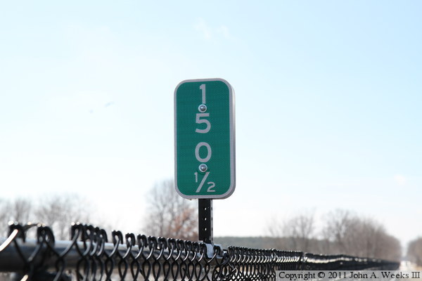
The photo below is a mile marker, which indicates that we are 150-1/2 miles
southwest of the trailhead in the Twin Ports area.
The photo above is looking southwest down the length of the bridge deck
towards the west bank of the Mississippi River. The photo below is a view
of the upriver side of the bridge as seen from the base of the nearby
Blanchard Dam. The fog on the left side of the photo is a cloud of spray
from the water pouring through the dam gates.


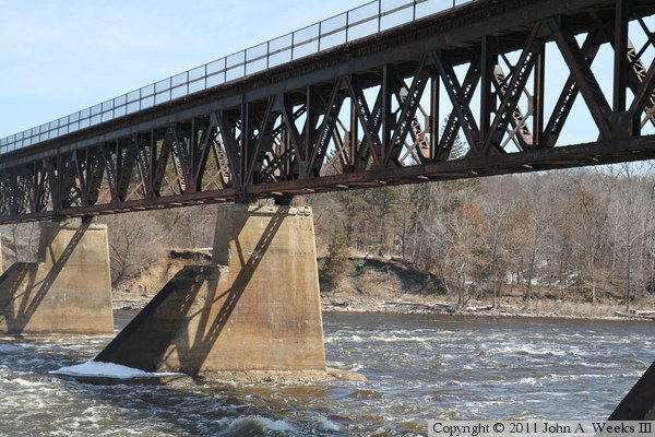
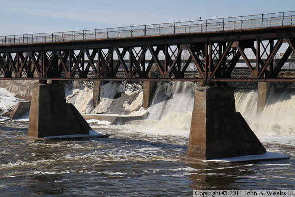
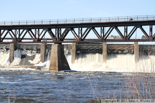
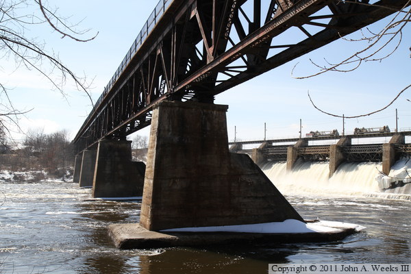
The photo above is a close view of the first pier on the west end of the
bridge. The photo below is a close view of the two center piers. The
angle on the upstream side of the piers serves to deflect and break up
ice. While little ice accumulates between the bridge and dam, the bridge
predates the dam by 16 years, so it had to face the full brunt of the
Mississippi River ice for a decade and a half.

Minnesota Power maintains three public recreation areas around the dam. The
shore fishing area is downstream of the dam and bridge on the east bank of the
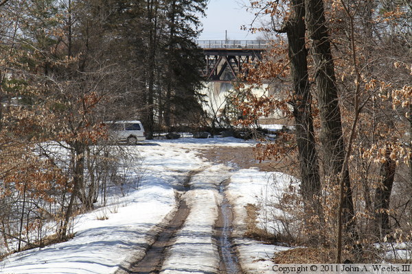
Mississippi River. The photo above is the sign on the road leading to the
parking area. The photo below is the entry road, which was both icy and muddy
on this day. I elected to park at the top of the hill and walk in. Note the
view of the bridge and dam through the trees in the center of the photo.

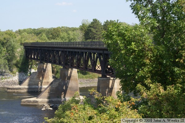
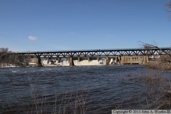
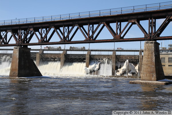
These two photos are views from the top of the riverbank on the east side
of the Mississippi River. The photo above includes four of the five bridge
spans, while the photo below is a close view of the center bridge span.
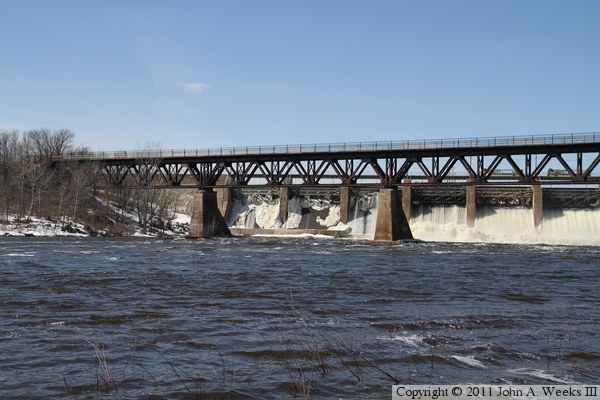
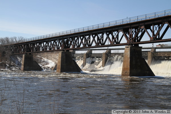
These two photos are views looking north from a sandbar that extends a dozen
yards into the river, giving the impression that these photos were taken
from mid-river. The photo above is a profile view of the bridge, showing
how close the dam is located to the bridge. The photo below is a closer view
of the western bridge spans.
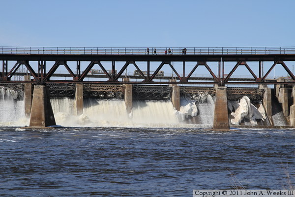
These two photos are views of the center bridge span. Note the people
on the bridge watching water pour over the dam through the gates that are
open in the center of the dam.
These two photos are additional views of the bridge as seen from the east
shore of the Mississippi River. The photo above is the pier located just
downstream of the power house, while the photo below is the western
half of the bridge.
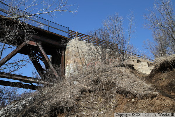
These two photos are the east bridge abutment. The photo above is a side
view, showing where people have been making the steep walk down the abutment
to get to the shoreline. The photo below is looking up from the front side
of the abutment.


These two photos are looking west along the downstream face of the Soo Line
Trail Bridge. The vantage points are two locations on the embankment
supporting the west bridge abutment.
|
