| Highways, Byways, And Bridge Photography |
Eisenhower Bridge
US-63 Mississippi River Crossing At Red Wing
Red Wing, Minnesota
|
• Structure ID: |
NBI B47002400000000. |
|
• Location: |
River Mile 790.6. |
|
• River Elevation: |
667 Feet. |
|
• Highway: |
US-63. |
|
• Daily Traffic Count: |
10,000 (2001). |
|
• Bridge Type: |
Steel Continuous Truss Through Deck. |
|
• Length: |
1,631 Feet Overall, 432 Foot Longest Span. |
|
• Width: |
35 Feet, 2 Lanes. |
|
• Navigation Channel Width: |
420 Feet. |
|
• Height Above Water: |
65 Feet. |
|
• Date Built: |
Opened November 1960. |
The Eisenhower Bridge is a 2-lane steel continuous truss bridge that carries
US-63 across the west channel of the Mississippi River at Red Wing, Minnesota.
The Wisconsin side of the river crossing features a long causeway and a
smaller bridge across the east channel of the Mississippi River known as the
Lloyd Spriggle Memorial Bridge.
The first river crossing at Red Wing was a ferry boat that began service in
1863. This boat was a flat-bottom paddle boat. The paddle wheel was driven by
a pair of horses walking on a belt. The horse powered boat was replaced in
1865 by a new boat that operated along a cable stretched across the river.
The first bridge at Red Wing was approved in 1872 by the US Congress, but there
was no funding included in that approval. The local citizens approved funding
the bridge through bonds in 1893, and the new Red Wing High Bridge was open
two years later. The bridge collected tolls to replay the bond debt.
After half a century of service, the Red Wing High Bridge was in need of
replacement. Congress came to the aid of Red Wing in the late 1950's. The
new bridge was initially called the Interstate Bridge, but it was renamed the
Hiawatha Bridge before it was completed. When the bridge opened, President
Eisenhower visited Red Wing to give the dedication speech. It was the largest
gathering in Red Wing history with over 20,000 people turning out to hear the
President speak. Eisenhower stressed that the government in Washington was
listening to the people and taking care of their needs even though they were
over 1000 miles from the federal capital. In reality, 1960 was an election
year, and Vice President Nixon was in a tough battle with Senator Kennedy.
Eisenhower came to Minnesota in support of Nixon's election bid, an election
that Kennedy eventually won. The people of Red Wing later renamed the bridge
in Eisenhower's honor.
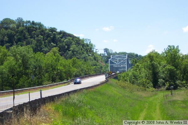
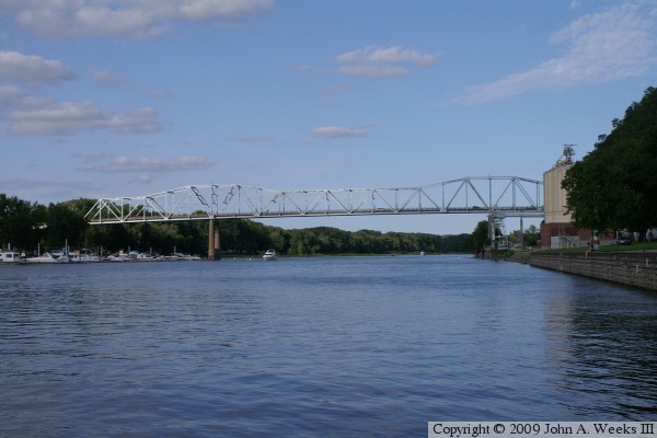
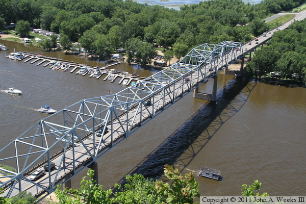
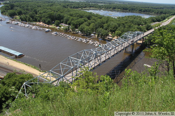
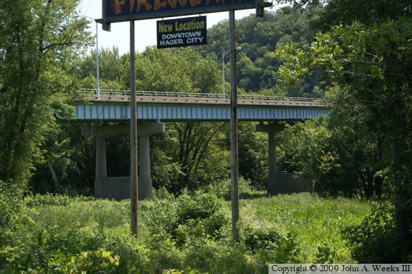
The photo above is a view of the east approach to the bridge as seen from
a side road located just east of the river channel. The photo below is a
view from an overlook located along Skyline Drive. The bridge is about
two-thirds of a mile from the overlook, which towers 350 feet above the
river level. Barn bluff is located to the right of the bridge. The east
river channel is located about a mile and a quarter to the north of the
Eisenhower Bridge.
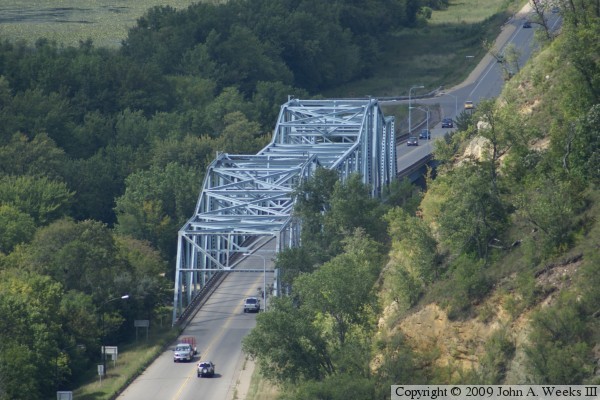
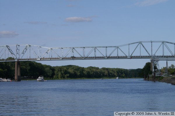
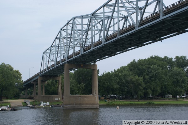
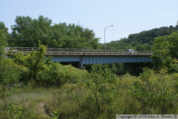
These two photos are views from the east end of Bay Point Park, located
on the south side of the river just upstream from downtown Red Wing. The
photo above is a overview of the river crossing, while the photo below is
a close view of the truss structure. Due to a curve in the river, these
photos appear like they were taken from the middle of the river channel.
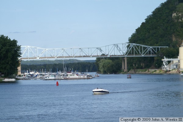
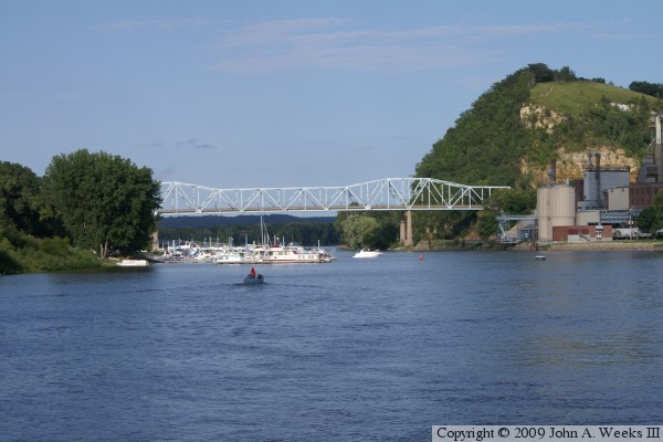
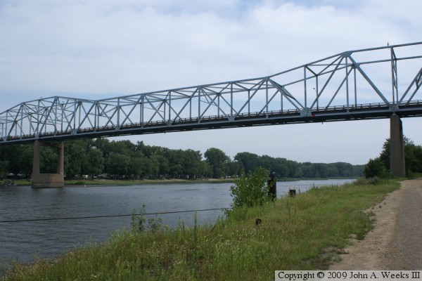
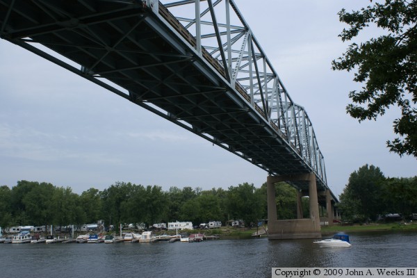
These two photos are views of the Eisenhower Bridge from the city of Red
Wing public boat landing. The photo above is an overview of the river
crossing, while the photo below is a close view of the main river channel
span.
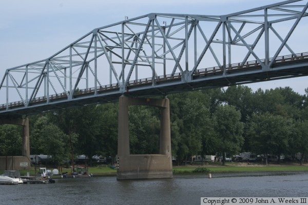
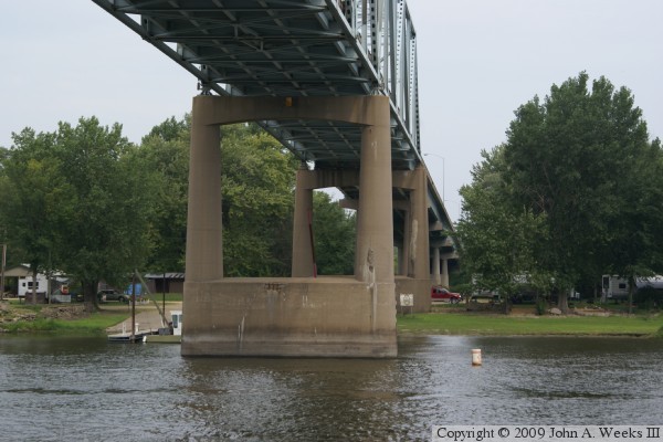
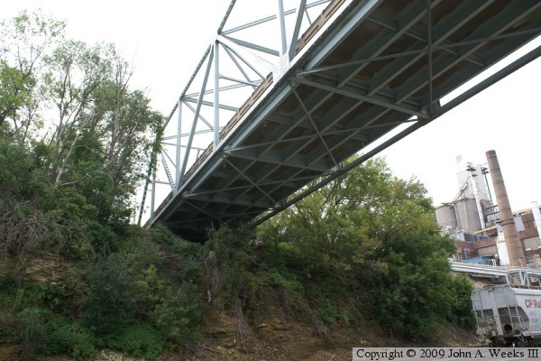
The photo above is the upriver face of the bridge truss. The photo below is
a close view of the pier on the north side of the navigation span. The
vantage point is an access road that runs along the river behind the
Archer Daniels Midland processing plant. The ADM plant extracts and
refines edible oils from soybeans and flax.
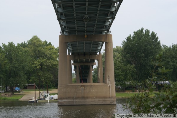
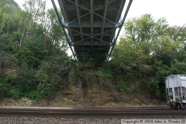
The photo above is the upstream face of the north end of the main truss
span, and the steel girder approach spans. The photo below is a view from
directly under the bridge looking across the navigation channel to the
north. A private campground is located along the north side of the west
river channel.
These two photos are more views of the bridge looking across the west river
channel towards the north. The photo below is the downriver side of the
approach spans, while the photo above is the downriver face of the truss
span.
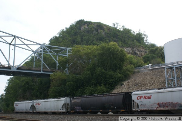
The photo above is looking east towards the south end of the Eisenhower
Bridge. The bridge lands on Barn Bluff. The highest point on the bluff is
about 980 feet above sea level, which is just over 300 feet above typical
water levels. The photo below is a view looking south from directly under
the bridge. The bridge abutment sits on the bluff, so there is no pier
supporting the south end of the bridge truss.
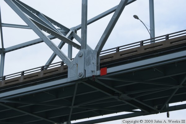
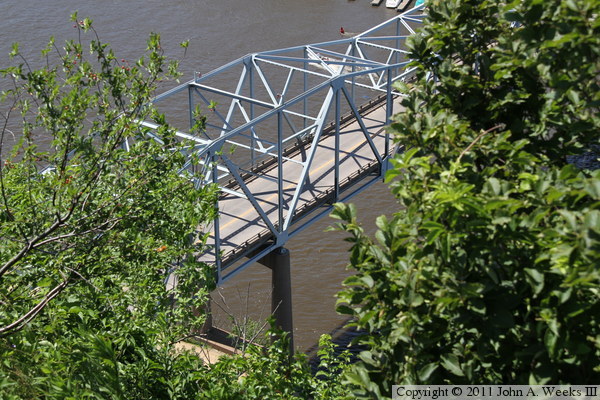
The photo above is the south end of the bridge truss as seen from the
downriver side of the structure. The photo below is a close view of the
joint between two sections of the main truss. The center of the truss is
an independent structure that is held up by truss sections on either side
of the navigation span, and is supported by steel hangars and pins. This
bridge design is often refereed to as a pin-connected structure. The red
square is a navigation channel marker.
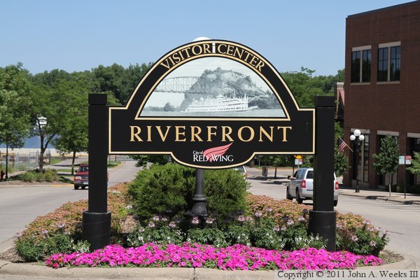
The photo above is a guide sign located in downtown Red Wing for the Riverfront
Park and Visitor Center. Like the city limit signs, this sign uses a
historic photo of a riverboat passing under the old river bridge in front
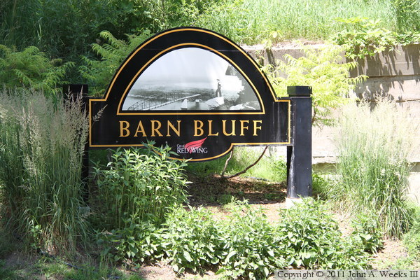
of Barn Bluff. The photo below is the guide sign located at Barn Bluff,
which uses a view of the old bridge from the top of the bluff.
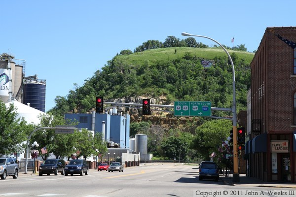
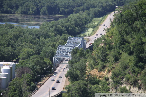
The photo above is Barn Bluff as seen from downtown Red Wing. This view is
looking south along highway US-61. The bridge is to the left and behind the
factories, while US-61 bends to the right to pass Barn Bluff. The top of the
bluff is at elevation 999 feet. The river is at 667 feet, putting the top
of the bluff at 332 feet above the river level. The parking lot at the
south end of the bluff is 15 feet above the water, and the high point on the
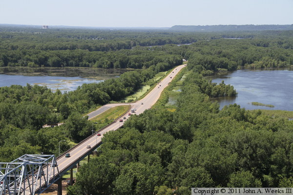
trail is 990 feet, which still leaves a 310 foot climb. The photo below is
looking off to the northwest as US-63 heads across the river flats towards
the Wisconsin Channel of the Mississippi River.
These two photos are looking down on the Eisenhower Bridge from two different
locations near the observation platform at the west end of Barn Bluff.
The photo above is looking through the trees towards the north main bridge
pier from the stairway leading down to the north trail from the observation
platform. The photo below is another view looking north from the overlook at
the Soldiers Memorial Park. The overlook is at about 1,025 feet in elevation,
and located 3,330 feet south of the Eisenhower Bridge. This photo shows how
the bridge sits right next to the bluff.
These two photos are the first of a four photo set that shows a typical
river crossing heading towards the west on southbound US-63. In the photo
above, we have just entered the plate girder bridge spans on the east
end of the structure. We are just approaching the truss structure in
the photo below.
These two photos are the final photos of a four photo set showing a typical
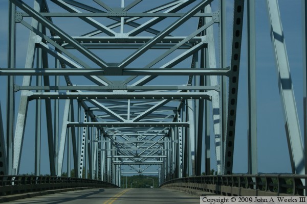
river crossing heading southbound on US-63 towards Red Wing. In the photo
above, we are traveling through the truss structure high over the middle
of the river navigation channel. We are approaching the west end of the
truss structure and existing the bridge in the photo below.
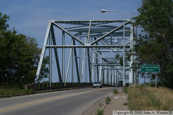
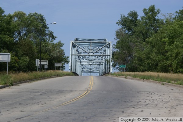
These two photos are views from the sidewalk at the southeast corner of the
structure. The photo above is the south bridge portal, while the photo
below is a view looking north down the length of the bridge deck. While
there is a sidewalk leading to the bridge, there is no sidewalk or bicycle
path on the bridge. Given the narrow lanes and high traffic volumes, it
would be dangerous to attempt to cross this bridge on foot or with a bicycle.
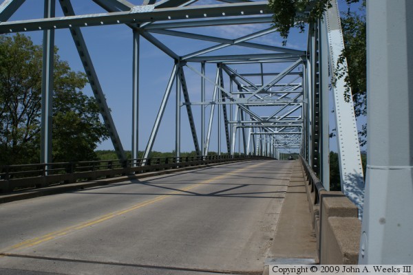
These two photos are views from the southwest corner of the bridge.
The photo above is looking down the length of the upriver face of the
bridge, while the photo below is looking down the length of the bridge
deck. I had to wait over 20 minutes to get photo without cars on the
bridge.
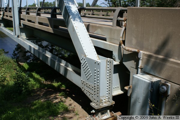
These two photos are views of the upriver side of the steel girder approach
spans on the north end of the bridge. The photo above is the third span
when heading southbound. The photo below is the abutment at the north
end of the structure. Note that the first span is much shorter than the
other approach spans, and is constructed from much smaller steel beams.
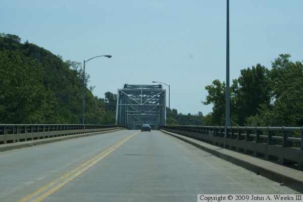
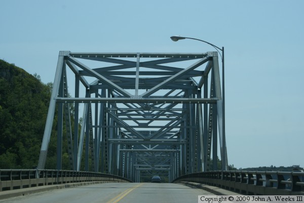
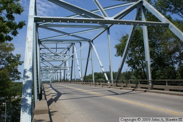
These two photos are the first of a four photo set showing a typical bridge
crossing heading northbound towards Wisconsin. The photo above is the
approach to the south end of the bridge. There is an overpass over US-61,
then a sweeping 90-degree curve and small incline leading towards the bridge
portal. The photo below is the view after entering the truss structure.
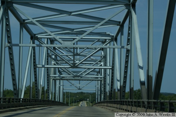
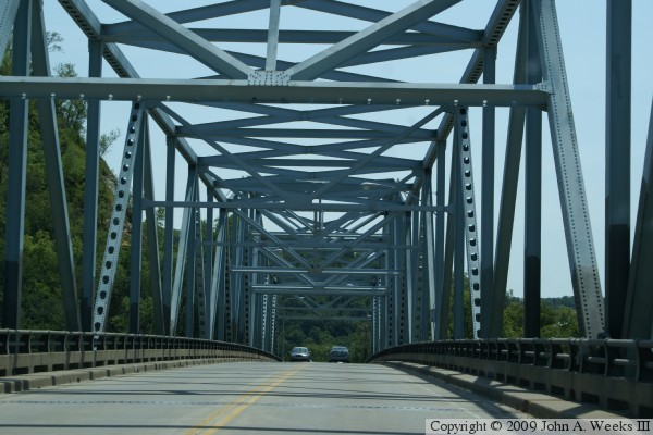
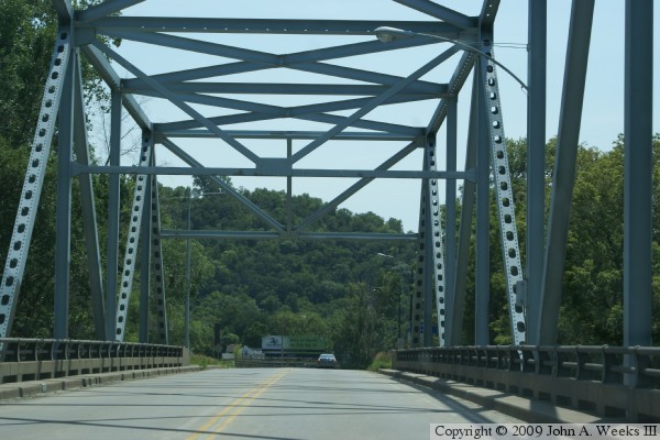
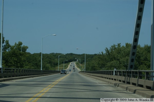
These two photos are the final photos of a four photo set showing a typical
northbound bridge crossing. The photo above is the view looking north
from the middle of the truss structure. The photo below is heading downhill
on the steel girder approach spans towards Wisconsin.
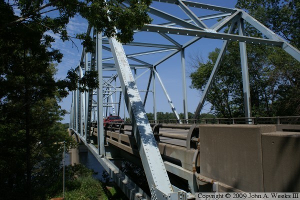
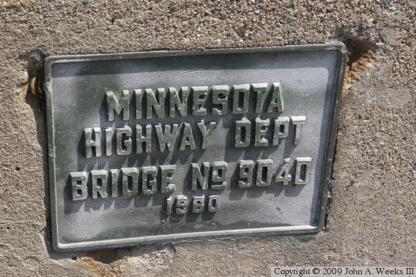
The photo above is a close view of the steel truss structure at the
southwest corner of the bridge. Note that there are no approach spans
on the south end of the bridge. Rather, the truss structure lands directly
on the bluffs. The photo below is the bridge plate. There is no signage
on the bridge stating its status as an officially named bridge by the
state legislature.
|
