Current Weather Conditions
John A. Weeks III
Friday, March 12, 2010, 3:22:55 PM CST
Home 12 Easy Steps Random Topics About The Author Portal
Aviation Spacecraft Highways & Bridges Photo Tours Rail Fan

Google Search

 Maps  Groups
 Images  Search
  Home
  • 12 Easy Steps
  • Aviation
  • Spacecraft
  • Highways & Bridges
    » Bridge Photography
      - MSP River Bridges
      - Illinois River
      - Minnesota River
      - Mississippi River
        › Lake Itasca Area
        › Bemidji Area
        › Cass Lake - Ball Club
        › Grand Rapids Area
        › Blackberry - Crosby
        › Brainerd Lakes Area
        › Little Falls Area
        › St. Cloud Area
        › North Metro Area
        › Port Of Minneapolis
        › St. Anthony Falls Area
        › Mississippi Rvr Gorge
        › St. Paul Area
        › S St. Paul - Hastings
        › Red Wing - Winona
          · Lock & Dam #3
          · Eisenhower Bridge
          · Lloyd Spriggle Mem
          · Lake Pepin Winter Rd
          · Milw Road Pontoon Br
          · Wabasha-Nelson Br
          · Pontoon Slough Br
          · Beef Slough Bridge
          · Buffalo Slough Br
          · Shively Slough Br
          · Lock & Dam #4
          · Lock & Dam #5
          · Lock & Dam #5A
          · Winona Main Channel
          · Winona N Channel Br
          · C&NW Winona Br
          · John A. Latsch Br
          · Lock & Dam #6
        › La Crosse Area
        › Lansing - Clinton
        › Quad Cities Area
        › Muscatine - Louisiana
        › St. Louis Area
        › Chester - Cairo
        › Miss - Tenn - Ark
        › Ark - Miss - Louisiana
        › Louisiana Structures
      - Missouri River
      - St. Croix River
      - St. Louis River
      - Wisconsin River
      - Cable Stayed Bridges
      - McGilvray Road
      - I-35W Bridge Disaster
      - Miscellaneous Bridges
    » Road Geek Topics
  • Random Topics
  • Photo Tours
  • Rail Fan
  • About The Author
  • John's Portal
 
Site Search By JRank
Highways, Byways, And Bridge Photography
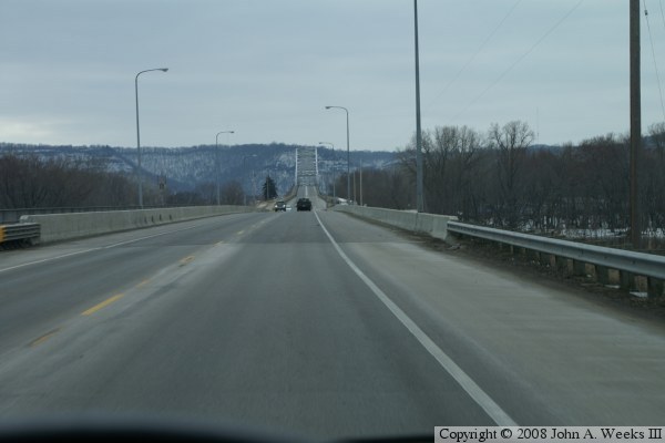
Winona North Main Channel Bridge
MN-43/WI-54 Mississippi River Crossing At Winona
Winona, Minnesota

Winona North Channel Bridge

• Structure ID: NBI 5930 (MN), B06075200000000 (WI).
• Location: River Mile 725.8.
• River Elevation: 646 Feet.
• Highway: MN-43, WI-54.
• Daily Traffic Count: 11,400 (2002).
• Bridge Type: Concrete Girder, Concrete Deck.
• Length: 1,008 Feet Overall, 101 Foot Longest Span.
• Width: 61 Feet, 2 Lanes.
• Navigation Channel Width: 97 Feet.
• Height Above Water: 20 Feet.
• Date Built: Opened 1942, Rebuilt 1997.
The river crossing here is composed of 3 bridges in all, the Main Channel Bridge, this bridge (North Channel Bridge), and a short bridge over the railroad tracks on the Wisconsin side. This is the second highway bridge to stand in this spot, having replaced the 1891 structure. It was built in 1942 as a steel girder bridge. It was totally rebuilt as a concrete girder bridge in 1997.

Winona North Channel Bridge

Made With Macintosh
Authored by John A. Weeks III, Copyright © 1996—2010, all rights reserved.
For further information, contact: john@johnweeks.com