Current Weather Conditions
John A. Weeks III
Friday, May 3, 2024, 1:50:04 AM CDT
Home Photo Tours Rail Fan 12 Easy Steps
Aviation Spacecraft Highways & Bridges About The Author
 
Google Search
Maps   Groups   Images   Search
 
  Home
  • 12 Easy Steps
  • Aviation
  • Spacecraft
  • Highways & Bridges
    » Bridge Photography
      - MSP River Bridges
      - C & D Canal
      - Illinois River
      - Minnehaha Creek
      - Minnesota River
      - Mississippi River
        › Lake Itasca Area
        › Bemidji Area
        › Cass Lake - Ball Club
        › Grand Rapids Area
        › Blackberry - Crosby
        › Brainerd Lakes Area
        › Little Falls Area
        › St. Cloud Area
        › North Metro Area
        › Port Of Minneapolis
        › St. Anthony Falls Area
        › Mississippi Rvr Gorge
        › St. Paul Area
        › S St. Paul - Hastings
        › Red Wing - Winona
          · Lock & Dam #3
          · Eisenhower Bridge
          · Lloyd Spriggle Mem
          · Lake Pepin Winter Rd
          · Milw Road Pontoon Br
          · Wabasha-Nelson Br
          · Pontoon Slough Br
          · Beef Slough Bridge
          · Buffalo Slough Br
          · Shively Slough Br
          · Lock & Dam #4
          · Lock & Dam #5
          · Lock & Dam #5A
          · Winona Main Channel
          · Winona N Channel Br
          · C&NW Winona Br
          · John A. Latsch Br
          · Winona Bridge Rwy
          · Lock & Dam #6
        › La Crosse Area
        › Lansing - Clinton
        › Quad Cities Area
        › Muscatine - Louisiana
        › St. Louis Area
        › Chester - Cairo
        › Miss - Tenn - Ark
        › Ark - Miss - Louisiana
        › Louisiana Structures
      - Missouri River
      - St. Croix River
      - St. Louis River
      - Wisconsin River
      - Best Miss River Photos
      - Cable Stayed Bridges
      - McGilvray Road Bridges
      - I-35W Bridge Disaster
      - Miscellaneous Bridges
      - Madison County Bridges
      - Hist Br Weekend 2013
    » Road Geek Topics
  • Photo Tours
  • Rail Fan
  • About The Author
 
Site Search By JRank
Highways, Byways, And Bridge Photography
Winona Main Channel Bridge
MN-43/WI-54 Mississippi River Crossing At Winona
Winona, Minnesota

Winona Main Channel Bridge

• Structure ID: NBI 5900.
• Location: River Mile 725.8.
• River Elevation: 646 Feet.
• Highway: MN-43, WI-54.
• Daily Traffic Count: 11,400 (2002).
• Bridge Type: Steel Truss Through Deck.
• Length: 2,288 Feet Overall.
• Width: 31 Feet, 2 Lanes.
• Navigation Channel Width: 434 Feet.
• Height Above Water: 64 Feet.
• Date Built: Opened November 21, 1942, Rebuilt 1985.
Winona was once located on a island in the river. The western-most channel has since filled in with silt or has been filled in with debris over the years. The result is that the highway river crossing is about a mile through city streets from the main route of US-14 and US-61. The lack of a direct route diminishes the usefulness of this bridge.

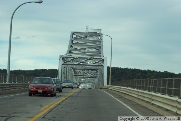
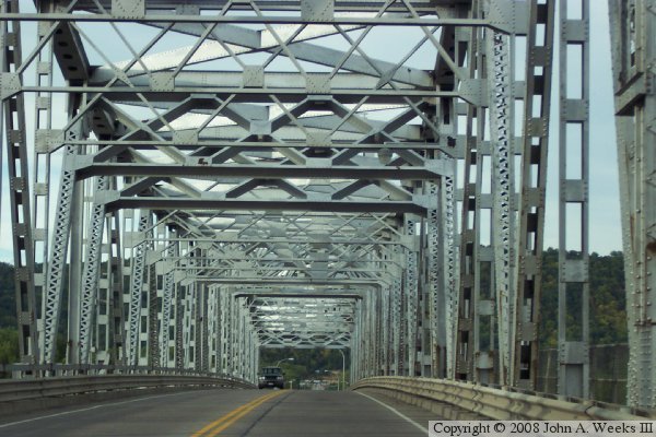
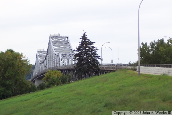
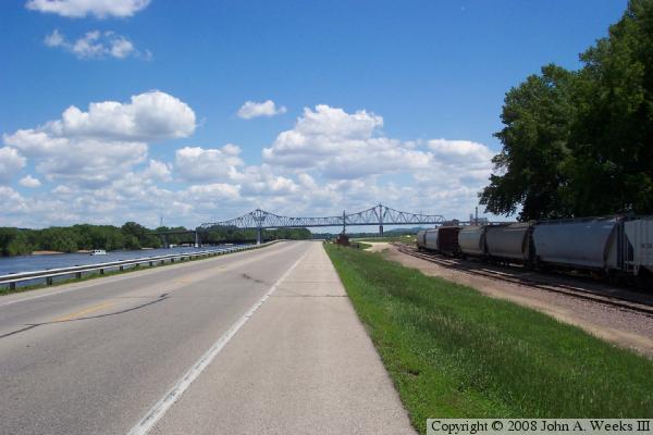
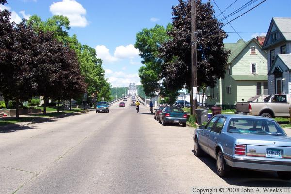
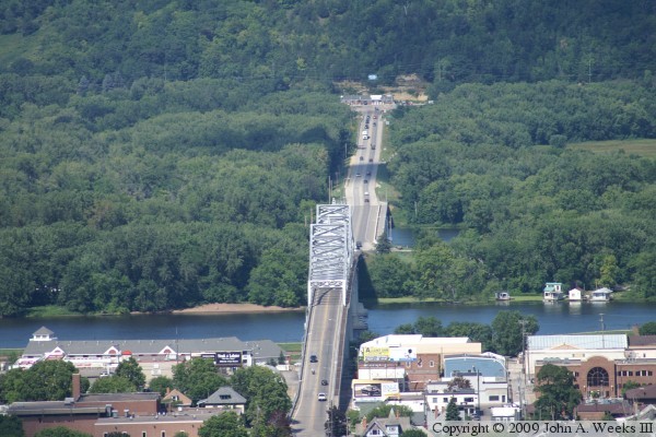
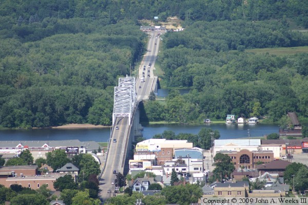
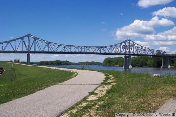
The river crossing here is composed of 3 bridges in all, this main channel structure, the North Channel Bridge, and a short bridge over the railroad tracks on the Wisconsin side. This is the second highway bridge to stand in this spot, having replaced the 1891 structure. There once was two railroad bridges at Winona, both just downstream from this location.

Update—MN-DOT suddenly closed the Winona Main Channel Bridge on June 3, 2008, after it was discovered that the bridge had similar gusset plate problems as the I-35W and DeSoto Bridges. The gusset plates were only marginal to begin with, and showed extensive damage due to rust. It is not known how long the bridge will be closed, or if it can be repaired. The nearest river crossings are La Crosse and Wabasha.

Update—as of June 14, 2008, the Winona Main Channel Bridge is once again open to car and pickup truck traffic. Inspections were made to the bridge and gusset plates, and a new weight limit was set for the bridge. In addition, a series of repairs are needed. The result is that truck traffic, RVs, and trailers are banned from the bridge. Pedestrian and bicycle traffic is also banned since the sidewalks will be used to stage equipment for the bridge repairs. MN-DOT has scheduled this bridge to be replaced in 2014.

Update—the main repairs are now finished, and the bridge was opened for truck traffic on July 22, 2008, ten days ahead of schedule. At that time, there was still repair work to be completed, but the major structural repairs are complete. The remaining work will require the sidewalks to be closed.

Update—as of October 3, 2008, the last of the work on the Winona Main Channel Bridge is complete. The sidewalk and bicycle lanes are once again open for use.

Winona Main Channel Bridge

These two photos are views of the Mississippi River crossing at Winona, Minnesota, as seen from Garvin Heights Park located high on the bluffs on the west side of the river. The city of Winona is on the near side of the river, and highway WI-35 is on the far side of the crossing. The route between WI-35 and the west end of the bridge in Winona covers a distance of 1.4 miles. The photo below is a slightly different angle that includes a view of the old C&NW Railroad bridge on the far right side of the image. The land between the two river channels is known as Island #72.

Winona Main Channel Bridge

Made With Macintosh
Authored by John A. Weeks III, Copyright © 1996—2016, all rights reserved.
For further information, contact: john@johnweeks.com