Current Weather Conditions
John A. Weeks III
Tuesday, March 19, 2024, 1:10:28 AM CDT
Home Photo Tours Rail Fan 12 Easy Steps
Aviation Spacecraft Highways & Bridges About The Author
 
Google Search
Maps   Groups   Images   Search
 
  Home
  • 12 Easy Steps
  • Aviation
  • Spacecraft
  • Highways & Bridges
    » Bridge Photography
      - MSP River Bridges
      - C & D Canal
      - Illinois River
      - Minnehaha Creek
      - Minnesota River
      - Mississippi River
        › Lake Itasca Area
        › Bemidji Area
        › Cass Lake - Ball Club
        › Grand Rapids Area
        › Blackberry - Crosby
        › Brainerd Lakes Area
        › Little Falls Area
        › St. Cloud Area
        › North Metro Area
        › Port Of Minneapolis
        › St. Anthony Falls Area
        › Mississippi Rvr Gorge
        › St. Paul Area
        › S St. Paul - Hastings
        › Red Wing - Winona
          · Lock & Dam #3
          · Eisenhower Bridge
          · Lloyd Spriggle Mem
          · Lake Pepin Winter Rd
          · Milw Road Pontoon Br
          · Wabasha-Nelson Br
          · Pontoon Slough Br
          · Beef Slough Bridge
          · Buffalo Slough Br
          · Shively Slough Br
          · Lock & Dam #4
          · Lock & Dam #5
          · Lock & Dam #5A
          · Winona Main Channel
          · Winona N Channel Br
          · C&NW Winona Br
          · John A. Latsch Br
          · Winona Bridge Rwy
          · Lock & Dam #6
        › La Crosse Area
        › Lansing - Clinton
        › Quad Cities Area
        › Muscatine - Louisiana
        › St. Louis Area
        › Chester - Cairo
        › Miss - Tenn - Ark
        › Ark - Miss - Louisiana
        › Louisiana Structures
      - Missouri River
      - St. Croix River
      - St. Louis River
      - Wisconsin River
      - Best Miss River Photos
      - Cable Stayed Bridges
      - McGilvray Road Bridges
      - I-35W Bridge Disaster
      - Miscellaneous Bridges
      - Madison County Bridges
      - Hist Br Weekend 2013
    » Road Geek Topics
  • Photo Tours
  • Rail Fan
  • About The Author
 
Site Search By JRank
Highways, Byways, And Bridge Photography
Lock & Dam #4
Mississippi River Lock & Dam
Alma, Wisconsin

Lock & Dam #4

• Structure: Lock & Dam #4.
• Location: River Mile 752.8.
• Dam Width: 7,100 Feet Overall, 367 Foot Wide Dam Structure.
• River Elevation (Pool): 667 Feet.
• River Elevation (Outflow): 660 Feet.
• Water Fall: 7 Feet.
• Annual Lock Traffic: 13,202 Vessels, 8,054,000 Tons (2005).
• Date Opened: May 1935.
The pool behind Lock & Dam #4 includes Lake Pepin, the largest lake that is part of the main river (not considering some of the lakes in the headwaters region that the river flows through). The dam does not, however, create Lake Pepin, the lake has been there since before the river was first mapped. What happens is geologically interesting. The river channel was carved 12,000 years ago when the glacial Lake Agassiz drained at the end of the ice age. The Chippewa River flows into the Mississippi just north of Alma, carrying with it a large load of sediment. Between 12,000 years ago and 9,500 years ago, that sediment accumulated to form a natural dam across the river channel. This dam caused Lake Pepin to form. Today, the lake is about 22 miles long, and averages 1 to 2 miles in width.

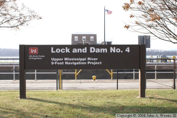
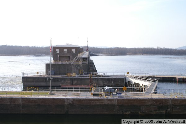
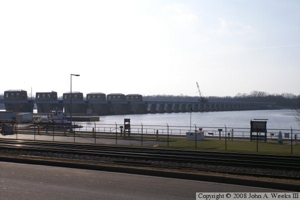
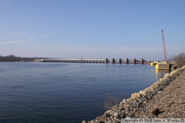
The dam itself has a rather small main structure, but a very long earth embankment. The dam consists 6 of the older style roller gates and 22 of the newer style Tainter gates. This is unlike Lock & Dam #3, just up river, which was opened about the same time. Lock & Dam #3 has only roller gates. The Lock 
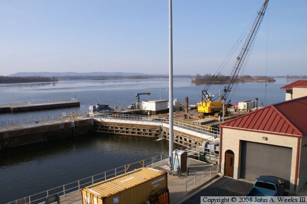
& dam features a single lock 110 feet wide by 600 feet long, which is very typical of the upper river locks.


Lock & Dam #4
Lock & Dam #4
Lock & Dam #4
Lock & Dam #4
Lock & Dam #4
Lock & Dam #4
Lock & Dam #4
Lock & Dam #4

Made With Macintosh
Authored by John A. Weeks III, Copyright © 1996—2016, all rights reserved.
For further information, contact: john@johnweeks.com