The main channel of the Mississippi River is often ice-free in the winter,
and at other locations, the ice has open spots and thin spots. The reason
is that the wing dams and control structures cause the water to flow year
around in the navigation channel. At Lake Pepin, a wide spot in the
Mississippi River, the water slows down and allows ice to get relatively
thick in the winter.
There are several locations on the Minnesota side of the river where public
access boat ramps provide access to the river in the winter. Sportsmen
use this access to haul ice fishing shelters and RVs out onto the river.
There are several thousand of these seasonal structures on Lake Pepin.
Access from the Wisconsin side is limited, but at Maiden Rock, the locals
have plowed an access road to reach the ice fishing villages on the west
side of the river.
Lake Pepin is about 2 miles wide, with the shipping channel being about a
mile wide. The lake averages 18 feet deep, but it is notorious for having
several very deep spots. The ice road extends about 1.75 miles to the west
from the Wisconsin side of the river. There is then about a 1/4 mile gap
before the road picks up again on the west side of the river, and continues
the final 1/2 mile to the western shore. While I did not attempt to drive
the unplowed section, I watched a number of SUV and 4-wheel drive pickups
make the crossing. It appears that some locals are using this route as
a short-cut to cross the river.
Ice roads on Lake Pepin are not a new invention. Farmers used to wait until
the river froze so they could cross the river to haul their cash crops to
market. There was once a railroad bridge at Reed's Landing at the south
end of Lake Pepin. This bridge was a pontoon bridge. It was built across
a series of small boats. When a river tow would approach the bridge, a
tug boat would pull the pontoon bridge out of the way. Once the tow passed,
the tug boat would pull the pontoon bridge back into place to allow trains
to cross. During the winter, this pontoon bridge was pulled out of the water
to prevent it from being crushed. Once the river froze, railroad tracks
would be laid across the ice to allow trains to operate in the winter.
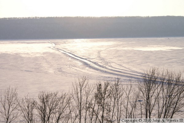
The photo above is a view looking west across the frozen Mississippi River
from highway WI-35 in Maiden Rock, Wisconsin, towards Old Frontenac,
Minnesota, on the west bank of the great river. This photo is looking
directly into the afternoon sun.
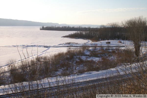
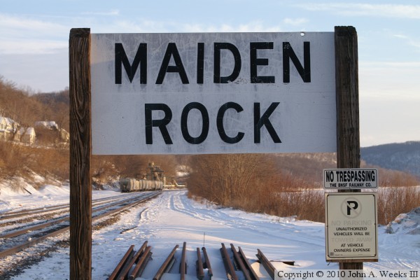
The photo above is looking northeast from highway WI-35 towards Maiden Rock
Village Park. The dark line leading to the river is the village boat dock,
which has been pulled out of the water for the winter. The boat landing
used by the ice road is behind the dock. The photo below is the railroad
sign pointing out the village of Maiden Rock. The BNSF tracks at this
location are very busy, with trains traveling through the village at speeds
of up to 60 MPH.
The photo above is a view looking southwest down the boat ramp and out onto
the ice. The photo below is a lighted buoy that marks the east side of
the navigation channel. The navigation channel is a mile wide at this
location in Lake Pepin, while the river itself is just over 2 miles wide.
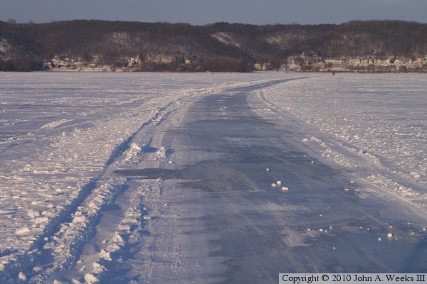
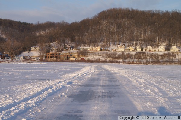
These two photos are views heading eastbound on the ice road towards the
Wisconsin shore. The photo above is about a mile and a half from the east
riverbank, while the photo below is from about a mile from the east riverbank.
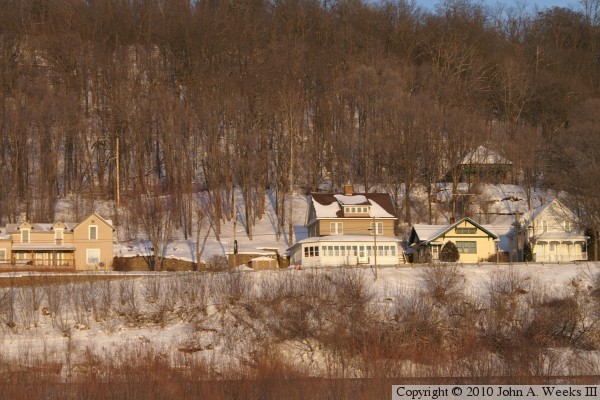
The photo above is a view heading eastbound about one-half mile from the
riverbank on the Wisconsin side of the Mississippi River. Note that there is
much more snow on the ice as we near the east side of the river due to the
shore area being sheltered from the prevailing winds by the river bluffs. The
photo below is a view of homes along the bluff in Maiden Rock.
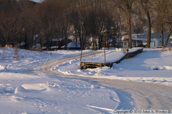
The photo above is heading eastbound off of the ice and up onto the boat
ramp at Maiden Rock, Wisconsin. Note that the ice on the ramp is very
rough compared with the river surface. The photo below is the road leading
out of Maiden Rock Village Park heading towards highway WI-35. A steep
icy grade makes it difficult to turn onto WI-35.
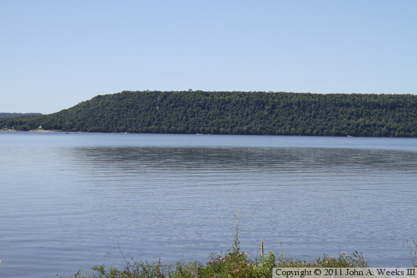
The photo above is a summer view looking west from the Maiden Rock boat
landing across the Mississippi River roughly where the ice road crosses
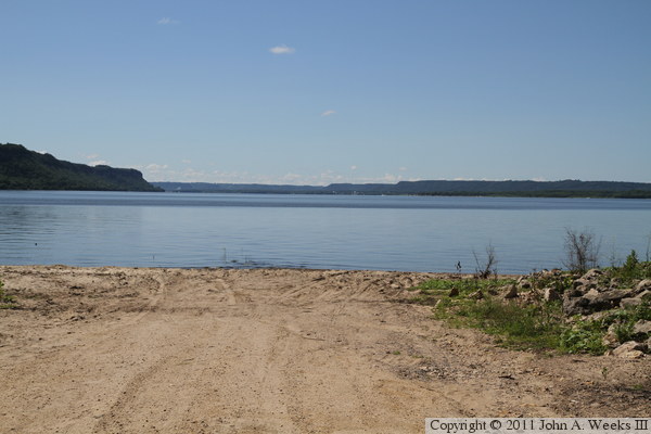
the river in the winter. The photo below is looking southwest down the
boat landing where the ice road begins on the east shore of Lake Pepin.
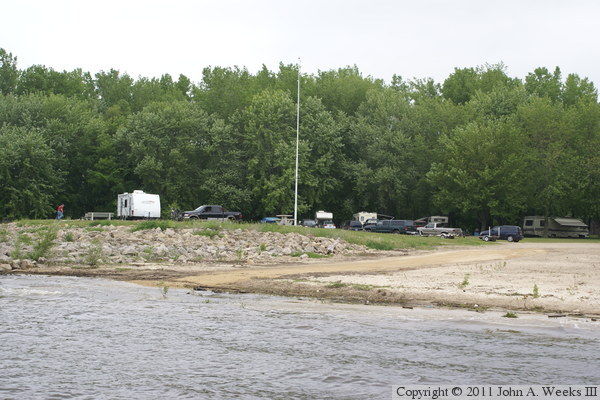
The photo above is looking back towards shore from a boat dock that extends
into the Mississippi River at the Maiden Rock boat landing. The area just
to the north of the boat landing is a public camping area during the summer.
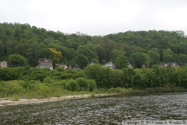
The photo below is a view looking towards the village of Maiden Rock from
the boat dock.
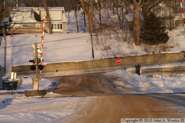
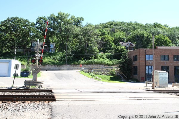
The photo above is the busy BNSF railroad crossing on the road leading to the
boat landing. The photo below is a summer view of the Maiden Rock sign
along the railroad tracks, looking north in this view. In contrast, the
winter photo of the railroad sign above is looking to the south.