Current Weather Conditions
John A. Weeks III
Thursday, March 11, 2010, 8:37:06 PM CST
Home 12 Easy Steps Random Topics About The Author Portal
Aviation Spacecraft Highways & Bridges Photo Tours Rail Fan

Google Search

 Maps  Groups
 Images  Search
  Home
  • 12 Easy Steps
  • Aviation
  • Spacecraft
  • Highways & Bridges
    » Bridge Photography
      - MSP River Bridges
      - Illinois River
      - Minnesota River
      - Mississippi River
        › Lake Itasca Area
        › Bemidji Area
        › Cass Lake - Ball Club
        › Grand Rapids Area
        › Blackberry - Crosby
        › Brainerd Lakes Area
        › Little Falls Area
        › St. Cloud Area
        › North Metro Area
        › Port Of Minneapolis
        › St. Anthony Falls Area
        › Mississippi Rvr Gorge
        › St. Paul Area
        › S St. Paul - Hastings
        › Red Wing - Winona
          · Lock & Dam #3
          · Eisenhower Bridge
          · Lloyd Spriggle Mem
          · Lake Pepin Winter Rd
          · Milw Road Pontoon Br
          · Wabasha-Nelson Br
          · Pontoon Slough Br
          · Beef Slough Bridge
          · Buffalo Slough Br
          · Shively Slough Br
          · Lock & Dam #4
          · Lock & Dam #5
          · Lock & Dam #5A
          · Winona Main Channel
          · Winona N Channel Br
          · C&NW Winona Br
          · John A. Latsch Br
          · Lock & Dam #6
        › La Crosse Area
        › Lansing - Clinton
        › Quad Cities Area
        › Muscatine - Louisiana
        › St. Louis Area
        › Chester - Cairo
        › Miss - Tenn - Ark
        › Ark - Miss - Louisiana
        › Louisiana Structures
      - Missouri River
      - St. Croix River
      - St. Louis River
      - Wisconsin River
      - Cable Stayed Bridges
      - McGilvray Road
      - I-35W Bridge Disaster
      - Miscellaneous Bridges
    » Road Geek Topics
  • Random Topics
  • Photo Tours
  • Rail Fan
  • About The Author
  • John's Portal
 
Site Search By JRank
Highways, Byways, And Bridge Photography
Beef Slough Bridge
MN-60/WI-25 Mississippi River Crossing At Wabasha
Wabasha, Minnesota

Beef Slough Bridge

• Structure ID: NBI B06002100000000.
• Location: River Mile 760.2.
• River Elevation: 667 Feet.
• Highway: MN-60, WI-25.
• Daily Traffic Count: 5,300 (2002).
• Bridge Type: Concrete Girder, Concrete Deck.
• Length: 562 Feet Overall, 70 Foot Main Span.
• Width: 28 Feet, 2 Lanes.
• Navigation Channel Width: 67 Feet.
• Height Above Water: 10 Feet.
• Date Built: Opened 1956.
There are five bridges as part of the Wabasha-Nelson Mississippi River crossing. The main channel bridge is at the state line. The Beef Slough Bridge is the second causeway bridge heading east from Minnesota, and it is located a mile and one tenth east of the state line.

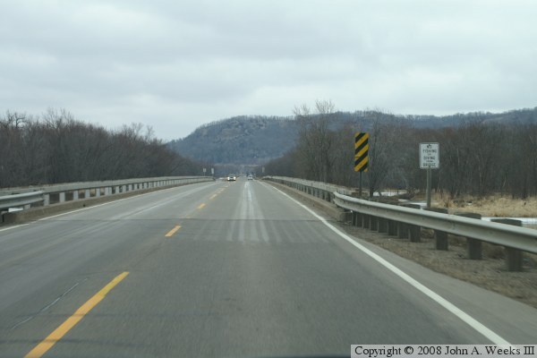
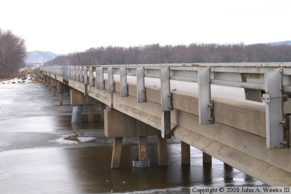
The bridge itself is nearly a carbon copy of the Pontoon Slough Bridge, with the only visible difference being that the Beef Slough Bridge is four feet longer.


Beef Slough Bridge
Beef Slough Bridge

Made With Macintosh
Authored by John A. Weeks III, Copyright © 1996—2010, all rights reserved.
For further information, contact: john@johnweeks.com