Current Weather Conditions
John A. Weeks III
Friday, July 26, 2024, 9:45:41 PM CDT
Home Photo Tours Rail Fan 12 Easy Steps
Aviation Spacecraft Highways & Bridges About The Author
 
Google Search
Maps   Groups   Images   Search
 
  Home
  • 12 Easy Steps
  • Aviation
  • Spacecraft
  • Highways & Bridges
    » Bridge Photography
      - MSP River Bridges
      - C & D Canal
      - Illinois River
      - Minnehaha Creek
      - Minnesota River
      - Mississippi River
        › Lake Itasca Area
        › Bemidji Area
        › Cass Lake - Ball Club
        › Grand Rapids Area
        › Blackberry - Crosby
        › Brainerd Lakes Area
        › Little Falls Area
        › St. Cloud Area
        › North Metro Area
        › Port Of Minneapolis
        › St. Anthony Falls Area
        › Mississippi Rvr Gorge
        › St. Paul Area
        › S St. Paul - Hastings
        › Red Wing - Winona
        › La Crosse Area
          · Lock & Dam #7
          · Dresbach Bridge
          · Round Lake Bridge
          · French Slough Bridge
          · Rest Area Bridge
          · Black River Channel
          · Hiawatha Islands Br
          · Clinton Street Bridge
          · Fisherman's Bridge
          · CP RR La Crosse
          · CP RR East Channel
          · CP RR French Slough
          · CP RR Black Rr Br
          · Pettibone Park Br
          · The Miss River Br
          · West Channel Bridge
          · Isle La Plume Foot Br
          · Niedbalski Bridge
          · Green Island Bridge
          · Goose Island Bridge
        › Lansing - Clinton
        › Quad Cities Area
        › Muscatine - Louisiana
        › St. Louis Area
        › Chester - Cairo
        › Miss - Tenn - Ark
        › Ark - Miss - Louisiana
        › Louisiana Structures
      - Missouri River
      - St. Croix River
      - St. Louis River
      - Wisconsin River
      - Best Miss River Photos
      - Cable Stayed Bridges
      - McGilvray Road Bridges
      - I-35W Bridge Disaster
      - Miscellaneous Bridges
      - Madison County Bridges
      - Hist Br Weekend 2013
    » Road Geek Topics
  • Photo Tours
  • Rail Fan
  • About The Author
 
Site Search By JRank
Highways, Byways, And Bridge Photography
Black River Channel Bridge
I-90 Mississippi River Crossing At La Crosse
La Crosse, Wisconsin

Black River Channel Bridge

Westbound Structure
• Structure ID: NBI B32003500000000.
• Highway: I-90 Westbound.
• Daily Traffic Count: 14,180 (2003).
• Length: 564 Feet.
• Width: 36 Feet.
 
Eastbound Structure
• Structure ID: NBI B32003400000000.
• Highway: I-90 Eastbound.
• Daily Traffic Count: 13,250 (2003).
• Length: 564 Feet.
• Width: 36 Feet.
 
Statistics Common To Both Structures
• Location: River Mile 701.8.
• River Elevation: 631 Feet.
• Bridge Type: Steel Girder, Concrete Deck.
• Navigation Channel Width: Non-Navigable.
• Height Above Water:  
• Date Built: Built 1964, Rebuilt 1994.
The I-90 Mississippi River crossing at La Crosse is nearly 3 miles across. The crossing consists of long causeways, the main channel Dresbach Bridge, the Round Lake Bridges, the French Slough Bridges, and these two bridges over the Black River Channel. The Black River flows for about 160 miles, starting in Taylor County in north-central Wisconsin. The Black river once converged with the Mississippi near downtown La Crosse, flowing in a channel that was roughly parallel to the Mississippi over its final 10 miles. When Lock & Dam #7 was built, the Mississippi River captured the Black River several miles upstream from the Lock & Dam structure. Part of the historic Black River channel dried up and is now farmland, much of it remains wetlands, and the final few miles is now a backwater of the Mississippi River.

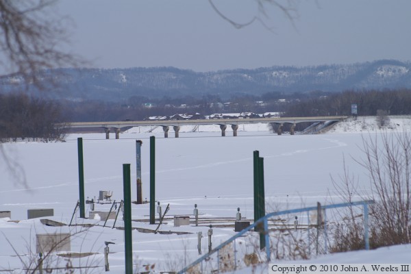
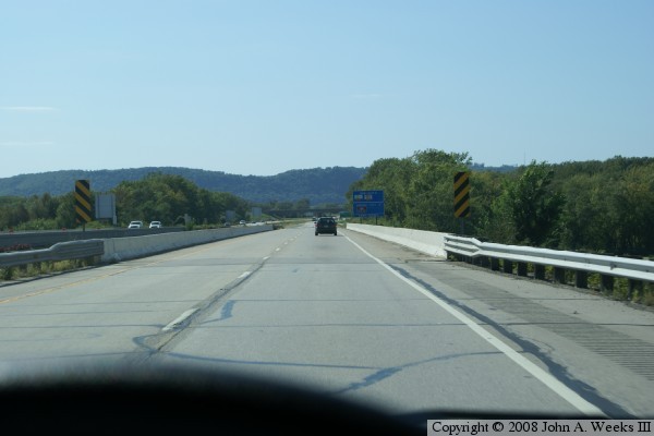
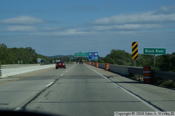
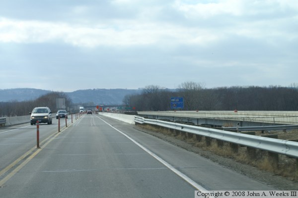
The photo above is a profile shot of the bridge taken on a slightly gray winter day in early 2007 while repairs were being done on the bridge decks. Both directions of traffic were routed onto one bridge while the other bridge was under construction. The bottom photo shows traffic flowing in both directions on the eastbound span, with the photo taken as we are crossing to the west. The photo below is the westbound bridge, while the third photo is the eastbound bridge, this time, taken during late summer.


Black River Channel Bridge

Made With Macintosh
Authored by John A. Weeks III, Copyright © 1996—2016, all rights reserved.
For further information, contact: john@johnweeks.com