Current Weather Conditions
John A. Weeks III
Saturday, July 27, 2024, 8:47:07 AM CDT
Home Photo Tours Rail Fan 12 Easy Steps
Aviation Spacecraft Highways & Bridges About The Author
 
Google Search
Maps   Groups   Images   Search
 
  Home
  • 12 Easy Steps
  • Aviation
  • Spacecraft
  • Highways & Bridges
    » Bridge Photography
      - MSP River Bridges
      - C & D Canal
      - Illinois River
      - Minnehaha Creek
      - Minnesota River
      - Mississippi River
        › Lake Itasca Area
        › Bemidji Area
        › Cass Lake - Ball Club
        › Grand Rapids Area
        › Blackberry - Crosby
        › Brainerd Lakes Area
        › Little Falls Area
        › St. Cloud Area
        › North Metro Area
        › Port Of Minneapolis
        › St. Anthony Falls Area
        › Mississippi Rvr Gorge
        › St. Paul Area
        › S St. Paul - Hastings
        › Red Wing - Winona
        › La Crosse Area
          · Lock & Dam #7
          · Dresbach Bridge
          · Round Lake Bridge
          · French Slough Bridge
          · Rest Area Bridge
          · Black River Channel
          · Hiawatha Islands Br
          · Clinton Street Bridge
          · Fisherman's Bridge
          · CP RR La Crosse
          · CP RR East Channel
          · CP RR French Slough
          · CP RR Black Rr Br
          · Pettibone Park Br
          · The Miss River Br
          · West Channel Bridge
          · Isle La Plume Foot Br
          · Niedbalski Bridge
          · Green Island Bridge
          · Goose Island Bridge
        › Lansing - Clinton
        › Quad Cities Area
        › Muscatine - Louisiana
        › St. Louis Area
        › Chester - Cairo
        › Miss - Tenn - Ark
        › Ark - Miss - Louisiana
        › Louisiana Structures
      - Missouri River
      - St. Croix River
      - St. Louis River
      - Wisconsin River
      - Best Miss River Photos
      - Cable Stayed Bridges
      - McGilvray Road Bridges
      - I-35W Bridge Disaster
      - Miscellaneous Bridges
      - Madison County Bridges
      - Hist Br Weekend 2013
    » Road Geek Topics
  • Photo Tours
  • Rail Fan
  • About The Author
 
Site Search By JRank
Highways, Byways, And Bridge Photography
Hiawatha Islands Bridge
Nakomis Avenue Mississippi River Crossing At La Crosse
La Crosse, Wisconsin

Hiawatha Islands Bridge

• Structure ID: NBI B320121000000.
• Location: River Mile 700.4.
• River Elevation: 631 Feet.
• Highway: Nakomis Avenue.
• Daily Traffic Count: 500 (2008).
• Bridge Type: Prestressed Concrete Girder, Blacktop Deck.
• Length: 55 Feet.
• Width: 34 Feet, 2 Lanes.
• Navigation Channel Width: Non-Navigable.
• Height Above Water: 14 Feet (Estimated).
• Date Built: 1987.
The Mississippi River is very wide in the La Crosse area. The river consists of a main channel, a number of sloughs and back channels, a large island known as French Island, and the Black River channel. The Black River channel was once an independent river, but the Mississippi captured the Black River several miles upstream.

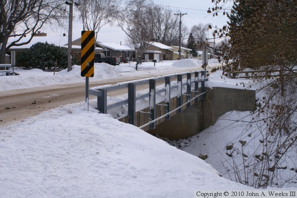
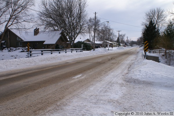
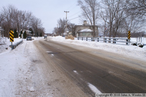
The Hiawatha Islands are a pair of long narrow islands that run parallel to and on the west side of the Black River channel. Clinton Street crosses the lower island carrying County Highway B between the mainland on the Wisconsin side of the river and French Island. Nakomis Street branches off and runs the length of the lower Hiawatha Island. A short causeway connects to the upper Hiawatha Island. A channel has been cut across the lower island, which has been bridged by this short concrete girder bridge. The islands have been developed as the Hiawatha Islands subdivision. The south end of the lower island is a park.

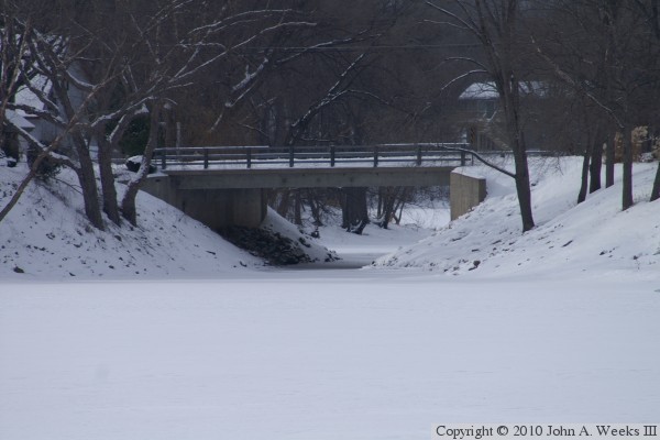
The photo above is the east face of the Hiawatha Islands Bridge as seen from the east shore of the Black River channel of the Mississippi River. The vantage point is the parking lot of a motor lodge on US-53 just south of Interstate I-90. This photo, and the 4 photos that follow, were shot on a very cold January day in 2010.


Hiawatha Islands Bridge
The photo above is the west face of the bridge as seen from the northwest corner of the structure. Note that the bridge railing is attached to the side of the concrete deck structure. The photo below is looking east across the bridge deck, and across the Black River channel of the Mississippi.

Hiawatha Islands Bridge
These two photos are views looking down the length of the bridge deck. The photo above is looking to the south from the west side of the highway. The photo below is looking to the north, also from the west side of the highway.

Hiawatha Islands Bridge

Made With Macintosh
Authored by John A. Weeks III, Copyright © 1996—2016, all rights reserved.
For further information, contact: john@johnweeks.com