Current Weather Conditions
John A. Weeks III
Friday, July 26, 2024, 7:59:52 PM CDT
Home Photo Tours Rail Fan 12 Easy Steps
Aviation Spacecraft Highways & Bridges About The Author
 
Google Search
Maps   Groups   Images   Search
 
  Home
  • 12 Easy Steps
  • Aviation
  • Spacecraft
  • Highways & Bridges
    » Bridge Photography
      - MSP River Bridges
      - C & D Canal
      - Illinois River
      - Minnehaha Creek
      - Minnesota River
      - Mississippi River
        › Lake Itasca Area
        › Bemidji Area
        › Cass Lake - Ball Club
        › Grand Rapids Area
        › Blackberry - Crosby
        › Brainerd Lakes Area
        › Little Falls Area
        › St. Cloud Area
        › North Metro Area
        › Port Of Minneapolis
        › St. Anthony Falls Area
        › Mississippi Rvr Gorge
        › St. Paul Area
        › S St. Paul - Hastings
        › Red Wing - Winona
        › La Crosse Area
          · Lock & Dam #7
          · Dresbach Bridge
          · Round Lake Bridge
          · French Slough Bridge
          · Rest Area Bridge
          · Black River Channel
          · Hiawatha Islands Br
          · Clinton Street Bridge
          · Fisherman's Bridge
          · CP RR La Crosse
          · CP RR East Channel
          · CP RR French Slough
          · CP RR Black Rr Br
          · Pettibone Park Br
          · The Miss River Br
          · West Channel Bridge
          · Isle La Plume Foot Br
          · Niedbalski Bridge
          · Green Island Bridge
          · Goose Island Bridge
        › Lansing - Clinton
        › Quad Cities Area
        › Muscatine - Louisiana
        › St. Louis Area
        › Chester - Cairo
        › Miss - Tenn - Ark
        › Ark - Miss - Louisiana
        › Louisiana Structures
      - Missouri River
      - St. Croix River
      - St. Louis River
      - Wisconsin River
      - Best Miss River Photos
      - Cable Stayed Bridges
      - McGilvray Road Bridges
      - I-35W Bridge Disaster
      - Miscellaneous Bridges
      - Madison County Bridges
      - Hist Br Weekend 2013
    » Road Geek Topics
  • Photo Tours
  • Rail Fan
  • About The Author
 
Site Search By JRank
Highways, Byways, And Bridge Photography
Goose Island Bridge
Co Road GI Mississippi River Crossing At Stoddard
Stoddard, Wisconsin

Goose Island Bridge

• Structure ID: NBI B32007600000000.
• Location: River Mile 691.3.
• River Elevation: 631 Feet.
• Highway: La Crosse County Road GI.
• Daily Traffic Count: 780 (2001).
• Bridge Type: Prestressed Concrete Girder, Concrete Deck.
• Length: 219 Feet Overall.
• Width: 28 Feet.
• Navigation Channel Width: Non-Navigable.
• Height Above Water: Unknown.
• Date Built: Opened 1978.
Goose Island is a 710 acre park located on an island in the Mississippi River about 3 miles downstream of La Crosse, Wisconsin. Access is from County Road GI on the Wisconsin side of the river. The park is operated by the La Crosse County Parks Dept., and it features over 400 camp sites and a large calendar of planned activities.

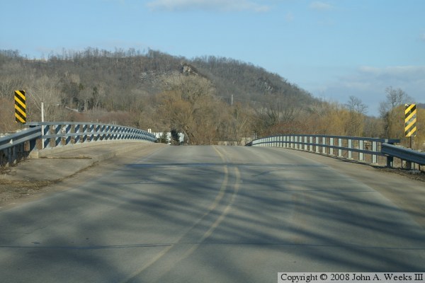
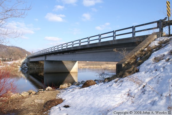
The Root River flows into the Mississippi River just above the north end of Goose Island. As a result, the river here is very wide and has extensive silt islands that form a maze of back channels and sloughs.


Goose Island Bridge

Made With Macintosh
Authored by John A. Weeks III, Copyright © 1996—2016, all rights reserved.
For further information, contact: john@johnweeks.com