| Highways, Byways, And Bridge Photography |
Lock & Dam #7
Mississippi River Lock & Dam
La Crescent, Minnesota
|
• Structure: |
Lock & Dam #7. |
|
• Location: |
River Mile 702.5. |
|
• Dam Width: |
11,500 Feet Overall, 940 Foot Wide Dam Structure. |
|
• River Elevation (Pool): |
639 Feet. |
|
• River Elevation (Outflow): |
631 Feet. |
|
• Water Fall: |
8 Feet. |
|
• Annual Lock Traffic: |
11,445 Vessels, 10,392,000 Tons (2005). |
|
• Date Opened: |
April 1937. |
Lock & Dam #7 is one of the most visited lock and dam structures
on the Mississippi River. It is located where Interstate I-90 crosses
from Wisconsin to Minnesota. There is a welcome center on the
Minnesota side, and the lock and dam visitor viewing area is accessed
from the same road. As a result, many folks who are traveling through
the area stop at the visitor center, then head over to check out the
lock and dam.
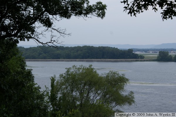
This structure is located at one of the most scenic spots on the Great
River Road. The river is miles wide at this point, with many islands.
The roadway is located high enough above the river and railroad tracks
that you get a nearly continuous stream of views that are both dramatic
and impressive. The only other section of the river that can compare
is the Palisades north of Saint Louis (north of Alton to the Illinois
River).
The locks and the main dam control structure are located on the Minnesota
side of the river. There is an 9,500 foot earth embankment running from the
east end of the dam structure over to French Island. French Island is part of
the city of La Crosse, and is the location of the regional airport. There is
another 2,050 foot earth embankment on the east side of French Island. It
blocks the main channel of the Black River. The Black River was once a
separate river in this area, but it was captured a few miles up river by the
Mississippi a few centuries ago. The dam across the Black River features a
concrete spillway to allow water to flow over the dam during periods of high
water.
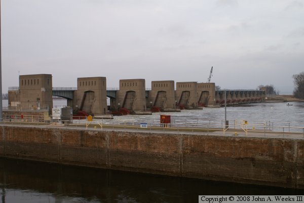
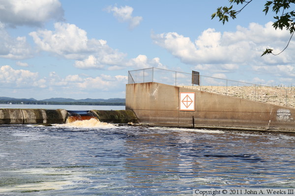
The photo above is looking east along the downstream face of the main
dam control structure from the viewing platform near the boat lock.

The photo above is the US Army Corps of Engineers sign for the lock & dam
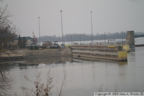
project. The photo below is looking upstream towards the boat lock from
the west bank of the Mississippi River at the nearby highway rest stop and
welcome center.
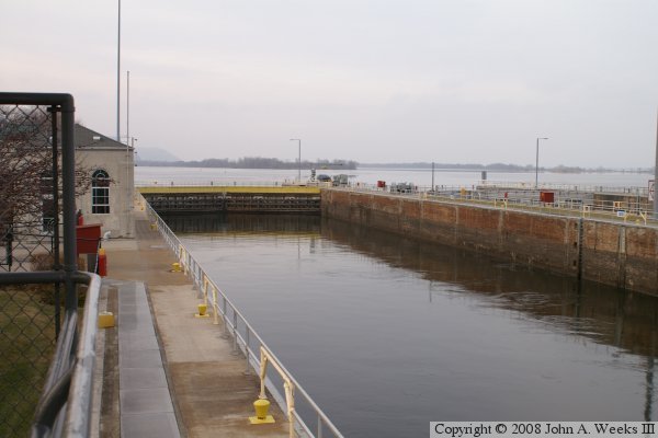
The photo above is looking towards the upstream end of the boat lock from
the viewers platform on a cold winter morning. The photo below is looking
downstream through the open end of the boat lock, also from the viewing
platform. The boat lock is the standard size for the upper Mississippi River,
600 feet long by 110 feet wide. The Interstate highway I-90 Dresbach Bridge
is visible in the distance.

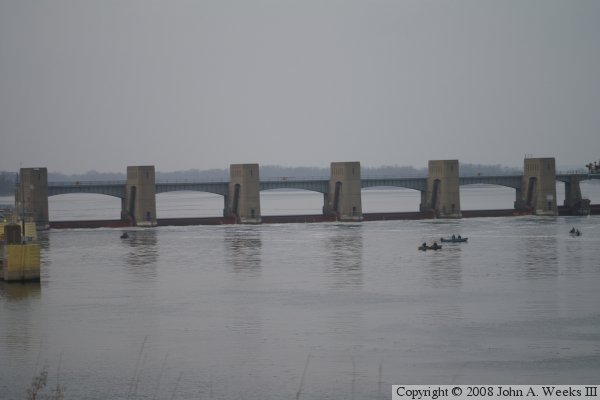
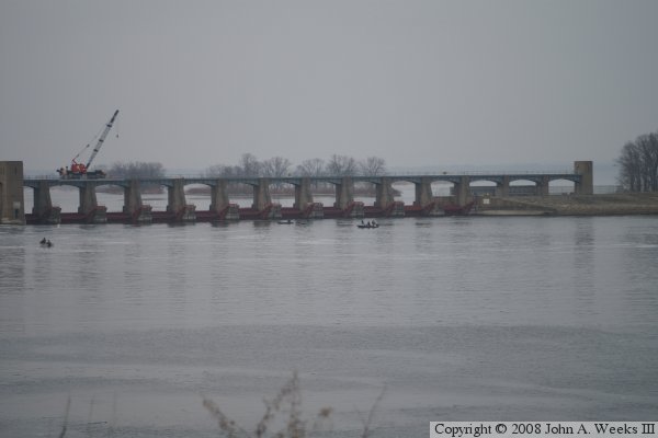
These two photos are views of the main dam control structure as seen looking
north from the nearby highway rest stop and welcome center. The photo above
is the 5 roller gates on the west end of the control structure. The photo
below is the 11 tainter gates on the east end of the control structure. This
structure is 940 feet long, not including the boat locks.
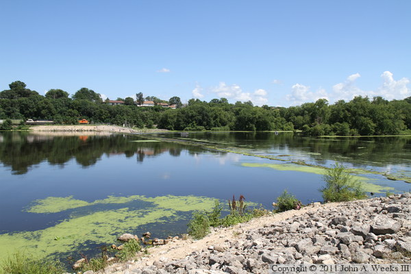
These two photos are views of the earthen dam segment and spillway on the east
side of French Island. The photo above is looking east down the dam embankment
from the access road on the east side of French Island. Onalaska, Wisconsin,
is in the background. The photo above is looking southwest towards the dam
from an overlook located on highway WI-35 about 3,000 feet north of the
structure. The La Crosse Municipal Airport, located on French Island, is
visible in the background.
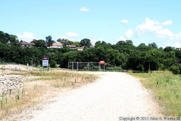
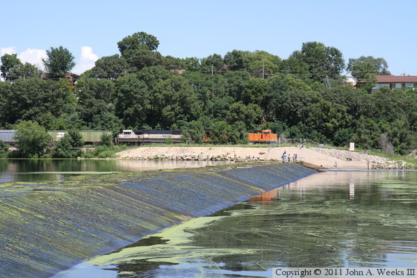
The photo above is a gate located on French Island leading to the eastern
segment of the dam between the island and Onalaska. The photo above is
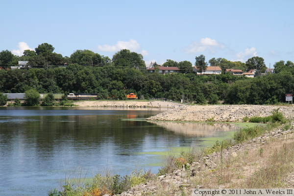
looking east towards Onalaska along the north side of the dam. A BNSF
freight train is parked on the far side of the river channel waiting for
a signal to give clearance to move into the north end of the BNSF rail yard
in La Crosse. The embankment and spillway are a total of 2,400 feet long.
The photo above is looking east towards the railing along the west edge of
the spillway on the dam segment located between French Island and Onalaska.
The photo below is looking east along the top of the spillway apron.
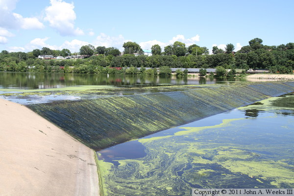
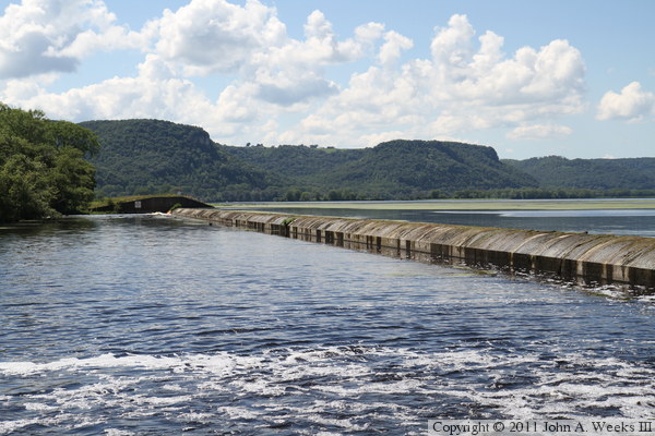
The photo above is another view looking east along the top of the spillway
located on the east side of French Island. This photo is a wider view that
shows the entire 670 feet of the concrete spillway. The photo
below is looking southeast from just upstream of the spillway.
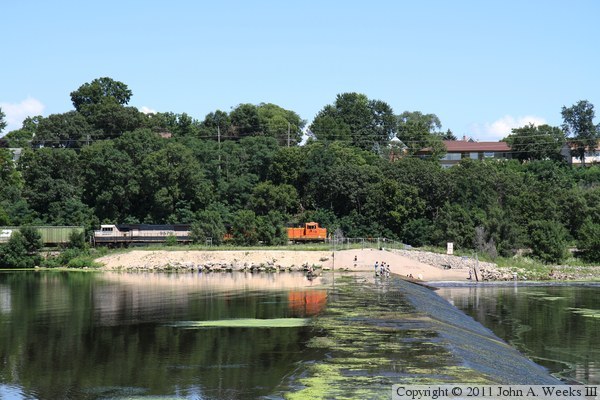
These two photos are views looking northeast towards the spillway structure
from just downstream of the structure. The photo above shows the eastern
section of the spillway, whereas the photo below shows the western section.
Note the people standing on the structure at the far end. There is a small
control structure at that location that is slightly above the water level.

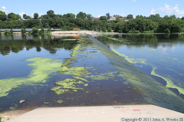
The photo above is looking east along the downstream face of the spillway
located on the east side of French Island. Note the accumulation of algae
on the spillway. This makes the concrete as slick as grease, making it
very risky to attempt to walk on the structure. The photo below is looking
back to the west towards French Island from the west end of the spillway.
The cars in the distance are in a small parking area located off of the
east side of Fishermans Road, which circles three sides of the airport.

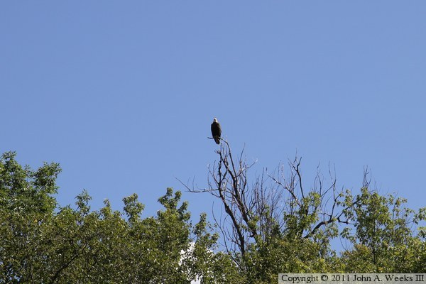
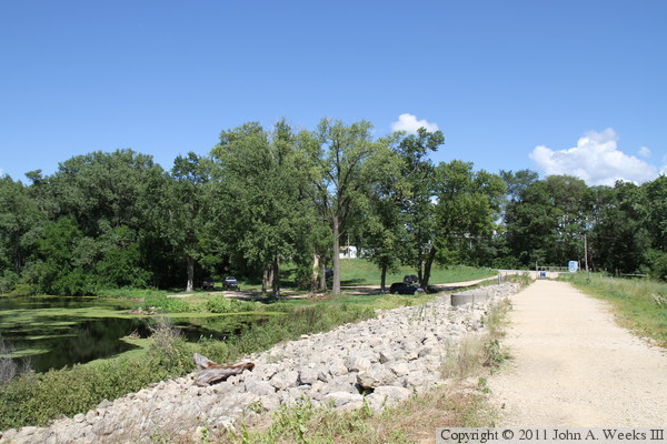
The photo above is looking east from French Island from just upstream of
the earthen embankment that runs between the Minnesota side of the
Mississippi River and French Island. The photo below is an eagle perched
in the trees high above the earthen dam.

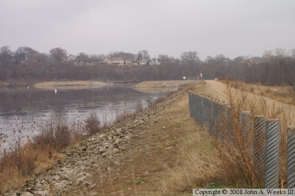
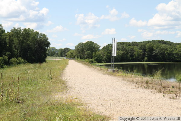
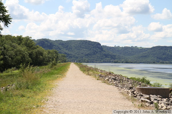
These two photos are looking west along the top of the earthen embankment
located on the west side of French Island. The photo above shows the gate
leading to the embankment, while the photo below is from just beyond the
gate. The western section of the dam has a 2,800 foot embankment, a 1,000
foot spillway, a 4,200 foot embankment, and then the 1,600 foot main
control structure and boat locks.

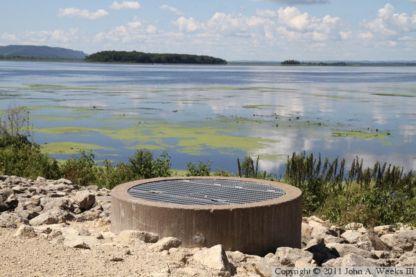
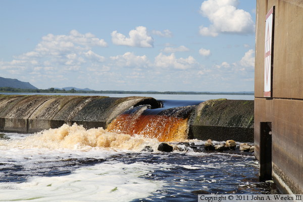
The photo above is water flowing from a small control gate that feeds
French Slough. The photo above is the access portal leading down to the
control valve that controls this water flow.
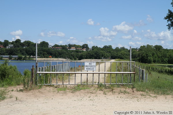
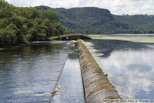
The photo above is looking west towards the fence along the east end of the
spillway located on the west side of French Island. The photo below is a
view looking west across the spillway, which is about 1,000 feet wide.
These two photos are views looking northwest towards the spillway from
just downstream of the structure. The photo above shows the west end of
the spillway, while the photo above includes the east end. There are small
notches in the concrete near each end of the spillway to allow water to flow
past through the structure and into Rournd Lake at normal pool levels.

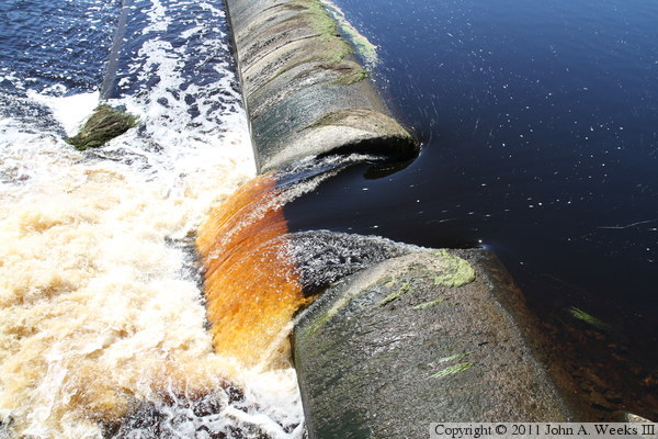
The photo above is looking down from above towards the small water outlet at
the east of the spillway. The photo below is a view looking to the north
from just downstream of the spillway. There is a small finger of dry land
that extends out into the channel just below the spillway that is a popular
location for anglers, which allows for these downstream views.
These two photos are additional views looking north towards the east end
of the spillway from just downstream of the structure.


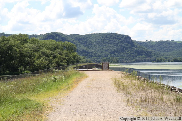
The photo is looking east towards French Island from the east end of the
spillway on the embankment located on the west side of French Island.
The photo below is another view looking east from the embankment towards
the parking area at the east end of this structure.
|
