| Highways, Byways, And Bridge Photography |
The I-35W Bridge Detour
Photo Tour Of The I-35W Bridge Detour
Traveling Northbound Via MN-280
MN-DOT was handed a tall order on August 1, 2007. That was to prepare
a safe marked detour for 140,000 cars a day with zero prior notice, and
hopefully not paralyze traffic in the largest city in the state in the
process. Fortunately, we had the nearly forgotten MN-280 4-lane highway
and available capacity on the recently rebuilt section of I-94 in our
collective back pocket. The detour markings started as a huge number
of temporary devices (such as cones), and evolved over time to a smaller
set of more permanent markers. This photo tour, shot in early September,
2008, shows the final version of the detour markings. While Flatiron
is getting recognized for finishing the new bridge months early, the
detour is where MN-DOT really hit a home run. Traffic was relatively
smooth despite the unexpected loss of the third most traveled bridge in
the state in the heart of the biggest downtown in the state.
This photo tour shows a typical trip through the I-35W detour heading
northbound following highways I-94 eastbound and MN-280 northbound.
Note—these materials are covered by copyright and may not be
used without written permission.
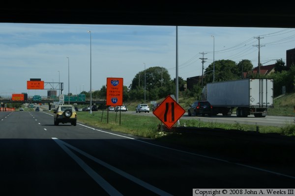
The photo above is our starting point. We are located on eastbound I-35W
in the downtown Minneapolis commons area. The roadway to our right is
I-94 eastbound. The ramp to our right is the cross-over ramp from I-94
to I-35W. The orange diamond sign warns that a lane on I-35W is being
dropped. The next orange sign instructs I-35W traffic to follow I-94.
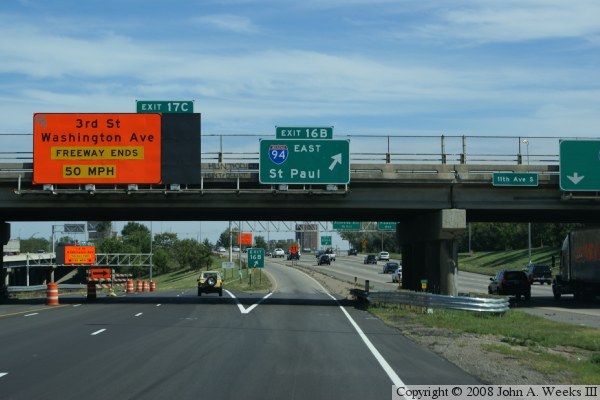
The photo above is where I-35W departs from the commons area and turns
to the north. Our options normally include two lanes staying with
I-35W (on the far left), two lanes branching off to the local exits near
the U of M campus, and this exit to the right to stay on the detour.
During the detour, the normal big green sign pointing to the lanes for
I-35 is covered up, and a big orange sign suggests that the freeway will end.
We continue on the marked detour.
The photo below shows our location once we are up onto I-94 eastbound.
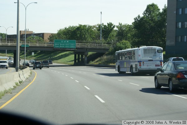
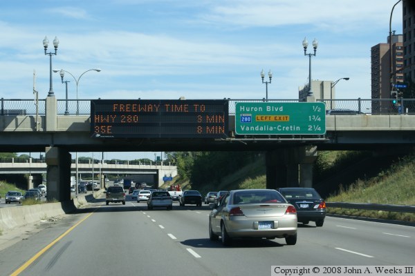
The photo above is I-94 eastbound crossing under an overpass between the
Elliot Park and Seward neighborhoods. We are heading towards the
Dartmouth Bridge over the Mississippi River. This area was repainted
to give 4 through lanes during the detour. The lanes are a foot narrower
than normal, and there are little or no shoulder area. The extra lane
did prove to be popular, so MN-DOT retained it after the new bridge was
opened. The variable message sign says 3 minutes to MN-280, which means
no delay at highway speed.
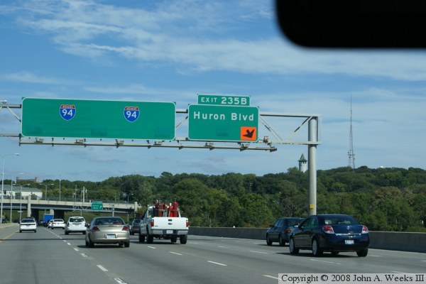
The photo below is crossing the Dartmouth Bridge over the Mississippi
River. The bridge has been repainted for 4 through lanes and one extra
lane for the Huron Blvd exit. Huron Blvd is the best exit for University
traffic. The arrows are removed from the sign and a temporary arrow was
installed since the lanes were shifted when the new lanes was added.

The photo above is I-94 eastbound near 27th Avenue. The orange sign
reassures drivers that they are still on the I-35W detour. It also
informs drivers that the detour is moving to MN-280, and that will be
a left exit.
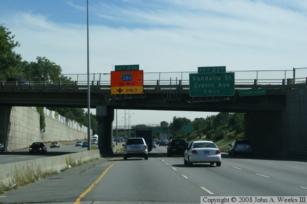
The photo below is passing under Franklin Avenue. The orange sign
informs drivers that MN-280 is 3/4 of a mile ahead, and that this
lane, the far inside lane, will be an exit only. That is, the lane
will exit to MN-280 with no option to continue on I-94.

The photo above is on I-94 eastbound. The big orange sign alerts drivers
that MN-280 is coming up. It also indicates that the far left lane will
exit onto MN-280, and the second from the left lane will have the option
of taking MN-280 or remaining on I-94.
The photo below shows the split where MN-280 branches off to the north,
and I-94 continues to the east. The second from the left lane divides
in two and goes both ways at this location. I-94 will remain 3 lanes
for about 1000 feet, where a ramp from MN-280 southbound will join I-94
as the 4th lane. The big orange sign now shows both lanes on MN-280
as exit only. This sign is here as much to warn traffic about a sharp
corner as much as any information like highway name.

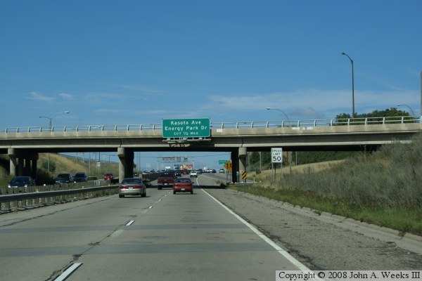
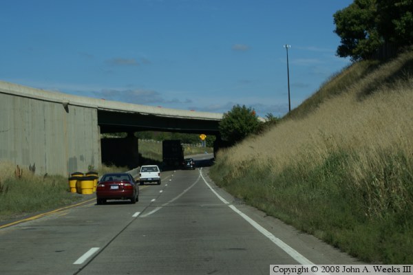
The photo above is MN-280 northbound. We are just crossing under
Territorial Road, which is just north of University Avenue. The
lower section of MN-280 was more or less unchanged when it became
part of the I-35W detour. The green sign informs drivers that the
exits for Energy Park Drive and Kasota Avenue are approaching.
The photo below shows the ramps for Energy Park Drive and Kasota
Avenue. The ramps are short and the curves are tight, but at least
there are acceleration lanes. While it is hard to see in this photo,
MN-DOT installed concrete K-blocks down the center of the highway
to act as a barrier to prevent vehicles from crossing over the median.

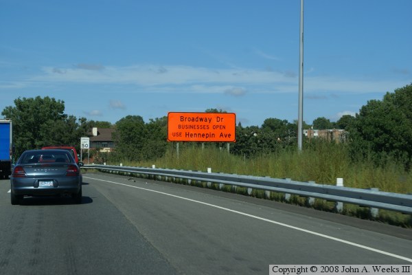
The photo above is MN-280 northbound near Como Avenue. The orange
sign suggests that drivers looking for Broadway Street should take
Hennepin Avenue instead. What is not being said here is that
Broadway Avenue is blocked off at MN-280.
The photo below is approaching the interchange for Larpenteur Avenue
and Hennepin Avenue. The border between Minneapolis and Saint Paul runs
more or less parallel to MN-280 just to the west of the highway. As
a result, many streets change names near or when crossing MN-280.
Larpenteur and Hennepin are one such example.

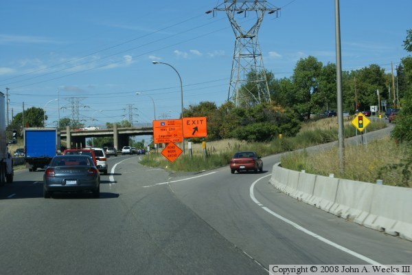
The photo above shows the Larpenteur/Hennepin exit, while the photo below
shows the entrance ramp merging into MN-280. Prior to the detour, these
ramps were very short and sharp. In addition, there were very tight
loops inside the ramps. When the detour was built, the loops were
removed and acceleration lanes were installed. K-blocks were installed
along the side of the road as a barrier. As shown below, the merge is
still a challenge for trucks.
Note that MN-DOT has scheduled a full replacement of this interchange
in 2009. The new interchange will meet modern freeway standards and
be a keystone in the MN-DOT effort to convert MN-280 into a full freeway.

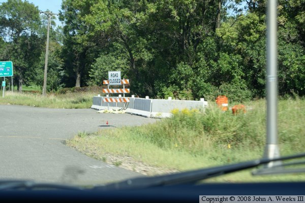
These two photos show intersections with city streets that have been
closed off. This allowed MN-DOT to convert the north end of MN-280
into an expressway with no stop signs or stop lights. The photo above
is Roselawn Avenue, while the photo below is Walnut Street.
Roselawn Avenue had a turn lane, so the turn lane had to be blocked as
well as the street. Walnut Street has no houses on its last block,
so it is also blocked off at Ryan Avenue.
These street barricades went through an evolution over time. On the first
few days of the detour, they were simply orange cones and squad cars. Then
the wooden barricades were installed. That was followed by temporary
water-filled plastic barriers, and then these concrete K-blocks.
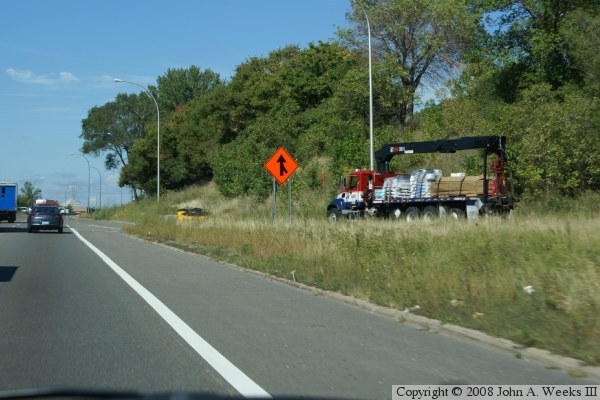
In the weeks before the new bridge was open, crews were removing trees
and brush from along the east side of MN-280. This work is to prepare
for installing sound walls as part of the MN-280 upgrade to be a full
freeway. This work can be seen in the photo above.
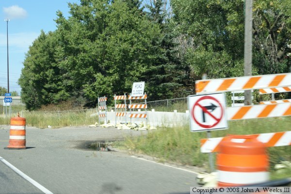
The photo above is a view of the last closed street while heading north,
County Road B. Orange barrels were placed to keep traffic from using the
turn lane since there is no merge lane for traffic to re-enter MN-280 once
they discover that the street is blocked off.
The photo below is the overpass for MN-36. This is part of the I-35W
commons area with MN-36. At this location, the 4 lanes of I-35W split
into two roadways, one set of 2 lanes for I-35W, and a set of 2 lanes
for MN-36. Since MN-280 traffic could select either highway, and MN-DOT
did not want people making 3 lane changes to reach I-35W, the ramps from
MN-280 are brought up in the middle between I-35W and MN-36. That
requires northbound MN-280 to pass under MN-36, then make a rather
sharp corner. This ramp has been one lane in the past, but it was
expanded to 2 lanes for the detour.

The photo above is the MN-280 northbound ramp merging into I-35W between
the lanes for I-35W and MN-36. The black car is in the lane from I-35W.
The two lanes in front of our view is from MN-280. Two lanes of MN-36
are to the right of the grass. We can see the temporary pavement and
blacktop curb where the MN-280 ramp was expanded to two lanes for the detour.
The photo below is the end of the detour as we are back on the main line
for I-35W. At this location, I-35W uses the left 3 lanes, and MN-36
uses the right 2 lanes. The two highways split just ahead, with MN-36
continuing east, while I-35W turns to the left to head north.

|

