| Highways, Byways, And Bridge Photography |
I-35W Bridge Construction
Views Of The New I-35W Bridge Project
At The 80% Mark — July, 2008
The busy Interstate I-35W bridge over the Mississippi River in downtown
Minneapolis, Minnesota, collapsed at the peak of rush hour on Wednesday,
August 1, 2007. Once the rescue operation was completed and the site
was cleaned up, MN-DOT was anxious to get a new bridge built. The Flatiron
company from Denver, Colorado, submitted the highest bid, and suggested
a project plan that would take the longest. They did, however, score the
highest on the technical review of the bid responses, and there was
concern that the other bidders would not be able to meet their proposed
timelines. As a result, Flatiron was selected to build the new bridge.
They accepted what sounds like a nearly impossible project, to build
a modern interstate highway bridge in a cramped urban location in the
flight path to a major airport over a river that supported barge traffic,
and do it within a year.
Note—these materials are covered by copyright and may not be
used without written permission.
Flatiron appears to be doing amazing work. In the span of 5 weeks
between the end of May and the 4th of July, they hoisted and installed
all of the precast concrete bridge segments for the main spans. That
left a 7 foot gap in the middle, which was filled with concrete. In
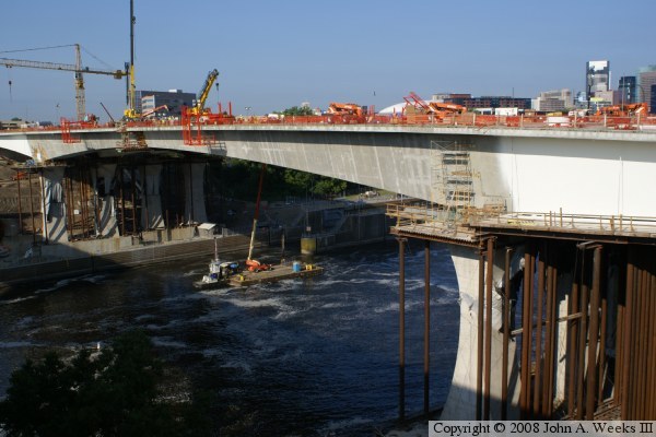
this view at the 80% completion mark, the bridge project is really
starting to look like a bridge.
Photographing this project is difficult due a limited viewing area, the
sun angle and shadows being right only a few minutes around 9:00 AM,
and a tall chain link fence. These photos had to be shot blindly over
that fence. That resulted in some shots being a bit tilted, and not
being as sharp as they could have been.
The photo above is an overview shot of the nearly completed main channel
span. The approach spans are nearly complete, and the piers
are complete. The main span was built by lifting short segments of
concrete into place using a very large crane, and then connecting the
segments to adjacent segments using cables that run through the bridge.
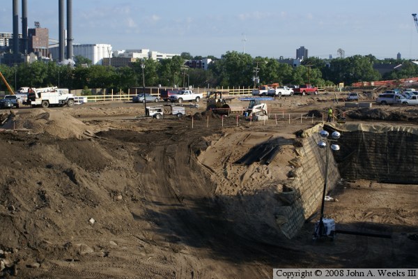
These photos are two views at the south end of the bridge project. The
photo above shows a worker compacting an earthen backfill behind a
retaining wall. I have not seen this retaining wall on any of the plans
that I have seen, so it might be the result of a change order. The
photo below shows the large retaining wall at the south end of the bridge,
and the landscaping along the edge of the bridge that will result in a
series of terraces flowing down to the edge of the river. The new bridge
is lower than the old bridge. The traffic lanes have been cut down by
as much as 20 feet in some areas.

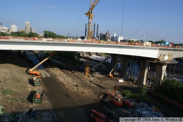
These photos are two views of the southern-most of the 3 major spans.
We see that the majority of the steel falsework and scaffolding has
been removed. The roadway under the bridge is the West River Parkway.
There will also be a bicycle and hiking trail, plus the entrance road
to the Lower Saint Anthony Falls Lock & Dam. The series of terraces
leading down to the river can be clearly seen in the photo below.

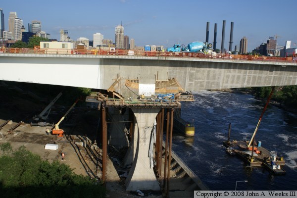
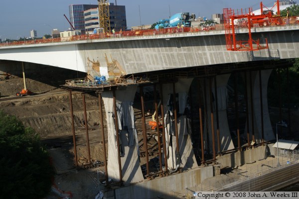
This is two views of the main piers at the south end of the bridge.
They can been seen now that the falsework has been removed from under
the first main span. The big U-shaped joint at the top of the piers
appear to be a major structural element, but in fact, they are strictly
a decorative item. Workers have built thin forms using standard dimensional
lumber on the surface of the bridge. They will pour concrete into those
forms to create the large U-shape joint. The main piers do look quite
thin in the middle. One sure hopes that the design engineer was keeping
track of his or her decimal points very closely.
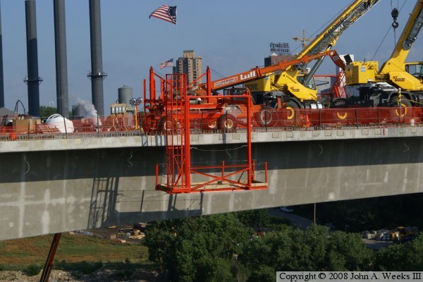
These two photos are close-up views of work platforms on the main span
of the bridge. The photo above shows a mobile scaffold system that reaches
over the edge and below the deck level. This allows for easy access to
the underside of the bridge for finishing construction details and future
bridge inspections.
The photo below is the major work event happening on the bridge project
at the time these photos were taken. This is the 7 foot wide gap at the
center of the bridge. Engineers felt that it would be difficult to
predict the exact size segment that would be needed for the center of
the main span. As a result, they simply assumed that there would be a
gap, and planned to fill it in with ready-mix concrete. To start the
process, a large steel beam was installed on top of the bridge deck.
A large jack was used to push on the beam, opening the gap even larger.
From there, forms were built and the concrete is being pumped in. Once
the concrete is set up, the jacks and steel beam will be removed. All
the pressure that the jack had placed on the beam will then be transferred
to the joints between segments, holding them tightly together almost as
if they had been welded up as one large piece. This little trick of adding
stress to the main span changes the behavior of the main span from being
a series of segments to being one large concrete beam.

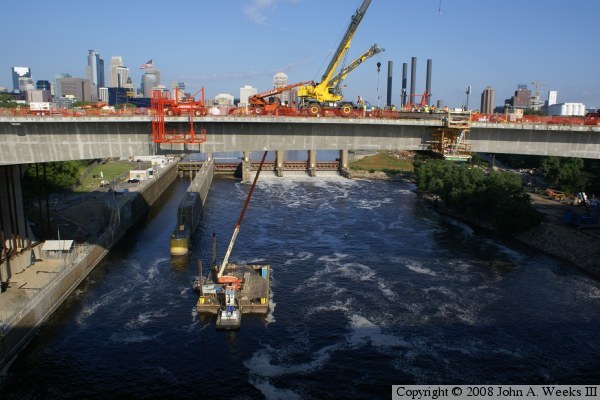
The photo above is an overview of the main span showing the equipment
that is supporting the process of closing the 7 foot gap, as well as
the crane barge working from the river channel.
The photo below is one last look at the main span, this time with a
great view of downtown Minneapolis in the background. Despite the
height above the water and the sheer size of the project, it has
remained a safe work site. There have been no serious injuries or
deaths. Compare that to a major civil works project like the Brooklyn
Bridge, which took 13-1/2 years to build and claimed move than 25 lives.

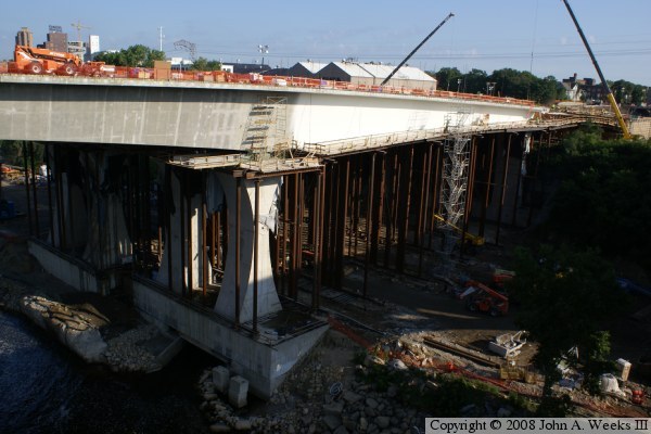
These photos are two views of the northern-most of the three main spans.
Unlike the south span, the steel falsework is still in place. The area
under the bridge is part of the river flats. It is currently unused, but
local kayak fans are hoping to build an urban white-water kayak course
along the edge of the river and under this bridge. One key activity
in these two photos is finishing the surface of the bridge. Workers
first sandblasted the surface of the concrete. They then apply two
coats of plaster, then spray on a coat of Snowbound White acrylic paint.
The bright white color will make a dramatic statement in contrast to the
blues of the sky and water and the green trees and grass.
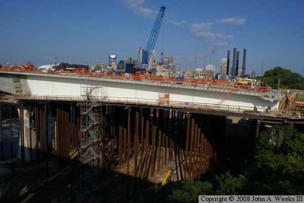
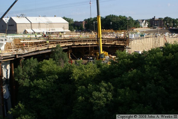
These two photos are views of the northern-most of the 4 spans of the
main bridge project. This span is being cast in place on top of a form
that is supported by steel falsework. This span crosses a former
railroad yard. That rail yard was dismantled about 20 years ago, and
the only remaining use was a rail line that supports the U of M steam
plant and the former Pillsbury milling complex. Future plans call for
the rail lines to be abandoned, and a parkway to be built in this area
that will eventually connect to the East River Parkway.
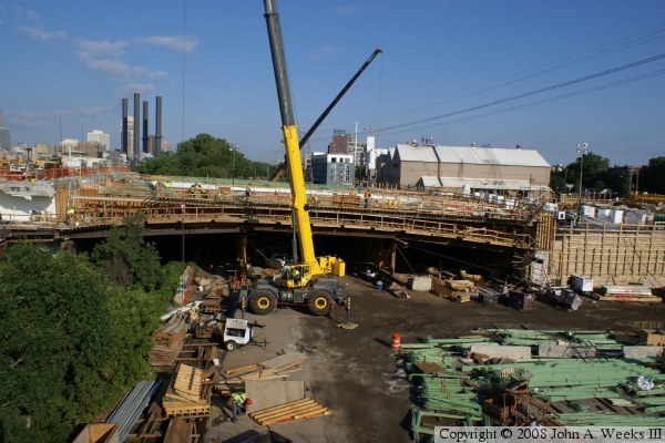
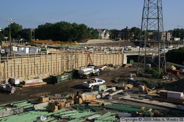
The photo above is a view of the bridge approach on the north end of
the structure. On the old bridge, this area was an elevated bridge.
For the new bridge, the roadway has been lowered as much as 20 feet,
so fill becomes more economical than a bridge. A tunnel is visible
just behind the electrical tower. That tunnel carries 2nd Street SE
under the bridge approach. The first overpass to the north of the
bridge is University Avenue. Exit ramps will branch off the bridge
approach for this interchange, which explains why the entrance to
the tunnel appears to be flared out.
The photo below is an overview of the bridge project looking from
the south towards the north. What looked like a series of random
activities 90 days ago today looks like a nearly completed bridge.

|

