| Highways, Byways, And Bridge Photography |
The Remembrance Garden
A Photo Tour Of The I-35W Bridge
Memorial Remembrance Garden
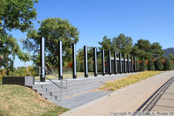
The I-35W bridge collapse memorial is known as the Remembrance Garden. It is
located about one-quarter mile west of the new I-35W Saint Anthony Falls Bridge
along West River Parkway. It is about a block east of the Guthrie Theater
and located directly north of Gold Medal Park. The garden was dedicated on
August 1, 2011, at 6:05 PM, exactly 4 years to the minute from the the
moment of the tragedy.
The photo above is looking east along the sidewalk and bicycle trail
running along West River Parkway. The main memorial consists of 13 steel
columns, one for each person who died as a result of the bridge collapse.
Note—these materials are covered by copyright and may not be
used without written permission.
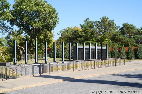
This view is looking northeast across West River Parkway. The structure
at the east end of the memorial is known as the Survivors Wall. It is a
water feature where the water trickles down over the face of the wall.
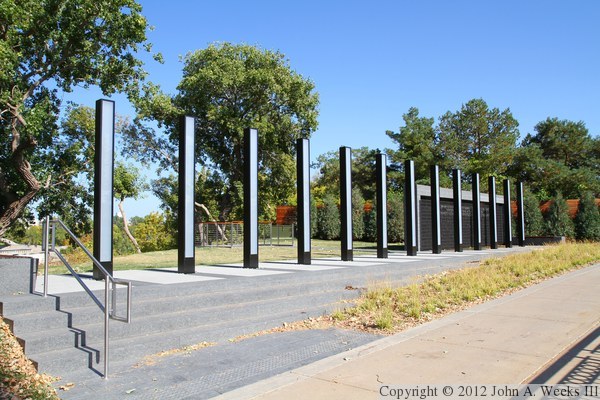
This is another view from the west end of the memorial. The steel columns
are installed on a level platform. Since the ground slopes away to the
west, the west end of the memorial has a series of steps leading down
to the sidewalk. Since the east end is level with the sidewalk, the
memorial is still fully accessible for disabled visitors.
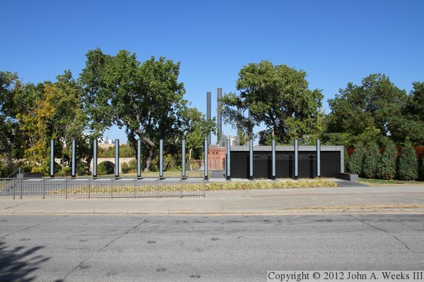
This view is from directly across the street from the memorial. The
Mississippi River is located behind the memorial. The memorial sits at
elevation 820, while the river is at 751 feet, resulting in the memorial
overlook being perched 69 feet above the surface of the water.

This view is looking northwest across West River Parkway from the sidewalk
running along the northern edge of Gold Medal Park. The memorial was
originally slated to be in Gold Medal Park, but it was moved to this location
because this land is owned by the city of Minneapolis, but Gold Medal Park
is privately owned.
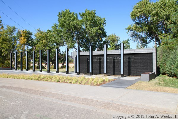
This view is similar to the photo directly above, but taken from the north
side of West River Parkway.
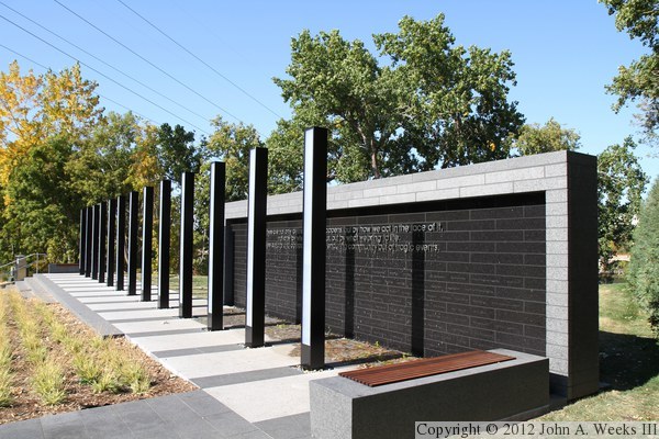
This photo is looking west down the length of the memorial. This gives a
good view of the survivor wall in relation to the vertical columns.
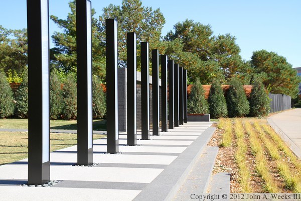
This photo is looking east down the length of the memorial. The wooden
wall in the background blocks the view into the site of the old Minnegasco
plant. The gas company once had a very large manufactured gas plant along
the riverfront. The city purchased much of that land to build the West
River Parkway. Centerpoint Energy still has a small facility, and much
of the rest is waiting to be developed into the Bluff Street Park.
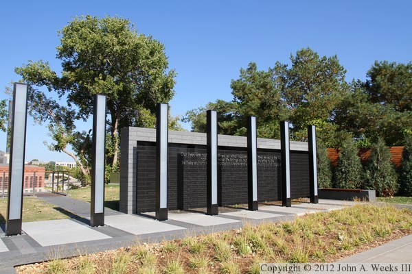
This photo is a closer view of the east end of the memorial and the
survivor wall. I attempted to photograph the memorial several times
after it opened, but there were always too many people around to get
photos of the memorial without any people in the way. Many of these
photos were taken in early October, 2011, in mid-afternoon with a
glorious clear blue sky in the background.
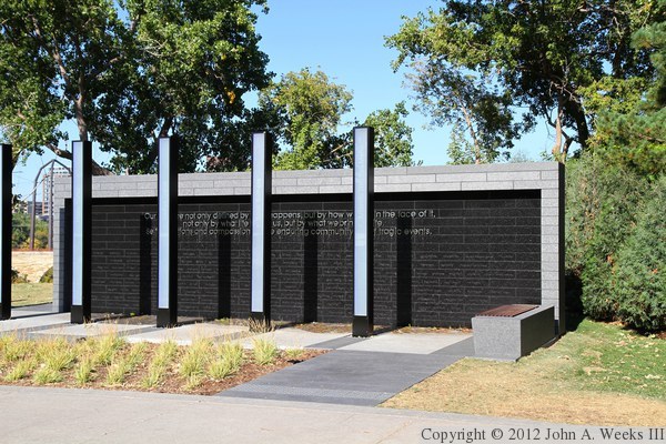
This is another view of the survivor wall looking to the north. The
inscription reads, “Our lives are not only defined by what happens, but by
how we act in the face of it, not only by what life brings us, but by what
we bring to life. Selfless actions and compassion create enduring community
out of tragic events.”
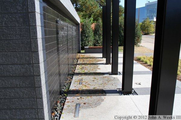
This photo is looking along the face of the survivor wall. The water
generally flows along the stonework into the river rock at the bottom,
but the wind and the lettering often allows the water to splash out onto
the walkway. The water had to be turned off shortly after the memorial
opened because it was found that the recycling system was not working.
Instead, the water ran down the bluff behind the memorial and was causing
erosion. As of July 2015, the city of Minneapolis is suing the firm that
designed the memorial. The water is now turned on only during the anniversary
of the collapse.
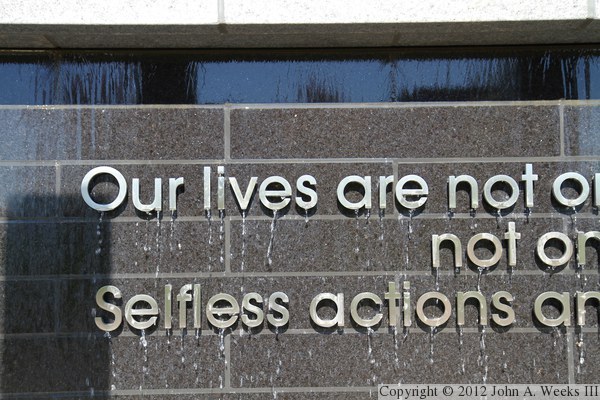
This is a close view of the lettering on the survivor wall. Some of the
letters were stolen shortly after the memorial was opened to the public.
The park board removed all of the letters to prevent further vandalism.
This photo was taken on October 3, 2011, shortly after the letters were
reinstalled. This time, stronger fasteners were used to prevent a repeat
occurrence. In addition to the raised letters, stonework below the letters
contains the names of the 171 people who were on the bridge and survived
the collapse.
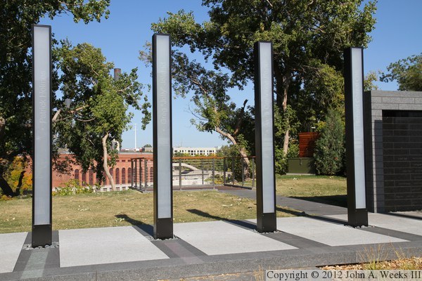
This is a closer view of four of the vertical columns. The University of
Minnesota Southwest Steam Plant is visible in the background on the far
side of the Mississippi River.
The following 13 images are composites that show each column in order from west to east, along with a close view of the text on the column. I did not know
any of the victims, and this biographical information was based on the
impressive Star Tribune work called ‘13 seconds in August.’
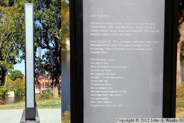
Column #1, Julia Blackhawk, 32 years old. Blackhawk was on her way home
from school at the Aveda Institute to her home in Savage. She had two
grade school aged sons. She was a member of the Winnebago Nation, and
family members described her as being proud of her native heritage.
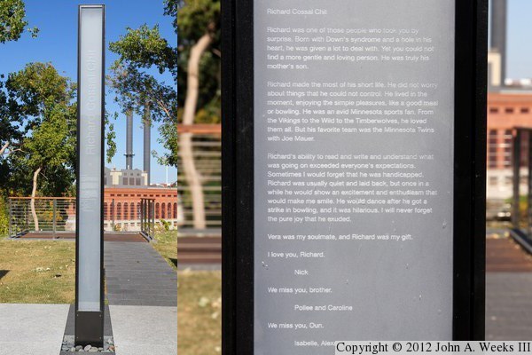
Column #2, Richard Chit, 20 years old. Chit was traveling with his mother,
Vera Peck, at the time of the bridge collapse. Their vehicle was trapped
in the water under the bridge deck, and they had no chance to escape.

Column #3, Paul Eickstadt, 51 years old. Eickstadt was driving a semi-truck
heading southbound, which came to rest right next to the yellow school bus
that received so much attention. Paul had just started his shift driving
for Sara Lee Bakery by picking up a Taystee truck in Roseville. He was
heading to Mason City, Iowa, about a three hour trip.
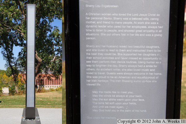
Column #4, Sherry Engebretsen, 60 years old. Engebretsen was on her way
home to Shoreview from work at Thrivent Financial in downtown Minneapolis.
The Star Tribune reports that Engebretsen often competed with co-workers
for a prime parking spot. Thrivent now keeps that parking spot open as
a memorial to their lost team member.
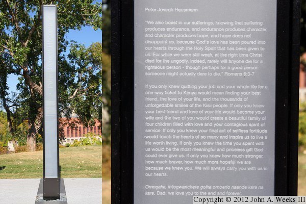
Column #5, Peter Hausmann, 47 years old. Hausmann, a father of four, was on
his way to Saint Louis Park to pick up a dinner guest. He happened to be on
his cellular telephone with his wife, Helen, and the phone went dead as the
bridge collapsed.
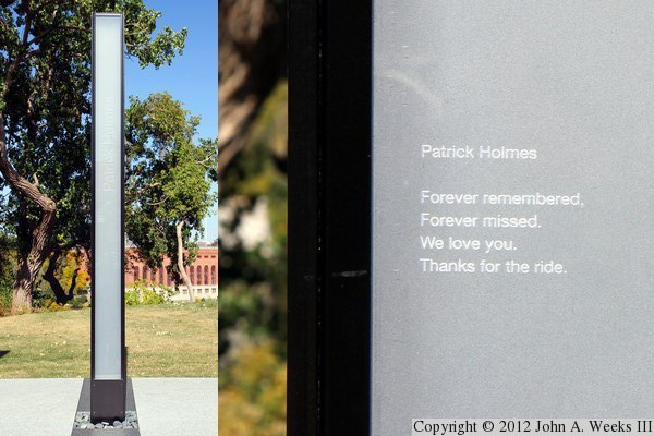
Column #6, Patrick Holmes, 36 years old. Holmes was on his way home to
Mounds View from his studies as an exercise therapist in Bloomington.
He left a wife and two children. Authorities believe that Holmes may have
survived the actual bridge collapse, but was fatally injured when a large
sign gantry fell on his vehicle.
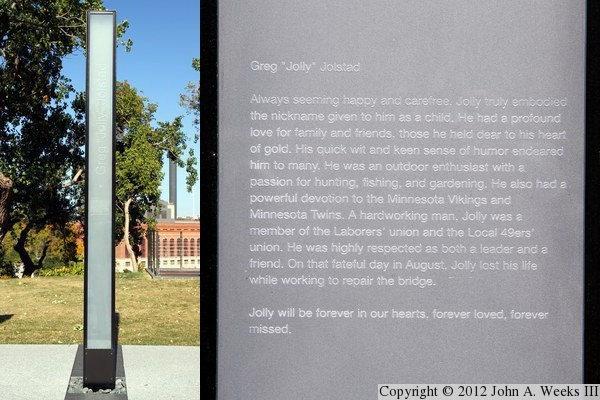
Column #7, Greg Jolstad. Known as ‘Jolly’, Greg was one of
18 construction workers on the bridge at the time of the collapse. All
of his co-workers survived. He is survived by his wife, Lisa, and three
stepchildren.
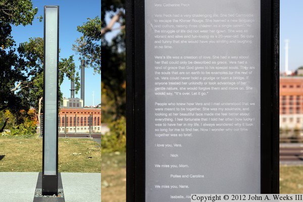
Column #8, Vera Peck, 50 years old. Peck and her son, Richard Chit, were
trapped in their car under the bridge. They had no chance to escape. As
a young adult, Peck emigrated from Cambodia to the United States in 1980.

Column #9, Christina Sacorafas, 45 years old. Sacorafas was on her way from
White Bear Lake to teach a youth folk dancing class at St. Mary's Greek
Orthodox Church, which is located along Lake Calhoun. Sacorafas, who
has Greek ancestry, became very involved in church after moving to the
Twin Cities in 2004.
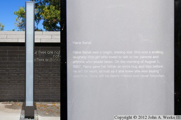
Column #10, Hana Sahal, 22 months old. At two months short of her second
birthday, Hana was the youngest person to perish in the bridge disaster.
Hana was riding in a car with her mother, Sadiya, who also died at the scene.
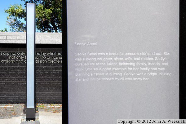
Column #11, Sadiya Sahal, 23 years old. Sadiya was a nursing student. She
was very excited about finishing her program and starting work so she could
serve her community. To compound the tragedy, Sahal's daughter, Hana, and
her unbound child were also killed in the collapse.
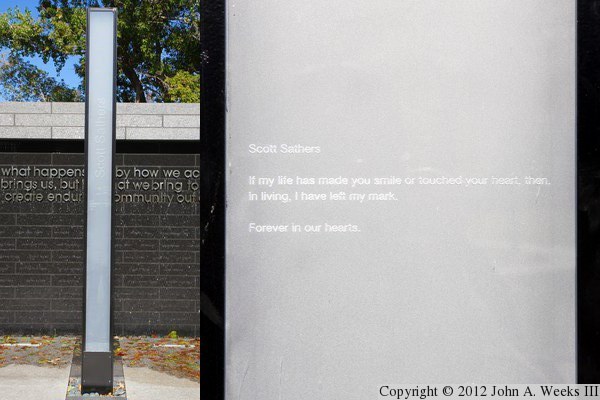
Column #12, Scott Sathers, 29 years old. Sathers was on his way home to
Maple Grove from his office at Capella University. He had left work late,
and might not have been on the bridge at the time of the collapse if he had
left at his normal time.
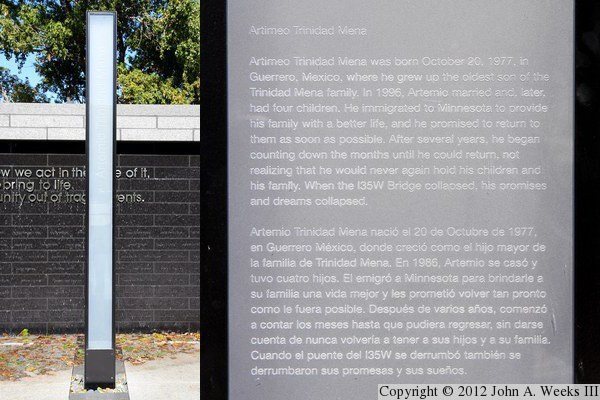
Column #13, Artemio Trinidad-Mena, 29 years old. Trinidad-Mena was running
an errand after work. He was employed as a delivery driver for a grocery
store on Lake Street, and lived only blocks from the store, so he did not
use the I-35W Bridge during his daily commute. Trinidad-Mena was a native
of Mexico, but had lived and worked in Minnesota for 10 years.
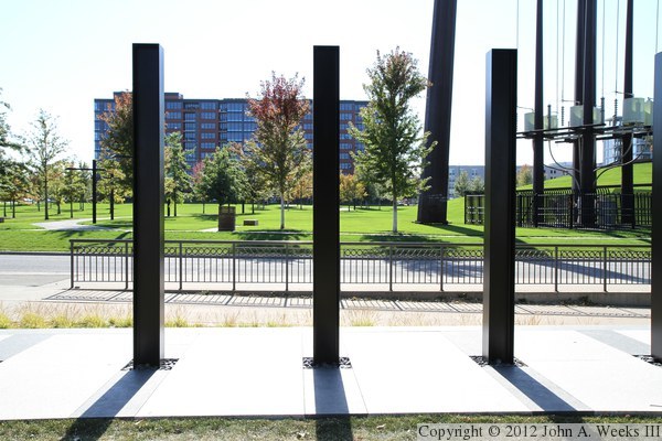
This photo is looking south from behind the memorial and across West River
Parkway and Gold Medal Park. The building in the background is the
Bridgewater Lofts, a condominium project completed in the mid-2000s.
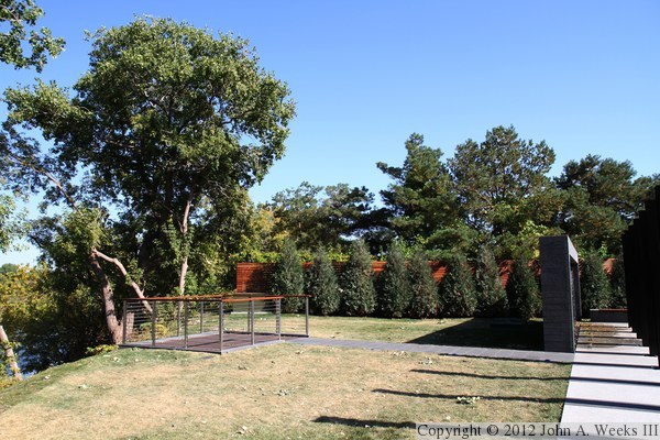
This photo is looking east towards the observation deck located behind
the memorial.
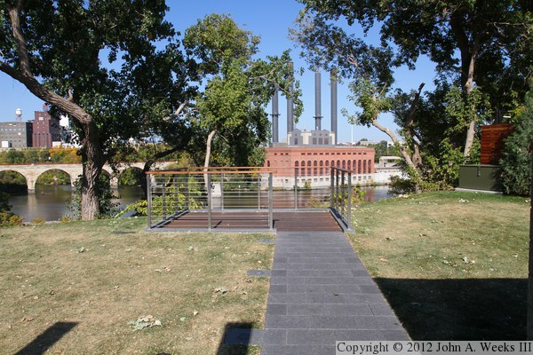
This view is looking north from the memorial along the walkway leading
out to the memorial. The University of Minnesota Southwest Steam Plant
is located directly across the river, with the Stone Arch Bridge being
located just upriver. Interestingly, the I-35W Saint Anthony Falls Bridge
is not visible from the memorial or from the observation deck.

This is a close view of the northeast corner of the observation deck. Note
that it uses a number of materials including wood, concrete, steel, and
wire cables.
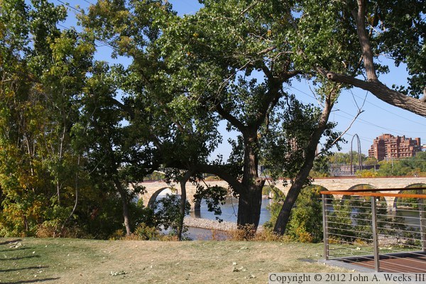
This view is looking northwest from the memorial, where we see the Stone
Arch Bridge crossing the Mississippi River. The Saint Anthony Main
apartment complex is visible in the background.
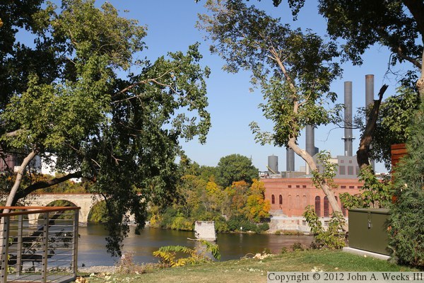
This view looking north across the river features the steam plant on the
right, the Stone Arch Bridge on the left, and one of the two remaining
piers of the Lower Bridge in the center. The Lower Bridge was built in
1874 but was closed in 1934 and demolished in 1943 as part of a WWII scrap
drive.
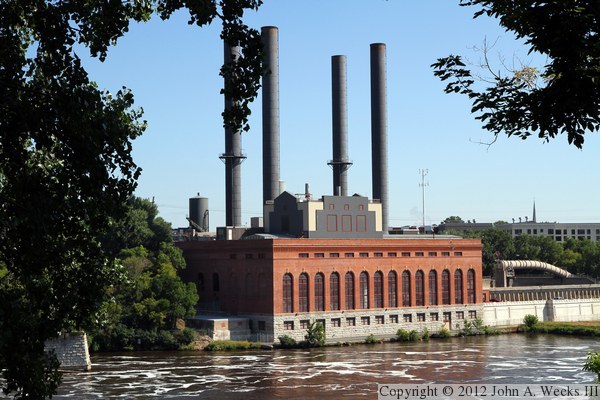
This photo is a view looking north across the Mississippi River from the
river overlook at the Remembrance Garden. The University of Minnesota
Southwest Steam Plant dominates the riverbank, with the remains of the
old Lower Bridge being visible on the far left side of the photo.

Looking upstream from the Remembrance Garden overlook, we see the Stone Arch
Bridge, with Riverplace and Saint Anthony Main in the background.
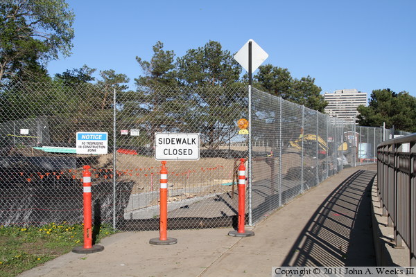
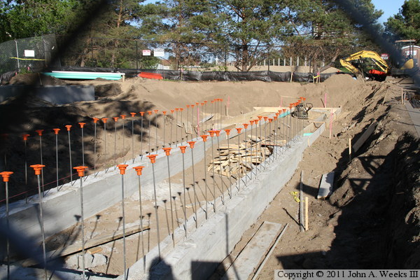
These two photos are views of the Remembrance Garden under construction in
May, 2011. The photo above is a view of the site looking east from the walkway
along West River Parkway, while the photo below is a view of the foundation
for the walkway in front of the series of vertical columns.
|

