
|
John A. Weeks III
Friday, July 17, 2026, 10:44:30 AM CDT |
|||
| Home | Photo Tours | Rail Fan | 12 Easy Steps |
| Aviation | Spacecraft | Highways & Bridges | About The Author |
|
|
|
|||||||||||||||||
I-35W Bridge Photo TourA Photo Tour Of The New I-35W Saint Anthony Falls Bridge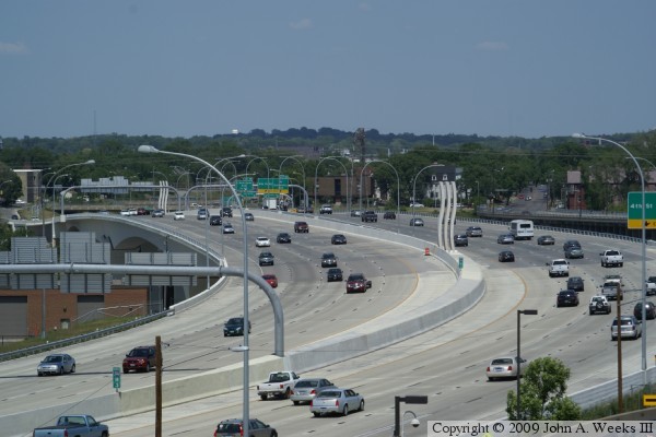
The new I-35W Saint Anthony Falls Bridge opened in September of 2008.
At that time, the landscaping was still fresh, and grass had not taken
root in many areas. Fall quickly arrived, the leaves fell and snow
started to pile up. The first chance to see the bridge with a background
of green grass and leafy trees turned out to be early summer of 2009.
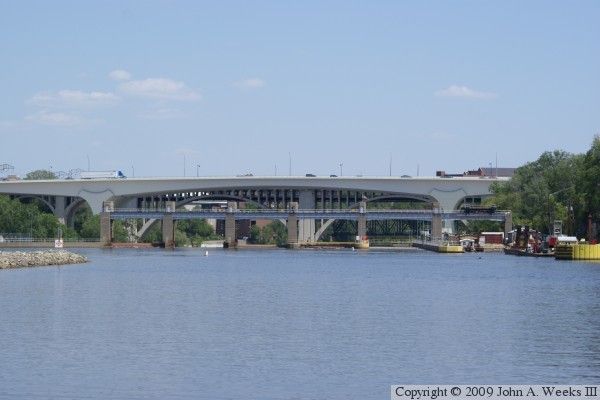
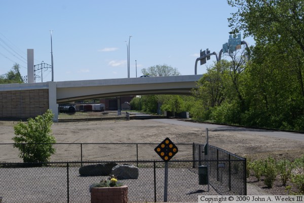
This series of photos shows the Saint Anthony Falls Bridge from on, around, and under this amazing structure with a background of blue skies and green vegetation. The bridge has been open for 8 months at the time these photos were taken. The bridge still looks new, but it has already carried over 30-million cars and trucks across the mighty Mississippi. Note—these materials are covered by copyright and may not be used without written permission. The photo above is an overview of the river crossing looking to the north. The vantage point is the top level of the municipal parking ramp located adjacent to the Holiday Inn hotel near the southeast corner of the bridge. 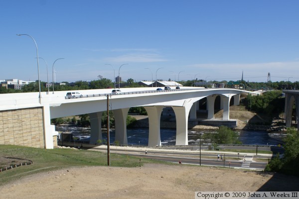
The photo above is the east side of the I-35W bridge looking to the north
across the Mississippi River from the top of the bluff on the south side
of the river. The photo below is a view of the bridge deck looking north
from the south end of the structure.
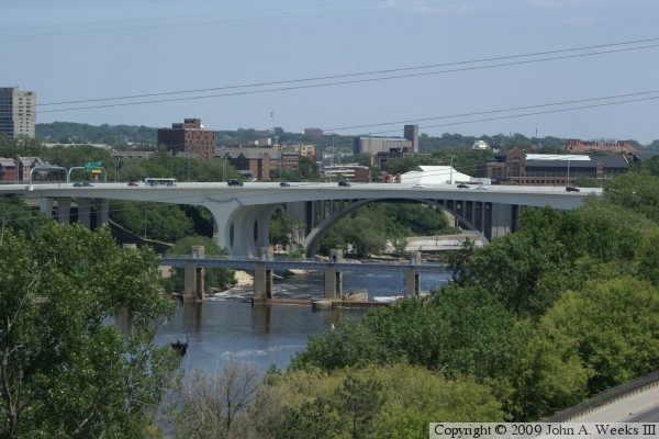
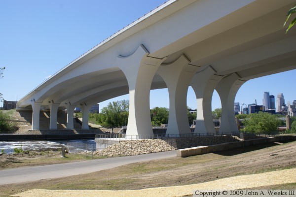
These two photos are views of the west face of the I-35W bridge. The photo
above is a view from the Endless Bridge at the Guthrie Theater, a walkway and
observation deck that extends from the theater building to give a vantage point
that is high over the river parkway. The photo below is a view from
the Mill Ruins Park along the south bank of the Mississippi River. The
Lower Saint Anthony Falls Lock & Dam is in the foreground, and both
the 10th Avenue Bridge and Northern Pacific Bridge #9 are visible in the
background.
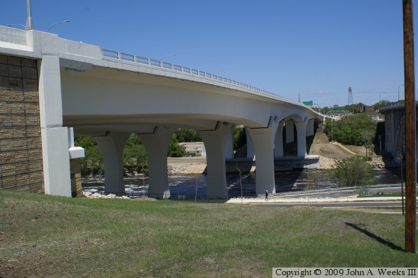
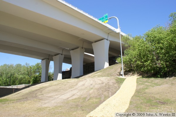
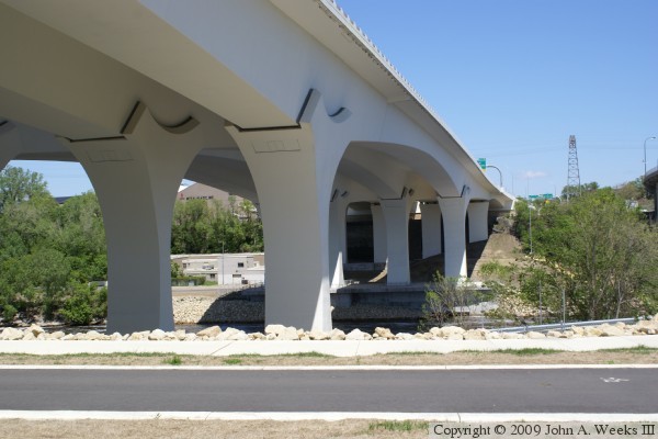
These two photos are views of the east face of the bridge looking to
the north. The photo above is a view from the West River Parkway, a
road that runs under the south end of the bridge. The photo below is
a similar view from near the top of the bluffs near the south bridge
abutment.
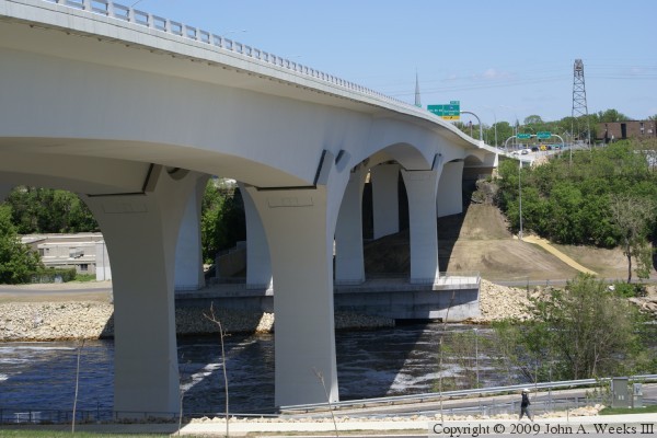
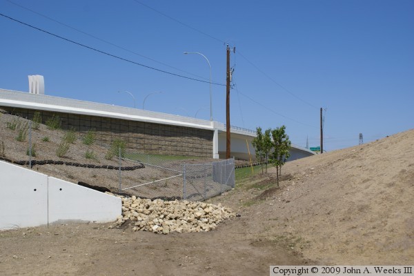
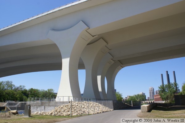
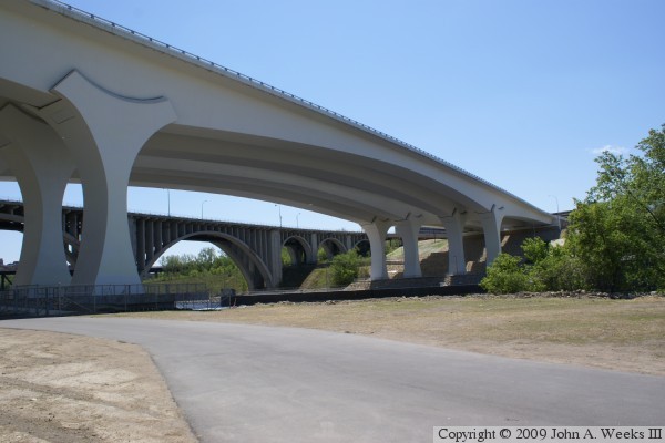
The photo above is a view of the main river span as seen from the river
bluff on the south side of the Mississippi River. The photo below is
the bridge abutment on the south end of the structure.
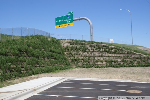
The photo above is an indent in the embankment leading to the south bridge
abutment. The indent is stabilized by an interlocking retaining wall. I
have no idea why this indent was created, but it appears to be there to
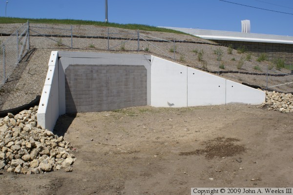
preserve an existing property line. The photo below is the tunnel for
a future regional trail to connect the Northern Pacific Bridge #9 to
the bicycle trail that runs along the Mississippi River. The tunnel
has been sealed with concrete blocks until the trail is developed.
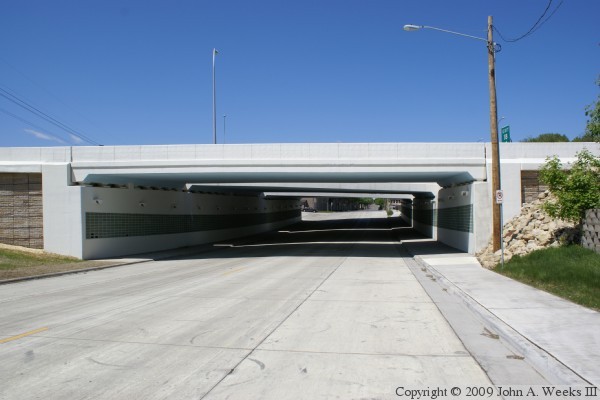
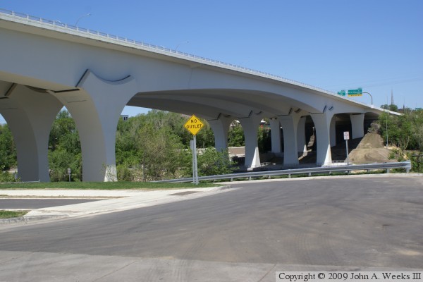
The photo above is the underpass for 2nd Avenue SE at the north end of
the river crossing. This is actually a separate bridge independent of
the river crossing structure. The walls of the underpass are covered with
tile much like other highway tunnels in Minneapolis. The photo below
is the north bridge abutment.
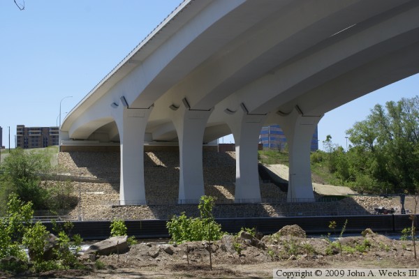
The photo above is the northern-most set of bridge piers. Unlike the
main bridge piers, these piers have few decorative elements. The photo
below is the main bridge piers on the north side of the Mississippi River.
There is an observation deck built at the base of these piers, but it is
not open to the public as of the Summer of 2009.
These two photos are views of the main river span as seen from the river
flats on the north side of the Mississippi River. The photo above is
the east face of the bridge, while the photo below is the west face of
the bridge.
The photo above is the south end of the structure as seen from the
river flats on the north side of the river. The Mississippi River is
just beyond the small trees in the foreground. The photo below is
the north end of the bridge as seen from the parkway on the south
side of the river. The building in the river flats on the far side
of the river is the Tandem Accelerator Laboratory operated by the
University of Minnesota Physics Department.
These two photos are the first of 3 photos showing a typical bridge
crossing heading northbound from the point of view of a vehicle in
traffic. The photo above is just entering the bridge near the south
abutment. The photo below is the view from the crest of the bridge
at mid-span. The outside bridge railing on the right side of the photo
has caused some controversy. Some motorists are afraid to drive in the
right lane due to the low height and open structure of the railing.
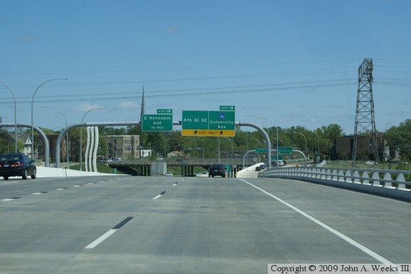
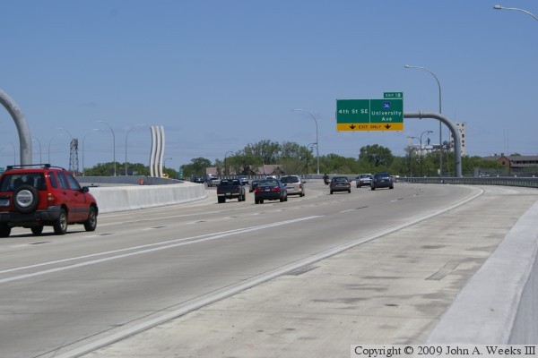
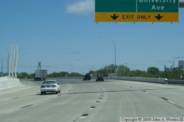
The photo above is the third of a three photo set showing a northbound
bridge crossing. In this view, we see that the right-most two lanes
exit to 4th Avenue SE and University Avenue, while 3 lanes continue
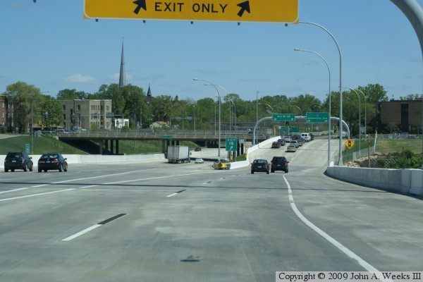
to the north. The photo below is the first of the 3 photo sequence
showing a typical southbound bridge crossing. In this photo, we are
entering the structure from a freeway ramp from University Avenue.
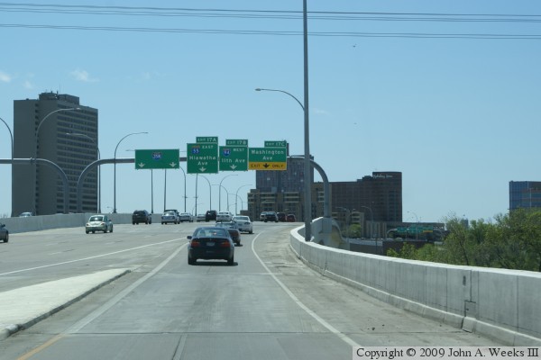
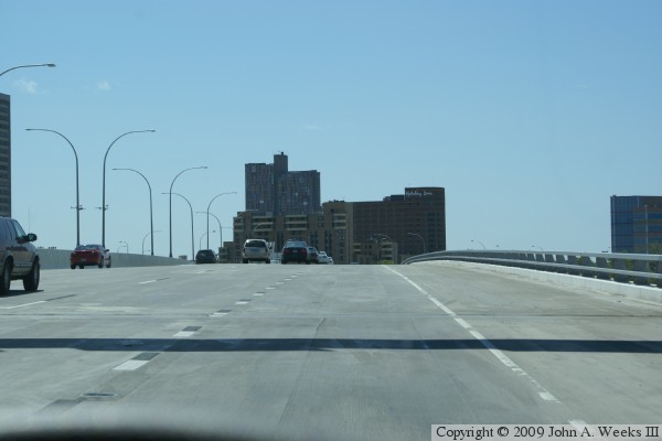
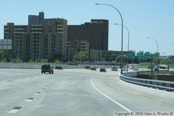
These two photos are the final two photos of a three photo sequence showing
a typical bridge crossing heading southbound. The photo above is nearing
the crest of the bridge at mid-span. The photo below is entering the curve
at the south end of the structure. The right-most lane will exit the
freeway to Washington Avenue.
|
|
|
Authored by John A. Weeks III, Copyright © 1996—2016, all rights reserved. For further information, contact: john@johnweeks.com
|