
|
John A. Weeks III
Thursday, January 15, 2026, 7:08:31 PM CST |
|||
| Home | Photo Tours | Rail Fan | 12 Easy Steps |
| Aviation | Spacecraft | Highways & Bridges | About The Author |

|
|
|||||||||||||||||
I-35W Bridge Up CloseAn Up Close 360 Tour Of The I-35W Saint Anthony Falls Bridge
The new I-35W Saint Anthony Falls Bridge opened in September of 2008.
While the bridge was open to traffic, there was still construction going
on at the site, and landscaping continued into late autumn. As a result,
access to some locations was limited. Over the four years since that
time, I have extensively explored the falls area, and I have photographed
the new Interstate highway bridge from nearly every possible angle except
for being out on the river in a boat. I have only recently learned about
a kayak and canoe outfitter in the falls area (Above The Falls Sports) that
offers canoe and kayak trips in the area, so I plan to fill in that gap
someday. In the mean time, here is an up close 360-degree photo tour
of the new bridge.
Note—these materials are covered by copyright and may not be used without written permission. The photo above is looking upstream to the west from the southbound traffic lanes. In this view, we see the Stone Arch Bridge in the center, the Southeast Steam Plant on the right, and the north end of downtown Minneapolis on the right. This photo actually took a number of attempts, with each attempt involving crossing the bridge twice since this view was only available from the far right southbound lane. On my first attempt, I managed to get street light poles in each shot. On my second attempt, the autofocus locked in on the guardrail. The trick was to go to manual focus. I still wish the shot was aimed just a little higher so the tops of the smokestack was not cut off. The photo below is looking east towards the upstream face of the I-35W Bridge from the Endless Bridge at the Guthrie Theater. The Endless Bridge is an observation deck that is cantilevered off of the side of the Guthrie Theater building located along the riverfront about 1/2 mile upstream from the I-35W bridge. This is the single most spectacular observation deck located anywhere along the Mississippi River. 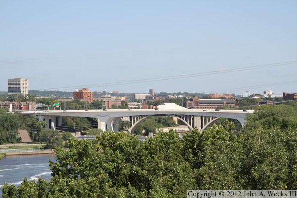
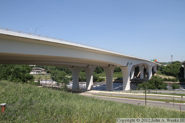
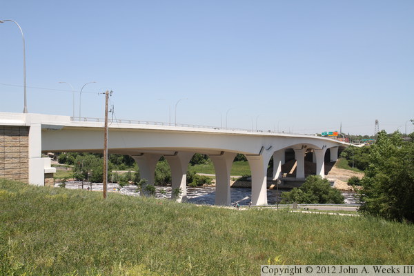
These two photos are my favorite view of the I-35W Saint Anthony Falls Bridge.
The vantage point is on the river bluff on the south side of the Mississippi.
The photo above is taken from near the south bridge abutment with the camera
located about the same elevation as the bottom of the large concrete backbone
of the structure. The photo below is taken from under the west edge of the
nearby 10th Avenue Bridge, with the camera being at approximately the same
elevation as the top of the bridge deck.
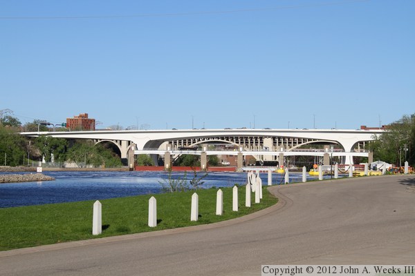
The photo above is looking downstream from the parking area at Mill Ruins
Park, located in the small river flats area between the Upper and Lower
Saint Anthony Falls Locks & Dams. The photo below is a similar photo
taken from the wall just below the upper lock, which gives the illusion
that we are in the middle of the river. The upper photo is from later in
the afternoon with the sun shining on the bridge. The photo below is from
just after noon when the side of the bridge deck is in a shadow cast by
the bridge deck.

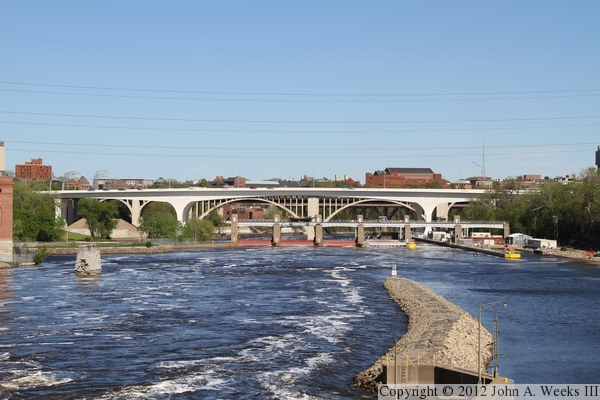
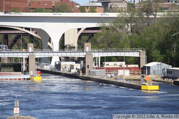
The photo above is a view looking downstream from the deck of the Stone
Arch Bridge. The navigation channel is on the right side of the photo,
with the main river channel being on the left. The turbulence is generated
by the water having just passed over the upper falls. The photo below is
a close view of the lower boat lock, with the south main bridge piers
located just below the lower dam. The building in the background are on
the University of Minnesota east bank campus.
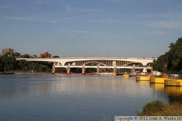
These two photos were taken very late in the evening, in the so called
‘golden hour’ when the sunlight is shifted towards the red
end of the spectrum. The photo above is a view from the riverbank in
Mill Ruins Park, while the photo below is from the deck of the Stone Arch
Bridge. The single pier in the river in the foreground is from the Lower
Bridge, which was dismantled in 1943 during a WWII scrap drive.

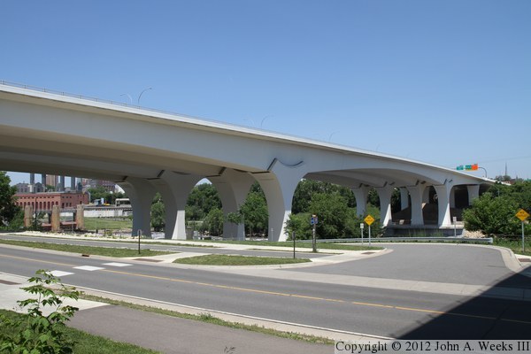
The photo above is about the widest angle view of the downstream side of the
I-35W Bridge that is available. The 10th Avenue Bridge is located only 160
feet downstream, so any wider angle view would be obstructed. In fact,
this photo was taken while standing next to one of the piers of the 10th
Avenue Bridge. The photo below is a closer view of the main navigation
channel span over the Mississippi River as seen from the edge of the West
River Parkway.

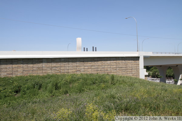
The photo above is the south bridge abutment as seen from the top of the
river bluffs. This area is currently vacant. It is owned by the City of
Minneapolis, and was narrowly saved from being developed into a high-rise
tower in 2009. The area was once the site of the Gas Works where coal was
converted into natural gas. The area was highly contaminated. It has been
partially cleaned up and seeded with native grasses. It is hoped that the
park can be further developed with a walking path and overlook.
The photo below is a placeholder for a future photo of the bicycle underpass through the south bridge abutment that is currently blocked pending further development of the trail system along the river. 
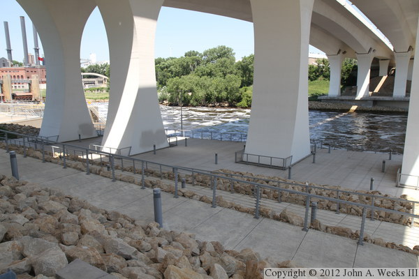
The photo above is looking down at the south observation deck as seen from
the road leading into the Lower Saint Anthony Falls Lock & Dam.
The photo below is looking back up the hill from the south observation deck towards the south bridge abutment. The railings mark the switchbacks in the sidewalk leading down the face of the bluff. What isn't visible in this view are the two streets that pass under the bridge right before our eyes, the West River Parkway (near the bridge abutment) and the access road for the Lower Saint Anthony Falls Lock & Dam (at the top of the first switchback going uphill). 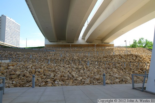

The photo above is looking south towards the bridge abutment from the same
location. The south bridge monument is visible in the gap between the two
parallel bridge spans. The monument is made of a photocatalytic concrete that
facilitates a reaction with ultraviolet sunlight to remove carbon monoxide,
nitrous oxides, and sulfur dioxide from the air.
The photo below is looking north across the Mississippi River from the sidewalk leading down to the south observation deck. The camera is situated directly below the gap between the two bridge spans. 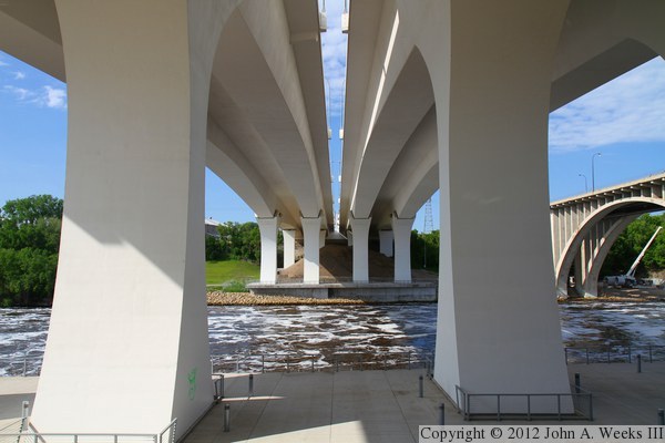

The photo above is the top of the main bridge piers on the south end of
the main river navigation span supporting the southbound bridge span. The
structure at the top of the piers is called a saddle. It is largely
decorative. The doors in the saddle allow for access to the bridge bearings
at the top of the piers.
The photo below is a close view of the base of one of the main bridge piers. The railing encloses a storm drain, which also houses a LED light panel that is aimed upwards to illuminate the north and south faces of the piers. 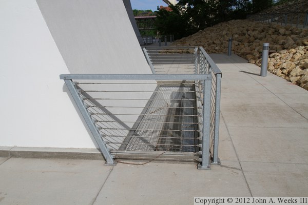
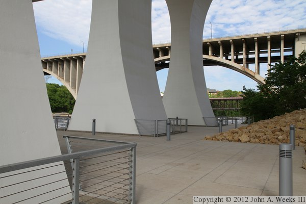
These two photos are views of the observation deck, both looking to the
east with the 10th Avenue Bridge in the background. The photo above is
the south side of the deck, which backs up to the river bluffs. The photo
below is the north side of the deck which runs along the river. There are
four main bridge piers, two per span, and the two pairs are slightly offset.

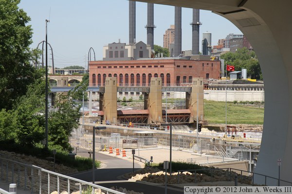
The photo above is the Lower Saint Anthony Falls Lock & Dam as seen
from the walkway along the north side of West River Parkway. This structure
is located on the upstream side of the I-35W Bridge. The building in the
background is the University of Minnesota Southeast Steam Plant.
The photo below is a long exposure night view of the boat lock at the Lower Saint Anthony Falls Lock & Dam, showing how the observation deck and foundation for the south main bridge piers directly adjoins the lock and dam structure. The office and control center for the lock is located to the left of the lock chamber, while the structure on the right side of the lock chamber is the new hydro-electric generation unit. The generators are turned by ducted fans which can be lowered into the river current. 
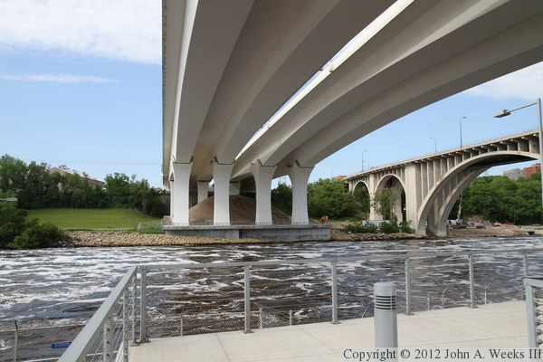
These two photos are looking north across the Mississippi River from the south
observation deck. The photo above is looking along the upstream west face
of the bridge, while the photo below is looking along the downstream
east face of the structure. Note the construction equipment on the far
side of the river. This was part of a sewer construction project. Sand
that was excavated from the sewer tunnel was piled up under the I-35W
bridge. The empty space to the left of the bridge is where the Tandem
Accelerator Lab was once located. The accelerator was last used in
1992, and it was torn down after the I-35W bridge collapse, though the
building itself was not damaged in the bridge disaster.

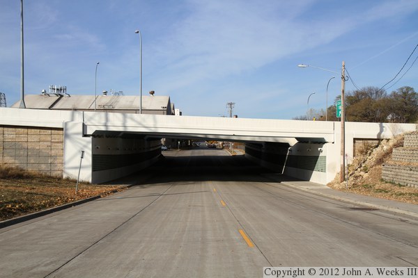
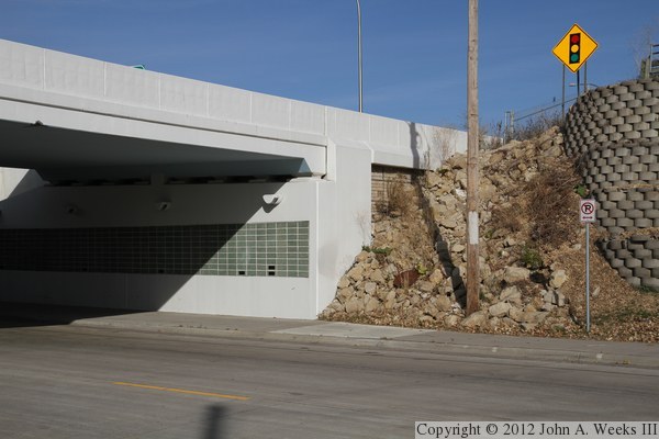
The photo above is looking west through the bridge over SE 2nd Street. This
bridge was built at the same time as the new I-35W Saint Anthony Falls Bridge,
and it is part of the approach to the north end of that structure. The
bridge is wider than it is long, so it is actually a tunnel. The photo
below is the northeast corner of the tunnel. Note the green tile on the
wall.
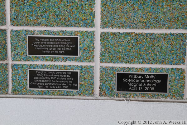
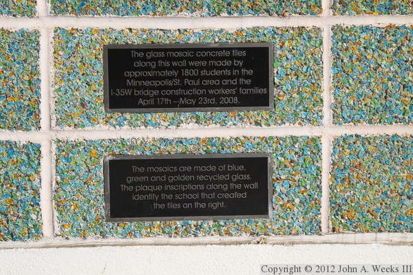
These two photos are close views of the tile on the tunnel wall. As it
turns out, these tiles are made up of crushed glass. They were made
by students at various schools across the Twin Cities area in the spring
of 2008.
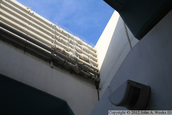
The photo above is looking upwards at the gap between the two parallel
bridge spans that make up the tunnel that carries SE 2nd Street under
I-35W on the north side of the Mississippi River. There are a number of
utility conduits attached to the east side of the southbound bridge span.
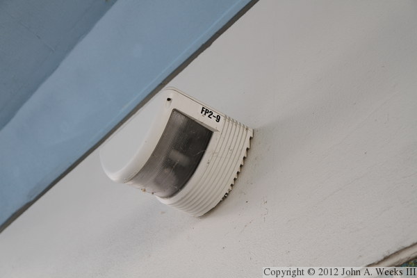
The photo below is a close view of one of the light fixtures located along
the tunnel wall.
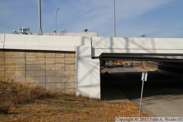
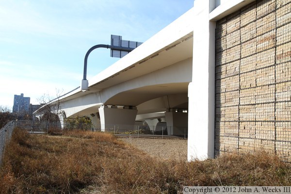
The photo above is the southeast corner of the SE 2nd Street tunnel.
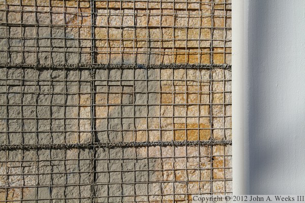
The sides of the highway retaining wall are made up of cut stones that
are encased in a wire mesh. This technique is known as a gabion wall.
The Kesota stone came from the same quarry that supplied the stone for
the nearby Stone Arch Bridge. The photo below is a close view of the
wall structure.

The photo above is the east face of the approach road between the SE 2nd
Street tunnel (right) and the north bridge abutment (left). The photo
below is the northeast corner of the Saint Anthony Falls Bridge including
the bridge abutment and the secondary span over the old railroad yard on the
north side of the Mississippi River.
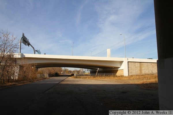
The photo above is looking west under the secondary bridge span at the
north end of the I-35W Saint Anthony Falls Bridge, with the north bridge
abutment on the right side of the photo. There is a railroad track on
the right side of the photo, and a service road for the University of
Minnesota running under the center of the span. The abutment is fenced
off. The photo below is a closer view of the east end of the bridge
abutment.

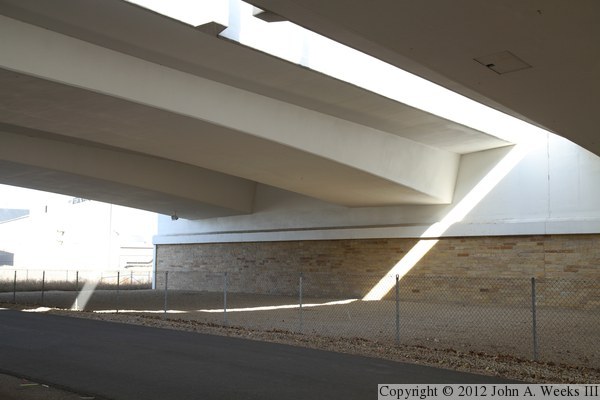
The photo above is a view of the bridge abutment from under the northbound
traffic lanes. The photo below is looking east through the secondary bridge
span. This large open area was once a railroad yard. The yard still exists,
but the tracks end just east of the 10th Avenue Bridge (on the far side
of the I-35W structure. The East River Parkway will eventually pass through
this area, but construction is not yet funded or scheduled.


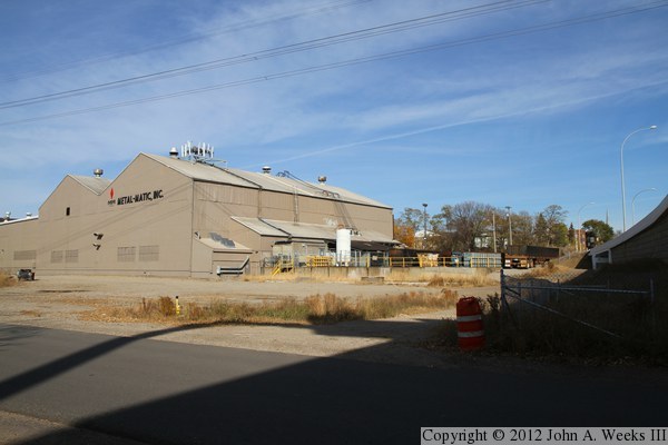
The photo above is the west side of the I-35W bridge abutment. The property
west of this location is owned by Metal-Matic, a large manufacture of carbon
steel tubing. The photo below is a view of the Metal-Matic factory building.
The factory runs around the clock, and many employees rushed to the aid of
victims of the bridge collapse.

The photo above is looking south across the Mississippi River along the
downstream east face of the I-35W Bridge. The vantage point is standing
next to the north main bridge pier for the nearby 10th Avenue Bridge.
This view is only available early in spring before the trees leaf out.
The photo below is a similar view of the downstream face of the bridge,
but with the vantage point located under the edge of the bridge deck.
Notice that the bridge is already accumulating dirt under the bridge
deck despite being less than 4 years old in this photo.
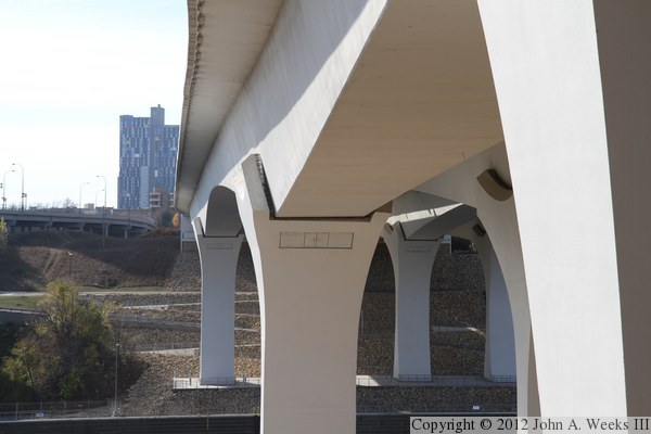
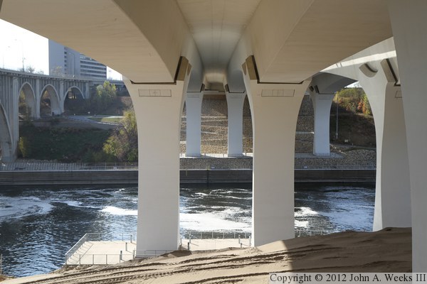
These two photos are looking south across the Mississippi River from directly
under the structure. The photo above is looking between the main bridge
piers for the northbound span, while the photo below is standing under the
gap between the two parallel bridge spans. The dirt pile is from a sewer
tunnel project that is being staged in the river flats between the I-35W
bridge and the 10th Avenue Bridge.

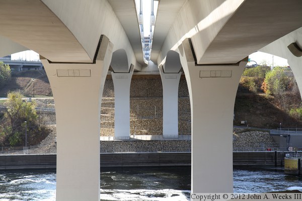
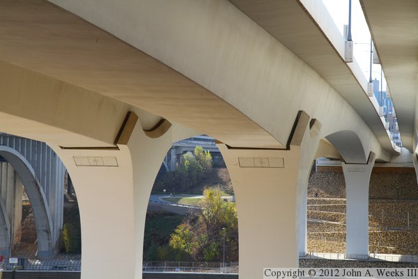
The photo above is another view looking south across the Mississippi River
from under the bridge structure. While this view is similar to the photo
above, that photo showed the secondary piers on the north side of the river,
while the photo here is zoomed in a little more showing just the main
bridge piers and the observation deck on the south side of the river. The
photo below is a closer view of the top of the main bridge piers on the
north side of the river.
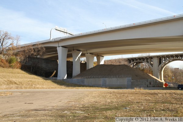
These two photos are views of the upstream side of the north end of the
bridge as seen from the river flats. The empty area along the river
bluffs is the location of the former Tandem Accelerator Lab, which was
torn down shortly after the I-35W bridge collapse. The north end of the
bridge has a set of secondary piers that are not present on the south end
of the structure. Note the stone wall along the top of the river bluffs.
We will look at that a little more closely in the next two photos.
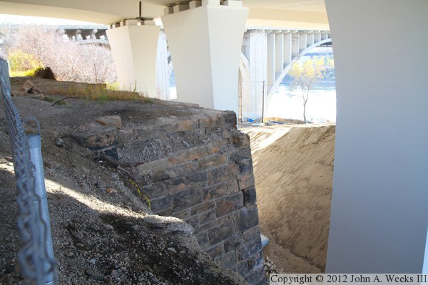
These two photos are detail views of the stone wall at the top of the river
bluff on the north side of the Mississippi River. The photo above is where
this wall makes a small jog, while the photo below is the top of the wall.
This wall is the abutment of the old Minneapolis Western Railroad Bridge.
This bridge was built in 1887, acquired by the Great Northern Railroad in
1928, and removed in 1952. This stonework is considered to be historical
in nature, and preservation of the wall was a consideration in the I-35W
bridge project.


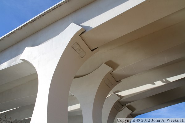
The photo above is the top of one of the secondary piers on the north side
of the Mississippi River. The photo below is looking up towards the top of
the main bridge piers on the north side of the river, as seen from the
river flats some 100 feet below the pier saddles. Note the access doors
to allow workers to enter the saddles to inspect the bridge bearings.
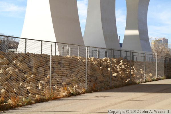
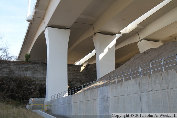
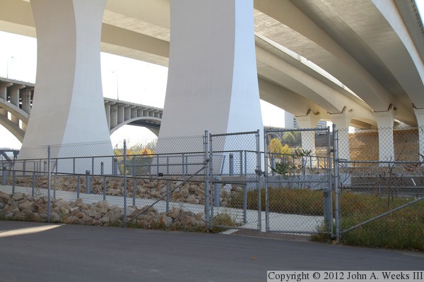
These two photos are views of north observation deck and the base of the north
main bridge piers as seen from the access road running along the river flats.
The north observation deck was completed with the main bridge construction
project, but as of the summer of 2012, it is still fenced off and not open
to the public.
|
|
|
Authored by John A. Weeks III, Copyright © 1996—2016, all rights reserved. For further information, contact: john@johnweeks.com
|