| Highways, Byways, And Bridge Photography |
The I-35W Bridge Detour
Photo Tour Of The I-35W Bridge Detour
Traveling Southbound Via MN-280
MN-DOT was handed a tall order on August 1, 2007. That was to prepare
a safe marked detour for 140,000 cars a day with zero prior notice, and
hopefully not paralyze traffic in the largest city in the state in the
process. Fortunately, we had the nearly forgotten MN-280 4-lane highway
and available capacity on the recently rebuilt section of I-94 in our
collective back pocket. The detour markings started as a huge number
of temporary devices (such as cones), and evolved over time to a smaller
set of more permanent markers. This photo tour, shot in early September,
2008, shows the final version of the detour markings. While Flatiron
is getting recognized for finishing the new bridge months early, the
detour is where MN-DOT really hit a home run. Traffic was relatively
smooth despite the unexpected loss of the third most traveled bridge in
the state in the heart of the biggest downtown in the state.
This photo tour shows a typical trip through the I-35W detour heading
southbound following highways MN-280 southbound and I-94 westbound. Note
that some of the photos were shot looking into the sun, so they may lack
a bit of contrast.
Note—these materials are covered by copyright and may not be
used without written permission.
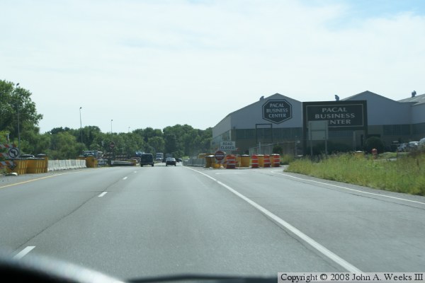
The photo above is our starting point at the very north end of MN-280,
heading south past the Pacal Business Center and County Road B. The
Pacal Business Center was once a major scrap steel recycler. The plant
is still used as a steel rolling mill and fabrication plant, but space
in the facility is also rented to other heavy industrial businesses.
County Road B is open to the right to allow traffic into the Pacal
complex. There is also a single lane road along the building made up
of a long line of K-blocks. This road allows materials to be moved
around the Pacal complex. We can also see a line of K-blocks in the
center of MN-280. This is to block any attempt of traffic to use the
former County Road B intersection for left turns or a U-turn.
The photo below is a view looking down Walnut Street. Walnut street
is blocked with K-blocks at the MN-280 end, and with wooden barricades
at Ryan Avenue. This view also shows the divider between traffic lanes.
The north half of MN-280 is not built to current freeway standards. In
this area, the road is essentially a 4-lane highway with a metal
guardrail down the center of the highway. MN-DOT does plan to convert
this road into a full freeway at some point in the future.

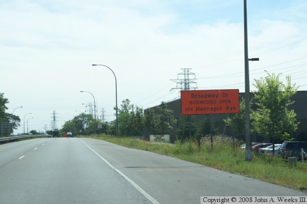
The photo above is southbound on MN-280 near the Broadway Drive
intersection. This is a T-intersection. It is blocked off. The
orange sign suggests that traffic use Hennepin Avenue.
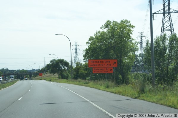
The photo below is just north of the Hennepin Avenue and Larpenteur
Avenue interchange. The sign suggests that traffic headed to Broadway
Drive use this exit ramp.
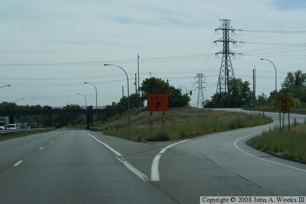
The photo above is the Hennepin Avenue and Larpenteur Avenue exit. The
dividing line between Minneapolis and Saint Paul is just to the right of
this photo. Many streets change names when crossing the city limits.
Hennepin and Larpenteur is one example, Energy Park Drive and Kasota
Avenue is another example. University Avenue and Como Avenue are
counter examples that keep their names as they cross the city limits.
This interchange had very little in the form of acceleration and
deceleration lanes. The ramps are short and have tight curves with
limited visibility. The inside loops were dangerously tight, and
the narrow bridge piers left merging cars in a dangerous situation.
For the detour, MN-DOT did what they could to add to the acceleration
lanes. They also removed the inside loops. This interchange will be
fully rebuilt in 2009 to bring it up to modern freeway standards.
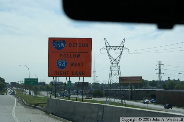
The big orange sign in the photo below informs motorists that the
detour is being handed off to I-94 westbound, and that traffic should
stay in the right line for that change. This location is the south
end of the Como Avenue overpass.
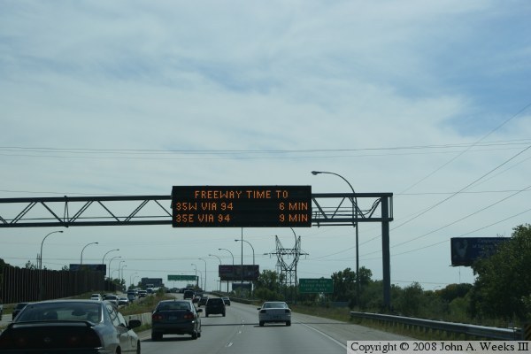
The photo above is a view of MN-280 as we head southbound. We are in a
section where the two roadways are divided by a median. This location
is north of the Energy Park Drive and Kasota Avenue overpass. The
variable message sign indicates 6 minutes to I-35W, which means that
there is no traffic backups at the moment. Notice that MN-DOT installed
a line of K-blocks at the left edge of the roadway. This is to provide
a center divider wall to keep vehicles from crossing into on-coming
traffic in the event of an accident.
The photo below shows MN-280 where the ramp from Energy Park Drive and
Kasota Avenue enters MN-280. At this point, the lanes of MN-280 are
adjacent to each other divided only by a tall concrete wall.

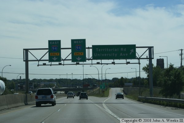
These two photos are views from near the south end of MN-280. In
the photo above, signs indicate that the lanes will split just ahead,
with one lane going east on I-94, the other lane going west on I-94.
We also have an exit ramp to our right for University Avenue.
The photo below shows that the northbound and southbound have split,
but the two southbound lanes are still next to each other.
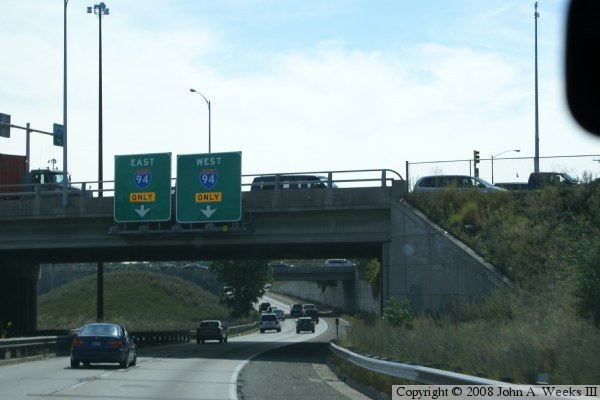

In the photo above, the lane from southbound MN-280 to westbound I-94
has split from the lane leading to eastbound I-94. In the photo below,
we have crossed under I-94, and we are making a long sweeping turn to
the right to meet I-94, where it will enter the highway from the left.
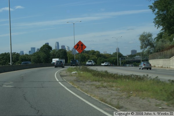

In these two photos, we are now heading westbound on I-94. In the
photo above, we have entered busy I-94 from a left entrance. To make
this left entrance safer, MN-DOT blocked the left lane before the
interchange. Prior to the detour, cars entering from the left had to
merge into high-speed traffic.
These two photos show this section of I-94 repainted for 4 through
lanes. This can lead to some close clearances. For example, in the
photo below, the railroad bridge pier and abutment are located directly
at the edge of a highway lane, leaving no shoulder and allowing no wide loads.

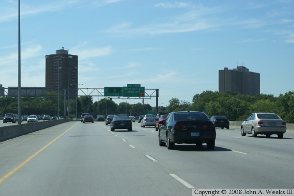
In these two photos, we continue westbound on I-94. The photo above
is a view from the Dartmouth Bridge over the Mississippi River. Note
that the big green sign with instructions on how to reach northbound I-35W
have been covered up. In addition, a temporary arrow was added to the
Riverside Ave exit sign since the exit lane moved a bit to the right
when the highway was repainted for 4 through lanes.
The photo below informs traffic that the ramp to I-35W is 1 mile
ahead, and that it is an exit only. That means that this lane will
split off as part of that exit.

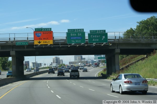
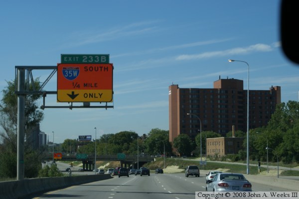
These two photos show that we are getting closer to the I-35W exit.
In the photo above, we are three-fourths of a mile from the exit, while
in the photo below, we are only a quarter mile from the exit. In fact,
if you look up the freeway, you can see the next big orange sign for the
exit. It is at the bottom of the small grade.
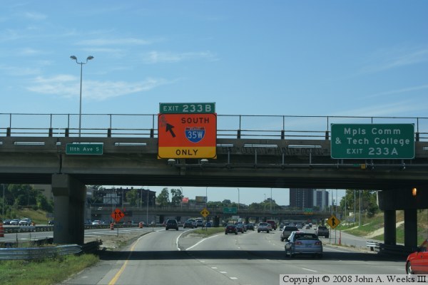
The photo above is a view of the exit ramp from I-94 westbound to
I-35W southbound. Prior to the detour, this exit was optional, as
marked by a big green sign. The big greens sign has been covered by
a big orange sign since this is now an exit only after the highway was
repainted for 4 through lanes. I-94 drops to 3 through lanes after
this exit.
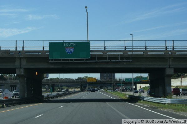
We are now in the commons area south of downtown Minneapolis where I-35W
and I-94 intermingle. The arrows have been removed from the overhead
sign. The reason is that for part of the detour, this section of road
was lined with cones and barrels with the entrance ramp getting its own
lane, and traffic from the construction zone getting its own lane.
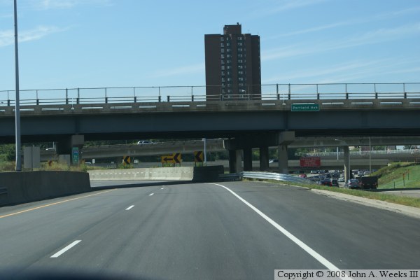
The photo above is the famous hairpin curve on I-35W. The roadway has
just been repaved, cleaned up, and new guardrails installed. This area
normally is debris strewn and the guardrails are normally mangled as
driver misjudge the turn and strike the concrete divider.
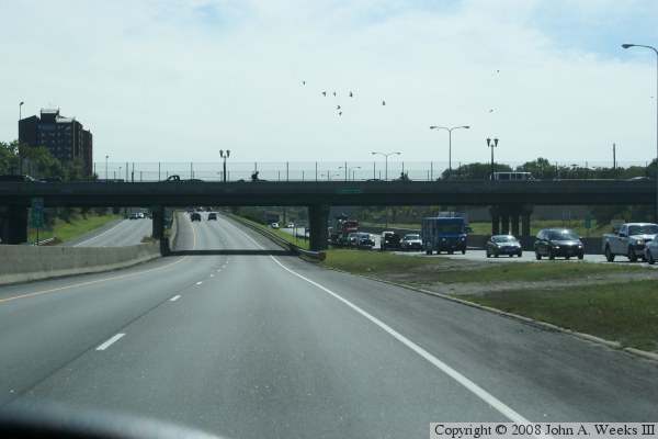
The photo below is the famous section of I-35W where you have oncoming
lanes of traffic on both sides of your two lanes of traffic. This is
very disorienting the first time you drive through this section since
it feels like you are on the wrong side of the freeway. What happens
here is I-35W splits heading into downtown, and half of the lanes in
each direction cross over to the other side of the freeway to end up
with two parallel freeways. One freeway enters downtown, the other
makes the hairpin turn and heads north towards the bridge over the
Mississippi River.
|

