
|
John A. Weeks III
Thursday, January 15, 2026, 8:23:25 PM CST |
|||
| Home | Photo Tours | Rail Fan | 12 Easy Steps |
| Aviation | Spacecraft | Highways & Bridges | About The Author |

|
|
|||||||||||||||||
I-35W Bridge CollapseView From The 10th Avenue Bridge — September 2, 2007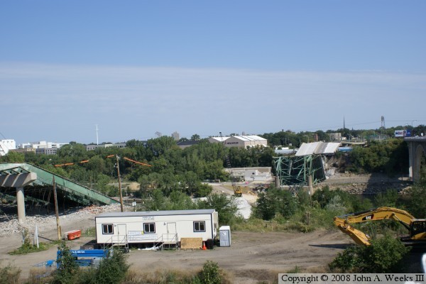
The busy Interstate 35W bridge over the Mississippi River in downtown
Minneapolis, Minnesota, collapsed at the peak of rush hour on Wednesday,
August 1, 2007. These photos are taken from the
10th Avenue Bridge,
which had been closed for a month following the collapse of the I-35W bridge.
They are arranged from south to north, and we are looking west towards
downtown Minneapolis. They were taken the morning of September 2, 2007.
Some of these photos are off-center. That is due to shooting the photos
blindly. Officials erected a tall fence along the edge of the 10th Avenue
Bridge, so many of these photos were taken by holding the camera high in
the air above the fence, and taking random shots until I stumbled on a
shot that was acceptable.
Note—these materials are covered by copyright and may not be used without written permission. The photo above gives an idea of just how wide the river crossing is at this point just below the Saint Anthony Falls. The bridge itself was over 1,900 feet long, more than a third of a mile. 
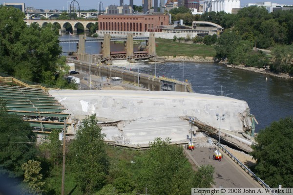
The photo above shows the work going on at the south end of the bridge
to remove concrete and rebar. The photo below shows how the bridge
spans landing on the south bank of the Mississippi River. The river
gorge is over 100 feet deep at this point. The very bottom sections
of concrete show the shift to the east that investigators are looking
into. Both photos show the temporary construction offices that have
been set up. A wooden stairway has been put in to give easier access
to the job site.


These photos are two more views of the bridge spans on the south end
of the river crossing. Note that the diagonal line in the upper photo
is part of the chain link fence that I was shooting through. Several
other photos in this series have similar artifacts.

The photo above is the remains of the bridge span that fell into the
main channel of the Mississippi River. The concrete and rebar have
already been removed. The water is about fifteen feet deep in this
area. Some of the bridge truss remained intact under the roadway,
which caused the roadway itself to stay above water.
The photo below is an overview of the north end of the bridge collapse site. The track crane is sitting on a temporary causeway that has been built about halfway across the river. 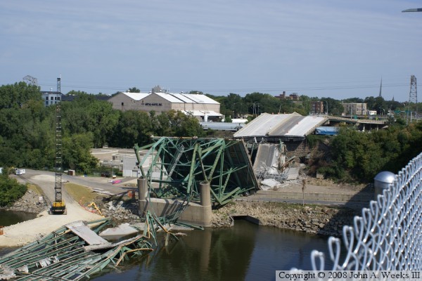
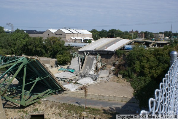
The photo above is a closer view of the roadway section on the north
side that suffered the most damage. The photo below shows part of
the truss section on the north end of the bridge. This section
appears to have become disconnected from the section that spans the
river. When it lost support, it tipped backwards, pushing the support
piers out of plumb.

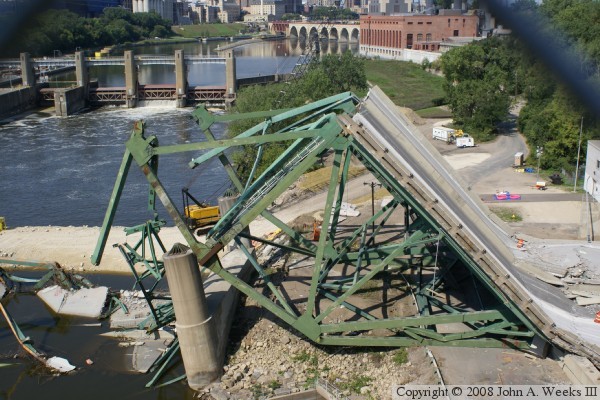
Here are two more views of the truss at the north end of the bridge.
This section fell backwards, causing the span to the right to pancake
onto a parking lot that was located below the bridge.


The photo above is a close-up view of the very north end of the truss,
which pancaked onto the parking lot below when it lose support. The
building in the background is the University of Minnesota Tandem
Accelerator Lab, which hosts high-energy physics experiments.
The photo below is a close-up of the northern-most pier. Unlike other areas of the bridge where the broken truss ended up largely intact, here, the structural steel members look like wet noodles draped over the support pier. 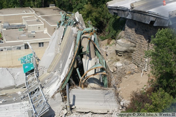
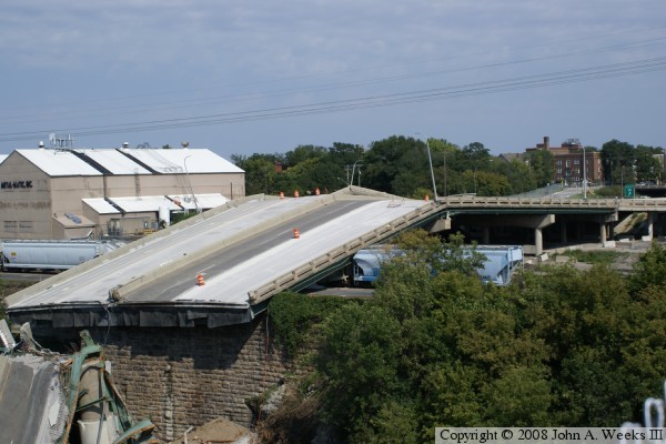
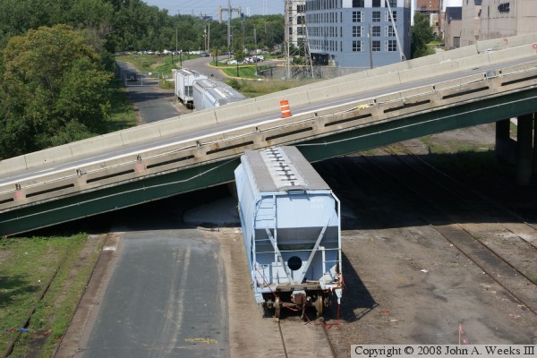
These two photos show one of the approach spans that fell as part of
the bridge collapse. This section landed on a 19th century retaining
wall that supports the small rail yard. Several parked railroad cars
were damaged in the accident.
|
|
|
Authored by John A. Weeks III, Copyright © 1996—2016, all rights reserved. For further information, contact: john@johnweeks.com
|