Current Weather Conditions
John A. Weeks III
Sunday, December 1, 2024, 11:56:02 AM CST
Home Photo Tours Rail Fan 12 Easy Steps
Aviation Spacecraft Highways & Bridges About The Author
 
Google Search
Maps   Groups   Images   Search
 
  Home
  • 12 Easy Steps
  • Aviation
  • Spacecraft
  • Highways & Bridges
    » Bridge Photography
      - MSP River Bridges
        › 10th Avenue Bridge
        › Arcola High Bridge
        › Betty Adkins Bridge
        › Bloomington Ferry
        › Bloomington Fry Tr
        › BNSF RR Bridge
        › Boom Island Foot Br
        › Broadway Avenue Br
        › C&NW Bridge (1)
        › C&NW Bridge (2)
        › Camden Bridge
        › Cedar Avenue Bridge
        › Cedar Ave Br (Old)
        › Cedar Ave Bicycle Br
        › Cedar Bend RR Br
        › Chaska Bridge (Old)
        › Chaska Swing Bridge
        › Chaska Trestle
        › Coon Rapids Dam
        › CP RR Bridge
        › Dan Patch Line Br
        › Dartmouth Bridge
        › East Channel Bridge
        › East Channel RR Br
        › East River Flats Br
        › Endless Bridge
        › F. W. Cappelen Mem
        › Father Henn Bluffs
        › Father Louis Henn Br
        › Ferry Street Bridge
        › First Avenue Bridge
        › Fort Road Bridge
        › Fort Snelling Br (Old)
        › Fort Snelling High Br
        › Great Western Bridge
        › Grey Cloud Channel
        › Grey Cloud Island Br
        › Grey Cloud Trail Br
        › Hastings High Bridge
        › Hastings Spiral Br
        › Holmes St Ped Bridge
        › Highway 243 Bridge
        › I-35W Bridge
        › I-35W Bridge (Old)
        › I-494 Bridge
        › I-694 Bridge
        › Interstate Bridge
        › Intercity Bridge
        › L St. Anthony F L&D
        › Lafayette Bridge
        › Lake Street Bridge
        › Lewis Street Bridge
        › Lexington Bridge
        › Lions Levee Pk Foot
        › Lock & Dam #1
        › Lock & Dam #2
        › Long Meadow Bridge
        › Lower Bridge
        › Lowry Bridge (Old)
        › Meeker Island L&D
        › Mendota Bridge
        › Merriam Street Br
        › Mill Ruins Park Br
        › Milwaukee Road Br
        › M&StL Bridge
        › Miss River Bridge 15
        › MN-101 Bridge
        › MN-41 Backchannel
        › MN-41 Back Ch (Old)
        › MN-41 Bridge
        › New Saint Croix Br
        › New Trunk-41 Bridge
        › Nicollet Island RR Br
        › North Miss Park Pier
        › NP Bridge #9
        › NP RR Bridge
        › Pike Island Bridge
        › Plymouth Bridge
        › Point Douglas DB
        › Raspberry Island Br
        › Richard P. Braun Br
        › Robert Street
        › Rock Island Swing Br
        › Runway 30 Light Br
        › Short Line Bridge
        › Smith Avenue High
        › Southeast Steam Plant
        › St. Anthony Falls Br
        › St. Anthony Falls Lab
        › St. Anthony Falls PP
        › St. Croix Boom Site
        › St. Croix Falls Dam
        › Stillwater Lift Br
        › Stone Arch Bridge
        › Third Avenue Bridge
        › Toll Bridge (Old)
        › U St. Anthony F L&D
        › US-8 Bridge
        › Wabasha Street Bridge
        › Wakota Bridge
        › Wakota Bridge (Old)
        › Walnut Street CW
        › Washington Ave Br
        › WI Central RR Br
        › WI Central RR Ruins
        › Wright Co Hwy 42
      - C & D Canal
      - Illinois River
      - Minnehaha Creek
      - Minnesota River
      - Mississippi River
      - Missouri River
      - St. Croix River
      - St. Louis River
      - Wisconsin River
      - Best Miss River Photos
      - Cable Stayed Bridges
      - McGilvray Road Bridges
      - I-35W Bridge Disaster
      - Miscellaneous Bridges
      - Madison County Bridges
      - Hist Br Weekend 2013
    » Road Geek Topics
  • Photo Tours
  • Rail Fan
  • About The Author
 
Site Search By JRank
Highways, Byways, And Bridge Photography
10th Avenue Bridge
10th Avenue Mississippi River Crossing
Minneapolis, MN

10th Avenue Bridge

• Structure ID: NBI: 2796.
• Location: River Mile 853.10.
• River Elevation: 725 Feet.
• Highway: 10th Avenue SE (North), 19th Avenue (South).
• Daily Traffic Count: 10,300 (2001).
• Bridge Type: Concrete Arch.
• Length: 2,921 Feet Overall,
2,174.9 Foot Arch Sections,
265.5 Foot Longest Span.
• Width: 4 Traffic Lanes, 68.1 Feet.
• Navigation Channel Width: 228 Feet.
• Height Above Water: 100 Feet.
• Date Built: Opened September 1929.
By the early part of the 1900s, Minneapolis already had a number of Mississippi River bridges. These bridges ranged from older wagon bridges, railroad bridges, street car bridges, and more modern highway bridges. Most of this infrastructure was concentrated near the Saint Anthony Falls and downtown area. City leaders were concerned about the congestion downtown, and worried that it would only get worse as the city grew. To address the problem, a bridge was proposed on the eastern fringe of the core of the city of Minneapolis. The theory was a new bridge would serve as a bypass to downtown Minneapolis. It would also help connect some of the newer industrial areas northeast and southeast of the downtown area. Finally, a new bridge would be a good connector for the newly built Duluth Highway (today known as US-8, whose route is closely followed by I-35W).

The bridge was approved for construction in 1924, with the construction plans being finalized in 1926. The approaches were built between 1923 and 1926. When it came time to build the main bridge structure, several firms bid for the work. The city of Minneapolis also bid on the job. In fact, the city was the winning bidder. The bridge was built between June, 1926, and October, 1929. The work was accomplished using day labor. The official dedication ceremony was held in September of 1929.

The completed bridge was 2,921 feet long. This includes the two main arches which span 265-1/2 feet, two smaller side arches of 93 feet, and a number of smaller concrete girder spans. The main arches had a vertical clearance of 110 feet above the Mississippi River, making it the highest bridge in the city of Minneapolis.

The Cedar Avenue Bridge served its purpose for nearly four decades. By the mid and late 1960s, the bridge was badly in need of an overhaul. At the same time, the new Mississippi River crossing for Interstate Highway I-35W was being built. This new bridge opened in 1967. In the process of building the new I-35W, the streets in the area between I-94 and the Mississippi River were significantly altered. The south end of the Cedar Avenue Bridge would no longer connect to Cedar Avenue. Rather, the bridge approach was curved to the east so it would connect to 19th Avenue South. The north end was similarly changed in that it no longer connected to Johnson Street. Rather, it would connect to 10th Avenue SE.

To accommodate the building of the new I-35W, the Cedar Avenue Bridge was closed near the end of 1967, with the new I-35W bridge acting as the official detour. I-35W was opened across the Mississippi River in 1971. At that time, the city of Minneapolis made the decision to complete a major rebuild of the Cedar Avenue Bridge. The approaches would be reworked to meet the new street alignments. The girder spans would be removed. Some of the approach spans would be replaced with smaller concrete arches, while other approach spans would be filled in and eliminated. This resulted in a bridge that was about 800 feet shorter, but much more attractive given all the smaller arch spans. The main spans were repaired, and a new wider traffic deck was installed. This allowed for 4 traffic lanes and two sidewalks to be carried over the river. When the bridge reopened in 1976, it was renamed the 10th Avenue Bridge to reflect the new street alignments.

The 10th Avenue Bridge was added to the National Register of Historic Places in 1989. It was included as a result of its design, which is an example of the highest form of the golden age of the reinforced concrete arch bridge.

The 10th Avenue Bridge was closed on August 1, 2007, following the collapse of the 1967-era I-35W bridge located just upstream of the 10th Avenue Bridge. The bridge reopened on August 31, 2007, as a 2 lane bridge open to all traffic, plus a dedicated bicycle lane. Crews installed a chain link on the west side of the bridge and have set up a pedestrian viewing area on that side of the bridge to allow people to watch the construction of the new Saint Anthony Falls Bridge for I-35W. The new I-35W bridge was completed in September, 2008. The city of Minneapolis removed the fence and barricades returning the bridge to its 4-lane configuration on October 1, 2008. The viewing area was well received and heavily used during the construction of the new I-35W bridge.

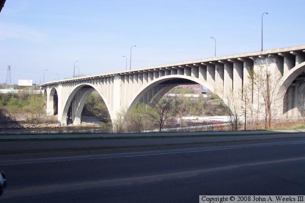
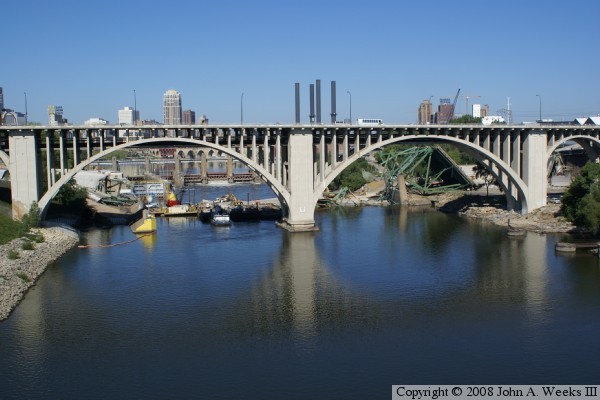
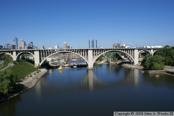
The photo above was taken from West River Parkway in the spring of 2005 looking northeast at the main river crossing. Only part of the bridge is in view since the bridge makes three distinct curves. The photo below was taken in August, 2007, from the Northern Pacific Bridge #9 just days after the I-35W bridge collapse. Wreckage from the I-35W bridge can be seen, as well as the lower falls dam, the Stone Arch Bridge, and the Minneapolis city skyline.

10th Avenue Bridge
10th Avenue Bridge
These two photos were taken in the spring of 2006 from the southwest end of the bridge via West River Parkway. The photo above is a view of the river crossing looking northeast. The photo below is a look at the approach spans on the south end of the bridge. The shadow in these two photos was cast by the old I-35W bridge, which is located just upstream from the 10th Avenue Bridge.

10th Avenue Bridge
10th Avenue Bridge
These two photos were taken prior to the collapse of the I-35W bridge in spring of 2007. The I-35W bridge can been seen in both photos. The photo above is a view looking south from the parking lot of the former Hardees fast food outlet. The bridge crosses a street and a rail yard before crossing the east river flats and finally the river itself. The photo below was taken from the east river flats area from ground level.

10th Avenue Bridge
10th Avenue Bridge
These two photos were taken from the Northern Pacific Bridge #9, the next bridge downstream. The wreckage of the collapsed I-35W bridge can be seen behind the 10th Avenue Bridge. The photo above was taken from the center of the river span of the NP bridge, while the photo below was taken from the west end of the NP bridge while standing high over Bohemian Flats.

10th Avenue Bridge
10th Avenue Bridge
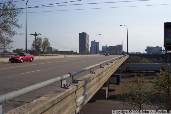
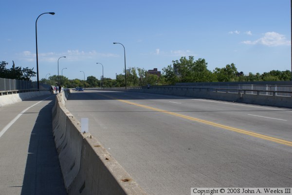
These two photos are the first of 4 photos to show a typical crossing of the 10th Avenue Bridge driving from south to north across the Mississippi River crossing. The photo above is the entrance to the bridge on the south. The photo below is taken at the first curve where the bridge makes a 5-degree turn to the east. Notice that the bridge is in the I-35W construction configuration with the chain link fence and the concrete divider in the first traffic lane.

10th Avenue Bridge
10th Avenue Bridge
These two photos are the final two photos of a 4 photo series showing a typical crossing of the 10th Avenue Bridge. The photo above is taken at the midpoint of the river crossing. The bridge makes a gradual turn back to the west at this location. The photo below is the north end of the bridge where the structure lands on 10th Avenue SE. The bridge makes another 5-degree turn to the east as it crosses over an old railroad yard.

10th Avenue Bridge
10th Avenue Bridge
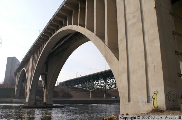
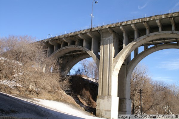
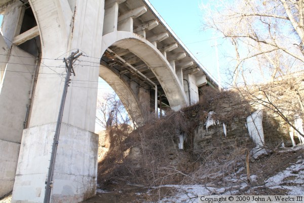
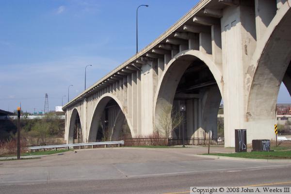
These two photos are views of the smaller 93 foot arch on the north end of the 10th Avenue bridge. The photo above is looking east, while the photo below is looking west. These two photos give a good view of the support structure above the arches, as well as the utility pipes that are carried under the bridge.

10th Avenue Bridge
10th Avenue Bridge
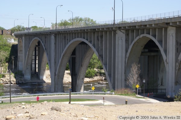
The photo above is a view of the river crossing as seen from the I-35W Saint Anthony Falls Bridge construction site on the south side of the river. The photo below is the pier that serves as the transition point between the concrete girder spans and the first arch span.

10th Avenue Bridge
10th Avenue Bridge
The photo above is a view looking south at the concrete girder spans towards the south bridge abutment. The photo below is the bridge deck in the summer of 2009. The roadway has returned to its 4-lane configuration now that the I-35W bridge construction is complete.

10th Avenue Bridge

Made With Macintosh
Authored by John A. Weeks III, Copyright © 1996—2016, all rights reserved.
For further information, contact: john@johnweeks.com