According to the Minnesota State Historical Society, there have been two
previous bridges at this location. The first was built was a wagon bridge
in 1880. This bridge featured very tall cut stone piers, and then a long
continuous deck truss span that crossed the river. The north end was built
with a number of 4 leg towers. These towers had cables, rods, and beams
placed across the gaps to hold up the roadway. This bridge was in use
until 1912. It was known as the Fort Snelling High Bridge.
A steel arch bridge was built in 1912 to replace the wagon bridge. This
bridge had three main piers, one just below Fort Snelling, one in the
river, and one on the river flats on the north side of the river. A pair
of large arches spanned these three piers, with the road deck built above
the arch trusswork. A short deck truss span was located on each end of
the bridge to connect the end of the arch spans to the bridge abutments.
This bridge was known as the Second Fort Snelling Bridge.
The current bridge opened in November, 1961. This bridge, known as the
Fort Road Bridge, is a modern style steel plate girder bridge. A series
of concrete piers were built, and steel girders were erected on top of
the piers. Cross beams were installed, and a concrete deck was put on
top of the metal structure. The interesting design feature is that while
most of the piers are set at right angles to the roadway, the two piers
that are in the river are set at a right angle to the river current, which
is not a right angle to the to the roadway. So, while most of the piers
are square to the bridge, two are set at an angle to the bridge.
The Fort Road bridge is a fracture critical bridge. That is, it has a
design where if one key part fails, the bridge does not have enough
redundant parts to prevent the entire structure from collapsing. The
fracture critical issue was dramatically demonstrated when the I-35W
bridge collapsed in 2007. The issue with the Fort Road bridge is that
there are only two main girders per span (with two spans side by side).
If one of these girders were to fail, that span would collapse. A bridge
with redundancy would have at least 3, and preferably at least 4 main
girders. The additional girders would leave a margin of error.
Beyond the technical issues, this is a bridge that I know very little about.
The Fort Road bridge has not been in the media as far as I recall. Yet, with
a traffic count of 59,000 cars a day, this bridge carries a huge load and
is a key piece of highway infrastructure.
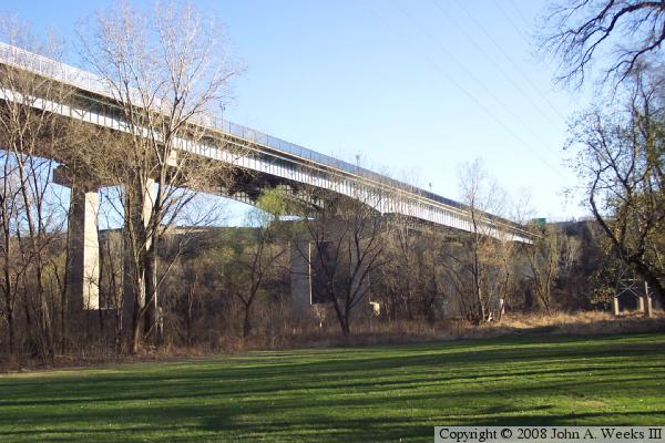
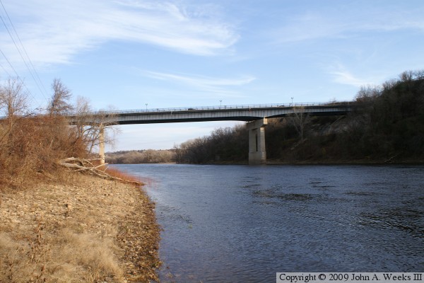
The photo at the top of the page was taken from Hidden Falls Regional Park.
This area of the park can be accessed by Lower Hidden Falls Drive. The
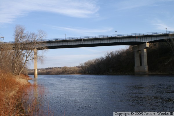
photo below was taken from the small park on the northeast end of the
bridge. That park is built on the abutment remaining from the 1912 bridge.
The buildings in the background are part of Fort Snelling.
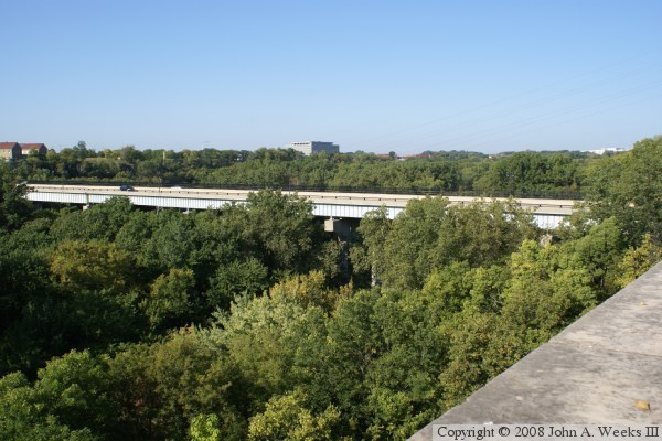
These two photos attempt to show profile views of the bridge. The bridge
deck is located right at the tree-top level, and the area has heavy
vegetation, so only bits and pieces of the bridge are visible from any
given vantage point. The photo above was taken from Crosby Farm Road
on the north end of the bridge just downstream of the river crossing.
The photo below was taken from the parking lot at the visitor center
for historic Fort Snelling, which is on the south side of the river
just upstream of the bridge.
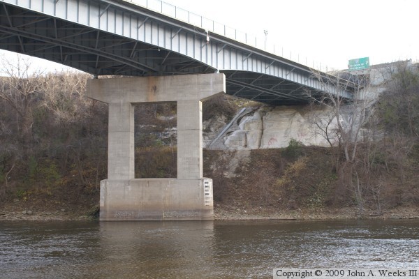
These two photos are views of the upstream face of the Fort Road Bridge as
seen from the north bank of the Mississippi River. The photo above is an
overview of the main river channel crossing, while the photo below is a
close view of the main channel span. These two bridge piers are set
parallel to the river flow rather than being square with the bridge deck.
The photo above is looking southeast towards the south bridge abutment. The
bridge abutment is carved into the bluff. A Milwaukee Road railroad line
once sat on the ledge under the bridge, but that railroad line was abandoned
before this bridge was constructed. The railroad right-of-way is now a
regional trail. The photo below is a view of the structure under the bridge
deck. While the bridge appears to be freshly painted, there is already
rust showing on the steel below the joint in the bridge deck above this pier.
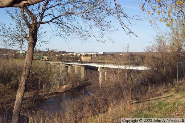
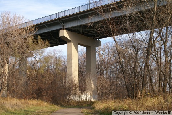
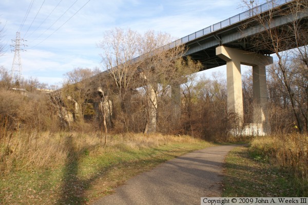
The photo above is a close view of one of the bridge piers on the flood
plain on the north side of the Mississippi River. The photo below shows
the rest of the bridge on the north side of the river. This section of
the bridge is hidden from view in the summer by the trees.
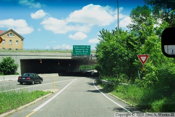
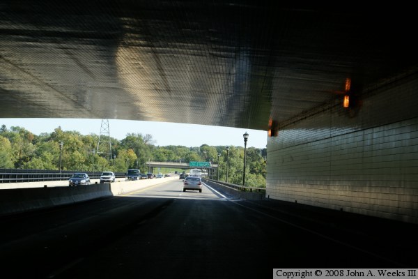
These two photos are the first of five photos showing a typical Mississippi
River crossing using the Fort Road bridge. This journey will start
on the south side of the river, and head north into Saint Paul. Just prior
to the bridge, we pass through a tunnel that is built under Fort Snelling.
In the photo above, we enter the tunnel from the tricky short ramp exiting
from westbound MN-55 and MN-62 after just having crossed the Mendota Bridge.
In the photo below, we are northbound on MN-5 having just passed the MSP
International Airport.
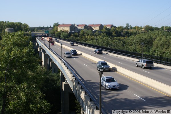
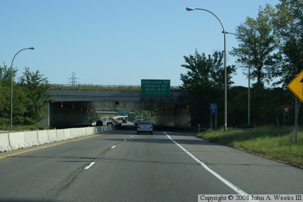
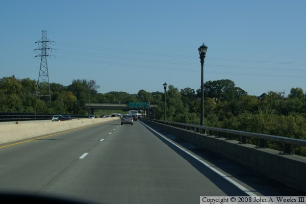
The photo above is a view from inside the tunnel under Fort Snelling. The
Fort Road bridge begins at the end of the tunnel. The photo below is a
view after exiting the tunnel and entering the bridge. Notice how tight
the traffic lanes are to the guardrails.
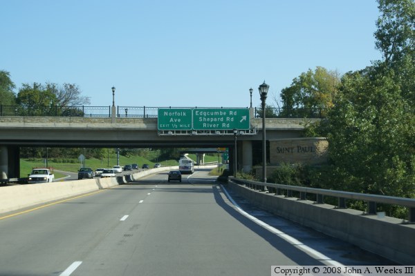
The photo above completes our Mississippi River crossing. Just as we
exit the bridge, we pass under two overpasses. Notice the elegant cut
stone monument announcing our entrance into Saint Paul. The photo below
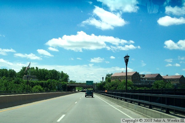
is a view headed southbound on the Fort Road bridge. Looking up the
highway, we see the tunnel under Fort Snelling. The historic fort is
on the left side, while the more modern complex on the right side dates
from the 1880s and 1890s.
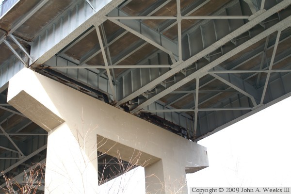
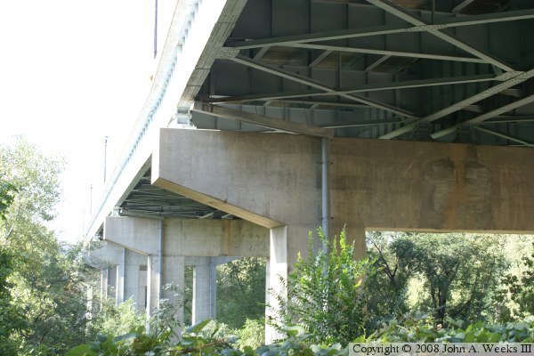
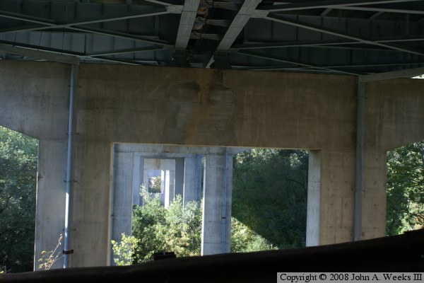
These two photos are views from under the Fort Road bridge. The photo
above gives a detail view of how the steel is placed to cross-brace
the two girders, and how the deck is supported by large steel cross-beams.
The photo below is looking south through all the piers.