| Highways, Byways, And Bridge Photography |
Wakota Bridge
I-494 Mississippi River Crossing
South Saint Paul, MN to Newport, MN
|
Eastbound Span |
|
• Structure ID: |
NBI: 82855. |
|
• Highway: |
I-494 Eastbound. |
|
• Width: |
86 Feet, 5 Traffic Lanes. |
|
• Date Built: |
Opened July 1, 2010. |
|
|
|
Westbound Span |
|
• Structure ID: |
NBI: 82856. |
|
• Highway: |
I-494 Westbound. |
|
• Width: |
99 Feet, 5 Traffic Lanes. |
|
• Date Built: |
Opened August 2006. |
|
|
|
Statistics Common To Both Spans |
|
• Location: |
River Mile 832.40. |
|
• River Elevation: |
686 Feet. |
|
• Daily Traffic Count: |
89,000 (2007). |
|
• Bridge Type: |
Post-tensioned Continuous Concrete Box Girder. |
|
• Length: |
1,892 Feet, 466 Foot Longest Span. |
|
• Navigation Channel Width: |
450 Feet (Estimated). |
|
• Height Above Water: |
58 Feet. |
The old Wakota Bridge was been a southeast
metro area landmark since it was built. While the bridge was still sound,
it was simply overwhelmed by traffic, with significant backups many hours
each day. The new bridge combined with the US-61 freeway upgrade will
dramatically improve quality of life for anyone who has to commute
through that area. For example, the old bridge had 2 lanes in each
direction, while the new bridge will have 5 lanes on each span. In fact,
this will be the widest bridge in the state when it is completed. The
new I-35W bridge was shown in early plans to be wider than the Wakota
Bridge, but as built, the I-35W bridge ended up 4 feet narrower than
the combined Wakota Bridge spans.
- Click here for more about the Wakota Bridge construction project.
The new bridge will also include a bicycle path. This will improve the
bicycle trail connections in the east metro area given that there are no
other bicycle river crossings in that area.
The plan was to build the westbound span just north of the old bridge.
All I-494 traffic would be moved to the new span, and then the old
span would be imploded. Due to the large volume of barge traffic,
the old bridge would have to be removed during the winter off season for
navigation. Once the old bridge was gone, the eastbound span of the
new bridge would be built.
The westbound span was built like a huge teeter-totter. Several piers
were erected, and the bridge structure was built both directions from
each pier. Construction crews had to be careful to build the same
amount on both sides of a pier to keep the structure in balance. Once
the bridge sections made connection with each other, the delicately
balanced sections would join to create a very strong bridge. The west
end was especially tricky to built. First, there are two interchanges
very close to the bridge that had to remain open. Next, the I-494 highway
was in the way and had to be moved south a dozen feet. And then there
is an active railroad and a street that intersect directly under the
bridge, both of which had to remain open. That section of the bridge
was supported with steel falsework.
The bridge project was cruising right along, until MN-DOT noticed that
the new bridge was starting to crack. In fact, it was in danger of
collapsing under its own weight. It turns out that the bridge designer
made a key mistake and underestimated the amount of steel rebar that
needed to be installed in the bridge. This caused the edges of the
bridge to droop a bit, and the extra stress was cracking the concrete.
Construction was shifted into low gear until a solution was found.
That solution was two fold. First, the design was modified so all
remaining construction had enough rebar. Second, the already built section
was retrofit with a number of steel cables under high tension. The cables
pulled the sides of the bridges together. The weight of the sides pulled
the cable tight, which caused the cable to push down on the stronger center
back bone of the span. This transferred the weight off of the sides, stopped
them from drooping, and reduced the stress on the concrete. Engineers say
it will not impact the life of the bridge, but only time will tell for sure.
The net result of the project is that the new bridge was not ready for
the winter of 2005/2006, so the old bridge could not be removed until
the winter of 2006/2007. That pushed the completion of the second span
back to the fall of 2008.
Note—yet another problem with the Wakota Bridge project. MN-DOT
and Lunda Construction were unable to agree on a price for building the
eastbound span over the Mississippi River. As a result, MN-DOT canceled
the contract with Lunda, and has decided to rebid the bridge. Lunda will
complete its current work and remove the old bridge. It may take as long
as a year to rebid the bridge, pushing the completion out to 2009 or 2010.
Note—yet more problems. First, it appears that Lunda was correct
in their estimate of $60-million to build the second span, and that Lunda
will receive about $10-million in a breach of contract settlement. MN-DOT
has about $40-million left to finish the project, which puts the second
span in danger of being delayed years to find the additional funding.
Second, MN-DOT is concerned about a cash flow problem related to the new
I-35W bridge. The money is needed early in the project to pay the
contractors as they go, but the federal money is not available until
later in the project when the bridge is substantially complete. One
solution is to raid the Wakota Bridge money to keep I-35W moving, and
delay the Wakota Bridge until the funding can be replaced. As a result,
one wonders if the second span will ever be built.
As of January 2008, MN-DOT has requested and opened bids for the second
span. The low bidder is, not surprisingly, Lunda Construction of Black
River Falls, WI. Their $60-million bid is within a few hundred thousand
dollars of their earlier bid that resulted in them being fired from the
project. Construction on the second span has started as of March, 2008.
Update—in November 2008, MN-DOT announced that they will recover
$20-million from the bridge designer to compensate for the design errors.
This $20-million will cover the $19.6-million cost to fix the westbound span,
and leave a few dollars left to contribute towards the $30-million price
increase to build the eastbound span. The increased cost of the westbound
span is due partly to the new design being more complex and costly to build,
and partly due to price increases during the construction delay.
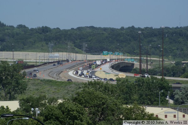
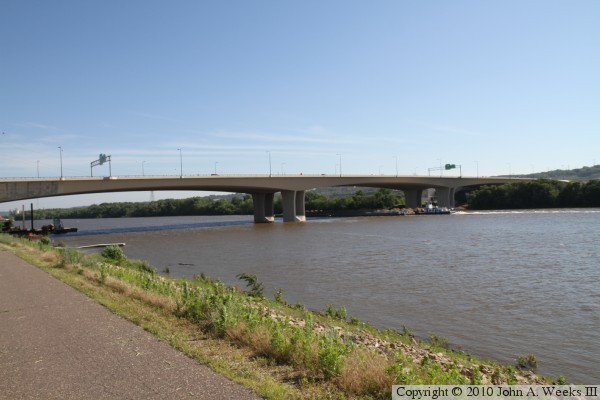
The photo above is looking east towards the Wakota Bridge from the bluffs
above Concord Avenue in Saint Paul Park. Newport is on the far side of the
river. Interstate I-494 makes a sweeping S-curve as it enters from the
right side of the photo, and exits to the left side of the photo on the
far side of the river.
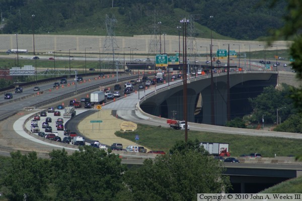
These two photos are additional photos from high on the river bluffs on the
west side of the Mississippi River. The photo above is a view of the bridge
deck during rush hour the second day that the eastbound span was open. Some
lanes are still blocked off due to construction. The photo below is a view
of the south face of the bridge.

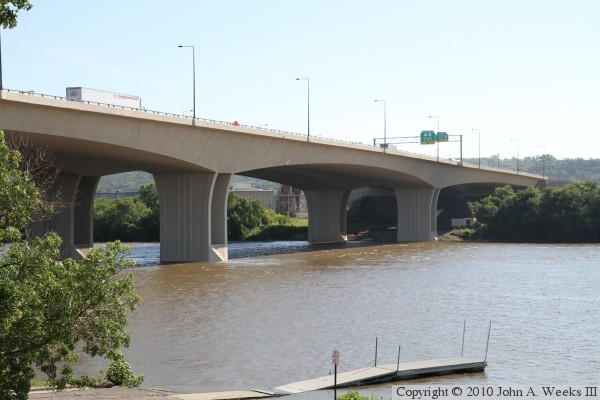
The photo above is the bridge monument at the west end of the river crossing.
There is no trail or pedestrian access to either bridge monument, so this
photo was taken through the windshield of a moving vehicle. The photo below
is looking northeast towards the south face of the river spans. The closer
span is the newer eastbound structure.
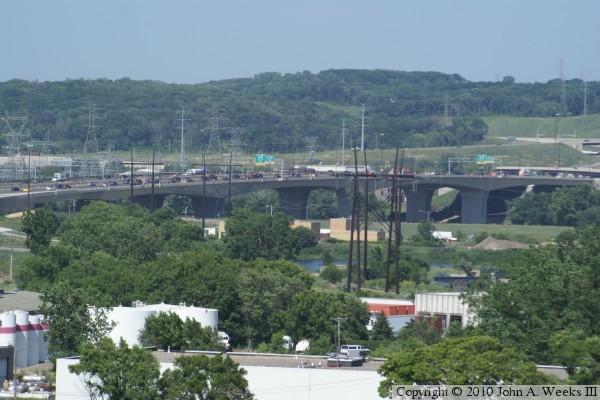
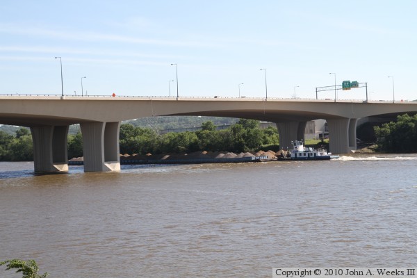
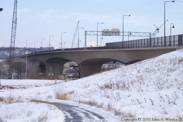
The photo above is looking north from the regional trail that runs along the
levee on the west side of the Mississippi River. Two spans cross the river.
In addition, two slightly smaller spans are located on the west side of the
river, and one smaller span on the east side of the river. The photo below
is a closer view of the main navigation channel as a tow boat passes under
the Wakota Bridge pushing barges filled with sand and gravel upriver.
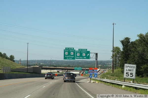
These two photos are the first of a nine photo series showing a typical
river crossing heading westbound across the older of the two bridge spans.
These photos were taken on July 1, 2010, the date that the new eastbound
span opened. The photo above is descending the river bluffs on the east
side of the river. We are approaching the ramps for the US-10 and US-61
interchange. The photo below is approaching the bridge over the US-10 and
US-61 freeway.
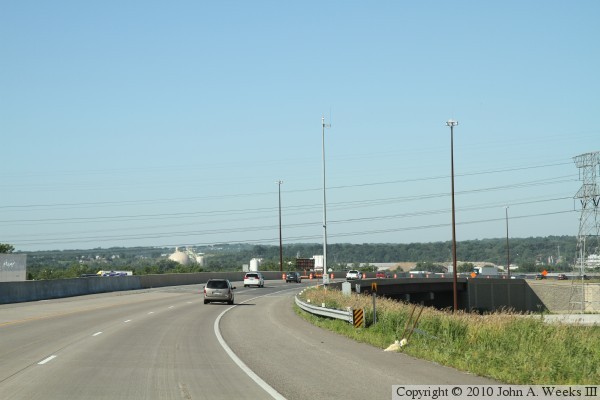

These two photos continue our westbound crossing of the Wakota Bridge. The
photo above is the roadway between the US-10 and US-61 overpass and the east
end of the Wakota Bridge. The photo below is entering the east end of the
bridge. The bridge sidewalk is located on the upriver right side of this
span.

These two photos continue our westbound crossing of the Wakota Bridge. The
photo above is about one-third of the way across the bridge, which is above
the river navigation channel. The photo below is about two-thirds of the way
across the bridge, which is above the west bank of the Mississippi River.


These two photos continue our westbound crossing of the Wakota Bridge. The
photo above is approaching the west end of the bridge. The photo below is
a curve to the left just after exiting the west end of the bridge.
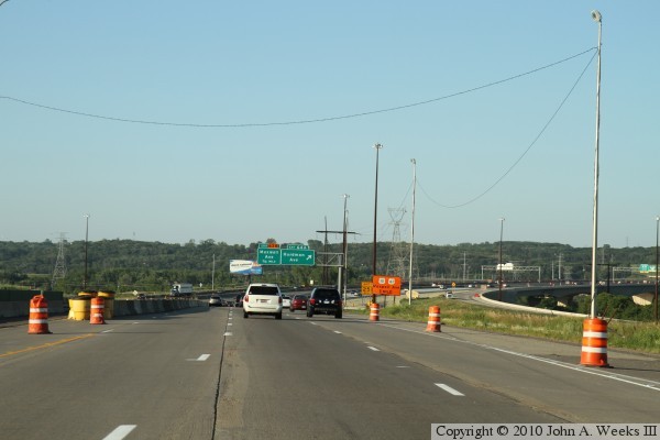
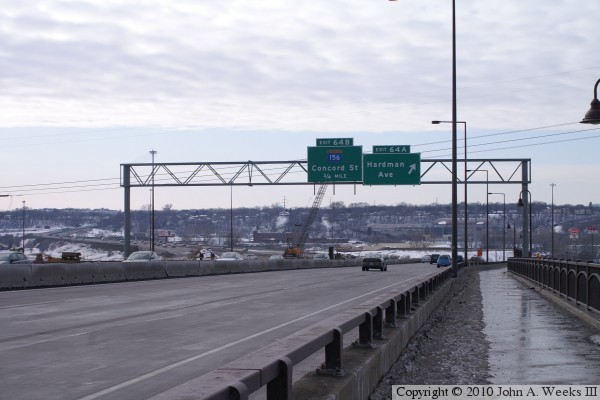
The photos above is the last of a nine photo set showing a typical westbound
crossing of the Wakota Bridge. In this photo, we are approaching the overpass
over Hardman Avenue. This gives a good view of the lane configuration prior
to the eastbound span opening. The eastbound traffic use the 3 lanes that
are to the left of the temporary K-block divider. The shoulders were used to
allow room for six lanes of through traffic.
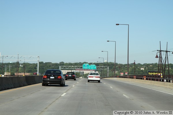
The photo below is the first of a seven photo set showing a typical eastbound
crossing of the Wakota Bridge. These photos were taken on the afternoon of
July 1, 2010, the day that the eastbound span was opened to traffic.
Highway I-494 makes a sweeping S-curve as it crosses the Mississippi River.
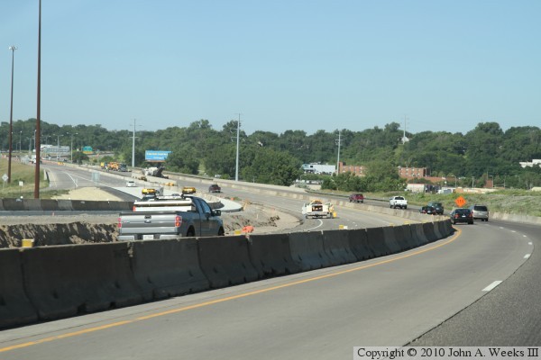
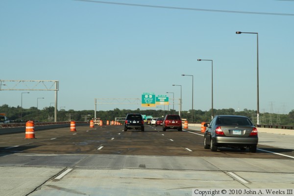
These two photos continue our eastbound crossing of the Wakota Bridge. The
photo above is our journey along the the old pavement that was put in place
before the new Wakota Bridge was built. The photo below is the transition
to new pavement that leads to the eastbound bridge span.

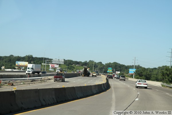
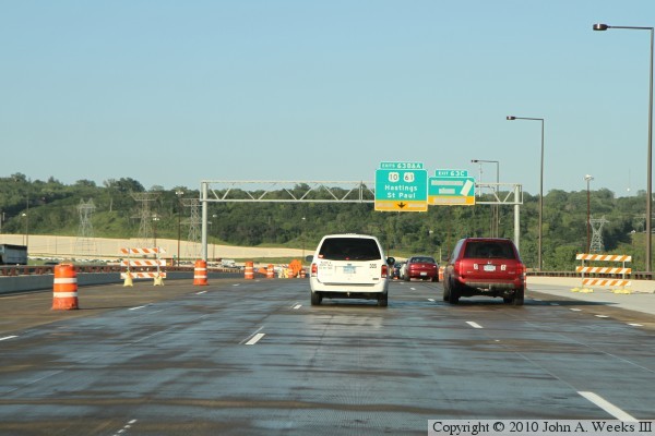
These two photos continue our eastbound crossing of the Wakota Bridge. The
photo above is entering the west end of the eastbound bridge span. The photo
below is a view from about one-third of the way across the bridge. At this
point in the construction, the ramp to Maxwell Avenue is closed. The exit
only section of the US-10 and US-61 interchange is covered because the
shoulder of the highway is being used as a through lane until all five
lanes of the bridge span are open to traffic.

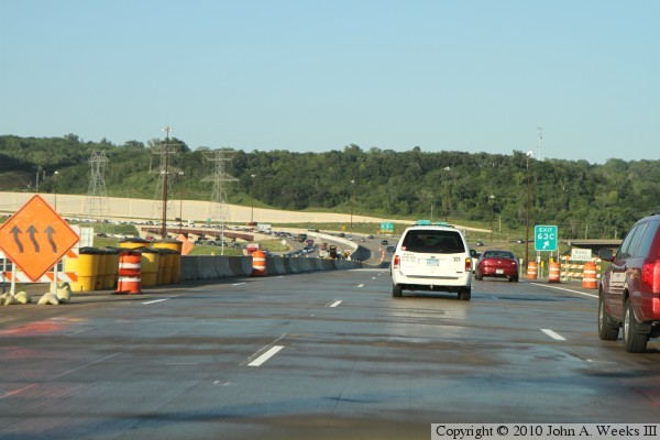
These two photos are the final two of a seven photo set showing a typical
eastbound crossing of the Wakota Bridge. The photo above is a view from
two-thirds of the way across the bridge. The photo below is exiting the east
end of the eastbound bridge span.
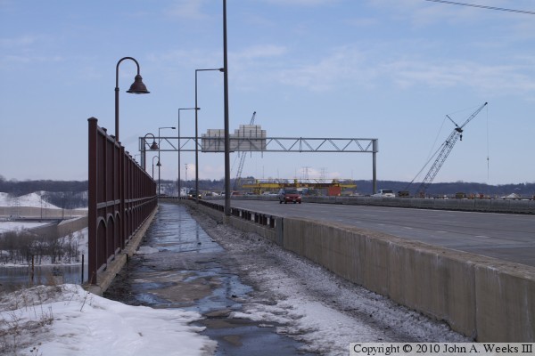
These two photos are the first of a six photo set showing scenes from walking
the westbound bridge span in February, 2010. All traffic is using the
westbound span due to the eastbound span not being completed at that time.
The photo above is looking east down the length of the sidewalk on the
upriver north side of the Wakota Bridge. The photo above is looking east into
the three lanes of westbound traffic. The yellow machine is a form
traveler that supports the moving concrete forms that were used to build the
bridges. Only one form traveler remains at work at this late stage in the
construction project.
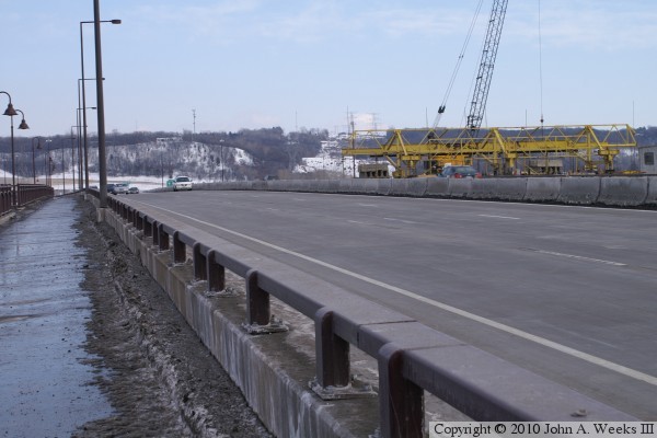
These two photos continue our journey on the bridge sidewalk. The photo
above is looking southwest across the traffic lanes on the bridge. Both
eastbound and westbound traffic are using this span at this time. The
photo below is one of the observation bump-outs on the north side of the
bridge. Note the cool retro style lamps above the walkway.
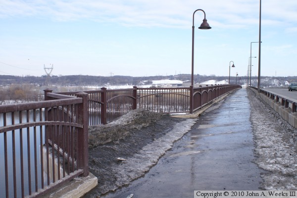
These two photos are the final two of a six photo set from February, 2010.
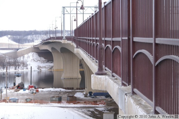
The photo above is looking east along the north face of the Wakota Bridge.
While everything about this photo looks icy cold, it actually was an
unseasonably warm day. The river is not frozen, and there was significant
snow melt in the days leading up to this adventure. The photo below is
another view of the upriver side of the bridge as seen from the trail
connector that runs between the riverfront trail and the trail that
crosses the bridge.
|
