Current Weather Conditions
John A. Weeks III
Tuesday, March 19, 2024, 2:18:20 AM CDT
Home Photo Tours Rail Fan 12 Easy Steps
Aviation Spacecraft Highways & Bridges About The Author
 
Google Search
Maps   Groups   Images   Search
 
  Home
  • 12 Easy Steps
  • Aviation
  • Spacecraft
  • Highways & Bridges
    » Bridge Photography
      - MSP River Bridges
        › 10th Avenue Bridge
        › Arcola High Bridge
        › Betty Adkins Bridge
        › Bloomington Ferry
        › Bloomington Fry Tr
        › BNSF RR Bridge
        › Boom Island Foot Br
        › Broadway Avenue Br
        › C&NW Bridge (1)
        › C&NW Bridge (2)
        › Camden Bridge
        › Cedar Avenue Bridge
        › Cedar Ave Br (Old)
        › Cedar Ave Bicycle Br
        › Cedar Bend RR Br
        › Chaska Bridge (Old)
        › Chaska Swing Bridge
        › Chaska Trestle
        › Coon Rapids Dam
        › CP RR Bridge
        › Dan Patch Line Br
        › Dartmouth Bridge
        › East Channel Bridge
        › East Channel RR Br
        › East River Flats Br
        › Endless Bridge
        › F. W. Cappelen Mem
        › Father Henn Bluffs
        › Father Louis Henn Br
        › Ferry Street Bridge
        › First Avenue Bridge
        › Fort Road Bridge
        › Fort Snelling Br (Old)
        › Fort Snelling High Br
        › Great Western Bridge
        › Grey Cloud Channel
        › Grey Cloud Island Br
        › Grey Cloud Trail Br
        › Hastings High Bridge
        › Hastings Spiral Br
        › Holmes St Ped Bridge
        › Highway 243 Bridge
        › I-35W Bridge
        › I-35W Bridge (Old)
        › I-494 Bridge
        › I-694 Bridge
        › Interstate Bridge
        › Intercity Bridge
        › L St. Anthony F L&D
        › Lafayette Bridge
        › Lake Street Bridge
        › Lewis Street Bridge
        › Lexington Bridge
        › Lions Levee Pk Foot
        › Lock & Dam #1
        › Lock & Dam #2
        › Long Meadow Bridge
        › Lower Bridge
        › Lowry Bridge (Old)
        › Meeker Island L&D
        › Mendota Bridge
        › Merriam Street Br
        › Mill Ruins Park Br
        › Milwaukee Road Br
        › M&StL Bridge
        › Miss River Bridge 15
        › MN-101 Bridge
        › MN-41 Backchannel
        › MN-41 Back Ch (Old)
        › MN-41 Bridge
        › New Saint Croix Br
        › New Trunk-41 Bridge
        › Nicollet Island RR Br
        › North Miss Park Pier
        › NP Bridge #9
        › NP RR Bridge
        › Pike Island Bridge
        › Plymouth Bridge
        › Point Douglas DB
        › Raspberry Island Br
        › Richard P. Braun Br
        › Robert Street
        › Rock Island Swing Br
        › Runway 30 Light Br
        › Short Line Bridge
        › Smith Avenue High
        › Southeast Steam Plant
        › St. Anthony Falls Br
        › St. Anthony Falls Lab
        › St. Anthony Falls PP
        › St. Croix Boom Site
        › St. Croix Falls Dam
        › Stillwater Lift Br
        › Stone Arch Bridge
        › Third Avenue Bridge
        › Toll Bridge (Old)
        › U St. Anthony F L&D
        › US-8 Bridge
        › Wabasha Street Bridge
        › Wakota Bridge
        › Wakota Bridge (Old)
        › Walnut Street CW
        › Washington Ave Br
        › WI Central RR Br
        › WI Central RR Ruins
        › Wright Co Hwy 42
      - C & D Canal
      - Illinois River
      - Minnehaha Creek
      - Minnesota River
      - Mississippi River
      - Missouri River
      - St. Croix River
      - St. Louis River
      - Wisconsin River
      - Best Miss River Photos
      - Cable Stayed Bridges
      - McGilvray Road Bridges
      - I-35W Bridge Disaster
      - Miscellaneous Bridges
      - Madison County Bridges
      - Hist Br Weekend 2013
    » Road Geek Topics
  • Photo Tours
  • Rail Fan
  • About The Author
 
Site Search By JRank
Highways, Byways, And Bridge Photography
Intercity Bridge
Ford Parkway Mississippi River Crossing
Minneapolis, MN to Saint Paul, MN

Intercity Bridge

• Structure ID: NBI: 3575.
• Location: River Mile 847.80.
• River Elevation: 725 Feet.
• Highway: Hennepin Co 46, Ramsey Co 42.
• Daily Traffic Count: 18,000 (1998).
• Bridge Type: Concrete Arch.
• Length: 1,523.6 Feet Overall, 300 Foot Longest Span.
• Width: 4 Traffic Lanes, 64.7 Feet.
• Navigation Channel Width: 188 Feet.
• Height Above Water: 55 Feet.
• Date Built: Opened 1927, Rebuilt 1973 And 2002.
The Intercity Bridge was built to connect Minneapolis and Saint Paul at a time when the cities did not extend much further south than Lake Street. The idea was that the bridge would provide an access route for people on the Minneapolis side of the river to work at the Ford Motor plant on the Saint Paul side, while Saint Paul saw the bridge as a means to promote the development of the Highland Park area. Unfortunately, the great depression hit just after the bridge was finished, and that development did not occur until after WWII was completed.

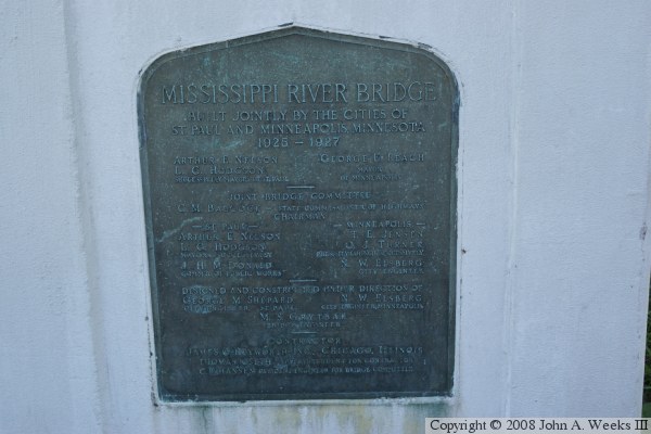
While the official name of the bridge is the Intercity Bridge, it is often called the Ford Parkway Bridge and less commonly the 46th Street Bridge due to those being the two streets connected by the structure. The bridge plate calls the bridge the Mississippi River Bridge.

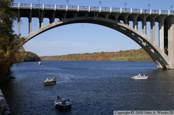
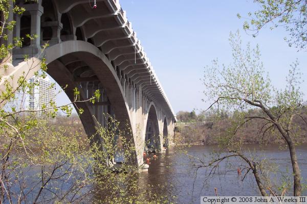
The Intercity Bridge crosses the mighty Mississippi River at its widest and deepest point in the twin cities. That is due to the bridge being located just upstream from Lock & Dam #1, also known as the Ford Dam. The bridge uses 3 huge 300-foot long reinforced concrete arches to cross the river, and two more 139 foot arches to reach the abutments on the river bluffs. The resulting bridge is one of the largest reinforced concrete bridges ever built. The bridge was built during the art deco era, which can be seen in the lines and curves molded into the concrete.

Building the bridge was a massive project. To supply the concrete needed for the project, a large concrete plant was built on the west side of the river. A 1,900-foot long cableway was built to move materials and concrete to specific job sites. The cableway was supported by timber towers that were 135-feet tall. These towers could be moved so concrete delivered by the cableway could be dropped at specific locations.

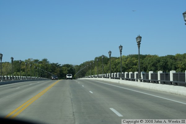
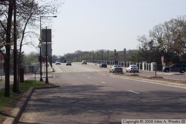
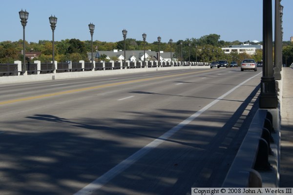
By the early 1970s, the bridge had deteriorated enough to require major refurbishment. The deck was removed, and many of the ribs were replaced. All the ribs were made wider, and a new wider deck was installed on the bridge. The result was a modern 4 lane bridge with sidewalks on both sides of the bridge. This work was completed in 1973. A second major project in the years 2002 to 2004 again replaced the deck, and made repairs to the ribs and arches. This time, the deck was made wide enough to accommodate narrow shoulders, and provided a curb and guardrail between the traffic lanes and the sidewalks. New decorative lighting and retro-style railings were added to the bridge as part of the upgrade.

While the bridge did get off to a slow start, today, it is key link in the Twin Cities transportation network. The design of the bridge was considered important enough for the bridge to be listed on the National Register of Historic Places in 1989.

The photo at the top of the page is an attempt to capture as much of the bridge as possible in one photo. The vantage point is the parking lot at the visitors center at Lock & Dam #1.


Intercity Bridge
These two photos are profile views of the Intercity Bridge. The photo above was taken from an overlook located on top of the bluffs in the park at the Old Soldiers Home. Due to a tall fence, this shot was taken blind by simply holding the camera in the air, pushing the button, and seeing what happens. The photo below was taken from the visitors area at the Lock & Dam and looking towards the northeast.

Intercity Bridge
Intercity Bridge
The photo above is a view of the main navigation channel of the Intercity Bridge. The channel is very near the west bank of the river in order to line up with the locks located just below the bridge.

The photo below is the first of three photos that show a typical crossing of the Intercity bridge travel from east to west, exiting Saint Paul and entering Minneapolis. This photo is a view from just entering the bridge on the east end of the structure. The decorative lighting and railings are new with the 2002 renovation of the bridge.


Intercity Bridge
Intercity Bridge
These two photos complete our journey crossing the Intercity Bridge. In the photo above we are about halfway across the bridge. In the photo below, we are coming up on the western end of the bridge. 46th Street will first pass the park at the Minnesota Soldiers Home, and then pass Minnehaha Park near the Minnehaha Falls.

Intercity Bridge
Intercity Bridge
These two photos are views of the bridge traffic deck taken from street level. The photo above is taken from the southeast corner of the bridge looking west towards Minneapolis. The photo above is taken from the southwest corner of the bridge looking east towards the Highland Park neighborhood of Saint Paul.

Intercity Bridge
Intercity Bridge
The photo above is a view of the side of the Intercity Bridge taken from the roadway that leads to Lock & Dam #1. The photo below is the bridge plate located on the southwest corner of the bridge.

Intercity Bridge

Made With Macintosh
Authored by John A. Weeks III, Copyright © 1996—2016, all rights reserved.
For further information, contact: john@johnweeks.com