When it opened in 1880, the Short Line Bridge brought Milwaukee Road
trains from Saint Paul into the Milwaukee Road Depot in Minneapolis.
The bridge also hosted the Selby Avenue street car line. The bridge
was rebuilt in 1902 with stone piers and the structure was vastly
strengthened. This was to accommodate the ever heavier railroad
equipment common in the early 20th century.
Prior to this bridge being built, passenger traffic from Saint Paul would
have to head southwest out of town, cross the river near Fort Snelling,
and then come back into Minneapolis along the present day Hiawatha Blvd.
The new bridge allowed trains from Saint Paul to go west out of the city,
and cross directly into Minneapolis, significantly cutting the length
of the route. As a result, locals called this the Short Line, and the
bridge became known as the Short Line Bridge. The last regularly
scheduled passenger train crossed the bridge in 1971.
The rail lines have been cut both north and south at Hiawatha Avenue on the
Minneapolis side of the river, and the line has been reduced to a single track.
Only a few industries in south Minneapolis are still served by rail, and
there is no through traffic on the line. As of 2005, the unused side of the
rail line is being converted into a rails-to-trails project called the
Mid-Town Greenway. The missing link in the trail connections is a
Mississippi River crossing. It is hoped that this bridge can be used for
the bicycle trail river crossing, but so far, its owner, CP Rail, is not
interested in seeing both bicycles and trains on the same bridge. A
suspension bridge was proposed to be built just downstream of the Short Line
Bridge, but that proposal is likely to be too costly to have a chance of
being funded.
When the Short Line bridge was in full operation, it was a favorite of
Milwaukee Road photographers and marketing people as a backdrop for fliers,
calendar photos, and other promotional materials.
On July 16, 2006, arsonists poured gasoline on the wooden floor of the
bridge and set it on fire. The fire burned the wooden beams and
cross-ties on a 300 foot section of the bridge. Repairs were expected to
take several months and cost upwards of $200,000. If you look close, you
can spot a yellow air compressor sitting on the east end of the bridge.
That marks the eastern extent of the fire.
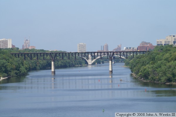
The photo above was taken from the Lake Street Bridge. The view is looking
northwest up the Mississippi River channel. The remains of the Meeker
Island Lock & Dam are in the right foreground of the photo near the
orange markers in the water.
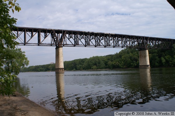
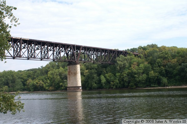
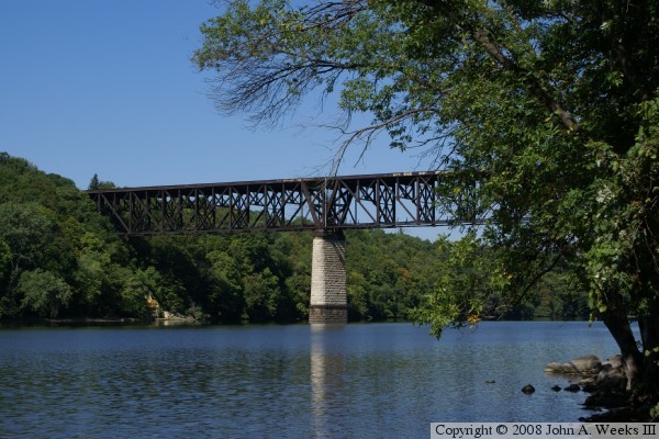
These two photos are views from the western river bank at the water level.
The photo above is a profile view of the bridge. The photo below is a
slightly closer view of the pier on the east side of the river channel.
There is no developed trail down to the waterline on this side of the
river. The climb down is dangerous, and the climb back up is exhausting.
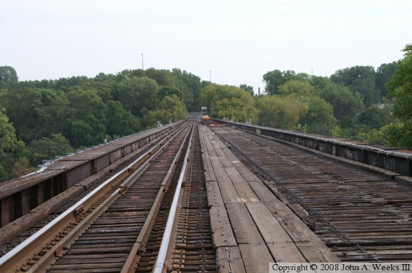
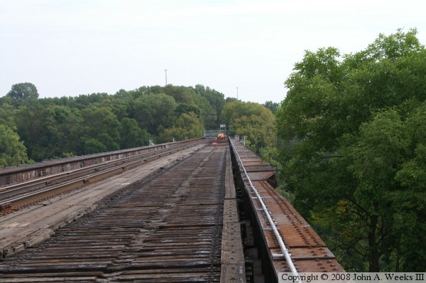
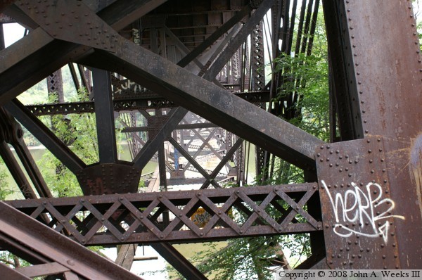
These two photos are views of the top deck of the bridge. The photo above
is looking down the center of the structure. The boards are a walkway for
workers. Given the low volume of trains, the downriver rails have been
removed and recycled. The inner set of rails are called guard rails. If
a car were to derail, the guard rails should prevent the car from falling
over the edge of the bridge. The photo below is a view looking down the
edge of the bridge. The steel plate on the edge is part of the truss
structure. The yellow machine on the deck is part of a repair crew working
to fix the damage from the 2006 fire.
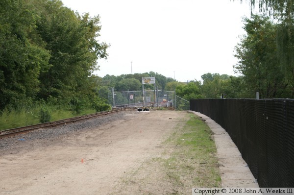
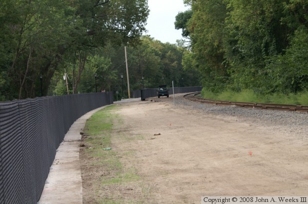
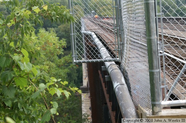
The Short Line right of way is being developed into the Midtown Greenway
Bicycle Path. An access ramp was built near the West River Parkway to allow
bicycles and pedestrians to access the trail. In the photo above, we are
looking east towards the Short Line Bridge. The bridge is blocked by a
fence due to recent vandalism. The photo below is looking west. Workers
are installing fence to keep trail users away from the railroad tracks.
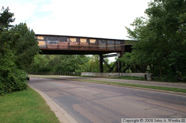
The photo above is a view of the deck plate girder span that crosses
West River Parkway. The Short Line runs on a fill through south
Minneapolis, then drops to street level as it approaches Hiawatha Avenue.
The photo below is a view looking deep into the truss structure.
The photo above was taken from the sidewalk level on the West River Parkway.
It is a view of the side of the structure. The vegetation makes it difficult
to see the bridge. The photo below was taken from the same location, except
it is from the top of the bridge rather than at street level.
The photo above is a view from the Cappelen Bridge at Franklin Avenue. The
view is looking downriver. The photo below is a view from the water level
on the east side of the river. While getting to the west bank requires
some climbing ability, there is a well developed staircase and path to the
east river bank to get to the Meeker Island Lock & Dam. The Short Line
bridge is just upstream from that location.