The 1873 wood bridge was replaced with an iron truss bridge in 1886. That bridge was rebuilt in 1913, and remodeled again in 1952 and 1953. The 1950s project raised the bridge to allow small two boats and barges to travel under the bridge. By the late 1970s, the iron bridge was badly deteriorated. It was closed in 1981, and removed shortly after it was closed.
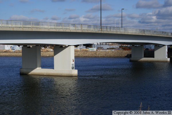
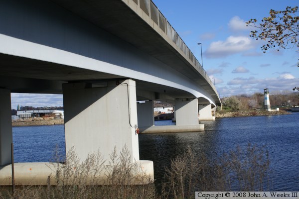
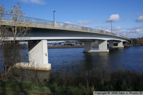
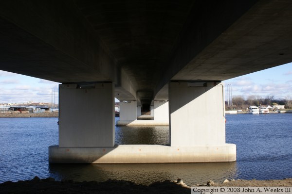
The current Plymouth Avenue Bridge opened in 1983. It was built by casting the concrete in place. Forms would be extended past the end of the bridge, concrete would be poured, and after the concrete was cured, the new section of bridge would be used as the work platform for the next section of the bridge. Once the concrete was in place, large cables were routed from end to end inside the bridge, and cable jacks were used to stretch the cables to a high tension. This has the effect of squeezing the bridge together, making the structure act like a single large beam.
The Plymouth Avenue Bridge was the first post-tensioned concrete box bridge in the state. Since it was built, variations on that method have been used on the new I-35W Saint Anthony Falls Bridge, Wabasha Street Bridge, and the Wakota Bridge.
Update—The Plymouth Avenue Bridge was closed on Friday, October 22, 2010, when serious corrosion was found on the post-tensioning cables. While the was still strong enough to hold itself up, it was felt that it might not be strong enough to safely carry vehicle traffic. It was also closed to pedestrians.
Update—A consultant was hired to evaluate the problem. On Tuesday, December 28, 2010, the Minneapolis City Engineer announced that that about one-quarter of the cables need to be replaced. This will cost upwards of $10-million. Assuming the money can be found, that pushes the bridge opening into the spring of 2012. Some residents have questioned the fact that the bridge was closed given that 250 tons of snow landed on the bridge during a 20-inch blizzard on the weekend of December 11 and 12, and the bridge did not collapse. The consultants, however, suggest that traffic would cause flexing of the bridge that could cause additional damage. They did give the OK to open the bridge to pedestrian traffic, which is expected to happen the first week of 2011.
Update—plan for repairing the Plymouth Avenue Bridge has been published. Repairs will begin in July, 2012, to fix the main bridge spans. The bridge will be reopened to traffic in October, 2012, but repairs to the side spans will continue through the summer of 2013. The bridge remains open to pedestrian and bicycle traffic.
Update—the Plymouth Avenue Bridge reopened to vehicle traffic on October 15, 2021, with one lane open in each direction. Repairs have been completed on the south side of the structure, with the lanes on the north side remaining closed. All lanes will be open during the winter. Work will continue next summer on the north side of the bridge, where those lanes will again be closed until September, 2013.
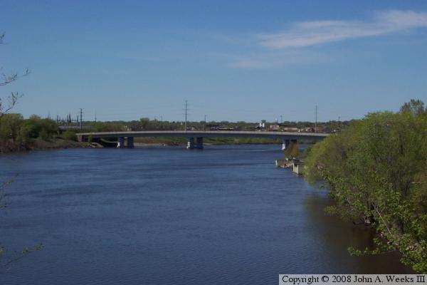
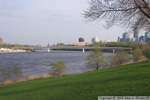
The photo above is a view of the Plymouth Avenue Bridge looking southeast from the park along the West River Parkway. This location is about a mile upstream of Saint Anthony Falls. The photo below is a view of the Plymouth Avenue Bridge looking upstream from the northern tip of Nicollet Island.