| Highways, Byways, And Bridge Photography |
Stillwater Lift Bridge
MN-36/WI-64 Saint Croix River Crossing
Stillwater, MN

|
• Structure ID: |
NBI: 4654 (MN), B55091900000000 (WI). |
|
• Location: |
River Mile 23.4. |
|
• River Elevation: |
675 Feet. |
|
• Highway: |
MN-36, WI-64. |
|
• Daily Traffic Count: |
18,000 (2007). |
|
• Bridge Type: |
Steel Through Truss With Lift Section. |
|
• Length: |
1,053 Feet. |
|
• Width: |
2 Traffic Lanes, 23 Feet Wide. |
|
• Navigation Channel Width: |
135 Feet. |
|
• Height Above Water: |
17 Feet (Lowered), 65 Feet (Raised). |
|
• Date Built: |
Opened 1931. |
The Stillwater Lift Bridge spans the Saint Croix River at Stillwater,
Minnesota. This bridge, one of only two automobile lift bridges in the state,
consists of six fixed spans of 140 feet each, plus a 140 foot vertical lift
section. The 1,050 foot long bridge plus a 750 foot causeway on the Wisconsin
side combine to span the approximately 1800 foot wide river.
The Stillwater Lift Bridge is not able to handle the traffic that
desires to cross the river. Traffic often backs up all the way
through Stillwater and down highway 95 and MN-36. A new 4-lane
freeway bridge has been proposed, but just about every interest
group in the free world has lined up against it. While the Stillwater
bridge fits in with the image of Stillwater, I advocate that quality
of life would be higher for locals, tourism would increase, and the
folks living in Western Wisconsin would have better access to the twin
cities if a new high bridge was built a few miles down river.
On April 15, 2008, MN-DOT opened the Stillwater Lift Bridge for the
first time in the 2008 season. At about 10:00 AM, the bridge lifted up
in the air, but then refused to come back down. Engineers and technicians
were brought in, and spent about 4 hours locating a bad electrical
connection. The bridge was finally brought back down about 2:00 PM in
the afternoon, just in time to clear out the traffic backup and get
ready for the evening commuter rush. The bridge became stuck in the
open position again at 12:30 PM on September 26, 2008, when sensors on
the bridge malfunctioned, and refused to allow the bridge to close.
The bridge was stuck in the open position for just over 8 hours.
On July 7, 2008, a boom truck entered the bridge from the Wisconsin
side of the river and became jammed under the upper bridge beams.
It took 5 hours to remove the truck and inspect the bridge for damage.
The bridge was reopened to cars and pick-up trucks, but due to the
extensive damage to the structure, truck traffic will be banned from
the bridge until the bridge can be repaired.
Update—on July 10, 2008, MN-DOT announced the plan for fixing the
Stillwater Lift Bridge. The bridge will be closed for several weeks
starting July 16, 2008, and remain closed through early August. This
time is needed to replace the damaged steel structural members. Due
to an expected influx of traffic for an annual festival, the bridge
will be temporarily opened to cars for the weekend of July 23 to July 28.
Update—once again, the Stillwater Lift Bridge is closed for an
extended period of time. It was shut down on September 10, 2012, and
was not expected to open until the first week of December, 2012. The
bridge will undergo a rehabilitation that includes repairing steel connectors,
electrical upgrades, repair of the concrete deck, replacement of floor
beams, repainting portions of the structure, guardrail replacement,
and curb and gutter work. While this is a significant amount of work,
it is needed because the replacement bridge will not be ready for several
years. It is also not wasted work since the lift bridge will remain in
service as a regional trail and fishing deck after the new Saint Croix
Crossing bridge opens.
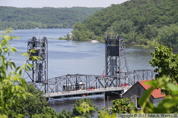
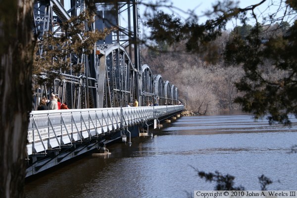
The photo above is a view of the south face of the Stillwater Lift Bridge
as it crosses the Saint Croix River from Minnesota on the near side to
Wisconsin on the far side. The photo below is a view of lift span as
seen from the bluffs in Stillwater high above the west bank of the river.
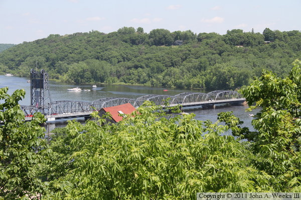
These two photos show the five fixed truss spans on the east side of the
lift span, as seen from two different locations along the edge of the river
bluffs in Stillwater. Wisconsin is on the far side of the river.


These two photos are closer views of the fixed truss spans towards the
east end of the Stillwater Lift Bridge. The photo above is the easternmost
span and east bridge abutment. The photo below is the second, third, and
fourth bridge spans counting towards the west from the Wisconsin side.

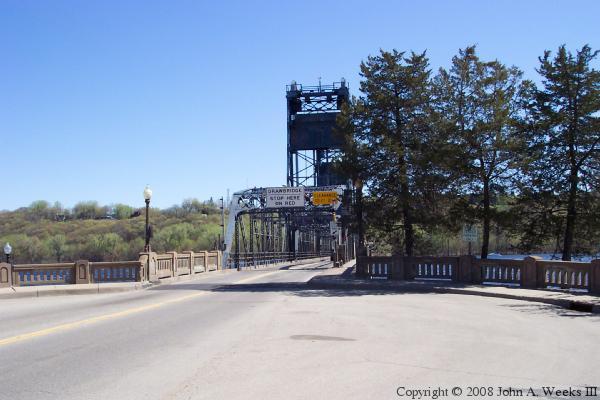
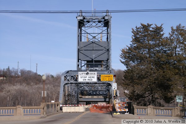
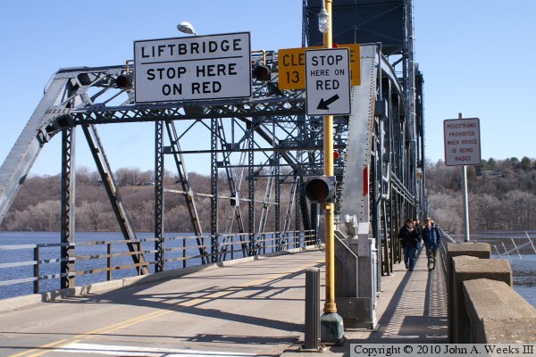
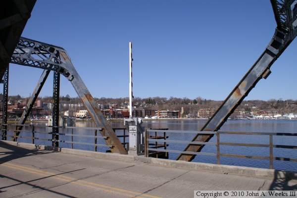
The photo above is the portal on the Minnesota side of the river looking
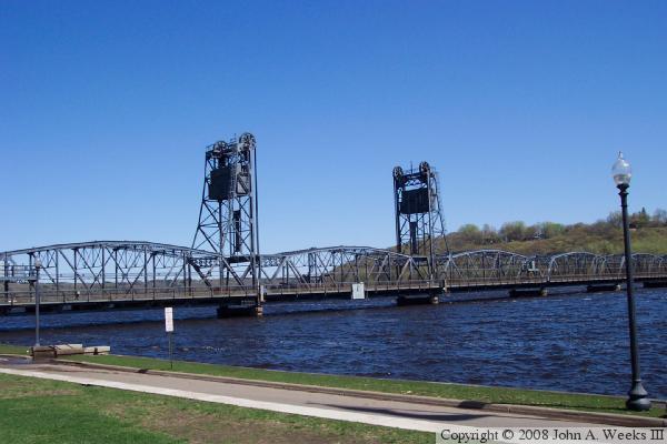
to the east. The photo below is a view of the lift span from the riverfront
just downriver of the structure in Stillwater.
These two photos are views looking down the length of the south face of the
Stillwater Lift Bridge. The photo above is looking east towards Wisconsin,
while the photo below is looking west towards Minnesota. These two photos,
and the next two that follow, were taken Sunday, March 21, 2010, just hours
before the bridge was planned to be closed due to high water.
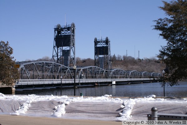
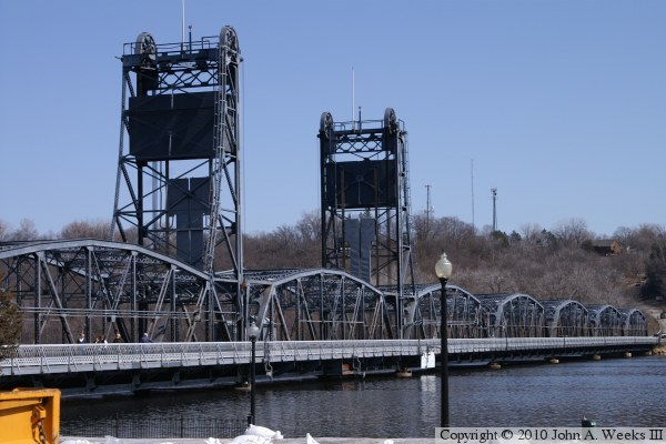
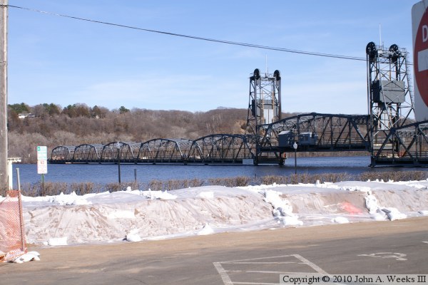
These two photos are views of the Stillwater Lift Bridge looking northeast
towards Wisconsin from the riverfront in downtown Stillwater. The photo
above is a view of the bridge with the temporary levee in the foreground.
The photo below is a closer view of the lift span.

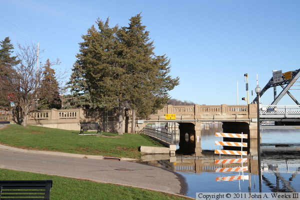
The Stillwater Lift Bridge was eventually closed for the flood on the
morning of Tuesday, March 23, 2010, just after the morning rush hour. These
two photos are views from the following afternoon. The photo above is an
overview of the scene at the west end of the bridge, while the photo below
is a view looking through the first bridge span. Concrete K-blocks were
placed on the bridge spans to prevent them from being dislodged in the flood.

These two photos are views of the south face of the Stillwater Lift Bridge
after it was closed for the Flood of 2010. The lift span was raised to
prevent the electrical wiring from getting wet. The photo above is an
overview, while the photo below is a close view of the lift span.

These two photos are views of the north face of the Stillwater Lift Bridge.
The photo above is an overview with the temporary dike in the foreground,
while the photo below is a close view of the lift span. The water was
predicted to rise another foot at the crest of the flood. That would put
the water above the low steel, but not over the bridge deck.


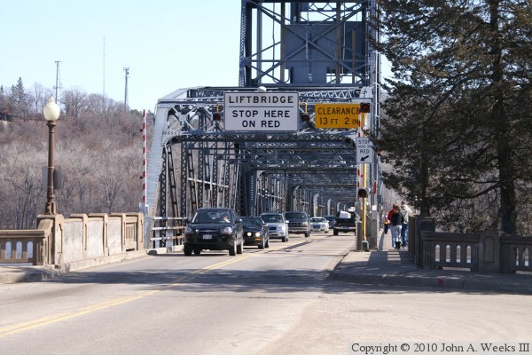
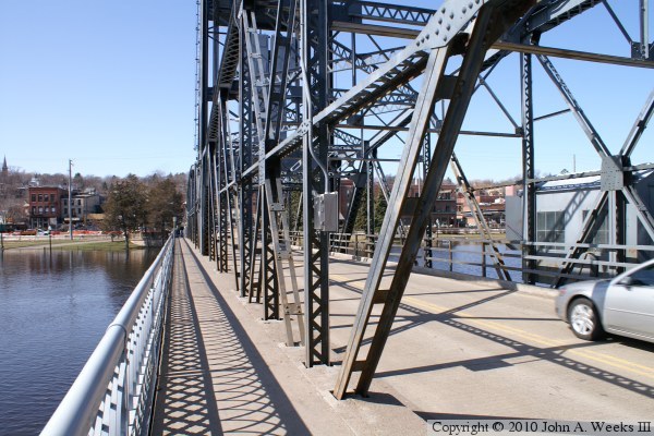
These two photos are views of the west bridge portal on the Minnesota side
of the river. There is a small plaza located on the Stillwater side of
the river. The photo above is looking through the truss structure, while
the photo below is a closer view of the west end of the bridge. Note the
heavy traffic coming out of western Wisconsin.
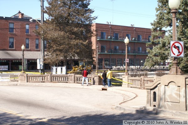
The photo above is a view looking at the plaza from the west end of the
bridge. A railroad track once crossed the highway at the end of the plaza,
but that railroad has since been abandoned and removed. The caution tape is
to prevent spectators from getting close to the water during the flood. The
photo below is the start of our walking trip across the bridge.
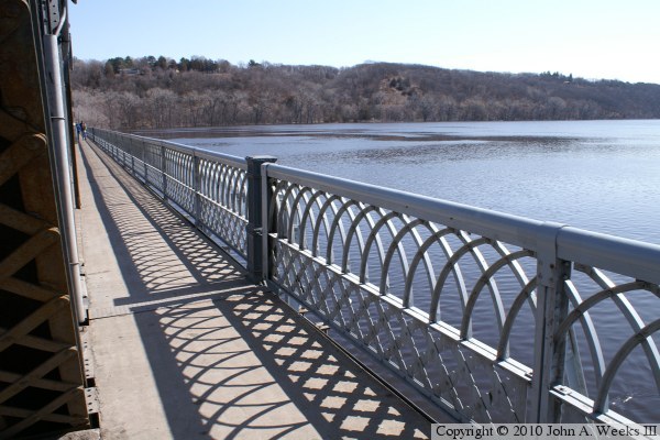
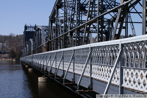
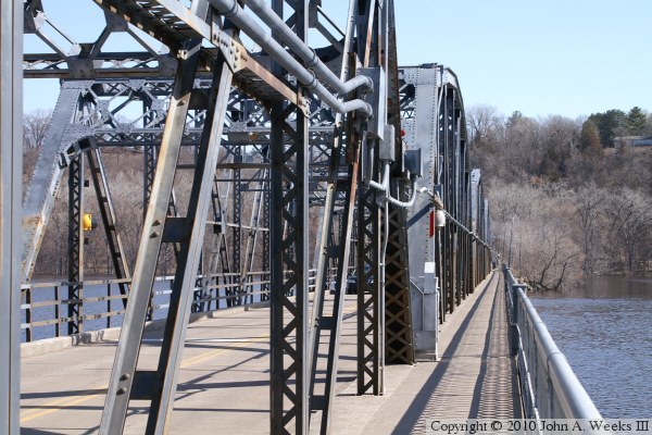
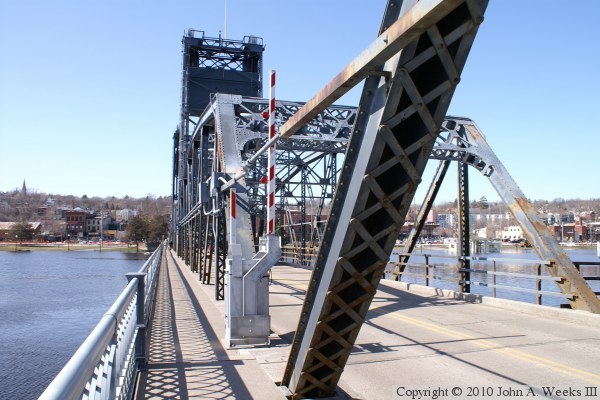
These two photos are views looking east down the length of the sidewalk that
is attached to the south side of the bridge structure. The photo above
shows the bridge railing to good advantage, while the photo below shows the
sidewalk in relation to the bridge truss structure.
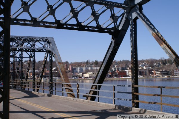
These two photos are views looking back towards Minnesota while walking across
the Stillwater Lift Bridge. The photo above is from the lift span, while
the photo below is from the center truss span. Note the crossing arm in the
photo below. This crossing arm not only blocks the highway traffic when the
lift span is operated, it also blocks pedestrian traffic.
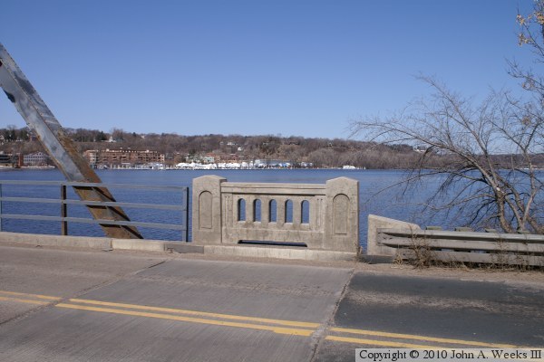
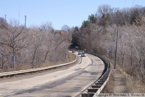
The photo above is a small concrete detail located on the north side of the
bridge at the east end of the structure. The photo below is looking east
along the causeway leading to the Wisconsin side of the river. Highway WI-64
climbs a relatively steep hill to get to the top of the bluffs.

The photo above is looking west towards the east bridge portal from the
highway WI-64 causeway near the eastern shore of the Saint Croix River. The
photo below is a closer view of the east bridge portal.


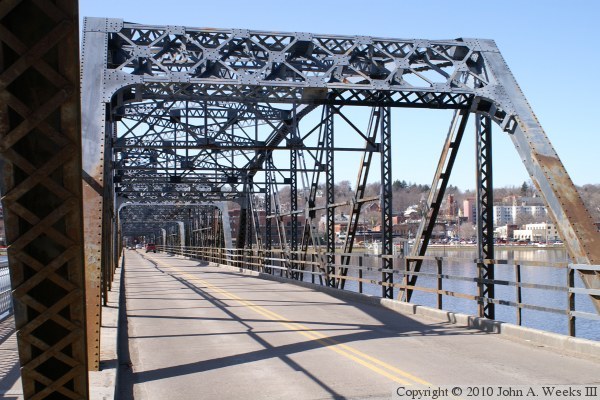
The photo above is looking west down the length of the highway deck from
the east end of the Stillwater Lift Bridge. The photo below is a view
of the steel truss structure where the first two truss sections are joined
on the east end of the bridge.
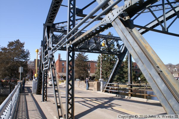
The photo above is looking west down the length of the highway deck from
the point where the first two bridge truss spans meet on the east end of
the Stillwater Lift Bridge. The photo below is a view of the west bridge
portal as seen from the bridge sidewalk.
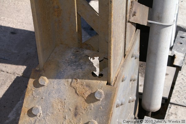
These two photos are examples of the deterioration of the bridge structure.
The photo above shows a steel plate that has rusted completely through. The
photo below shows several layers of rust that is peeling off of a joiner
between two beams.

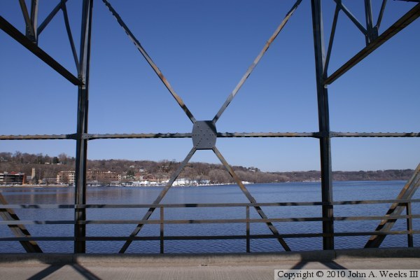
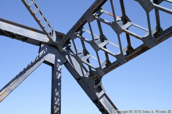
These two photos are examples of pre-war metalwork on the truss spans. The
photo above is a gusset plate that joins six different beams. The photo
below is a joint where beams from several different directions meet at the
same location. Note the crossmember that is made up of two parallel steel
beams that are connected by a series of small metal tabs that are joined with
rivets. This is very typical of pre-war bridge construction.
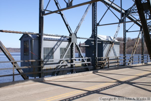
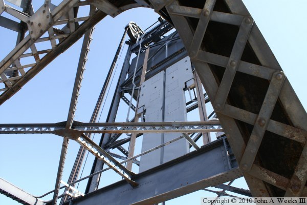
The photo above is the bridge tender house and an equipment room that is
attached to the north side of the lift span. The photo below is a view
looking up at the eastern of the two lift towers. The lift span is raised
by cables that are looped over a pulled and balanced by a heavy weight.
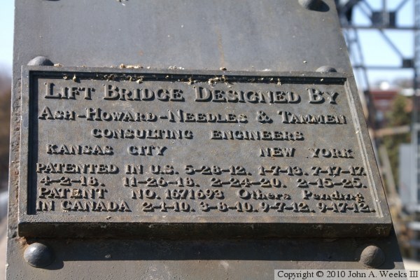
The photo above is the bridge plate. The photo below is the arm that
blocks the westbound traffic lane when the bridge is being operated.

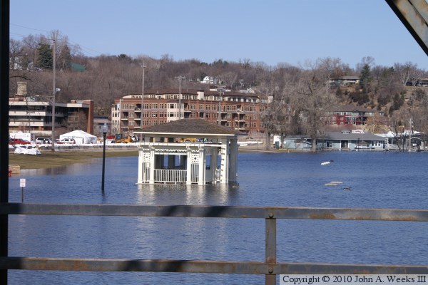
These two photos are scenes from near the west end of the Stillwater Lift
Bridge. The photo above is looking north from highway MN-36 along the
length of the temporary dike that was being built along the riverfront in
downtown Stillwater. The photo below is a park shelter that is flooded out.

These two photos, and the eight that follow, were taken in the late autumn
of 2010. Once again, we see high water on the Saint Croix River with flooding
along the riverfront in Stillwater. These two photos are looking east towards
Wisconing along the south face of the Stillwater Lift Bridge.
These two photos were taken from the riverfront park in Stillwater just south
of the bridge abutment. The reflections off of the water make it hard to
tell how high the water is. In fact, it is within a few feet of the bottom
of the bridge deck. In the photo below, the street sign on the bridge
gives a clearance of 9 feet 6 inches, but the water is about 5 feet below
that sign.
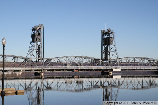
These two photos are focusing on the lift span, which is the second truss
span from the Minnesota side of the river. The sun is located southeast of
the bridge in this early morning view, which creates shadows within the
structure highlights the detail in the steelwork.
The water was extremely still at the time of my visit, resulting in almost
mirror-like reflections off of the water. Adding to the effect is the
pure blue sky, which is reflecting off of the water, making the water
look the same color as the sky.
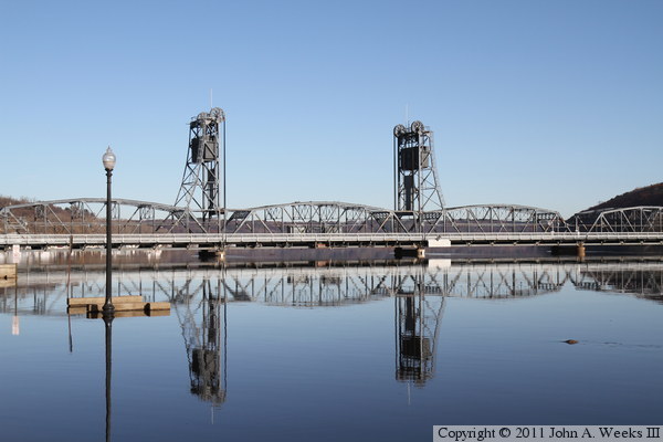
These two photos are wider shots taken from several hundred feet downstream
show the entire bridge reflection. We also see more examples of the flooding
in the foreground where only the tops of posts, railings, and lights of the
riverfront trail are sticking above the water.

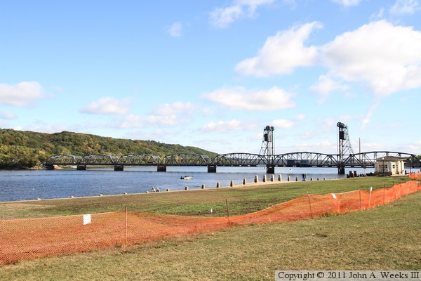
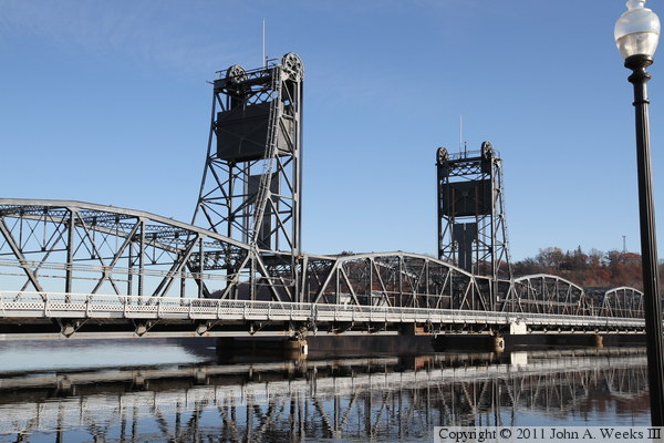
These two photos are views looking southeast from the waterfront in
Stillwater. These photos are from late in the afternoon when the sun is in
the northwest sky, which briefly lights up the north face of the bridge
before the sun ducks below the bluffs. The photo above is a view of the
entire bridge, while the photo below is the five fixed spans on the east
side of the lift span.
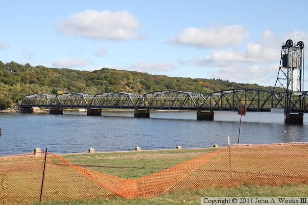
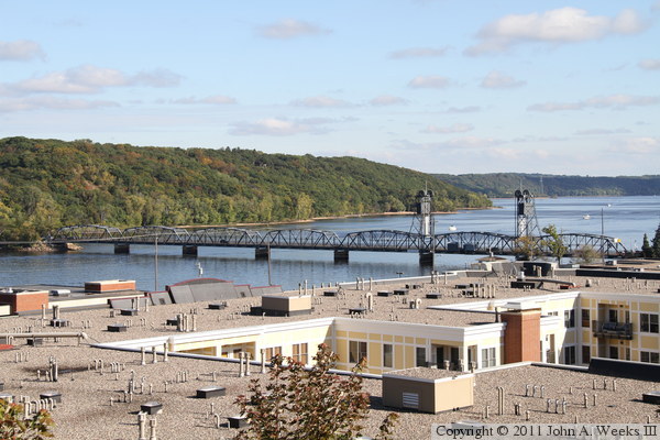
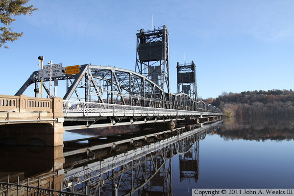
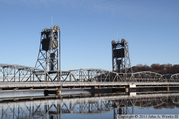
These two photos, and the four that follow, are views from 2nd Street North
near Pioneer Park. We are looking southeast late in the afternoon when the
sun briefly lights up the north side of the structure. The photo above is
a wide shot of the entire bridge, while the photo below is a closer view of
the fixed span on the Minnesota side of the lift span.

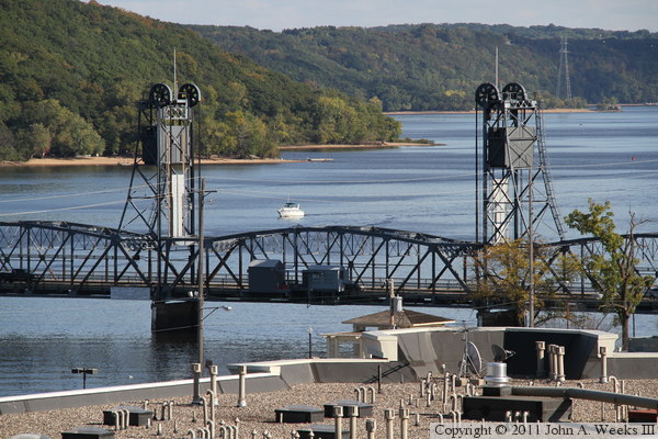
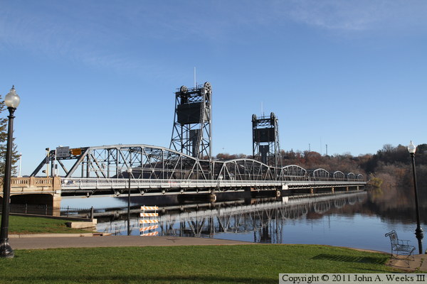
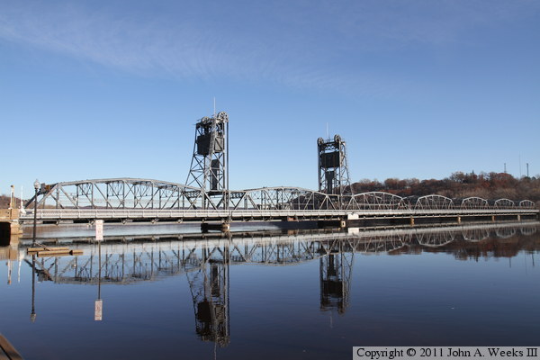
These two photos are additional views looking southeast from Pioneer Park.
The photo above is the lift span, while the photo below is the first fixed
span on the Wisconsin side of the lift span. The building roof in the
foreground is the top of the Stillwater Mills condo project, which features
98 upscale homes along with 14,000 square feet of retail space.


These two photos are additional views looking southeast from Pioneer Park.
The photo above shows the three spans at the middle of the structure, which
is the 3rd, 4th, and 5th spans counting from either end of the crossing.
The photo below are the first three spans on the Wisconsin end of the river
crossing. Note that there is a very short concrete culvert span at the
Wisconsin end of the river crossing.

|
