The Hastings & Dakota Railroad built a bypass around the Twin Cities area
in 1871. This line ran west across Dakota County, passed through Shakopee,
ran along the south side of the Minnesota River, and crossed the river into
Chaska. The river crossing consisted of a river flats trestle on the
south side of the river, swing bring over the main river channel,
and this long trestle leading into Chaska behind the present day Carver
County Government Center.
The Hastings & Dakota was bought by the Milwaukee Road. The line
through Chaska became a secondary route when a cut-off was built from
Hopkins to Cologne. Traffic dwindled over the old swing bridge. The
route was abandoned in 1972 after a derailment near Carver resulted in a
bridge being destroyed.
The Minnesota state DNR purchased the abandoned railroad right-of-way and
led a project in 1980 to convert the section between Shakopee and Chaska into
a bicycle and hiking trail. It was one of the first rails-to-trails projects
in Minnesota and paved the way for the extensive trail system that the state
now enjoys.
The Shakopee-Chaska Trail suffered two serious setbacks in 1996. First,
the center pier of the swing bridge failed in August, forcing the DNR to
remove the swing bridge, severing the trail. Later that year, a group
of youth accidentally set the Chaska Trestle on fire on Halloween night.
The trestle was damaged beyond repair, which effectively ended the work
to get a new main river channel bridge built.
The Shakopee-Chaska Trail languished for nearly a decade. An extension was
built from near the south end of the old swing bridge to a parking area near
highway MN-41, but there was no way to bring the trail across the river on
the narrow MN-41 bridge. A new highway bridge opened in 2007, allowing the
trail to enter Chaska.
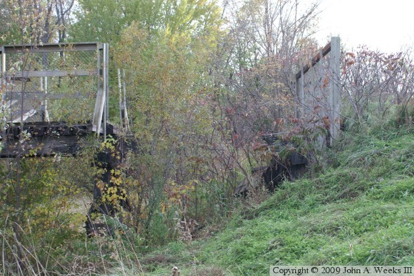
The remains of the Chaska Trestle still exist behind the Carver County
Government Center. A spur trail off of the levee leads to the north end
of the trestle. An access road for the power line passes near the
south end of the trestle. The area can be explored during the late
summer and autumn when the river bottoms are typically dry. The more
adventurous might want to explore the abandoned path of the bicycle trail and
the remains of the old swing bridge.
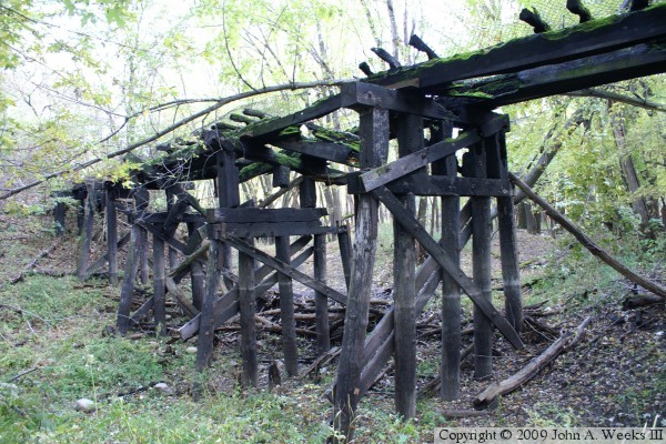
The photo above is a view of the fire damage on the south end of the Hastings
& Dakota trestle. Moss is growing on horizontal beams, likely due to
water pooling up in the cracks and pockets that were formed when the wood
burned.
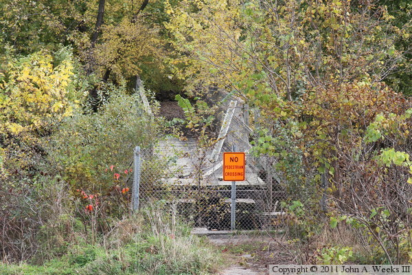
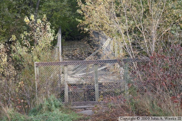
The photo above is a view of the north end of the Chaska
Trestle as seen from the levee just behind the Carver County Government
Center. The orange sign appeared in the summer of 2010. Also note that the
fence is held up by steel posts rather than the wooden posts that we see
below. The photo below is the first view of the north end of the structure
when hiking south from the trailhead parking area at the Carver County
Government Center.
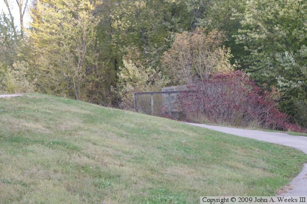
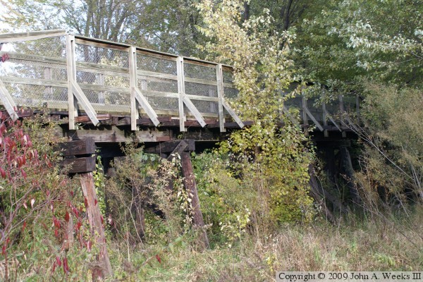
The photo above is a view of the east face of the Chaska
Trestle as seen from the levee that runs behind the Carver County Government
Center. The photo below is a view looking southwest towards the trestle from
the trail that runs along the top of the levee.
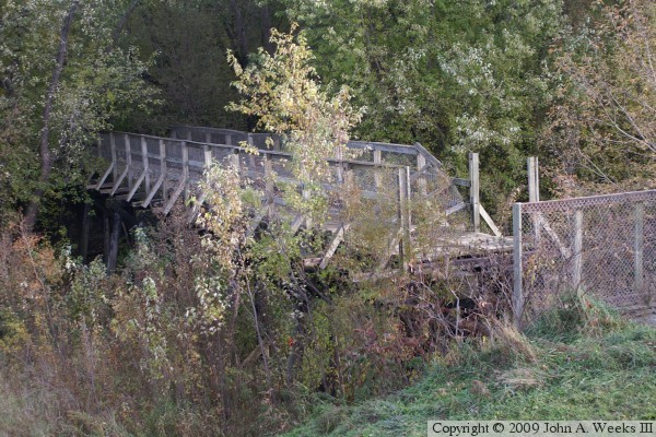
The photo above is looking south down the length of the trestle. The
trestle extends for quite a distance across the river bottom before it
connects to a mile long fill that runs along the bank of the Minnesota
River. The trestle is blocked off due to the fire damage, and one span
has been removed as an attempt to keep pedestrians off of the structure.
The photo below is a view of the west face of the trestle from the river
bottom area.
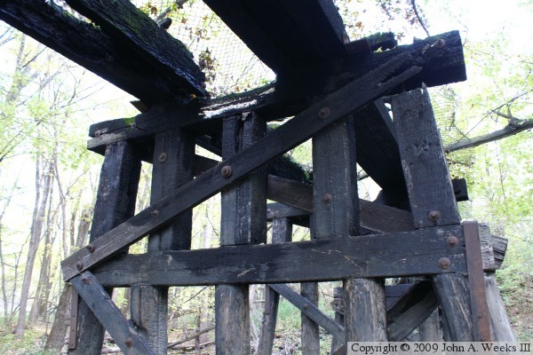
The photo above is a view of trestle from a trail that runs between the
power line service road to the east of the structure and the Minnesota River
to the west of the structure. The photo below is a close view of the
fire damage on the south end of the trestle. The deck has burned off, and
the stringers are all but destroyed.
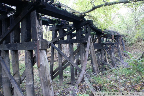
These two photos are looking south towards the south end of the trestle. The
photo above is the east face of the structure, while the photo below is the
west face. Several of the vertical supports near the end of the trestle
were totally consumed in the fire. Note that the wire mesh that once formed
the guard rails is still draped along the top of the ruins.
The photo above is another view of the fire damage on the south end of the
trestle. The photo below is a close view of the missing span at the north
end of the structure.
The Minnesota River experienced a rate autumn flood September and October
of 2010. These two photos show the floodwaters under the north end of
the trestle. The photo above is the east face of the trestle, while the
photo below is the west face of the trestle. The water is about three feet
deep along the line of trees in the background.

