Current Weather Conditions
John A. Weeks III
Friday, December 1, 2023, 4:14:23 AM CST
Home Photo Tours Rail Fan 12 Easy Steps
Aviation Spacecraft Highways & Bridges About The Author
 
Google Search
Maps   Groups   Images   Search
 
  Home
  • 12 Easy Steps
  • Aviation
  • Spacecraft
  • Highways & Bridges
    » Bridge Photography
      - MSP River Bridges
        › 10th Avenue Bridge
        › Arcola High Bridge
        › Betty Adkins Bridge
        › Bloomington Ferry
        › Bloomington Fry Tr
        › BNSF RR Bridge
        › Boom Island Foot Br
        › Broadway Avenue Br
        › C&NW Bridge (1)
        › C&NW Bridge (2)
        › Camden Bridge
        › Cedar Avenue Bridge
        › Cedar Ave Br (Old)
        › Cedar Ave Bicycle Br
        › Cedar Bend RR Br
        › Chaska Bridge (Old)
        › Chaska Swing Bridge
        › Chaska Trestle
        › Coon Rapids Dam
        › CP RR Bridge
        › Dan Patch Line Br
        › Dartmouth Bridge
        › East Channel Bridge
        › East Channel RR Br
        › East River Flats Br
        › Endless Bridge
        › F. W. Cappelen Mem
        › Father Henn Bluffs
        › Father Louis Henn Br
        › Ferry Street Bridge
        › First Avenue Bridge
        › Fort Road Bridge
        › Fort Snelling Br (Old)
        › Fort Snelling High Br
        › Great Western Bridge
        › Grey Cloud Channel
        › Grey Cloud Island Br
        › Grey Cloud Trail Br
        › Hastings High Bridge
        › Hastings Spiral Br
        › Holmes St Ped Bridge
        › Highway 243 Bridge
        › I-35W Bridge
        › I-35W Bridge (Old)
        › I-494 Bridge
        › I-694 Bridge
        › Interstate Bridge
        › Intercity Bridge
        › L St. Anthony F L&D
        › Lafayette Bridge
        › Lake Street Bridge
        › Lewis Street Bridge
        › Lexington Bridge
        › Lions Levee Pk Foot
        › Lock & Dam #1
        › Lock & Dam #2
        › Long Meadow Bridge
        › Lower Bridge
        › Lowry Bridge (Old)
        › Meeker Island L&D
        › Mendota Bridge
        › Merriam Street Br
        › Mill Ruins Park Br
        › Milwaukee Road Br
        › M&StL Bridge
        › Miss River Bridge 15
        › MN-101 Bridge
        › MN-41 Backchannel
        › MN-41 Back Ch (Old)
        › MN-41 Bridge
        › New Saint Croix Br
        › New Trunk-41 Bridge
        › Nicollet Island RR Br
        › North Miss Park Pier
        › NP Bridge #9
        › NP RR Bridge
        › Pike Island Bridge
        › Plymouth Bridge
        › Point Douglas DB
        › Raspberry Island Br
        › Richard P. Braun Br
        › Robert Street
        › Rock Island Swing Br
        › Runway 30 Light Br
        › Short Line Bridge
        › Smith Avenue High
        › Southeast Steam Plant
        › St. Anthony Falls Br
        › St. Anthony Falls Lab
        › St. Anthony Falls PP
        › St. Croix Boom Site
        › St. Croix Falls Dam
        › Stillwater Lift Br
        › Stone Arch Bridge
        › Third Avenue Bridge
        › Toll Bridge (Old)
        › U St. Anthony F L&D
        › US-8 Bridge
        › Wabasha Street Bridge
        › Wakota Bridge
        › Wakota Bridge (Old)
        › Walnut Street CW
        › Washington Ave Br
        › WI Central RR Br
        › WI Central RR Ruins
        › Wright Co Hwy 42
      - C & D Canal
      - Illinois River
      - Minnehaha Creek
      - Minnesota River
      - Mississippi River
      - Missouri River
      - St. Croix River
      - St. Louis River
      - Wisconsin River
      - Best Miss River Photos
      - Cable Stayed Bridges
      - McGilvray Road Bridges
      - I-35W Bridge Disaster
      - Miscellaneous Bridges
      - Madison County Bridges
      - Hist Br Weekend 2013
    » Road Geek Topics
  • Photo Tours
  • Rail Fan
  • About The Author
 
Site Search By JRank
Highways, Byways, And Bridge Photography
Pike Island Bridge
Fort Snelling Park Minnesota River Channel Crossing
Minneapolis, MN

Pike Island Bridge

• Structure ID: N/A.
• Location: River Mile 1.5.
• River Elevation: 686 Feet.
• Structure Type: Pedestrian Foot Bridge.
• Bridge Type: Concrete Girder.
• Length: 125 Feet (Estimated).
• Width: 12 Feet (Estimated).
• Navigation Channel Width: Non-Navigable.
• Height Above Water: 14 Feet (Estimated).
• Date Built: ???.
The Pike Island Bridge crosses the west channel of the Minnesota River connecting the river flats area near the visitor center to Pike Island at Fort Snelling State Park. The west channel is currently a cut-off between the main channel of the Minnesota River and the Mississippi River. It is considered to be non-navigable, but jet skies and small boats can use this waterway. Historically, this was the main channel of the river prior to the US Army Corps of Engineers moving the main river channel to its current location. The eastern tip of Pike Island is the confluence point of the current main channel of the Minnesota River and the Mississippi River.

The island is named after Zebulon Pike, of Pike's Peak fame. As an Army Lieutenant, Pike lead an expedition in 1805 to find the headwaters of the Mississippi River. As part of the expedition, Pike purchased land in the vicinity of Fort Snelling on behalf of the US Government to be used as a future military post. Fort Snelling was later established in 1819 after Pike had moved on to other adventures.

A dark chapter in Minnesota history occurred on Pike Island during the Civil War. A Native American uprising in southern Minnesota was put down by the military in 1862. After the war, approximately 1600 women, children, and elderly people were forced into a concentration camp on Pike Island during the winter of 1862 and 1863. Disease spread through the camp, with hundreds of people dying during the winter. Later, these people were forcibly relocated to the Dakota Terriroty. A drought caused further hardship before the surviving Native people moved to Nebraska.

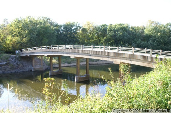
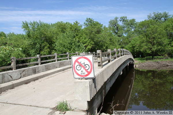
The photo above is a close view of the south face of the bridge as seen from Pike Island.


Pike Island Bridge
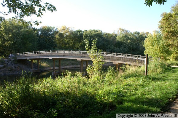
The photo above is the west end of the structure, with Pike Island being located on the far side of the river channel. The photo below is a profile view of the south face of the bridge.

Pike Island Bridge
Pike Island Bridge
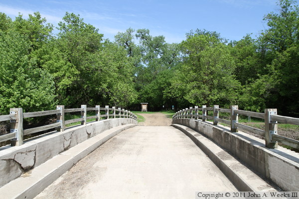
The photo above is a view looking east down the length of the bridge deck from mid-span. The photo below is a similar view from almost the exact same location, but taken three years later in the spring of 2011.

Pike Island Bridge
Pike Island Bridge
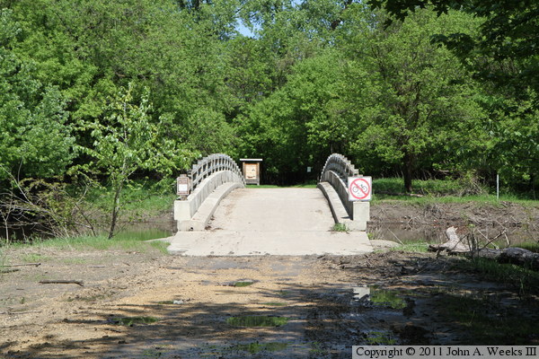
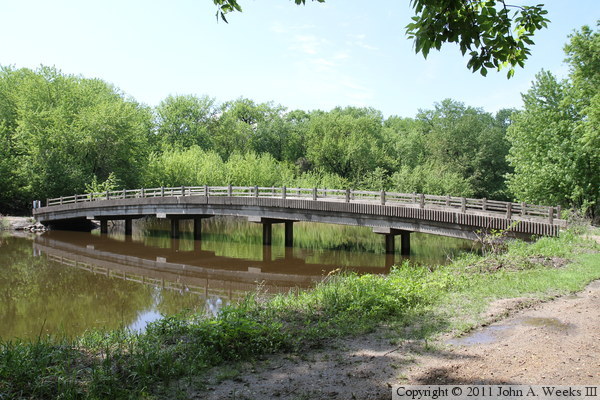
The photo above is looking east across the west channel of the Minnesota River towards the west end of the Pike Island Bridge. This photo was taken during the tail end of the spring flood of 2011. The flood water receded from this trail only a few days before my visit in late May. The photo below is looking east across the river channel along the south face of the bridge. The still water reflects the bridge and scenery like a mirror.

Pike Island Bridge
Pike Island Bridge
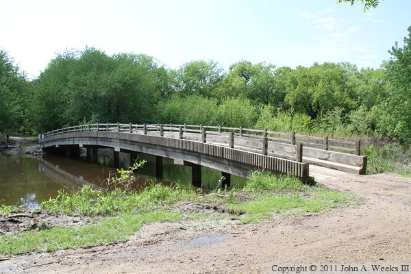
These two photos were taken from Pike Island looking towards the south face of the bridge. The photo above is a profile view, while the photo below was taken from near the southeast corner of the structure.

Pike Island Bridge
Pike Island Bridge
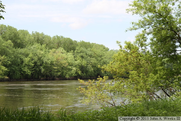
The photo above is a view looking east along the trail leading to the Pike Island Bridge. The photo below is a view looking northeast across the Mississippi River from the trail leading to the eastern tip of Pike Island where the main channel of the Minnesota River flows into the mighty Mississippi.

Pike Island Bridge

Made With Macintosh
Authored by John A. Weeks III, Copyright © 1996—2016, all rights reserved.
For further information, contact: john@johnweeks.com