The solution to the problem is that each log is marked on one end with an owners mark. This is done using a heavy maul that has the mark carved in reverse on the steel face of the maul. To mark a log, you hit it on the end with one of these branding mauls. This marking system was so successful that it is still used today.
To make this system work, the logs need to be sorted out and routed to the right mills. This was done by building a log boom. A large chain and timber barrier was stretched across the river. This would catch logs that come down the river. Crews of men called ‘boom rats’ would watch for the log brand markings, then group together logs with the same brand. Once a large group of logs of the same brand were assembled, they would be formed into a raft and sent downstream with a crew on board to steer the raft of logs into the proper mill.
The original Saint Croix River boom site was near Taylor's Falls. That proved not to work well because of the logs that floated down the Apple River to the south needed a second boom site, and loggers did not want to pay for booming more than once. The northern boom ran into financial trouble. A group of logging barons formed a syndicate and bought the boom, then moved it to a new site just north of Stillwater. This site had several advantages. It was relatively far south, it was on a narrow part of the river, and the river had several channels to act as sorting chutes. The icing on the cake was that the boom site was endorsed by the Minnesota Legislature, who authorized a relatively high boom fee.
The Saint Croix Boom was established in 1856, and it ran until the timber was played out in 1914. Nevers Dam was built 11 miles north of Saint Croix Falls to regulate the flow of logs to the boom. Even with that control, logs often backed up 15 miles or more waiting to be sorted. The boom served 200 logging companies, and sent log rafts to mills as far south as Saint Louis. This was one of the largest log booms in the US, handling 12 billion board feet of logs, as well as one of the most profitable.
The boom site shut down in 1914. The structures were removed from the river. No sign of the site remained on land. In fact, the site was essentially lost until it was rediscovered by the National Park Service in 1975. The state of Minnesota established a wayside at the site with a sidewalk that goes down to the river level. The site is now reforested. The Park Service has since located two period buildings in the overgrown forest. One of these buildings was an office for the crew that served double duty as a warming hut during the winter.
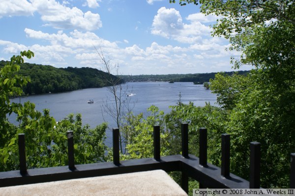
The photo above is looking downriver from the overlook at the boom site wayside.