| Highways, Byways, And Bridge Photography |
BNSF Bridge
BNSF Railroad Saint Croix River Crossing
Prescott, MN

|
• Structure ID: |
|
|
• Location: |
River Mile 0.2. |
|
• River Elevation: |
675 Feet. |
|
• Railroad: |
BNSF Railroad. |
|
• Daily Traffic Count: |
40 Trains Per Day (Estimated). |
|
• Bridge Type: |
Steel Truss With Vertical Lift Span. |
|
• Length: |
615 Feet (Estimated). |
|
• Width: |
18 Feet (Estimated), 1 Track. |
|
• Navigation Channel Width: |
215 Feet. |
|
• Height Above Water: |
20 Feet. |
|
• Date Built: |
1984. |
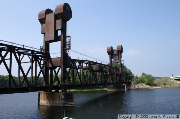
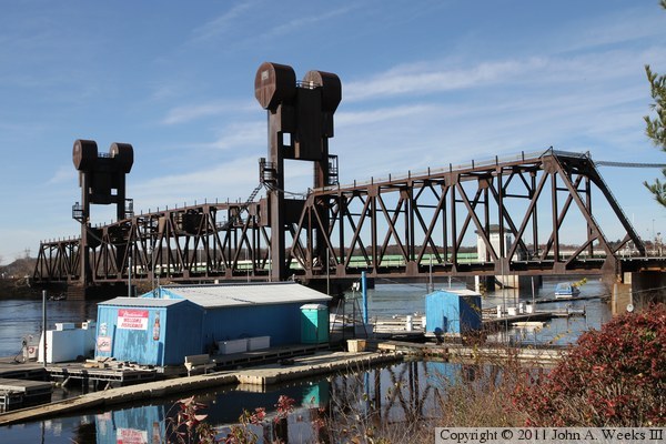
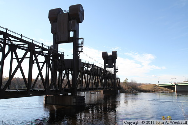
The BNSF railroad lift bridge at Prescott spans the Saint Croix River, but it
is located at the point where the Saint Croix River flows into the Mississippi
River. In the photo above, the far end of the bridge lands on Point
Douglas, the thin strip of land that divides the Mississippi River on the
left from the Saint Croix River on the right. The parking lot on the right
side of the photo is in Wisconsin. Minnesota is on both the left side of
the Mississippi River, and on the far end of the bridge between the two
rivers. Below this point, the Mississippi River forms the border between
Minnesota and Wisconsin. Above this point, the Saint Croix river divides
the two states.
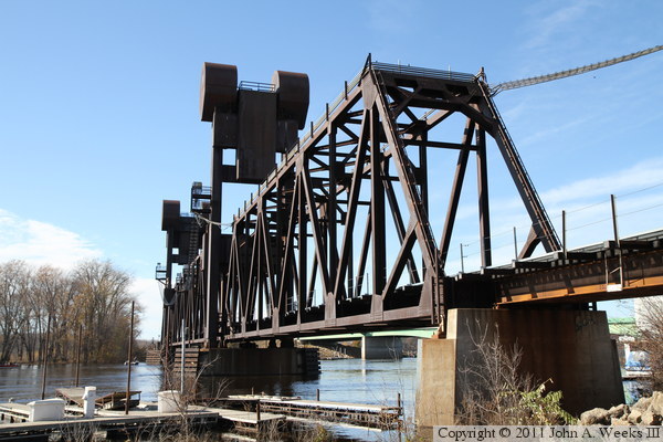
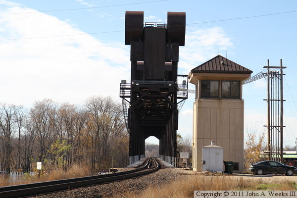
This is one industrial strength bridge. Everything is massive, from
the steel in the truss sections, the large counterweights, the massive
towers, and the huge motor assemblies at the top of the towers. The
bridge has to be strong to endure the pounding that it takes day in
and day out. The lift bridge is operated frequently in the summer due
to a high volume of recreational boaters on this section of the river.
Given the volume of trains, and the public parking right next to the tracks,
this is a great place to go train watching. Just be careful to keep off of
the tracks. A fast moving train that is throttled down can sneak up on you
before you know what has hit you. Trains are speed limited to 25 miles per
hour by the curve just before the bridge, but that is still moving fast for
such a huge object. Most of the trains are large cross-country freight trains
of 60 to 120 cars. You will see mixed freight trains, container cars, and
coal unit trains in this area. I have seen trains cross this bridge as
frequently as once every 11 minutes, so you normally do not have to wait long
to see railroad action up close and personal. If you cross the tracks, do not
step on the rails. The rails are heavily used, and as a result, very slippery.
If you slip, note that the other rail is about as far away as a person is tall,
so there is a chance of hitting your head or neck on the other rail. If you
get knocked out, you will be on the tracks when the next train arrives.
The BNSF lift bridge replaced an earlier swingspan built by the Chicago,
Burlington, and Quincy Railroad. The CB&Q is one of the three large
railroads that merged to form the Burlington Northern. The BN has since
merged with the Santa Fe to become the BNSF.
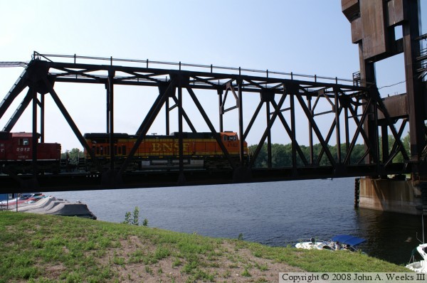
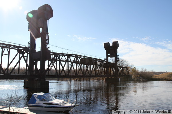
The photo above and the photo below are views of the north face of the
lift bridge as seen from the east shore of the Saint Croix River from
two different vantage points.

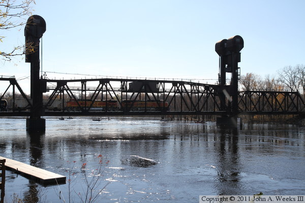
The photo above shows a BNSF locomotive pulling a mixed freight train
approaching the bridge from the east. The photo below shows the same
locomotive crossing the approach span on the east end of the structure.
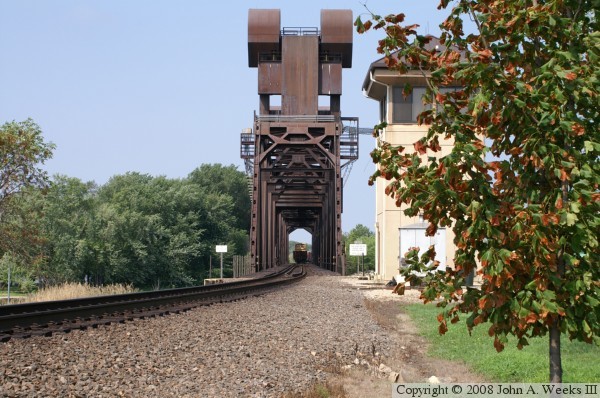
The photo above is looking through the truss structure, where the tail end of
a train is visible after having just crossed the life bridge heading
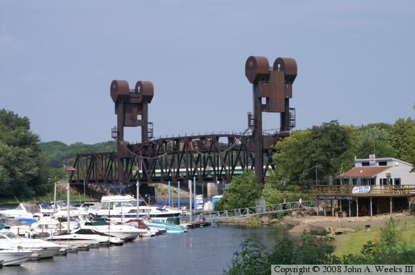
northbound. The photo below is the south face of the bridge, which is visible
from the marina located just to the east of the bridge on the Mississippi River.
These two photos are the west face of the BNSF lift bridge as seen from the
riverfront in Prescott. These two photos, and the fourteen that follow, are
views from the unusual late fall flood in 2010.
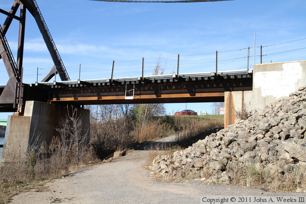
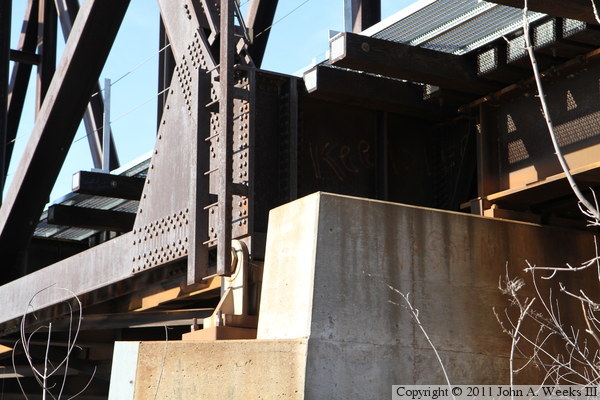
The photo above is the steel girder span at the south end of the lift bridge
that crosses an access road leading to a riverfront marina. The photo below
is a close view of the top of the bridge pier at the south end of the
steel through truss span on the south side of the lift span.
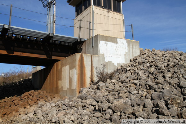
The photo above is the west face of the south bridge abutment. The photo
below is the tower located at the south end of the bridge for the bridge
tender.

The photo below is looking southwest towards the steel truss span on the
south side of the main river channel. The photo below is looking north
along the west face of the BNSF lift bridge.
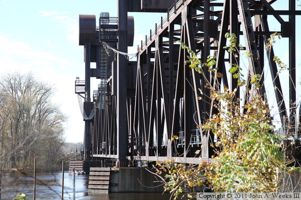

These two photos are looking northbound towards the BNSF lift bridge from
about a block south of the structure. The photo above is looking along the
west face of the bridge, while the photo below is looking through the truss
structure down the length of the bridge deck.

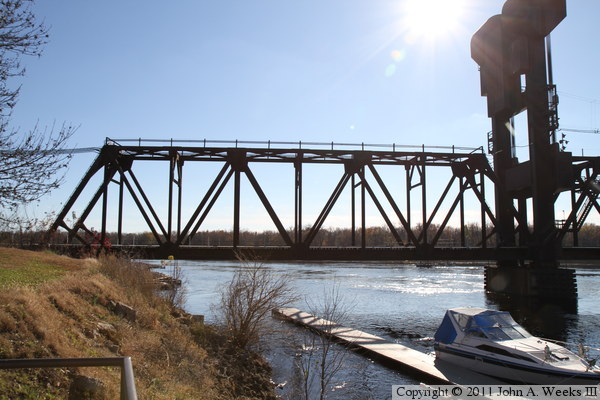
These two photos are looking north along the upstream east face of the BNSF
lift bridge. The photo above is a close view of the lift span, while the
photo below is a wider angle view. The pile of rocks on the far side of
the channel is where the abutment of the old swing bridge was located.
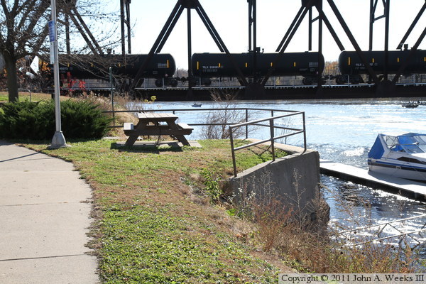
These two photos are additional views of the bridge as seen from just upstream
of the structure from the riverfront in Prescott. In the photo below, we
see a pair of locomotives on the lift span heading northbound towards the
twin cities pulling a tank car unit train. Note that there is a hopper car
just behind the second locomotive. BNSF always places a car between the
locomotives and the first tank car to protect the head of the train in the
event that there is a leak or explosion in one of the tank cars. These large
engines appear to look small compared to the massive size of this structure.
These two photos are the bridge abutment on the Wisconsin side of the
river for the old Chicago, Burlington, and Quincy swing bridge. The photo
above is looking south towards the BNSF lift bridge, while the photo below
is looking north with the highway drawbridge in the background. The bridge
pier is a great spot for watching trains.

|
