| Highways, Byways, And Bridge Photography |
Cedar Bend Drawbridge
Canadian National Saint Croix River Crossing
Osceola, WI

|
• Structure ID: |
N/A. |
|
• Location: |
River Mile 40.7. |
|
• River Elevation: |
682 Feet. |
|
• Railroad: |
Canadian National Railroad. |
|
• Daily Traffic Count: |
4 Trains Per Day, Closed In Winter. |
|
• Bridge Type: |
Steel Through Truss With Swing Span. |
|
• Length: |
675 Feet (Estimated), 286 Foot Swing Span. |
|
• Width: |
1 Track. |
|
• Navigation Channel Width: |
Non-Navigable. |
|
• Height Above Water: |
28 Feet (Estimated). |
|
• Date Built: |
1887. |
The Cedar Bend Drawbridge was built in 1887 by a forerunner of the Soo Line
Railroad as part of its Minneapolis to Sault Ste Marie mainline. This route
carried passenger traffic until 1961. This rail line was sold to the
Wisconsin Central Railroad, which was subsequently bought out by the Canadian
National Railroad in 2001. The two major users of the bridge today are the
Osceola & Saint Croix Valley Railway, a tourist railroad line run by the
Minnesota Transportation Museum, and ballast trains coming out of the Dresser
Trap Rock, Inc, quarry.
The Saint Croix River was once a major working river, carrying both boat
traffic and large groups of floating logs. To accommodate river traffic, the
Cedar Bend bridge was built as a swing span with a long wooden trestle on the
eastern approach. In modern times, there is no longer river navigation, and
the logging industry is played out. The result is that the bridge is no longer
required to accommodate river navigation. The swing span has been welded in
the closed position, essentially converting it into a fixed span. The wooden
trestles have since been replaced with concrete piers and steel plate girder
spans.
The Cedar Bend Drawbridge is one of the more difficult Saint Croix River
structures to visit. Most people who see this bridge do so in one of two
ways. First, the Saint Croix River is a very popular water trail for canoes
and kayaks. Second, the tourist train from Osceola crosses the Cedar Bend
Drawbridge. It is possible to visit the bridge on foot. The best approach
is from the Wisconsin side.
The east end of the bridge can be reached by heading west on 55th Avenue from
Wisconsin highway WI-35. 55th Avenue will turn into Drawbridge Road. This
road is narrow and has a very steep hill. It was muddy when I visited in 2007,
but had just been graded and was in good condition in 2011. Once you reach
the railroad tracks, I found a locked gate and a No Trespassing sign blocking
the road in 2007. In 2011, the gate was gone, and the sign has been taken
down. Topo maps indicate that this is a DNR public access area. The road
takes you to within 1,300 feet of the bridge. While it is possible to follow
deer trails during periods of very low water, most visitors walk along the
railroad tracks. That is dangerous because trains coming downgrade can be
unexpectedly silent, and the CN aggressively enforces their No Trespassing
policy.
On the Minnesota site, it is about a mile from highway MN-95. There is a DNR
trailhead located at the intersection of MN-95 and Pilar Road, and a trail
that runs down to the west end of the bridge. However, about 1,000 feet of
that trail is on private land that is posted for No Trespassing, and another
1,000 feet would require walking along the railroad tracks, which is illegal
in Minnesota. I would not recommend this approach since the views on the
Minnesota side are not worth the risk of prosecution.
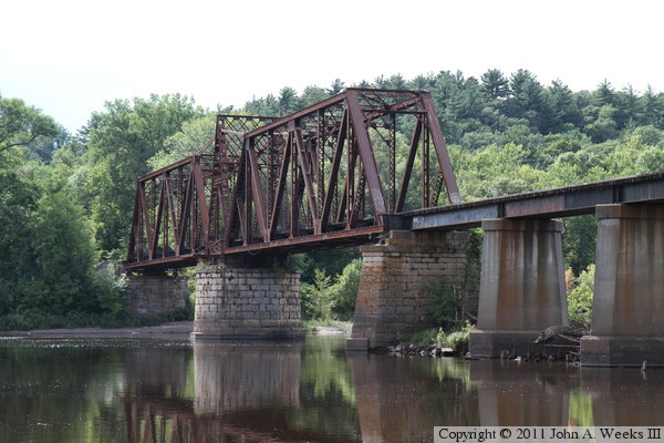
The photo above is a view of the main truss swing span of the Cedar Bend
Bridge. The vantage point is a location along the northwest bank of an island
on the east side of the main channel of the Saint Croix River. This island
is reachable during periods of low water by walking along the railroad
embankment to the east bridge abutment, then following a trail down to a small
sandy beach area.
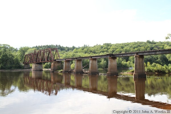
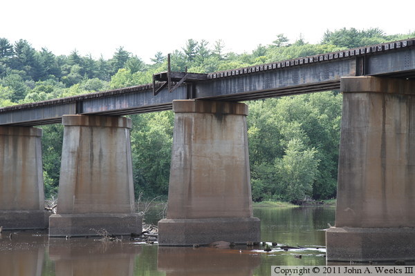
The photo above is another view of the main bridge spans as seen from the
island at the east side of the main channel of the Saint Croix River. The
photo below is a wider view of the bridge that includes the steel deck plate
girder spans on the east side of the swing span. This photos are looking
into the bright after noon sun on a day when the sky is overcast. That
makes from some nice reflections off of the water, but it also makes it a
challenge to pick an exposure setting--no matter what you pick, elements
of the photo are going to be over and under exposed.

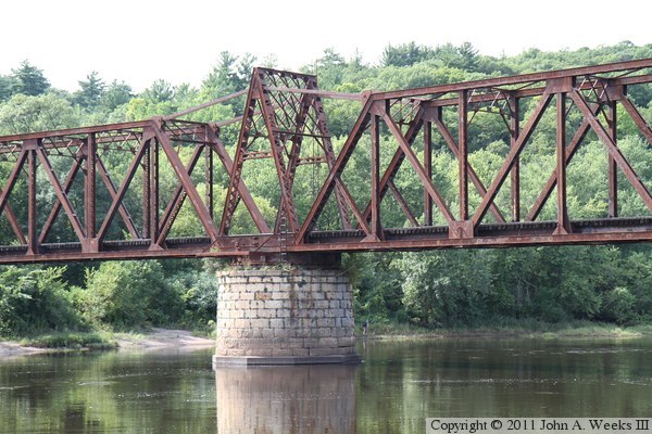
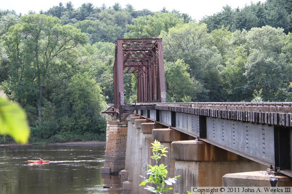
The photo above is a side view of the steel truss swing span looking upstream
to the northwest. The photo below is a closer view of the center pier that
supports the movable section of the bridge. The bridge was reportedly welded
shut following WWII, and it no longer operates. River boats once operated as
far north as Taylor's Falls, but today, large boats do not venture upstream
beyond the remains of the Wisconsin Central Bridge near Stillwater.
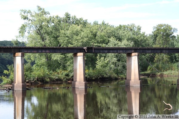
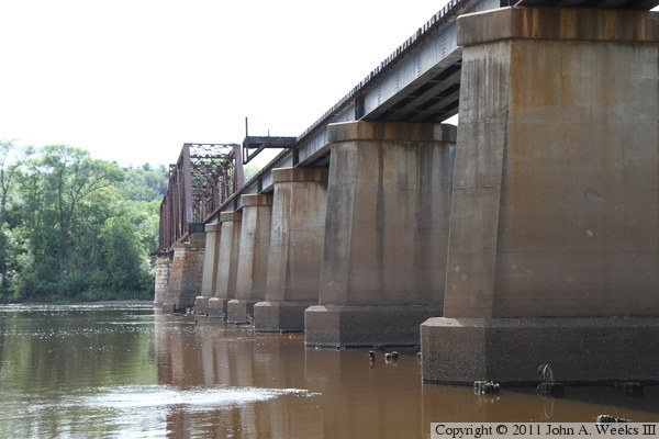
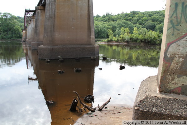
These two photos are views looking upstream towards the deck plate girder
spans on the east end of the structure. Note the small platform hanging
off of the downstream side of the bridge. Also note that remains of the
old trestle are visible just poking out of the water. These cut off
trestle piles normally stick a foot or two above the water line, but the
water is still high from spring run-off and several very large storms earlier
in the summer. I have not determined when the trestle was replaced. The
concrete looks old. Many bridges in the Twin Cities area were upgraded as
the US Government made preparations for World War 1, and this work might have
been completed at that time.
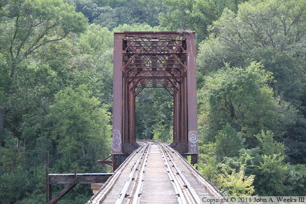
The photo above is looking west down the center of the railroad tracks from
the west bridge abutment. From here, the tracks enter Minnesota and head
towards William O'Brien State Park, Marine On Saint Croix, and White Bear
Lake before entering the Twin Cities. The photo below is looking west along
the downstream south face of the Cedar Bend Drawbridge.
The photo above is a similar view looking west along the downstream south face
of the Cedar Bend Drawbridge, but this time, from water level. The photo
below is a closer view of the water between the first two bridge piers at
the east end of the structure. We see the remains of the piles for the
wood trestle that once carried the railroad tracks just sticking above the
water.
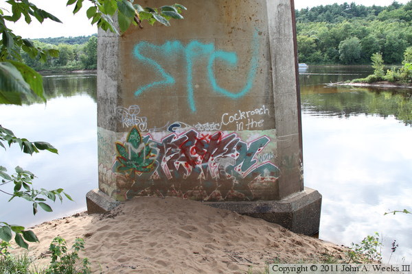
These two photos show graffiti on the first bridge pier and abutment at the
east end of the structure.


The photo above is the east bridge abutment looking up from the shoreline
at the edge of the river. The photo below was taken by Shawn Schoenberger,
whose father worked for the Soo Line and crossed this bridge many times during
his career.

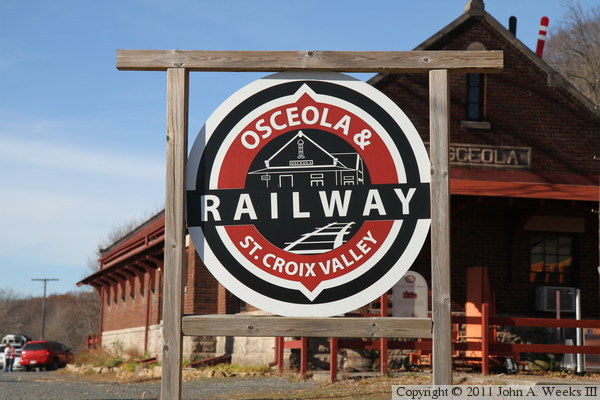
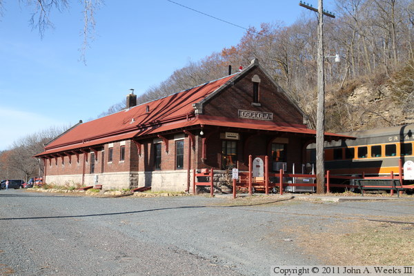
The photo above is the sign at the entrance to the Osceola & Saint Croix
Valley Railway, located on the south side of Osceola, Wisconsin, and about
four miles northeast of the Cedar Bend Drawbridge. The photo below is the
historic Osceola Depot, which serves as the headquarters of this tourist
railroad.
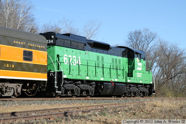
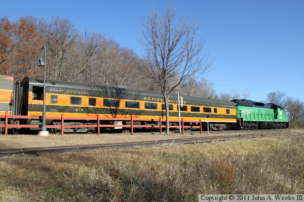
The photo above is a 1,750 horsepower EMD SD9 locomotive carrying cab number
6234. It was built in April, 1959, for the Chicago, Burlington, & Quincy
Railroad, and served with the Burlington Northern and BNSF railroads until
2002. The locomotive was donated to the Minnesota Transportation Museum,
where she was restored and has been running since 2004. In the photo below,
we see that BN 6234 is coupled to a Great Northern streamlined passenger
coach carrying road number 1213. This 60 seat coach was built in 1951 by the
American Car & Foundry and it ran ran as part of the Empire Builder
passenger train until 1970. This train was preparing to head out on one of
the museum's fall leaf tour excursions.

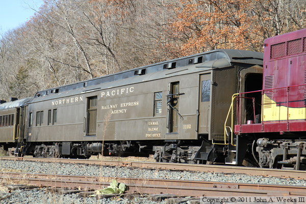
The photo above is Soo Line locomotive cab number 559, which frequently pulls
excursion trains on summer weekends for the Minnesota Transportation Museum
on its Osceola tourist trains. She was built in November, 1951, by EMD,
and features a 1,500 horsepower diesel engine. This locomotive was purchased
new by the Rock Island Railroad as cab number 1223, and later served in
C&NW colors after the Rock Island was acquired by the Chicago & North
Western. The museum purchased the locomotive in 1998. While 559 never
operated in Soo Line colors, she sure wears them well today. In the photo
below, we see 559 coupled to the Northern Pacific number 1102 triple combine
car. This car has a seating area, railway post office, and baggage
compartment. It was built in 1914, it ran on passenger trains until the
early 1960s, and was parked after the BN merger in 1970. The museum web
site indicates that this is their favorite coach and is part of nearly every
tourist train that they operate.
|
