| Highways, Byways, And Bridge Photography |
Cedar Avenue Bridge
MN-77 Minnesota River Crossing
Bloomington, MN to Eagan, MN
|
Northbound Span |
|
• Structure ID: |
NBI: 9600N. |
|
• Length: |
5,159 Feet Overall, 350 Foot Main Span. |
|
|
|
Southbound Span |
|
• Structure ID: |
NBI: 9600S. |
|
• Length: |
5,185 Feet Overall, 350 Foot Main Span. |
|
|
|
Statistics Common To Both Spans |
|
• Location: |
River Mile 7.9. |
|
• River Elevation: |
686 Feet. |
|
• Highway: |
MN-77. |
|
• Daily Traffic Count: |
46,500 (1996). |
|
• Bridge Type: |
Steel Tied Arch Suspended Deck. |
|
• Width: |
56 Feet Per Span, 3 Lanes Per Span. |
|
• Navigation Channel Width: |
331 Feet. |
|
• Height Above Water: |
55 Feet. |
|
• Date Built: |
Opened 1979. |
The Cedar Avenue Bridge is a pair of twin spans consisting of large steel arch
spans, flanked by long concrete girder causeways. The bridge spans the
Minnesota River valley, including large wetland areas on each side of the
main channel. These are certainly the most impressive bridge structures in
the Twin Cities area. In fact, the Cedar Avenue Bridge is the longest bridge
in Minnesota that is entirely within the state. The only other bridge in
Minnesota that is in this league is the US-2 Bong Bridge in Duluth.
The Cedar Avenue Bridge uses a tied arch for the main spans. A tied arch
has a large arch that connect to suspension cables. The suspension cables
hold up the bridge deck. A tied arch has horizontal tie beams that connect to
the two ends of each arch. The tie beams keep the arch from spreading out
wider under the weight of the bridge deck. Since the arch will not get wider,
the bridge piers only need to support the vertical weight of the bridge
rather than having to push sideways against the arches. This allows the
bridge to use much smaller and lighter piers under the arch spans.
The bridge is marked for three lanes of traffic, plus a wide shoulder on
the outside of each span. Transit buses are allowed to use the bridge
shoulders, so the bridge operates with four lanes on each span. This bridge
often backs up northbound in the morning due to a number of slow exits north
of the bridge. It is not unusual for morning traffic to back up all the way
into Apple Valley. In addition, traffic from I-35E backs up on the loop to
Cedar Avenue, and often back into the collector/distributor lanes. Now that
the MN-100 ‘Ease The Squeeze’ project is complete, this is probably
the single worst traffic issue in the twin cities metro area.
Dakota County and the Metropolitan Council are attempting to address the
traffic problem on Cedar Avenue. Highway MN-77 saw a large increase in
traffic between 1998 and 2002, with traffic levels as high as 60,000 vehicles
per day using the Cedar Avenue Bridge. As of 2011, it is estimated that
as many as 155,000 cars per day use some portion of Cedar Avenue, and
population of Dakota County cities along the Cedar Avenue corridor is
expected grow between 50% and 100% by 2025. The plan moving forward
is to build a Bus Rapid Transit line along Cedar Avenue. It will operate
much like a light rail system using dedicated highway lanes and a limited
number of passenger stations. The system, called the Red Line, will
begin operation on September 24, 2012, running between Dakota county
highway 70 and the Mall of America. Passengers can then board the
Hiawatha Line light rail, now known as the Blue Line, while some
buses will continue on to downtown Minneapolis or Saint Paul. Also
under consideration is adding HOT lane for high occupancy vehicles and
those willing to pay a toll to use an express lane.
A controversy erupted in 1977 during the construction of the fill leading
to the south end of the Cedar Avenue Bridge. A private land owner sold
the rights to remove fill from a parcel located near highway MN-13 and
Silver Bell Road. This parcel was known to contain a Native American
burial ground, which remains having previously been discovered in the
1940s. While Minnesota had a law for handling remains, it didn't apply
to private property. The owner of the property was not concerned with
the remains, so the construction project moved forward. The site was
over 90% disturbed before archaeologists became involved, causing the
destruction of a number of gravesites. This act of desecration led
to the adoption of new laws in 1980 to protect Native American graves
and the general operation of cemeteries, laws that have since been
strengthened several times.
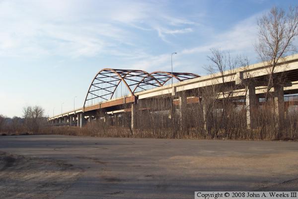
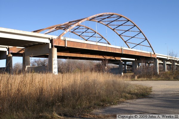
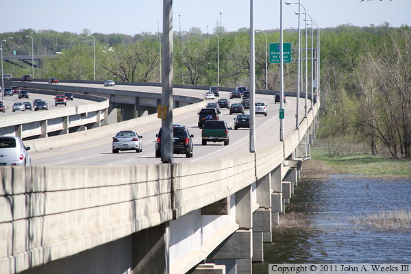
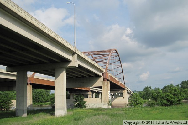
The photo above is looking northeast towards the parallel main span arches
of the Cedar Avenue Bridge. The vantage point is the parking lot at the
boat landing on the south side of the main river channel within Fort
Snelling State Park. The photo below is looking northwest towards the
main river spans. The vantage point is an overlook on the ramps leading to
the bicycle bridge that is attached to the east side of the main river span.
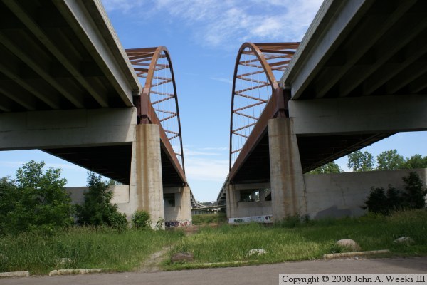
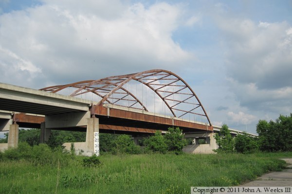
The photo above is the view looking north between the two bridge spans from
the Fort Snelling State Park parking lot on the south side of the main river
channel. The photo below is the west face of the eastern span as seen from
ground level. The bridge deck is about 50 feet above the ground. The
bicycle bridge can be seen on the far side of this span.

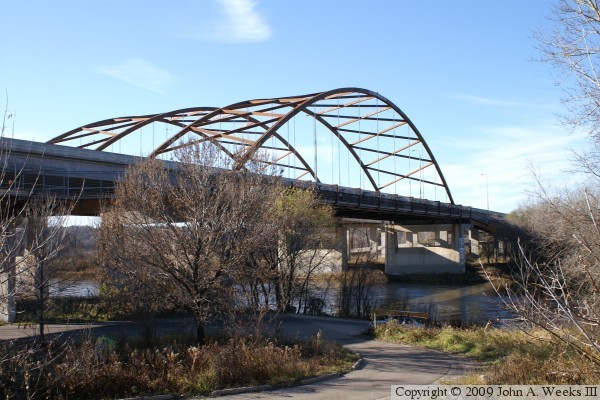
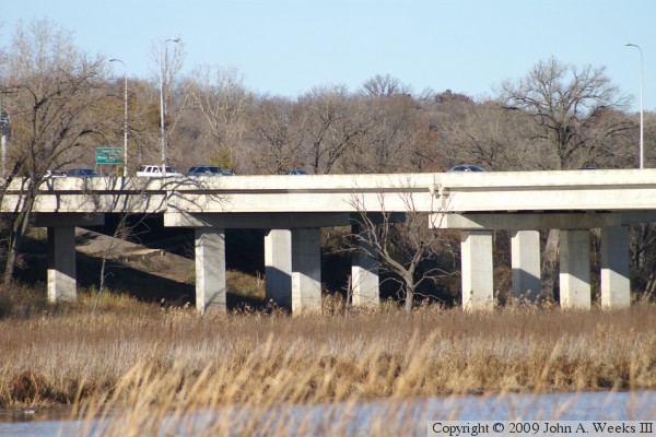
These two photos are looking south across the main channel of the Minnesota
River from a location between the two bridge spans. The photo above is the
upriver west face of the northbound (eastern) span. The photo below is the
downriver east face of the southbound (western) span. The island in the
middle of the river can be reached by walking over the bicycle bridge that
is attached to the side of the northbound bridge span.


These two photos are views from the two main channel tied arch spans as
seen from the island on the north side of the main river channel. The view
is looking southeast from two different angles. The pavement in the photo
below is the roadway that carried traffic between the two segments of the
old Cedar Avenue Bridge.

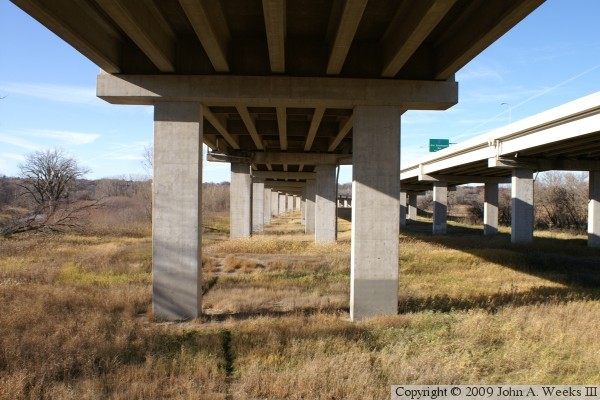
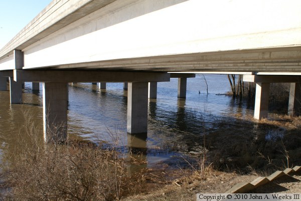
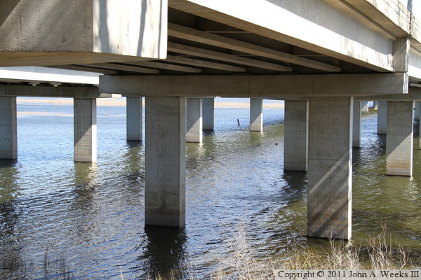
These two photos are views looking north under the concrete girder spans
on the north side of the main river channel as the bridge crosses the
island between the main river channel and backchannel marshes. The photo
above is the northbound span, while the photo below is the southbound span.
These photos were taken from the ramp leading to the bicycle bridge.

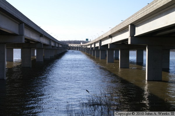
The photo above is looking north between the two concrete girder roadways.
The bridge crosses the river at an angle to true north, so it needs to make
a curve to line up with northbound Cedar Avenue on the Bloomington side
of the river. The photo below is the first concrete girder spans located
north of the main channel arch spans.
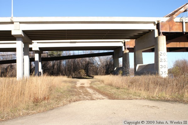

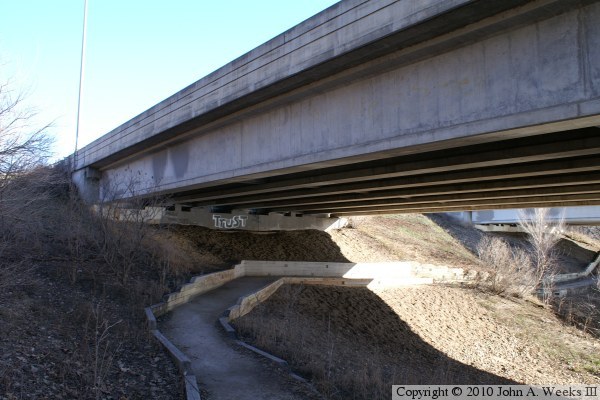
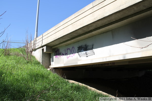
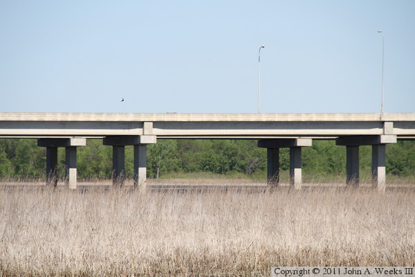
These two photos are views of the west face of concrete girder spans near the
north end of the structure. The photo above is an overview photo, while the
photo below is a close view of the spans located near the abutment at the
north end of the bridge. The vantage point is along Old Cedar Avenue leading
to the south end of the Long Meadow Bridge.

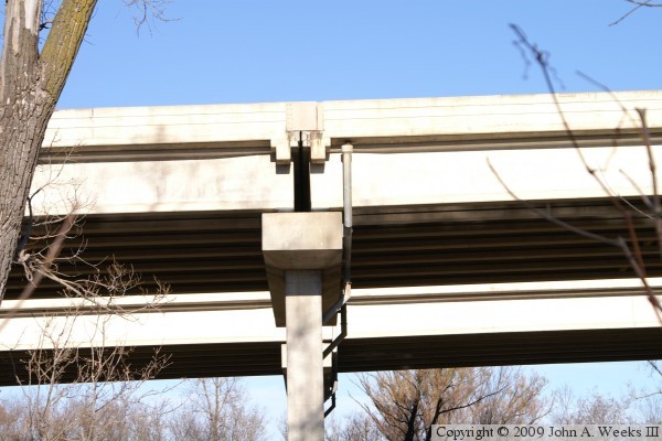
The photo above is one of the bridge piers that supports the concrete girder
spans. The photo below is a close view of a joint where two sets of girders
meet at a bridge pier. The gap between the girders allows the bridge to
move slightly as it expands and contracts due to temperature changes.
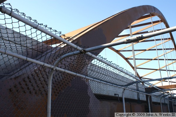
The photo above is a view of the joint between the arch and the horizontal
tie beam at the southeast corner of the northbound span. The chain link
fence is part of the bicycle bridge railing. The photo below is a view of
the main bridge span piers on the south side of the Minnesota River.
Red and green lights hang under the bridge to mark the navigation channel.
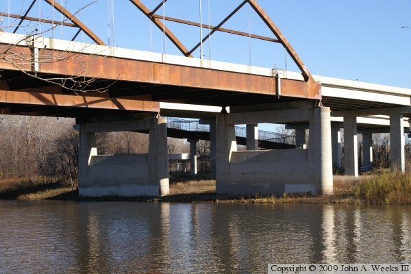

The photo above is a close view of a bridge bearing on top of a main channel
pier. Bearings allow the bridge to move slightly. This end is fixed in
place, but it allows the joint to flex. The bearings on the north side of
the channel are allowed to slide back and forth. This helps prevent the
bridge from flexing and twisting as it undergoes temperature changes. The
photo below is a close view of a pair of suspension cables as they attach
to the arch.

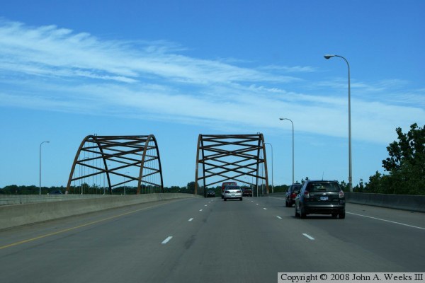
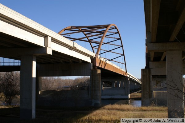
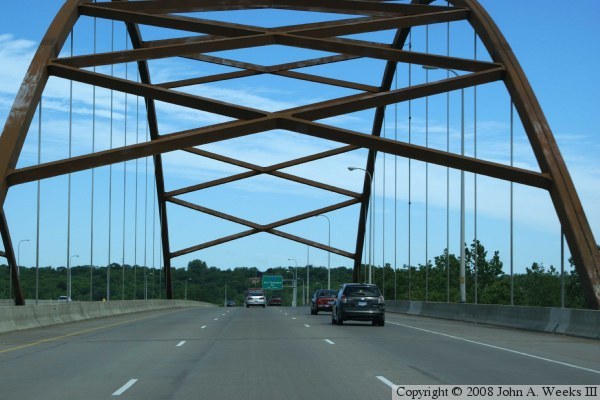
These two photos are the first of a three photo set showing a typical river
crossing heading northbound towards Bloomington. In the photo above, we are
cresting the high point in the bridge just prior to entering the main river
channel span. The photo below is a view from under the giant arch.
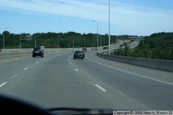
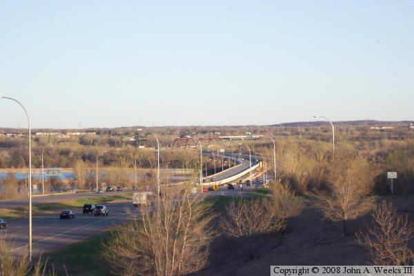
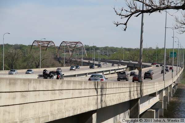
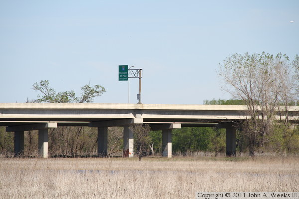
The photo above is the third of three photos showing a typical crossing
of the Minnesota River heading northbound. In this photo, we have just
passed under the main arch and are heading into Bloomington. The photo
below is an overview of the river crossing as seen from the County Highway
CSAH-1 bridge on the north end of the bridge.
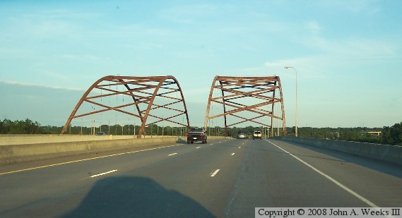
The photo above is an older photo that is scanned from a print. It shows
traffic approaching the main bridge spans very late in the evening in
the summer. Despite traffic heading southbound, the shadow of my vehicle
is visible. This is due to the sun being very far north at this hour of
the day in the summer. The photo below is an interpretive sign located
at the parking lot at the Long Meadow Bridge, an old bridge that formerly
carried Cedar Avenue across the Minnesota River.


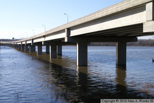
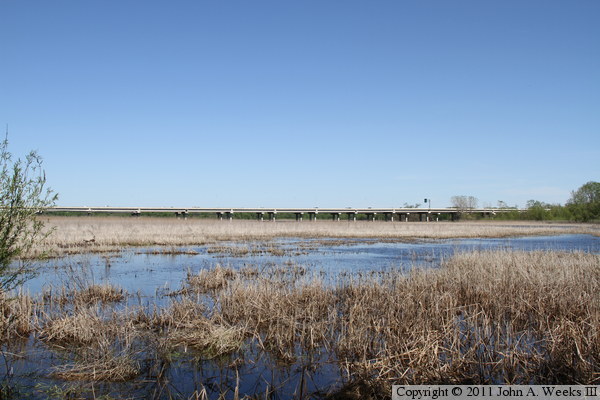
These two photos, and the four that follow, are views from the spring flood of
2010. The photo above is looking south along the downriver east face of the
Cedar Avenue bridge. The main river channel flows under the arches in the
distance. The photo below is a view of the north shore of Long Meadow Lake
near the north bridge abutment. The area under the bridge is generally
swampy, with a large island starting near the trees in the distance.
The photo above is a view looking south between the two bridge span, while
the photo below is a view of the east face of the southbound bridge structure.
These two photos are views from the north end of the Cedar Avenue bridges.
The photo above is the abutment of the southbound span, with the northbound
span visible in the background. The photo below is looking west under the
southbound span while standing under the northbound span. Hog Ridge trail
runs along the bluffs on the north side of the river. It can be accessed from
the parking lot at the south end of Old Cedar Avenue.


The Minnesota River flooded again twice in the spring of 2011. These two
photos were taken in mid-May, 2011, during the period between the two floods.
While the water was not back down to normal levels, it is considerably lower
than during the flood crest. The photo above is looking south along the west
face of the southbound spans. The photo below are the bridge piers at the
north end of the structure.
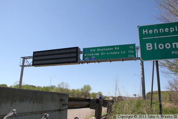
The photo above is the west face of the north abutment of the southbound
bridge span. The photo below is looking northbound along the east edge
of the north bridge abutment for the northbound bridge span. The overhead
traffic sign gantry includes an electronic message sign, part of the smart
highway system in the Twin Cities area.
These two photos were taken from near the west side of the north bridge
abutment. In the photo above, we are looking across the traffic lanes as
the curve southeast towards the main channel tied arch spans. In the photo
below, we are looking down the west face of the southbound bridge span.

The photo above is a telephoto view looking south between the two parallel
bridge spans. The telephoto view compresses distance, making the bridge
spans appear shorter than they actually are. Note the structure just sticking
out of the water at the far end of Long Meadow Lake. This appears to be
the remains of a trestle that was used during the construction of this
portion of the bridge. The photo below is a wide angle view of the concrete
girder spans of the Cedar Avenue Bridge looking to the east from near the
north abutment of the nearby Long Meadow Bridge.
These two photos are two more views of the concrete girder spans as seen
from near the north abutment of the Long Meadow Bridge. This view shows
the west face of the southbound spans, with the northbound spans sitting
directly behind the southbound spans.
In June, 2011, I decided to venture out under the concrete girder spans to
see if I could get to the structure that sits between the two parallel
bridge spans on the south edge of Long Meadow Lake, located on the north
side of the main bridge spans. These two photos, and the 8 that follow,
are from that late evening trek through the swamp. The photo above is
looking south across the Minnesota River along the west face of the southbound
bridge span, while the photo below is looking southeast towards the two
tied arch spans.

These two photos are views from under and between the two concrete girder
trestles. Both photos are looking north. The photo above is looking between
the two spans, with the southbound span located on the left. The photo below
is looking towards the northbound span. The land here is a sea of swamp grass,
but there is fairly well worn trail that was created by the graffiti artists.

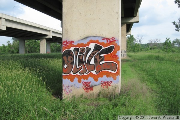
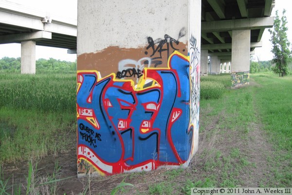
These two photos are two of my favorites of the outdoor urban art that is
displayed on many of the bridge piers. I am especially impressed with the
sharp edges on the outlines in the piece shown above, something that seems
like it would be difficult to do with an ordinary spray can. While the artwork
on the nearby Interstate highway I-494 Bridge are much larger, on the Cedar
Avenue Bridge, the pieces are smaller but far more numerous.
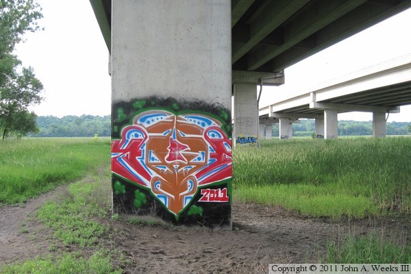

Here are two more of my favorite pieces of outdoor urban art from under the
Cedar Avenue Bridge. The work above is done with fluorescent colored paint,
which looks great in person, but it didn't photograph as well. The work
below is another example that features very tight and well defined outlines.
Given the size of these pieces and the amount of paint it would take, it must
be a bit of an undertaking for someone to hike out do this style of painting.
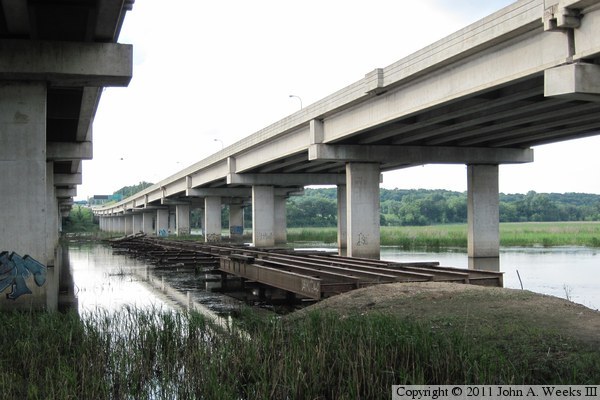
These two photos show the remains of a temporary construction bridge that
was built to support the construction of the concrete girder spans over
part of Long Meadow Lake. The remains are about 400 feet long and 20 feet
wide. There is an island at the far end of the steelwork. People have
been crossing this to get to the island as evidenced by the graffiti on
the bridge piers. The water was still pretty deep due to the spring
high water, and it will likely flood again just after my visit due to
additional heavy rainfall. It might not get dry enough until late fall
or the summer of 2012 before I would venture to the middle. I suspect that
the north side of the lake is deeper, which allowed barges to be used
rather than extending the trestle all the way across the lake. It is
also possible that the trestle did cross the lake, but that would raise
the question of why this section was left in place.

|
