Current Weather Conditions
John A. Weeks III
Friday, July 26, 2024, 11:20:14 PM CDT
Home Photo Tours Rail Fan 12 Easy Steps
Aviation Spacecraft Highways & Bridges About The Author
 
Google Search
Maps   Groups   Images   Search
 
  Home
  • 12 Easy Steps
  • Aviation
  • Spacecraft
  • Highways & Bridges
    » Bridge Photography
      - MSP River Bridges
        › 10th Avenue Bridge
        › Arcola High Bridge
        › Betty Adkins Bridge
        › Bloomington Ferry
        › Bloomington Fry Tr
        › BNSF RR Bridge
        › Boom Island Foot Br
        › Broadway Avenue Br
        › C&NW Bridge (1)
        › C&NW Bridge (2)
        › Camden Bridge
        › Cedar Avenue Bridge
        › Cedar Ave Br (Old)
        › Cedar Ave Bicycle Br
        › Cedar Bend RR Br
        › Chaska Bridge (Old)
        › Chaska Swing Bridge
        › Chaska Trestle
        › Coon Rapids Dam
        › CP RR Bridge
        › Dan Patch Line Br
        › Dartmouth Bridge
        › East Channel Bridge
        › East Channel RR Br
        › East River Flats Br
        › Endless Bridge
        › F. W. Cappelen Mem
        › Father Henn Bluffs
        › Father Louis Henn Br
        › Ferry Street Bridge
        › First Avenue Bridge
        › Fort Road Bridge
        › Fort Snelling Br (Old)
        › Fort Snelling High Br
        › Great Western Bridge
        › Grey Cloud Channel
        › Grey Cloud Island Br
        › Grey Cloud Trail Br
        › Hastings High Bridge
        › Hastings Spiral Br
        › Holmes St Ped Bridge
        › Highway 243 Bridge
        › I-35W Bridge
        › I-35W Bridge (Old)
        › I-494 Bridge
        › I-694 Bridge
        › Interstate Bridge
        › Intercity Bridge
        › L St. Anthony F L&D
        › Lafayette Bridge
        › Lake Street Bridge
        › Lewis Street Bridge
        › Lexington Bridge
        › Lions Levee Pk Foot
        › Lock & Dam #1
        › Lock & Dam #2
        › Long Meadow Bridge
        › Lower Bridge
        › Lowry Bridge (Old)
        › Meeker Island L&D
        › Mendota Bridge
        › Merriam Street Br
        › Mill Ruins Park Br
        › Milwaukee Road Br
        › M&StL Bridge
        › Miss River Bridge 15
        › MN-101 Bridge
        › MN-41 Backchannel
        › MN-41 Back Ch (Old)
        › MN-41 Bridge
        › New Saint Croix Br
        › New Trunk-41 Bridge
        › Nicollet Island RR Br
        › North Miss Park Pier
        › NP Bridge #9
        › NP RR Bridge
        › Pike Island Bridge
        › Plymouth Bridge
        › Point Douglas DB
        › Raspberry Island Br
        › Richard P. Braun Br
        › Robert Street
        › Rock Island Swing Br
        › Runway 30 Light Br
        › Short Line Bridge
        › Smith Avenue High
        › Southeast Steam Plant
        › St. Anthony Falls Br
        › St. Anthony Falls Lab
        › St. Anthony Falls PP
        › St. Croix Boom Site
        › St. Croix Falls Dam
        › Stillwater Lift Br
        › Stone Arch Bridge
        › Third Avenue Bridge
        › Toll Bridge (Old)
        › U St. Anthony F L&D
        › US-8 Bridge
        › Wabasha Street Bridge
        › Wakota Bridge
        › Wakota Bridge (Old)
        › Walnut Street CW
        › Washington Ave Br
        › WI Central RR Br
        › WI Central RR Ruins
        › Wright Co Hwy 42
      - C & D Canal
      - Illinois River
      - Minnehaha Creek
      - Minnesota River
      - Mississippi River
      - Missouri River
      - St. Croix River
      - St. Louis River
      - Wisconsin River
      - Best Miss River Photos
      - Cable Stayed Bridges
      - McGilvray Road Bridges
      - I-35W Bridge Disaster
      - Miscellaneous Bridges
      - Madison County Bridges
      - Hist Br Weekend 2013
    » Road Geek Topics
  • Photo Tours
  • Rail Fan
  • About The Author
 
Site Search By JRank
Highways, Byways, And Bridge Photography
Father Hennepin Bluffs Park Bridges
Father Hennepin Bluffs Park Mississippi River Trail Crossings
Minneapolis, MN

Father Hennepin Bluffs Park Bridges

Statistics Common To All Four Bridges
• Location: River Mile 853.7.
• River Elevation: 751 Feet.
• Structure: Four Pedestrian Bridges.
• Bridge Type: Laminated Wood Beam.
• Width: 8 Feet (Estimated).
 
Father Hennepin Bluffs Park Bridge #1
• Structure ID: NBI: 93916.
• Length: 98 Feet.
• Height Above Water: 3 Feet (Estimated).
• Date Built: 1970.
 
Father Hennepin Bluffs Park Bridge #2
• Structure ID: NBI: 93917.
• Length: 72 Feet.
• Height Above Water: 2 Feet (Estimated).
• Date Built: 1975.
 
Father Hennepin Bluffs Park Bridge #3
• Structure ID: NBI: 93918.
• Length: 76 Feet.
• Height Above Water: 4 Feet (Estimated).
• Date Built: 1975.
 
Father Hennepin Bluffs Park Bridge #4
• Structure ID: NBI: 93916.
• Length: 82 Feet.
• Height Above Water: 4 Feet (Estimated).
• Date Built: 1975.
While the falls were known to local people for eons, Father Louis Hennepin became the first European to see Saint Anthony Falls in 1680. At the time, the falls were several hundred feet downstream, about twice as high, and Hennepin Island was above the falls.

Father Hennepin was born in Belgium in 1640. He became a Franciscan Monk after completing his formal education. Hennepin loved to travel, and as part of his duties, he was sent to visit and write about the major churches of Italy. He later became a traveling merchant for the Franciscan Order. In 1675, Father Hennepin was sent to the new world as part of a group of four missionaries. He landed at Quebec.

Hennepin joined up with Chevalier de la Salle, and set sail up the Saint Lawrence river in 1679. They explored and built forts at such places as Niagara Falls and Green Bay. The trip took them down Lake Michigan and down the Illinois River. Here, Hennepin departed the La Salle party with orders to continue to the mouth of the Illinois River, then head north along the Mississippi River. After starting northward on the Mississippi River, Hennepin and his party were taken captive by Indians in April of 1680. The Indians were headed north, and they traveled to their home area near Lake Mille Lacs. The band of Indians traveled extensively, allowing Father Hennepin to explore east-central Minnesota and the upper Mississippi River. This lead to Hennepin being the first European to see Saint Anthony Falls. The Indians released Hennepin and his party in July, where it voyaged up the Wisconsin and Fox rivers to Green Bay.

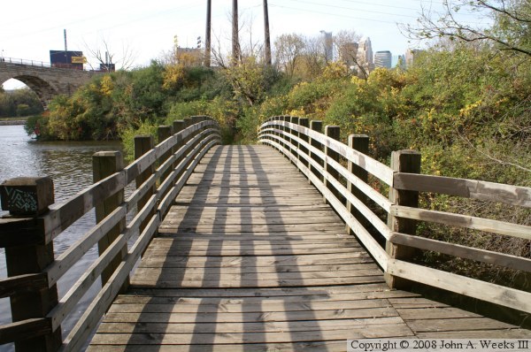
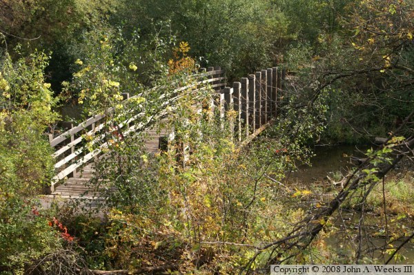
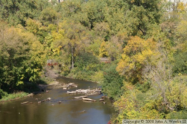
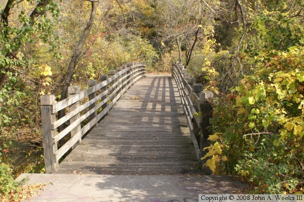
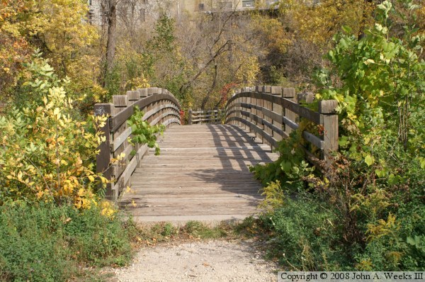
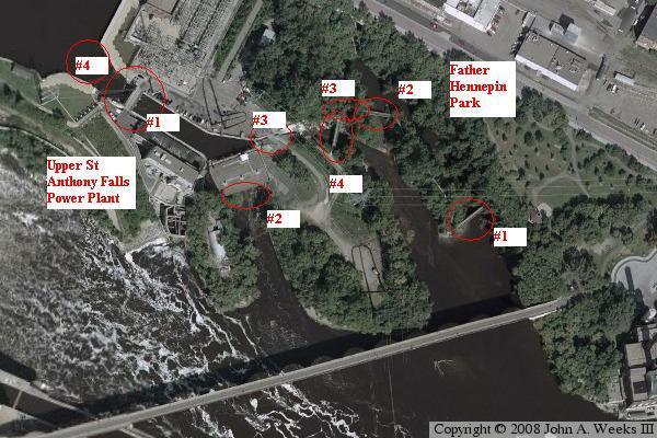
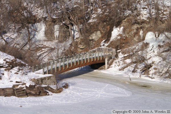
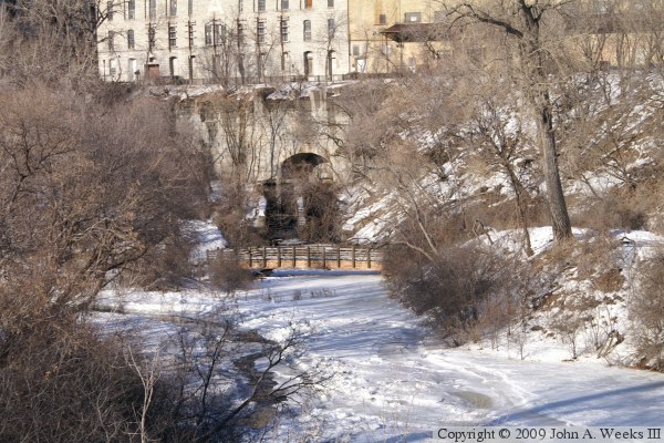
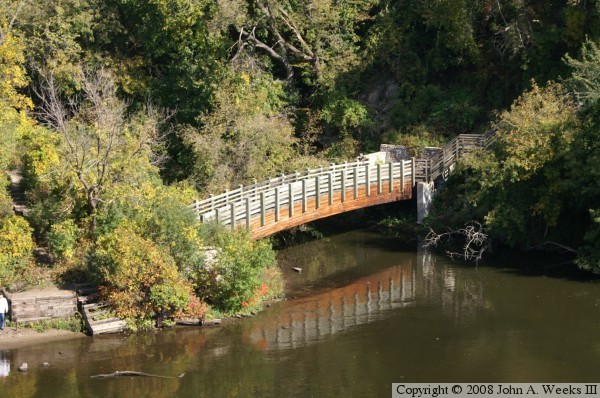
In later life, Father Hennepin returned to Europe, where he lived in Rome. He wrote extensively about his journeys. Hennepin died at the age of 61 in 1701. Today, Father Hennepin is remembered in a number of ways, such as having a county bearing his name, a major street, a bridge, and an island. The river front just below the present day falls on the north side of the river is the location of Father Hennepin Bluffs Park. The park features a stairway and walking path across an old river channel and two spillways. There are four pedestrian bridges as part of this path. One was built in 1970, the other three in 1975.

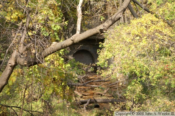
While these bridges are in good condition, the stairways have structural issues and some are closed. The paths are also in disrepair or are rugged and hard to follow. It looks like the park is in disrepair and has been ignored for many years. I also saw evidence that it is often used by homeless people. As a result, do not visit this place alone. There is a proposal to totally redevelop the east bank of the river between the two dams. Xcel Energy had proposed sending money to provide user access to the area, but it could not get community consensus in time for it to submit its application for license renewal. In a follow-up visit in 2008, it appeared that the stairways have been repaired and reopened to the public.


Father Hennepin Bluffs Park Bridges
These two photos are Bridge #1. The photo above is a profile view, while the photo below is a view looking across the span. This bridge is 5 years older than the other three bridges. It is also very more visible than the other 3 bridges. The photo at the top of the page is a view of Bridge #1 taken from the Stone Arch Bridge.

Father Hennepin Bluffs Park Bridges
These two photos are views of Bridge #2. The photo above is a profile shot taken from the Stone Arch Bridge. The photo below is looking down the length of the span.

Father Hennepin Bluffs Park Bridges
The photo above is another view of Bridge #2, this time, as seen from the deck of Bridge #4. The photo below is a view of Bridge #3 (on the right) and Bridge #4 (on the left) as seen from the Stone Arch Bridge.

Father Hennepin Bluffs Park Bridges
The photo above is a view looking across the span of Bridge #3. The photo below is a view looking across the span of Bridge #4. These two bridges are located very close to one another. Bridge #3 is visible in the background of the photo below.

Father Hennepin Bluffs Park Bridges
The image above is an aerial view of the upper falls area. The right side shows the location of the four bridges in Father Hennepin Park. The left side shows the location of four bridges near the Power Plant, Saint Anthony Falls Lab, and the new Water Power Park. The photo below shows one of the water canal entrances on the Saint Anthony side of the river. Steel beams have been installed to stabilize the walls to preserve the site for a possible future restoration.

Father Hennepin Bluffs Park Bridges
Shown here are two more water outlets from the tailrace on the east side of the river. During the milling boom, the industries got together to build a canal or tunnel that paralleled the river. Water would enter the canals above the falls, then be divided up among the flour and lumber mills to generate mechanical energy. After the water was used to turn turbines or drive millstones and saw blades, the water would be dumped back into the river below the falls using these outlets from the tailrace.

Father Hennepin Bluffs Park Bridges
The photo above is Bridge #1 as seen in the deep of winter. The parks department has been doing some work in this area. The steps leading down to this bridge deteriorated, and rather than replacing the steps, they were removed. Notice that a wall has been built around the north end of the bridge. In addition, the brush and smaller trees have been removed.

The photo below is a view of Bridge #2, taken in winter from the Stone Arch Bridge. The large Pillsbury A Mill is located in the background.


Father Hennepin Bluffs Park Bridges

Made With Macintosh
Authored by John A. Weeks III, Copyright © 1996—2016, all rights reserved.
For further information, contact: john@johnweeks.com