| Highways, Byways, And Bridge Photography |
East River Flats Catwalk
East River Flats Trail Mississippi River Bridge
Minneapolis, MN
|
• Structure ID: |
NBI: 94257. |
|
• Location: |
River Miles 851.6 To 852.0. |
|
• River Elevation: |
725 Feet. |
|
• Structure: |
East River Flats Park Foot Path. |
|
• Bridge Type: |
Steel Truss, Wood Deck. |
|
• Length: |
1,531 Feet. |
|
• Width: |
12 Feet (Estimated). |
|
• Navigation Channel Width: |
Non-Navigable. |
|
• Height Above Water: |
12 Feet (Estimated). |
|
• Date Built: |
1996. |
The undeveloped areas of the Mississippi River gorge have a number
of trails running though them, some marked, others just happen as
people use a particular path over time. The area under the Dartmouth
Bridge is very narrow, and is prone to rock slides. When the Dartmouth
Bridge was rebuilt, a rock slide made the existing path unusable. To
fix the problem, the City of Minneapolis Parks Department. contracted to have
a prefabricated bridge installed to run along the river shore. This
would allow the trail to safely traverse the unstable area, and also make
the trail safe at high water when there is almost no space between the
rock face and the river. The catwalk, as it is called by the Parks Department,
runs from the East River Flats Park south to near the Cappelen Memorial
Bridge at Franklin Avenue.
The east river bank saw a lot of construction work in 2008. The East
River Flats Park was refurbished, with a new roadway and parking lot
being installed, and a new park building being constructed. The City
of Minneapolis replaced the bridge and retaining walls on the East River
Parkway near Franklin Avenue and Bridal Veil Falls. Later in 2008, the
City of Minneapolis Parks Department began work to rebuild the trails along the
east bank of the Mississippi River. The goal is to establish a walking
and bicycle trail along the river between the city limits with Saint Paul
all the way to Anoka County on the east side of the river.
I visited this area again in 2011. The East River Flats trail had been
rebuilt between the south end of the East River Flats Catwalk and the
former Milwaukee Road Short Line Bridge, a distance of 1.4-miles. While
this area was only for the adventurous during my visit in 2009, I found
that the rebuilt trail was in fantastic shape despite having been flooded
earlier in the spring. The worst area had been in front of Bridal Veil
Falls, which was littered with falling rock. The falls was stabilized and
cleaned up in 2010, with the addition of a new bridge over the creek. I
found that the trail to be heavily used.
Early in the morning on August 29, 2007, a drunk driver somehow ended
up driving a 2 week old borrowed Cadillac Escalade onto the north end
of this catwalk. The vehicle made it about 360 feet down the catwalk
before it became hopelessly wedged between the railings. The driver
then fled the scene. A towing company worked for several hours later
that morning to remove the SUV from the pedestrian bridge. The $68,000
vehicle appears to be a total loss. The catwalk suffered some damage,
mostly broken railings.
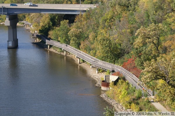
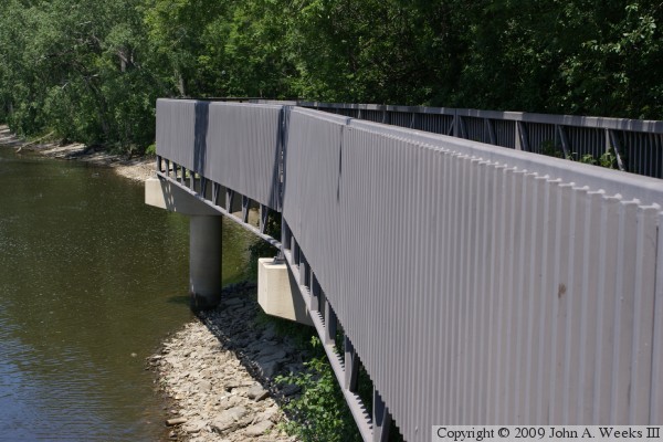
The photo above shows the south end of the catwalk. This view is from the
sidewalk on the Cappelen Bridge. The high vantage point from the Cappelen
Bridge and the deep river gorge combine to make this photo look like an
aerial photograph.
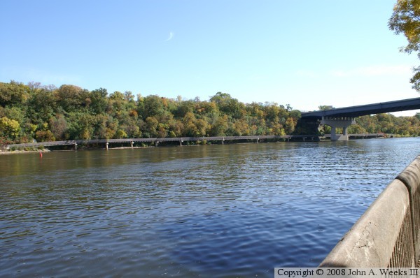
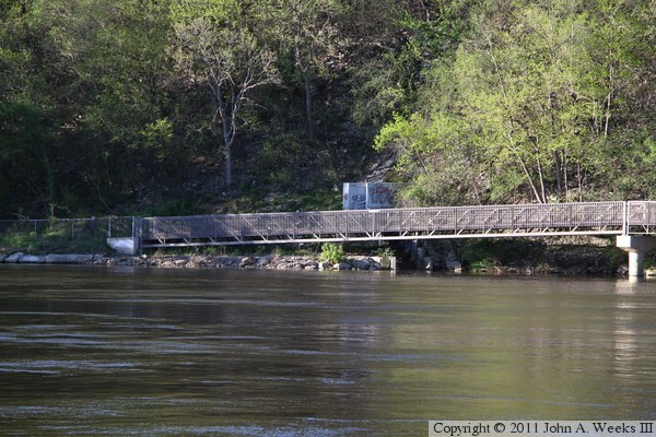
The photo above shows the north end of the catwalk as seen from the West
River Parkway in the Bohemian Flats park. The photo below is a close view
of the north end of the catwalk.
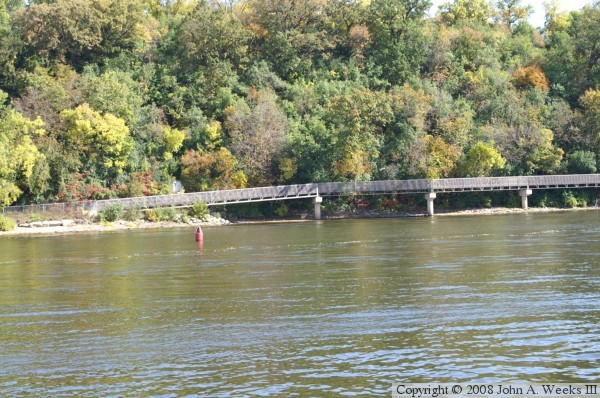
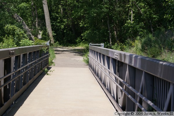
These two photos are views of the north end of the catwalk. The photo
above is looking south towards the first bridge span. The photo below
is looking north towards the path that leads to the University of
Minnesota boathouse.
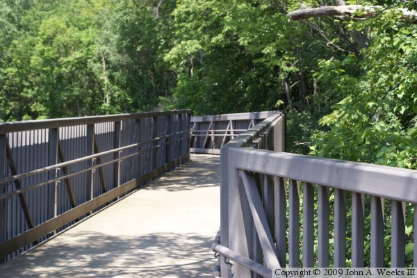
These two photos are views of the bridge deck near the north end of the
structure. A number of zigzags are built into the catwalk.
Since the river bluffs are very close to the river at this location, the
catwalk hugs the bluffs and trees overhang the deck along its entire length.
These two photos are views looking along the west face of the catwalk
structure. The catwalk has a number of zigzags, which makes it
possible to see the piers and structure under the bridge deck. Both
photos are of the same pier located near the north end of the bridge.
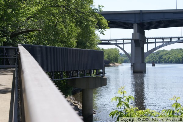
The photo below is looking south towards the Dartmouth, Cappelen, and
Short-Line bridges. The photo above is looking north.

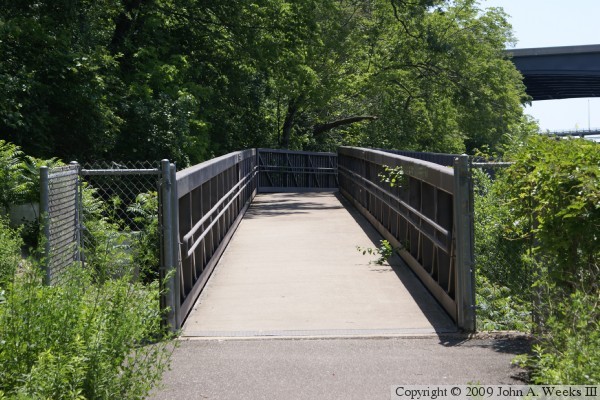
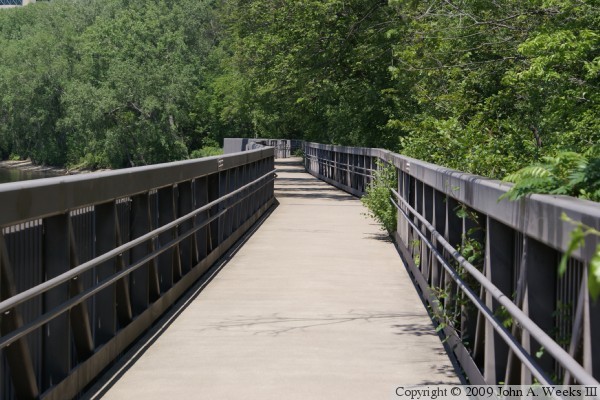
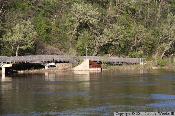
These two photos are views of the south end of the bridge. The photo
above is a view looking south down the length of the last two bridge
spans. The photo above is a view looking north towards the first two
bridge spans.


The photo above is one of two places where the bridge deck is slightly
wider to accommodate an observation area. The photo below is a close view
of the south end of catwalk as it passes under the Dartmouth Bridge.

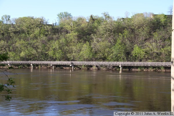
I returned in the late spring of 2011 to take additional photos of the I-94
Dartmouth Bridge, and I could not resist taking a few additional photos of
the East River Flats Catwalk from across the Mississippi River. These two
photos, and the two below, were taken during the late evening with a very
low sun angle, which is ideal lighting for a structure that backs up against
the face of a gorge. The photo above is the north end of the catwalk, while
the photo below is a long section located north of the Dartmouth Bridge.
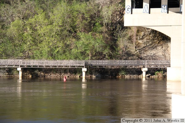
The photo above are the last few spans before the East River Flats Catwalk
passes under the I-94 Dartmouth Bridge. The photo below is the south end
of the structure.
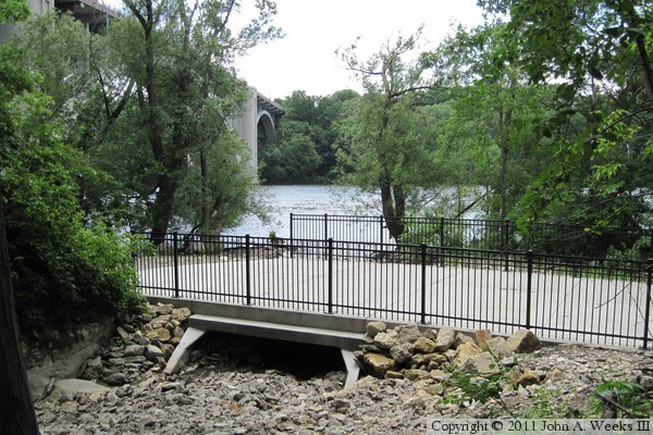
Bridal Veil Falls is located just south of the south end of the East River
Flats Catwalk. The trail in this area was all but impassible when I visited
in June, 2009. When I returned in June, 2011, I found a new bridge at the
site of the falls, along with a rebuilt and paved bicycle trail. The
photo above is looking from the falls area west towards the Mississippi
River. The photo below is a view looking south from the northeast corner
of the new trail bridge towards the Franklin Avenue Bridge.
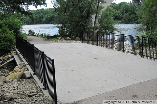

The photo above is a view of the west face of the new East River Flats trail
bridge over Bridal Veil Creek. The falls is visible in the background.
The photo above is a view of the falls from the trail bridge. The highway
bridge at the top of the falls was built in 2006, and the project to
stabilize the falls was completed in 2010.

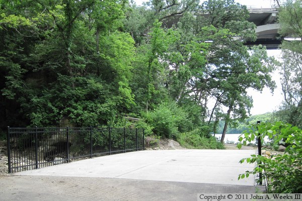
These are two final views of the trail bridge over Bridal Veil Creek. The
photo above is looking southbound, while the photo below is looking northbound.
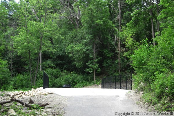
The trail runs from the East River Flats Park to a parking area just north
of the Short Line Bridge, a tall railroad bridge over the Mississippi River.
It is well worth checking out.
|
