| Highways, Byways, And Bridge Photography |
Bloomington Ferry Bridge
US-169 Minnesota River Crossing
Bloomington, MN and Eden Prairie, MN to Shakopee, MN

|
Northbound Span |
|
• Structure ID: |
NBI: 27624A. |
|
• Length: |
1.107 Miles (5,848 Feet). |
|
|
|
Southbound Span |
|
• Structure ID: |
NBI: 27624B. |
|
• Length: |
1.109 Miles (5,855 Feet). |
|
|
|
Statistics Common To Both Spans |
|
• Location: |
River Mile 18.7. |
|
• River Elevation: |
692 Feet. |
|
• Highway: |
US-169. |
|
• Daily Traffic Count: |
14,000 (1996). |
|
• Bridge Type: |
Concrete Girder, Steel Girder Main Span. |
|
• Width: |
52 Feet Per Span, 3 Lanes Per Span. |
|
• Navigation Channel Width: |
Non-Navigable. |
|
• Height Above Water: |
43 Feet. |
|
• Date Built: |
Opened 1996. |
The new Bloomington Ferry Bridge was built on a new alignment that followed
the old County Highway 18 straight south across the Minnesota River. County
18 was upgraded to a 4-lane expressway, then renamed to be US-169 when the
bridge was completed. At the same time, new US-169 freeway was built around
Shakopee starting at the south end of the new bridge. Later on, the Pioneer
Trail and Anderson Lakes Parkway intersections, located north of the new
bridge, were converted to full freeway interchanges, leaving just one grade
crossing on US-169 south of I-494 in the metro area.
The new Bloomington Ferry Bridge has been the catalyst for a major boom in
Savage, Shakopee, and Scott County. Prior to the new bridge, the old river
crossing would flood every second or third spring, and sometimes again in the
summer. The typical flood would close the crossing for a month, and cause
significant damage to the approach road. Even when the old river crossing was
high and dry, it was often a traffic bottleneck.
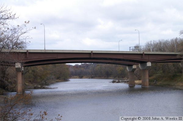
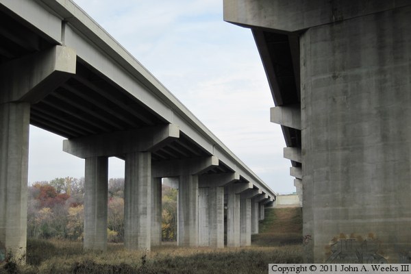
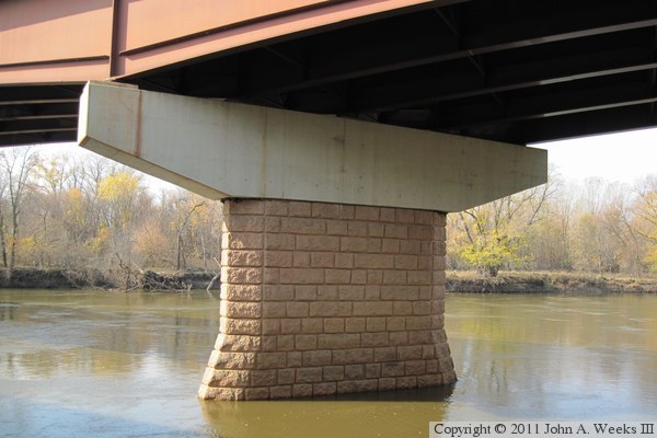
The photo above is the main river channel spans looking to the west from the
south bank of the Minnesota River. While the majority of the bridge is built
using precast concrete girders, the main river channel spans use steel plate
girders. In addition, the piers are decorated with stone, while the remaining
piers are raw concrete. The steel has additional plates welded to the girders
above the piers to increase the strength of the beams. These details are
rarely seen given that the main span is hidden deep within the Minnesota River
Valley National Wildlife Refuge and cannot be seen from any public location
other than by hiking into the refuge.
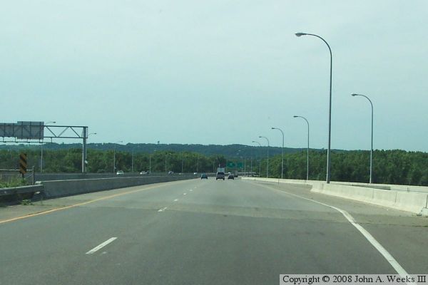
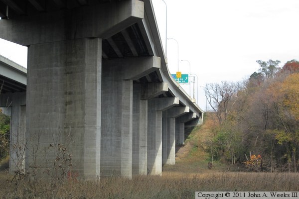
These two photos are the first of a three photo set showing a typical
river crossing headed southbound towards Savage and Shakopee. In the
photo above, we are just entering the north end of the western of the
two bridge spans. In the photo below, we are crossing the main channel
of the Minnesota River.

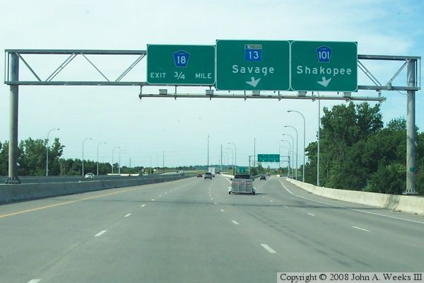
The photo above is the final photo of a three photo set showing a southbound
river crossing. This photo is near the south end of the structure, where
an exit branches off to provide access to MN-13 and CSAH-101.
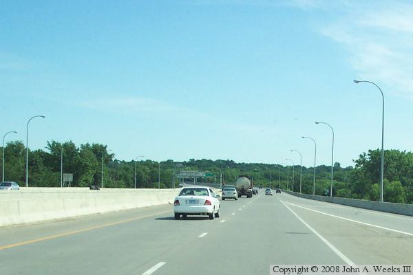
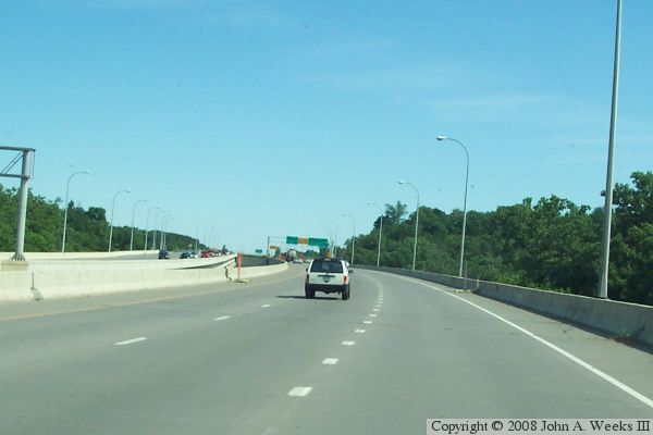
The photo below is the first of a three photo set showing a typical northbound
river crossing heading into Bloomington and Eden Prairie. This photo is
the view just after entering the eastern of the two bridge spans from the
south. The ramp merging in from the right is the ramp from westbound
CSAH-101 (the former MN-101).
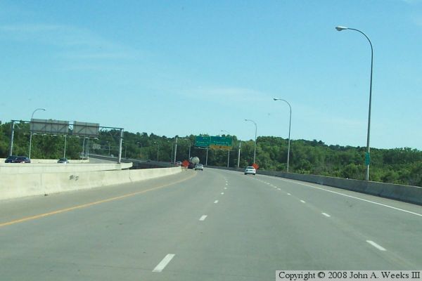
These two photos are the final two photos of a three photo set showing
a typical northbound river crossing. In the photo above, we are nearing
the main channel span over the Minnesota River. The photo below is near
the north end of the structure. The right lane will branch off as an
exit ramp to Old Shakopee Road.
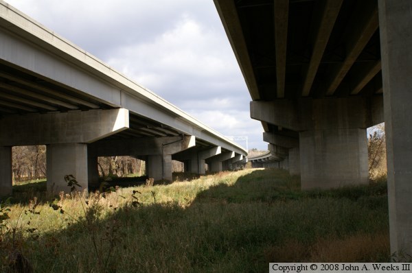
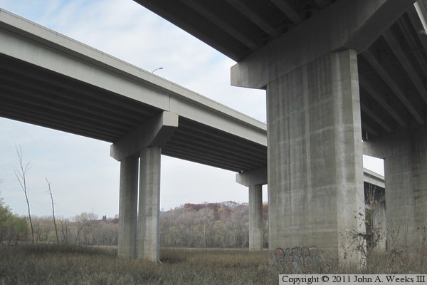
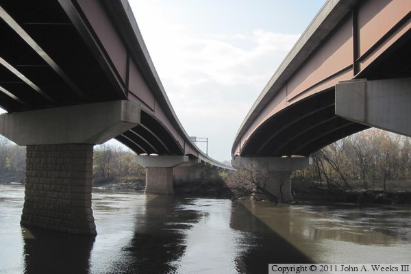
The photo above is the main river spans looking to the west from the south
bank of the Minnesota River. The photo below are the abutments at the
south end of the structure looking to the east.
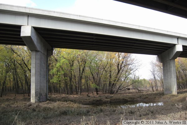
These two photos are views from under the south end of the structure.
The access road to this location is open during the fall to allow duck
hunters access to the wetlands south of the river. The photo above is
looking north from the gap between the two spans. The photo below is
the view from under the northbound span. Both photos are looking to
the north.
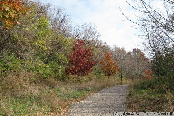
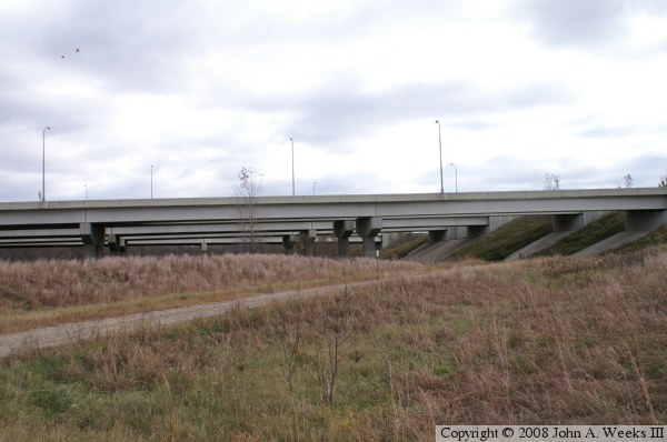
I was able to visit the north end of the Bloomington Ferry Bridge in late
autumn of 2010. This photo, plus the next 17 that follow, are from that
excursion. The photo above is a view along the trail leading to the bridge
on the north side of the Minnesota River. This trail follows a 2/3-mile
long haul road that was built to provide access to the bridge site for
construction crews. This road was very controversial at the time due to
being built without permits. MN-DOT and the contractors had secured all the
needed permits for the highway bridge, but overlooked the haul road. The
issue was resolved, but not without a lot of negative publicity. The photo
below is the first view of the bridge structure when walking westbound on
the haul road. The bridge transitions from steel spans over the river
channel to concrete girder approach spans at this location.
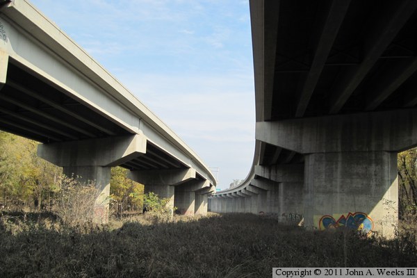
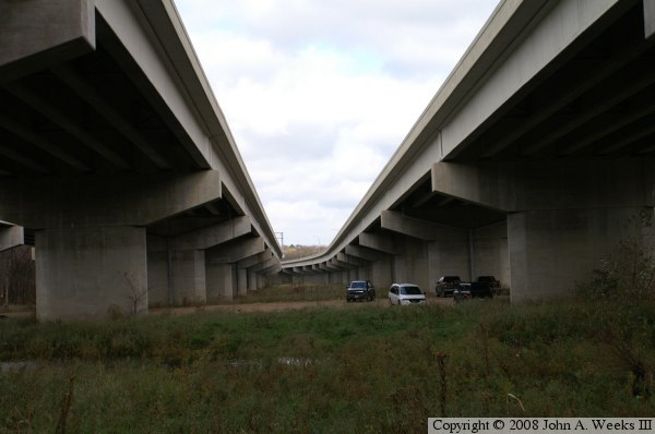
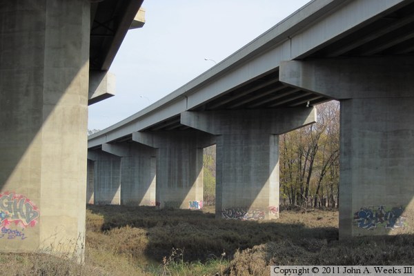
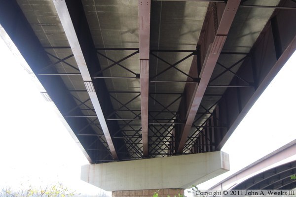
These two photos are looking north from under the bridge spans from a
vantage point near the north bank of the main river channel. The photo
above is under the northbound lanes, with the southbound lanes to the
left. The photo below is from under the southbound lanes, with the
northbound lanes at the right edge of the photo.
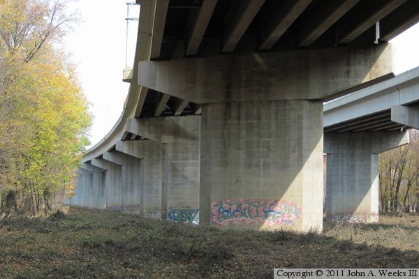
The photo above is a view of the northbound lane structure just north of
the haul road. The photo below is a closer view of one of the large
T-shaped piers. Note the graffiti on the piers. It looks like the urban
artists have been busy. I didn't see any trash or debris around the piers,
which suggests that the artists follow the wildlife refuge rules of carrying
out anything that you carry in.
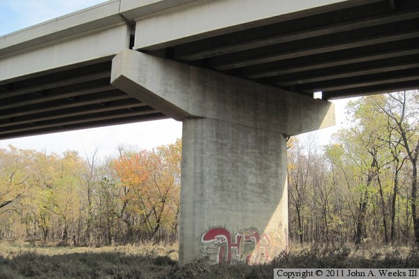
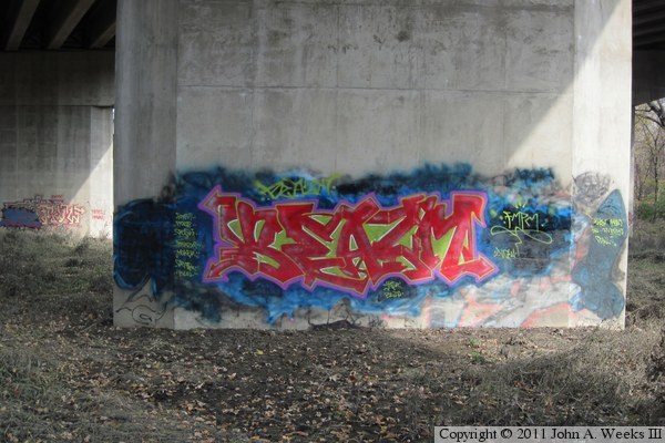
The photo above is a close view of one of the more vivid works of urban
art. This is a fresh painting. All of the other paintings were washed out
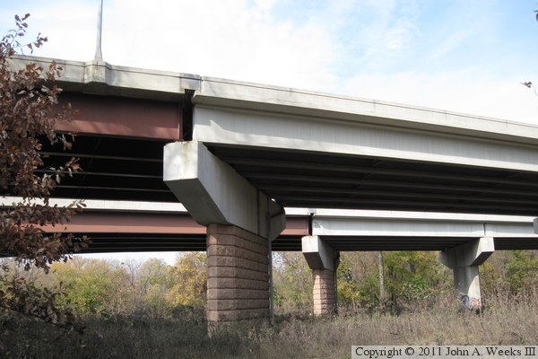
and covered with silt from the recent late-season flood. The photo above
is a close view of the transition from steel spans to concrete spans at
the first pier on the north side of the river channel.

The photo above is looking north along the east side of the northbound
traffic lanes near the north bridge abutment. This location was the end of
an access road running along the downstream side of the bridge. The ground
is swampy and has pools of open water between this vantage point and the
slope leading to the abutment. The photo below is looking west under the
bridge spans. It is interesting to note that some of the piers supporting
the southbound spans have two concrete legs rather than one larger concrete
vertical member.
The photo above is looking north between the two bride spans towards the
north bridge abutment. The two-legged piers support the southbound lanes.
The photo below is looking west towards the forest on the far side of the
southbound lanes.
The photo above is a close view of a mid-channel pier supporting the
steel girder spans for the southbound lanes. The piers that support the
steel girder spans are clad with a cut stone veneer. I was surprised to see
any decorative elements since this bridge is otherwise not dressed up.
Further, this location was be seen by so few people that any decorations
would go largely unseen. Perhaps there is a reason for the stone facing.
These spans do have a tapered bottom to help break up and deflect ice.
The photo below is looking south across the Minnesota River between the two
bridge spans.
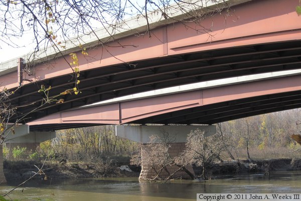
The photo above is looking towards the bottom of one of the steel girder
bridge spans. The photo below is a close view of the main river channel
spans. The steel girders are highly engineered. They are cut to shape
from long steel plates. The top and bottom flanges are then welded on,
and stiffeners are welded to the sides. Sections of girder are delivered
to the site, lifted with a crane, and then crews bolt the together using
long gusset plates.

These two photos are looking southwest towards the steel girder river channel
spans from the north bank of the Minnesota River. The photo above is from
a vantage point closer to the bridge than the photo below, allowing for a
view of the transition to concrete spans on the south side of the river.
The photo below shows more of the main river channel spans.

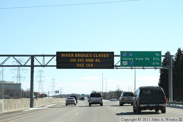
The photo above is an electronic sign located above the southbound lanes
of Interstate highway I-494 in Minnetonka, announcing that two bridges over
the Minnesota River are closed, and that travelers should use US-169 as
an alternative. These bridge closings in the spring of 2011 were the third
time in 12 months that they were closed due to flooding on the Minnesota
River. In an attempt to alleviate heavy traffic on the Bloomington Ferry
Bridge, MN-DOT restriped the bridge for an additional lane. The photo
below is the first of three photos showing the temporary pavement markings
heading northbound at the south end of the bridge.
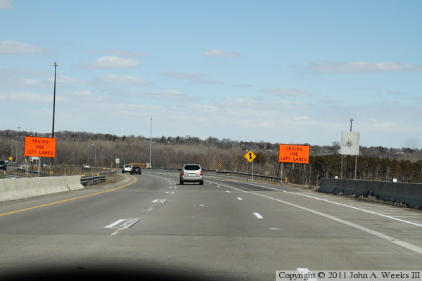

These two photos are additional views of the temporary lane markings heading
northbound across the Bloomington Ferry Bridge. The photo above is the
straight section of the bridge on the south side of the main river channel.
A third lane was added by using the shoulders. The photo above is the
middle of the bridge, where a temporary fourth lane was in place.
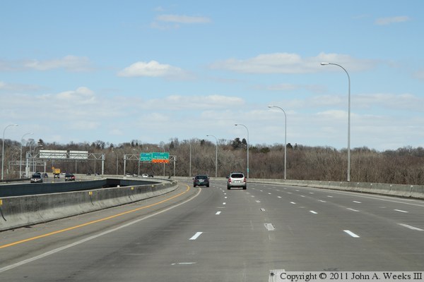

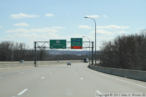
These two photos are heading southbound across the Bloomington Ferry Bridge,
where an additional lane was added as a temporary measure during the spring
flood of 2011. The photo above is the north end of the Ferry Bridge, where
the shoulder was used for a narrow third lane. The photo below shows the
temporary fourth lane near the main river span. The overhead sign for
highways 13 and 101 was modified to show that two lanes were available for
the exit rather than just one lane.
|
