| Highways, Byways, And Bridge Photography |
Highway 243 Bridge
MN-243/WI-243 Saint Croix River Crossing
Osceola, WI
|
• Structure ID: |
NBI: 6347 (MN), B48022400000000 (WI). |
|
• Location: |
River Mile 45.5. |
|
• River Elevation: |
683 Feet. |
|
• Highway: |
MN-243, WI-243 |
|
• Daily Traffic Count: |
7,330 (2003). |
|
• Bridge Type: |
Steel Truss Deck. |
|
• Length: |
674 Feet. |
|
• Width: |
31 Feet, 2 Traffic Lanes. |
|
• Navigation Channel Width: |
Non-Navigable. |
|
• Height Above Water: |
|
|
• Date Built: |
Opened 1953, Rebuilt 1980. |
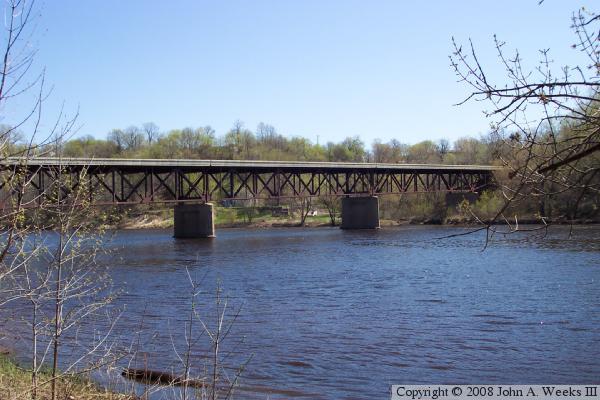
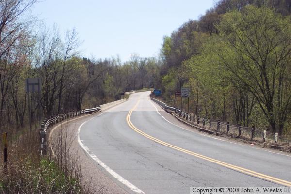
The Highway 243 Bridge crosses the Saint Croix River at Osceola, Wisconsin.
It provides a highway river crossing between WI-35 on the east side of the
river and MN-95 on the west side of the river, two highways that parallel
the Saint Croix. The road on the west side of the river is designated
MN-243, a highway that runs a grand total of 1-1/4 miles. The road on
the east side of the river, WI-243, is the shortest state trunk highway in
Wisconsin.
The Saint Croix River is much more calm here than upstream at the US-8 Bridge.
The river flows through a wide valley rather than being confined between walls
of rock found upstream in the Taylor's Falls area. The channel is wide and
shallow with a calm current. The result is a longer bridge that is built much
lower to the river.
The Highway 243 bridge gained a bit fame after the I-35W bridge collapse in
2007 due to the bridge being one of the few remaining deck truss bridges in
Minnesota. A deck truss bridge has a metal lattice work of cross members,
with the roadway being built on top of the truss. The deck truss is
considered to be an obsolete style of bridge. The reasons include being
fracture critical (i.e., non-redundant, which means that any one piece breaking
can result in the entire bridge failing), they are very hard to inspect (the
structure is under the road rather than above the road), they are easily
damaged by road salt (which can leak though cracks in the deck and cause the
steel to rust), and truss bridges are far more costly to maintain.
The Highway 243 bridge receives routine inspections every other year. An
additional inspection was completed shortly after the I-35W disaster. The
bridge is not considered to be deficient, so it is not being considered for
replacement anytime soon. The bridge was closed, however, for a month in
the Spring of 2010 for refurbishment. Highway 243 was repaved on both the
Minnesota and Wisconsin side of the river as part of this project.
Bridge fan Jake Lennington alerted me to a book titled ‘Osceola A
Village Chronicle Sesquicentennial 1844 1944’ that has a few photos of
the old bridge that was replaced by the current deck truss bridge in 1953.
The bridge consisted of a truss swing span on the Wisconsin side of the
channel and a single through truss span on the Minnesota side of the river.
It appears to have been a very light bridge, single lane, wood deck, and was
braced mostly with cables and rods as opposed to beams. I do not know when
the old bridge was built, but this construction style suggests that it was
built as a wagon bridge prior to the establishment of the highway system in
the 1920s. One of the photos in the book is dated 1910. A photo caption
indicates that the through truss span failed and collapsed into the river
in 1938, and was replaced with a new truss span. Even with this replacement
span, the bridge still carried a 4 ton weight limit. The bridge abutment on
the Wisconsin side of the river still exists, as does the road leading to
the east side of the river. The roadway leading to the west end of the bridge
is abandoned, but still visible on aerial photographs.
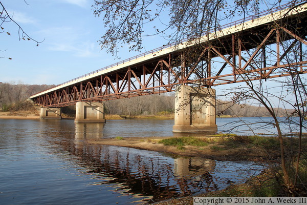
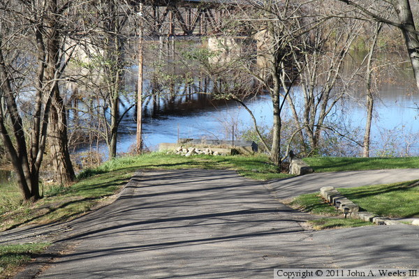
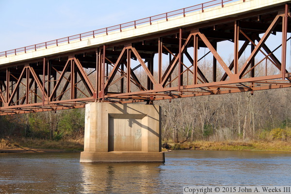
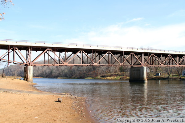
The photo above is looking west along the the downstream south face of the
MN-243 Bridge. The vantage point is a riverfront trail on the Wisconsin
side of the Saint Croix River. The photo below is looking southwest
towards the upstream of the structure. Note that the water level is near
the top of the bridge piers due to an unusual autumn flood in 2010.
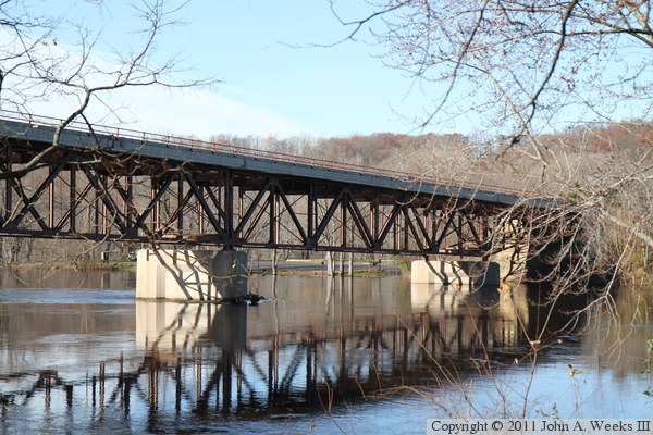
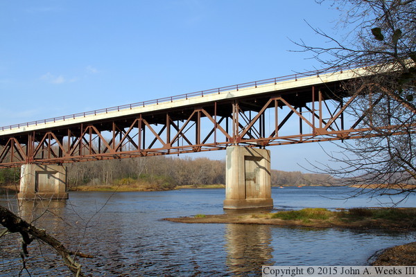
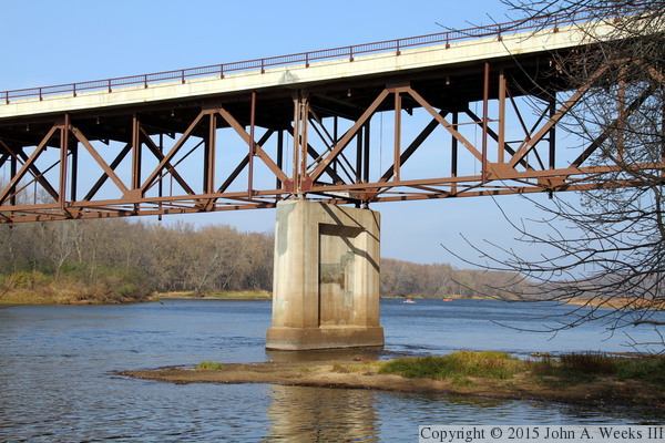
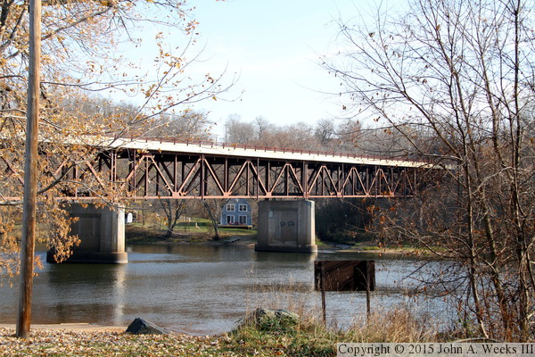
The photo above is a profile view of the Highway 243 bridge as seen from
a park located on the Minnesota side of the river just downstream from
the river crossing. The photo below is another view of the structure
from the same park on the Minnesota side of the river.
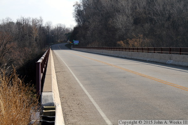
These two photos are views of the bridge deck looking east from the
Minnesota side of the river across the Saint Croix River to the Wisconsin
side of the river. The photo above was taken from the downstream south
side of the highway, while the photo below was taken from the upstream
north side of MN-243. Note that lack of sidewalks or bicycle paths, which
is unfortunate given how scenic this area is and how many people visit
the parks located on both sides of the river.
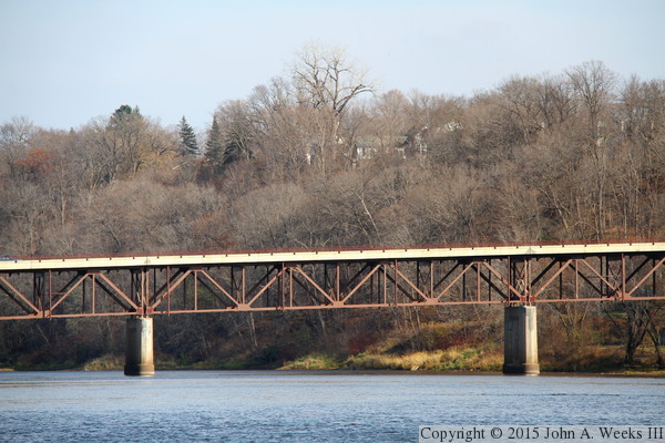
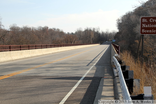
The photo above is looking east down the length of the bridge deck towards
Wisconsin, with a vantage point located a little further west of the two
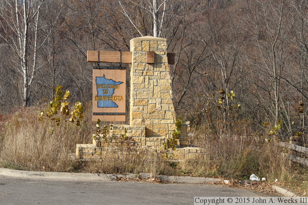
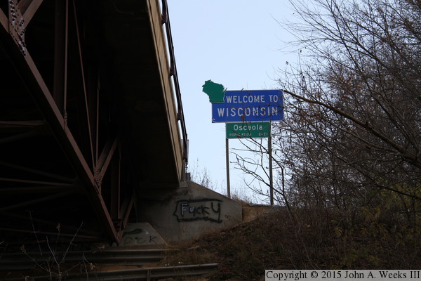
photos above. The photo below is the Minnesota state line sign located on
the west side of the river crossing.
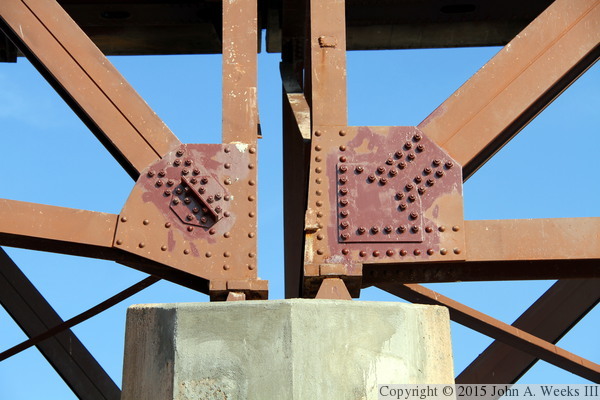
These two photos are detail views of two trusses as they sit on top of
a bridge pier. The photo above is looking north at the south side of the
bridge, while the photo below is looking south at the upstream north side
of the bridge. These repairs were made in 2010, in part due to the findings
from the I-35W bridge disaster. Some of the rivets were drilled out and
replaced with bolts. In addition, plate doublers (and additional steel
plate) were installed over part of the gusset plates to strengthen the
joints.
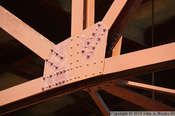
These are mid-span joints where steel truss members are joined with a
gusset plate. Again, we see that some of the rivets have been drilled out
and replaced with bolts.
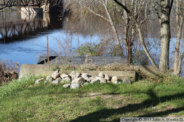
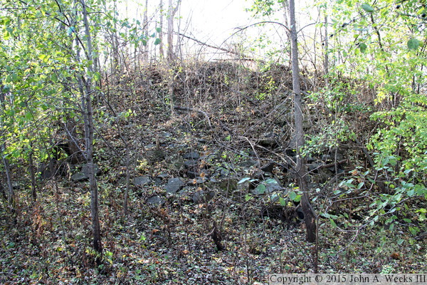
These two photos are views of the east abutment of the old swing bridge
that once crossed the Saint Croix River at this location. It is located
at the west end of 2nd Ave in Osceola and is now on private property. The
photo above is looking west down the hill leading to the old bridge. The
photo below is a closer view of the abutment.
These two photos are additional views of the old swing bridge abutment on
the Wisconsin side of the river.
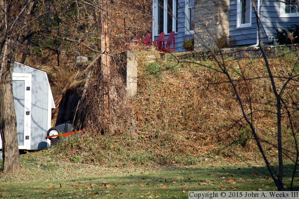
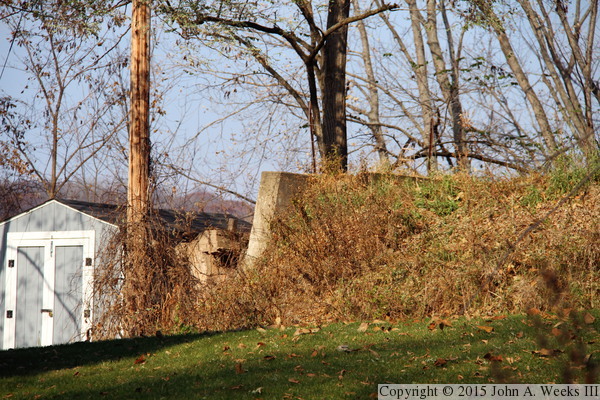
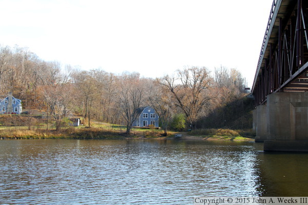
The abutment of the old bridge no longer exists on the Minnesota side of
the Saint Croix River, but the road leading to that location still exists
in the forest just north of highway MN-243. The photo above is the end
of that road where the abutment once stood. The photo below is the view
looking east across the Saint Croix River along the path of the old
bridge, with the east abutment located directly behind the small white
shed that is between the two houses on the far side of the river.
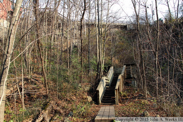
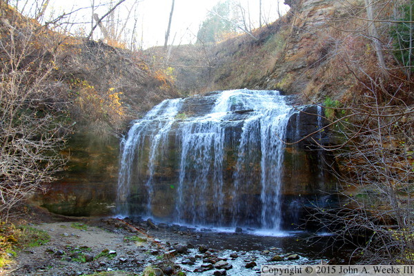
The city of Osceola has built a path down to the Saint Croix River from
Cascade Street, the main street that runs through town. The photo above
shows the large stair structure that takes hikers down into Wilkie Glen,
where Osceola Creek flows into the Saint Croix. Those who take this path
are rewarded with a view of Cascade Falls. The photo below is the lower
portion of the falls, but unfortunately, the view was looking directly
into the midday sun. The city installed LED lighting for the falls in
2013 and they have developed additional trails that take hikers past the
remains of early industry that used water power from this stream.
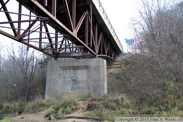
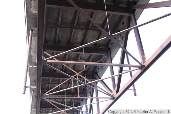
There is a view under the MN-243 Bridge from the trail that leads down
into Wilkie Glen. The photo below is the eastern end of the structure,
while the photo below is the Wisconsin state line sign posted just
beyond the east end of the bridge.
These two photos are views of the downstream side of the MN-243 Bridge
was seen from the riverbank on the Wisconsin side of the Saint Croix
River. This location can be accessed from a trail that runs through
Wilkie Glen from Cascade Street in Osceola. The photo above is looking
almost due west, while the photo below is taken from a little further
downstream.
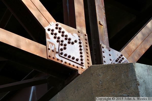
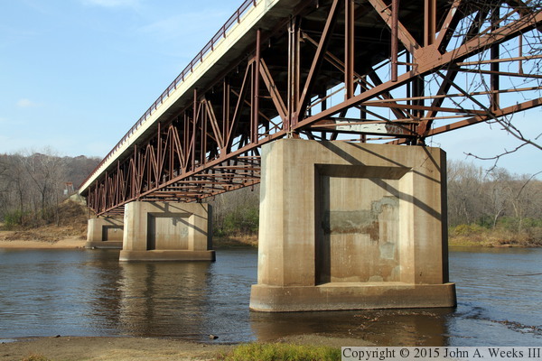
These two photos are closer views of two different bridge piers as
seen from the east side of the river. The photo above is the second
pier (counting from the west), while the photo below is the third pier.
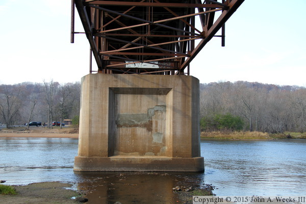
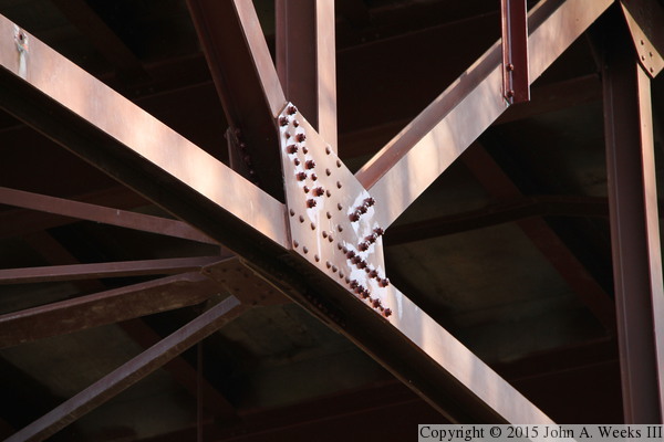
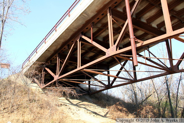
The photo above is the third pier (counting from the west end of the
structure), which is on the Wisconsin side of the river. This view is
from directly below the truss structure. The photo below is looking
up at the bottom side of bridge deck.
These two photos are views of the MN-243 Bridge as seen from the boat
ramp located on the Minnesota side of the river just downstream of
the bridge. The photo above shows the first and second piers (counting
from the west), while the photo below includes the second and third
piers.
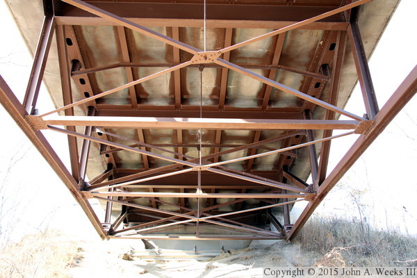
The photo above is the west bridge abutment. The photo below is the
under side of the bridge deck at the west bridge abutment. These two
photos were taken in November, 2011, just over a year after the bridge
was repainted in 2010.
|
