| Highways, Byways, And Bridge Photography |
Lafayette Bridge
US-52 Mississippi River Crossing
Saint Paul, MN
|
• Structure ID: |
NBI: 9800. |
|
• Location: |
River Mile 838.80. |
|
• River Elevation: |
686 Feet. |
|
• Highway: |
US-52. |
|
• Daily Traffic Count: |
75,000 (2002). |
|
• Bridge Type: |
Steel Girder. |
|
• Length: |
3,369 Feet, 362 Foot Longest Span. |
|
• Width: |
4 Traffic Lanes, 67 Feet Wide. |
|
• Navigation Channel Width: |
350 Feet. |
|
• Height Above Water: |
51 Feet. |
|
• Date Built: |
Opened November 1968, Rebuilt In 1992. |
US-52 crosses the Mississippi River 3 times, first at a crossing between
Savanna, Illinois and Sabula, Iowa, here at the Lafayette Bridge, and
again at the I-94 Dartmouth Bridge on in Minneapolis. This is the longest
bridge in Saint Paul at 3,369 feet, but the longest clear span is only 372
feet. Its relatively short clearance of 60 feet above the water forces some
river boats to fold their smoke stacks when they pass under the bridge on
their way to Lambert's Landing downtown Saint Paul.
This bridge narrowly averted disaster in 1975 when one of the large
main steel girders developed a crack. Despite being less than 10
years old at the time, the crack was already several inches wide.
The problem was noticed when the bridge deck sagged by 7-inches.
It is only by luck that the bridge did not collapse. Engineers
had to jack the southbound lanes back into position, and large
steel plates were bolted onto the cracked girder to fix the problem.
The Lafayette Bridge is built with a design that is called "fracture
critical". That means that there are certain parts on the bridge
where if one such part fails, the entire bridge might collapse. As a
result, MN-DOT has been watching this bridge carefully. The bridge
is being inspected on a regular basis since MN-DOT does not want a repeat
of the I-35W disaster. In late 2007, MN-DOT announced that the Lafayette
Bridge was scheduled to be replaced in 2011.
I often find conflicting numbers for the length of a bridge. As bridges are
remodeled, the end points sometimes change. Others might have different
methods for measuring a bridge, including how they treat any trestles leading
up to the bridge structure. In this case, I have seen length numbers of
3,366 feet (NBI), 3,375 (Mary Costello), and 3,709 (Historical Society), yet
the end points of the bridge seem unambiguous and have not been changed over
time. The 3,366 appears to be a typo of 3,369, and the 3,709 number
mistakenly includes the overpass over I-94. The correct number, according to
MN-DOT is 3,369, which they quote as 0.638 miles.
The photo above is taken from Warner Road on the north side of the river.
One can see the larger steel girders over the main river crossing, and
the smaller steel girders on the approach spans.
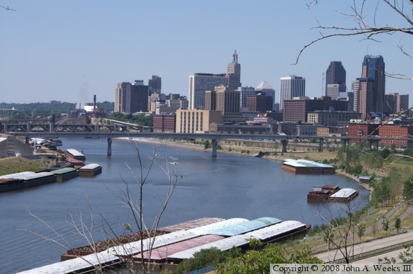
The photo above is a view from Mounds Park high above the river level. This
view is looking west towards downtown Saint Paul. The photo below was taken
on a rainy afternoon when I had an opportunity to legally enter the rail
yard on the north side of the river. This view shows the entire main span.

The photo above is an attempt to show just how long the Lafayette Bridge
really is. Here, we see the main span and the approaches on the north side
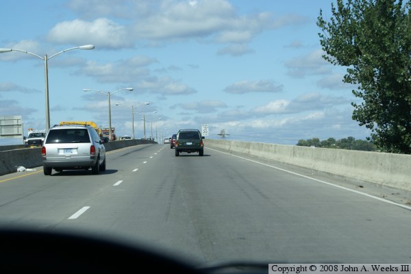
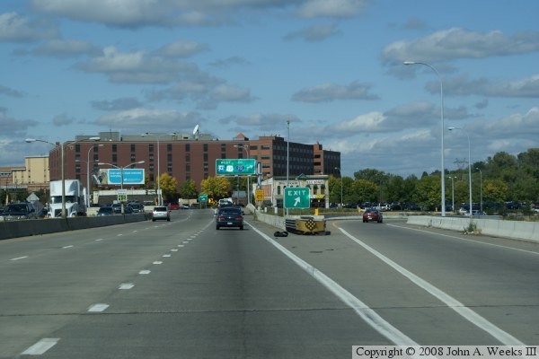
of the river. The photo below is the start of a crossing heading northbound
on US-52 over the Lafayette Bridge. In this view, we are heading up the
hill towards the start of the bridge. The bridge starts where the guard
rail changes from metal to concrete just beyond the big green sign.
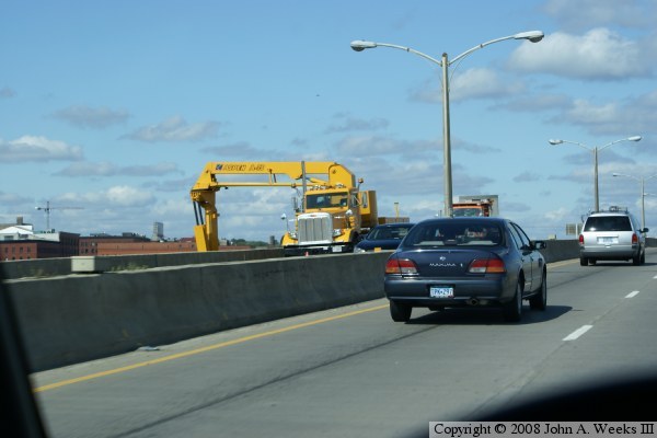
In the photo above, we continue to cross the bridge, heading slightly uphill
to reach the peak elevation of the main river span. The photo below shows
the MN-DOT bridge inspection truck at work. This truck has a platform
that allows workers to have access to the underside of the bridge.
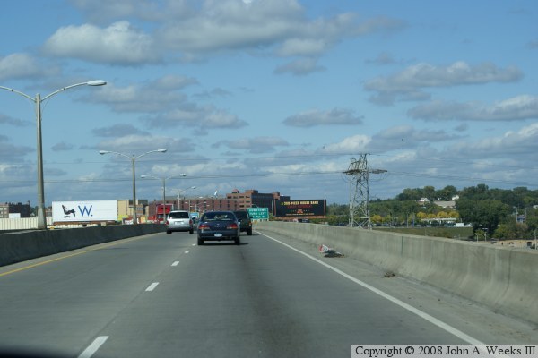
The photo above is a view from the peak of the main river span. From this
elevation, the bridge remains relatively level until the end of the bridge.
This is due to the north side being higher in elevation than the south side.
The photo below shows our trip as we near the end of the bridge.
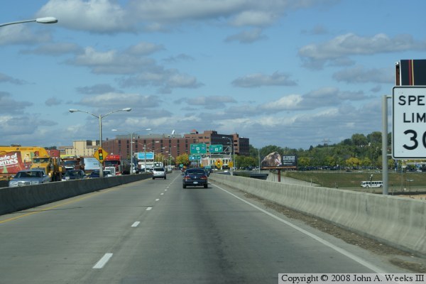
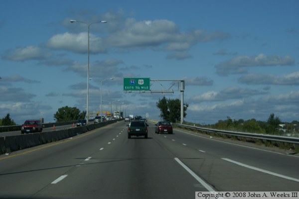
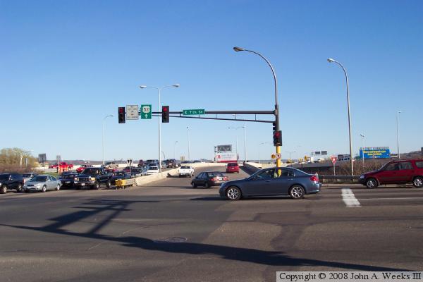
We have decisions to make at the very end of the bridge. The lane that
we are traveling in makes to very sharp corners and ends up on westbound
I-94, which can then merge onto I-35E. The lane to our right connects
to I-94 eastbound. The local lanes head into an old warehouse area that
has been recently been redeveloped into a number of state office buildings.
The photo below is looking in the reverse direction of the photo above.
Here, we see the traffic lights at the very north end of the bridge.
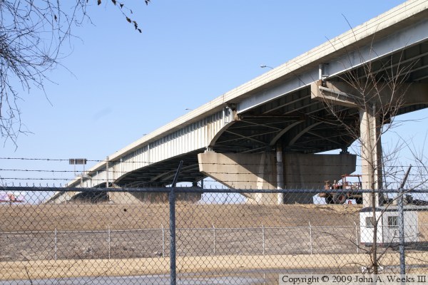
These photos are two views from under the smaller spans at the south end
of the bridge. The photo above is looking south, where the bridge crosses
a salvage yard. The photo below is looking north, where the bridge crosses
a vacant industrial lot, a flood protection levee, and a barge repair yard.
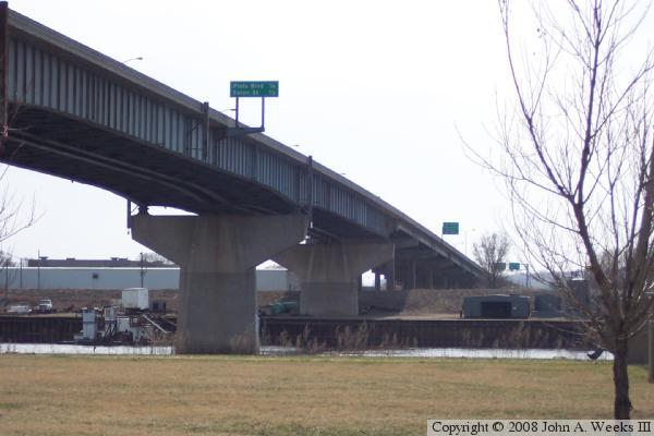
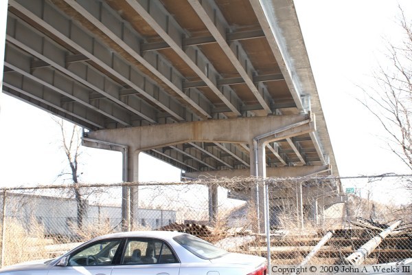
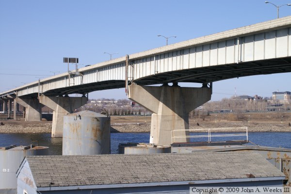
The photo above is a view of the transition between the smaller spans on the
south end of the bridge and the larger main channel spans. Note that the
smaller spans have 8 parallel beams, while the larger spans have only 4 beams.
The photo below is a view of the bridge span over the river navigation channel.
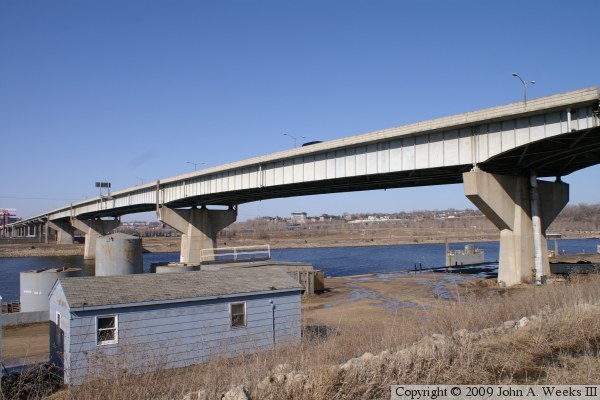
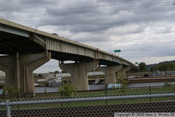
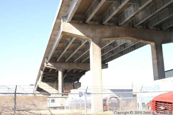
These two photos are views of the main channel spans as seen from the
levee on the south side of the river. The bridge piers have a single
vertical support for these spans. Note that the steel beams are much
taller on this section of the bridge.


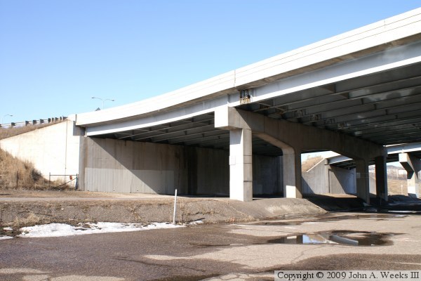
The photo above is a view of the south end of the bridge and the south
abutment. In this area, the bridge crosses Alabama Street, East Fillmore
Avenue, and a salvage yard. Note that the bridge piers have only two
columns on this section of the bridge. The photo below is a view of
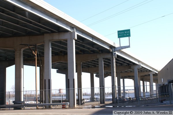
several spans between the north abutment and the main channel spans.
The bridge crosses a park and ride lot, East 4th Street, two parking
lots, a factory storage yard, a set of railroad tracks, Kellogg Boulevard,
and Warner Road. The piers on this side of the bridge have had additional
sections grafted on to support the addition of an entrance ramp and
merging lane that was not part of the original construction.

These two photos are views of the north end of the bridge. The photo above
shows the span over the park and ride lot, which is the first of the taller
spans. The photo below shows the north abutment and the first span, which
crosses East 5th Street.
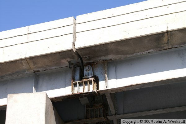
The photo above is a close view of a joint between sections of the smaller
bridge spans. The metal shows signs of corrosion, and places where the
corrosion has been fixed. These joints have been an endless source of
problems on this bridge, with one joint having deteriorated so badly as
to coming close to failing. The photo below is a few down the center
of the bridge under the structure. The bridge crosses several streets,
a parking lot, railroad tracks, the river, a boat yard, and a salvage
yard.

|
