| Highways, Byways, And Bridge Photography |
Hastings High Bridge
US-61 Mississippi River Crossing
Hastings, MN

|
• Structure ID: |
NBI: 5895. |
|
• Location: |
River Mile 813.90. |
|
• River Elevation: |
674 Feet. |
|
• Highway: |
US-61. |
|
• Daily Traffic Count: |
30,500 (2002). |
|
• Bridge Type: |
Continuous Steel Arch Truss w/Suspended Roadway. |
|
• Length: |
1,861 Feet, 514 Foot Main Span. |
|
• Width: |
2 Lanes, 32 feet wide. |
|
• Navigation Channel Width: |
502 Feet. |
|
• Height Above Water: |
64 Feet. |
|
• Date Built: |
Opened 1951. |
The Hastings High Bridge is the second automobile bridge to cross the
river in this area. The first was the famous Hastings Spiral Bridge,
which was built for wagon traffic in the 19th century. The current
bridge is the busiest two lane highway bridge in the State of Minnesota.
It also is the northernmost steel truss bridge still open to automobile
traffic on the Mississippi River.
Time may be catching up with this structure, too. Hastings is now
part of the Minneapolis/Saint Paul metro area, and US-61 is now a 4-lane
65-MPH expressway and freeway starting at the north end of the bridge.
The new bridge is lacking in capacity, and the structure has
deteriorated a bit, so talk is underway about replacing the High Bridge,
one of the most graceful Mississippi River crossings in the upper
river section.
Update—as of Spring 2008, MN-DOT has determined that the
Hastings High Bridge is at the end of its life. The bridge has structural
problems that are no longer economically feasible to fix. This includes
a lot of rust, and a structure that has shifted enough to shear off bolts.
The bridge has been given a very high priority for replacement, perhaps
third in line for major bridges after the DeSoto Bridge and Lowry Bridge.
In the Summer of 2008, MN-DOT ran a stop-gap project to try to extend
the life span of the bridge a few years. During construction, the bridge
was reduced to one lane. Traffic lights allowed groups of cars to cross
the bridge in alternating directions.
The photo above is a view of the bridge on a chilly autumn afternoon
from just downstream of the structure. The plaque and concrete posts
along the edge of the river is a memorial to the old spiral bridge.
The photo below is a view from the sidewalk on the west end of the
bridge in downtown Hastings.

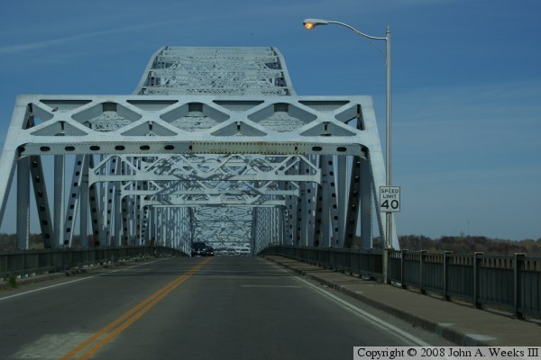
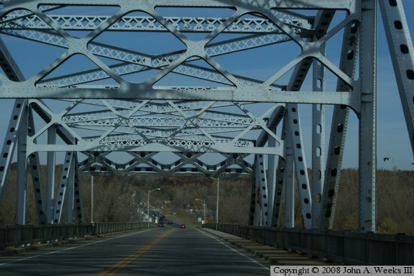
These two photos show a typical crossing of the bridge. The photo above
is traveling east towards the main span. The photo below is a view under
the arch.


These photos are two views under the bridge from Main Street. The photo
above is looking through the openings in each of the piers to the other
side of the river. The photo below is a view of the bridge from ground
level. The transition from from being a concrete girder bridge to being
a steel truss bridge happens on the pier nearest to our view.


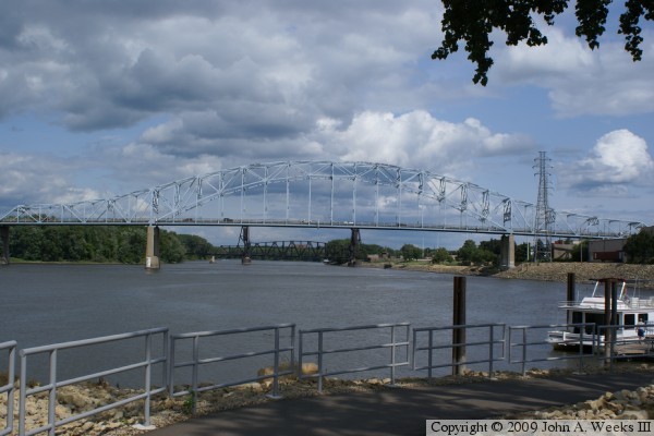
The photo above is a view looking east from the city park along the
Mississippi River near the Lock & Dam #2. The photo below is a similar
view from the same park, but from a location closer to the bridge.
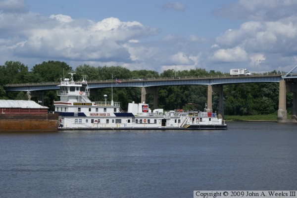
The photo above is looking east towards the upriver face of the steel girder
approach spans located to the north of the main river span. The tow boat is
holding in the navigation channel waiting for clearance to enter the lock at
Lock & Dam #2. The photo below is looking west from the riverfront park
in downtown Hastings from a vantage point near the Milwaukee Road lift bridge.


These two photos demonstrate how the Hastings High Bridge dominates the
skyline in the small town of Hastings. The photo above is your first view
of the bridge when cresting the river bluff on the south side of the
Mississippi River heading north on US-61 towards the crossing. The photo
below is an example of the traffic problems caused by the bridge. US-61
is a heavily traveled road that is 4 lanes in much of the state, yet the
bridge is only two lanes. This can cause large rush hour backups.


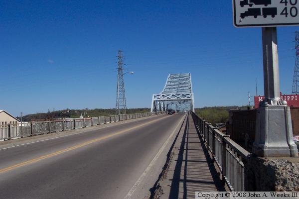
The next five photos show another river crossing, this time from November
of 2008. The photo above shows the start of the bridge, and the weight
limit signs that have been posted as a result of the structural issues
found in post I-35W collapse inspections. The photo below shows the
south portal of the truss span. Notice the metal plate riveted to the
bridge above the traffic lane. This is a repair from where a truck hit
the bridge and damaged the steel.

We continue our bridge crossing in these two photos. In the photo above,
we are under the main arch. Notice that the bridge uses boxed metal
beams to connect from the arch to the roadway. A more modern structure
would likely use cables or metal rods. The photo below is a view exiting
the truss span heading north.

The photo above is the last view showing a 2008 crossing
of the Hastings High Bridge. In this photo, we are just about to exit the
bridge heading north toward the Twin Cities. Notice that the road goes
back to a 4 lane configuration at the north end of the structure.
The photo below is a view of the bridge as seen from the river bluffs on
the east side of the river looking to the northwest. The bridge deck
appears to be right at tree-top level in this view.


The photo above is a
sign erected by MN-DOT during the 2008 construction. It warns travelers
that there might be lengthy delays in crossing the bridge while it is
reduced to a single lane. In some areas of the city, MN-DOT included
a digital display on these signs to inform drivers of the current delay.
This delay was often over 20 minutes.
|
