Current Weather Conditions
John A. Weeks III
Sunday, September 8, 2024, 5:10:00 PM CDT
Home Photo Tours Rail Fan 12 Easy Steps
Aviation Spacecraft Highways & Bridges About The Author
 
Google Search
Maps   Groups   Images   Search
 
  Home
  • 12 Easy Steps
  • Aviation
  • Spacecraft
  • Highways & Bridges
    » Bridge Photography
      - MSP River Bridges
        › 10th Avenue Bridge
        › Arcola High Bridge
        › Betty Adkins Bridge
        › Bloomington Ferry
        › Bloomington Fry Tr
        › BNSF RR Bridge
        › Boom Island Foot Br
        › Broadway Avenue Br
        › C&NW Bridge (1)
        › C&NW Bridge (2)
        › Camden Bridge
        › Cedar Avenue Bridge
        › Cedar Ave Br (Old)
        › Cedar Ave Bicycle Br
        › Cedar Bend RR Br
        › Chaska Bridge (Old)
        › Chaska Swing Bridge
        › Chaska Trestle
        › Coon Rapids Dam
        › CP RR Bridge
        › Dan Patch Line Br
        › Dartmouth Bridge
        › East Channel Bridge
        › East Channel RR Br
        › East River Flats Br
        › Endless Bridge
        › F. W. Cappelen Mem
        › Father Henn Bluffs
        › Father Louis Henn Br
        › Ferry Street Bridge
        › First Avenue Bridge
        › Fort Road Bridge
        › Fort Snelling Br (Old)
        › Fort Snelling High Br
        › Great Western Bridge
        › Grey Cloud Channel
        › Grey Cloud Island Br
        › Grey Cloud Trail Br
        › Hastings High Bridge
        › Hastings Spiral Br
        › Holmes St Ped Bridge
        › Highway 243 Bridge
        › I-35W Bridge
        › I-35W Bridge (Old)
        › I-494 Bridge
        › I-694 Bridge
        › Interstate Bridge
        › Intercity Bridge
        › L St. Anthony F L&D
        › Lafayette Bridge
        › Lake Street Bridge
        › Lewis Street Bridge
        › Lexington Bridge
        › Lions Levee Pk Foot
        › Lock & Dam #1
        › Lock & Dam #2
        › Long Meadow Bridge
        › Lower Bridge
        › Lowry Bridge (Old)
        › Meeker Island L&D
        › Mendota Bridge
        › Merriam Street Br
        › Mill Ruins Park Br
        › Milwaukee Road Br
        › M&StL Bridge
        › Miss River Bridge 15
        › MN-101 Bridge
        › MN-41 Backchannel
        › MN-41 Back Ch (Old)
        › MN-41 Bridge
        › New Saint Croix Br
        › New Trunk-41 Bridge
        › Nicollet Island RR Br
        › North Miss Park Pier
        › NP Bridge #9
        › NP RR Bridge
        › Pike Island Bridge
        › Plymouth Bridge
        › Point Douglas DB
        › Raspberry Island Br
        › Richard P. Braun Br
        › Robert Street
        › Rock Island Swing Br
        › Runway 30 Light Br
        › Short Line Bridge
        › Smith Avenue High
        › Southeast Steam Plant
        › St. Anthony Falls Br
        › St. Anthony Falls Lab
        › St. Anthony Falls PP
        › St. Croix Boom Site
        › St. Croix Falls Dam
        › Stillwater Lift Br
        › Stone Arch Bridge
        › Third Avenue Bridge
        › Toll Bridge (Old)
        › U St. Anthony F L&D
        › US-8 Bridge
        › Wabasha Street Bridge
        › Wakota Bridge
        › Wakota Bridge (Old)
        › Walnut Street CW
        › Washington Ave Br
        › WI Central RR Br
        › WI Central RR Ruins
        › Wright Co Hwy 42
      - C & D Canal
      - Illinois River
      - Minnehaha Creek
      - Minnesota River
      - Mississippi River
      - Missouri River
      - St. Croix River
      - St. Louis River
      - Wisconsin River
      - Best Miss River Photos
      - Cable Stayed Bridges
      - McGilvray Road Bridges
      - I-35W Bridge Disaster
      - Miscellaneous Bridges
      - Madison County Bridges
      - Hist Br Weekend 2013
    » Road Geek Topics
  • Photo Tours
  • Rail Fan
  • About The Author
 
Site Search By JRank
Highways, Byways, And Bridge Photography
Lexington Bridge
I-35E Mississippi River Crossing
Mendota Heights, MN to Saint Paul, MN

I-35E Lexington Bridge

• Structure ID: NBI: 62912.
• Location: River Mile 843.30.
• River Elevation: 686 Feet.
• Highway: I-35E.
• Daily Traffic Count: 81,000 (2002).
• Bridge Type: Steel Plate Girder.
• Length: 1,406 Feet, 340 Foot Longest Span.
• Width: 6 Traffic Lanes, 110 Feet.
• Navigation Channel Width: 330 Feet.
• Height Above Water: 64 Feet.
• Date Built: Completed 2004.
The first bridge at this location was completed in December, 1964, as part of the I-35E Interstate highway project. I-35E is the branch of I-35 that runs through downtown Saint Paul, whereas I-35W runs through downtown Minneapolis. The bridge was built as a steel plate girder bridge with 4 lanes and minimal shoulders.

The I-35E project became highly controversial. Neighborhood groups organized under the banner of "RIP I-35E" to attempt to block the project. The first result is that the bridge went largely unused for many years since I-35E did not connect to a freeway on the south end until the mid-1980s, and on the north end to the early-1990s. The second result of the lawsuits were that when I-35E was finally built, it was built as a 45 MPH parkway rather than a standard Interstate Highway. The compromise also prevent some feeder roads from being connected to the highway, such as Ayd Mill Road.

The original Lexington Bridge deteriorated unexpectedly fast, and a new bridge was needed by the late 1990's. Local opposition groups proposed a single 2-lane span to reduce traffic coming into Saint Paul. Their position was that a 2-lane bridge would make traffic backups intolerable, so commuters would find a different route to downtown Saint Paul, leaving the local neighborhoods a zone of bliss. MN-DOT wanted a modern 6-lane bridge. Community groups suggested a 4-lane compromise. The courts finally threw the NIMBY lawsuits out, and a full 6-lane bridge was built, 2 through lanes in each direction plus one local lane in each direction.

The construction of the new bridge was an impressive project. The new bridge was constructed in the same place as the old bridge, while keeping 4 lanes of traffic open at all times. A new span was built just south of the old bridge. When it was ready, northbound traffic was routed over that span. The old south span was then tore down, and a new span put in its place. All 4 lanes were now on the new bridge, which allowed the old north span to be tore down and replaced. Once all 6 lanes of the new span was built, traffic was moved to the outside lanes to allow the center divider to be built.

Shortly after the new Lexington Bridge opened in 2004, MN-DOT installed a bridge anti-ice system. This consists of a reservoir of de-icing chemicals, sprinkler heads embedded in the roadway, and pumps and piping to connect the system. When temperatures are right for ice to form, the system pumps de-icing chemicals onto the bridge, preventing the ice from forming. The system has been very successful, and has been credited with preventing many accidents each winter.

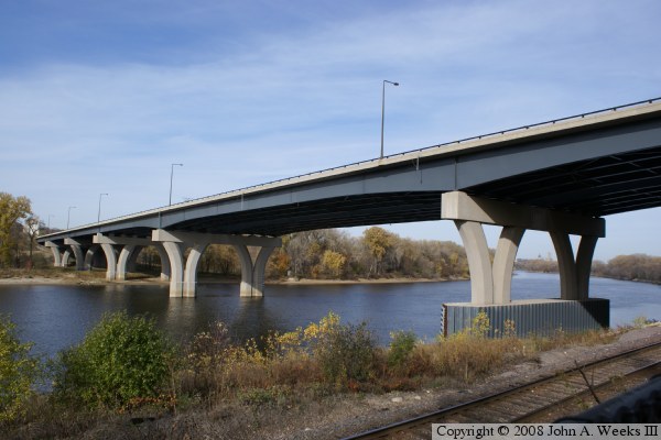
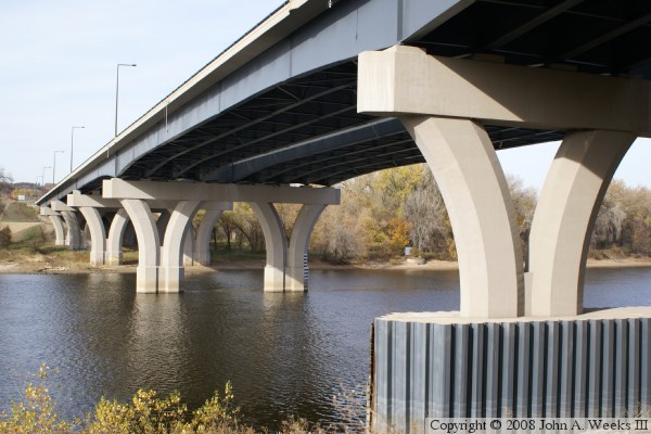
While the new bridge is very utilitarian looking, it does have some decorative elements in places where they did not excessively increase building costs. One example is the modern street lights with the right angle joint and square lamp fixtures. The piers feature a graceful Y-shape, which saved money by having smaller footprints at the base, and then spreading out the load on the top. A final feature of note is the regional trail crossing on the bridge. The trail has intricate metal rails, and features several overlooks complete with park benches.

Update—on July 7, 2009, MN-DOT reported that part of the barrier that protects the southern pier of the Lexington Bridge collapsed and fell into the river, blocking about 20 feet of the navigation channel. It appears that the bridge pier was struck by a barge. The bridge itself was not damaged. Navigation lights were placed around the debris. It will be removed from the river later in 2009.


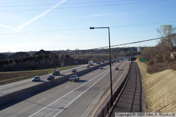
I-35E Lexington Bridge
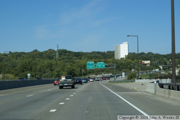
The photo above is a view of the bridge looking northbound from the MN-13 overpass. The regional trail in the foreground continues across the downriver side of the bridge. The photo below is a view from traffic level showing the south approach to the bridge. The ramp that is entering on the right is from Shepard Road.

I-35E Lexington Bridge
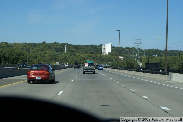
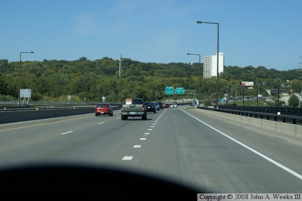
The next three photos show a typical crossing of the Lexington Bridge headed northbound. In the photo above, we are just entering onto the bridge in the center northbound lane. The lane to the right just entered from MN-13, and will exit to Shepard Road at the end of the bridge. The photo below is taken at the mid-channel spot.

I-35E Lexington Bridge
The photo above is the final photo of a 3 photo series showing a typical river crossing headed northbound. In this view, we are just exiting the bridge. We are now in the right lane, and will exit onto Shepard Road.

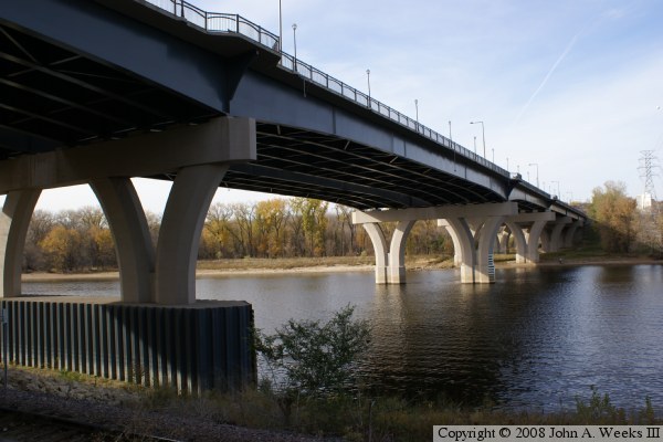
The photo below is a view of the bridge looking downriver and northeast towards downtown Saint Paul. This photo was taken in the fall of 2008 during a low water period.


I-35E Lexington Bridge
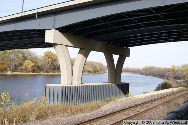
The photo above is a close view of the first pier on the south end of the structure. The river navigation channel runs close to this pier, so it was important to protect this pier from scour with steel sheet pile. The photo below shows the remainder of the piers under the bridge as a comparison.

I-35E Lexington Bridge
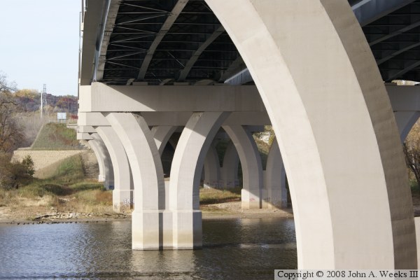
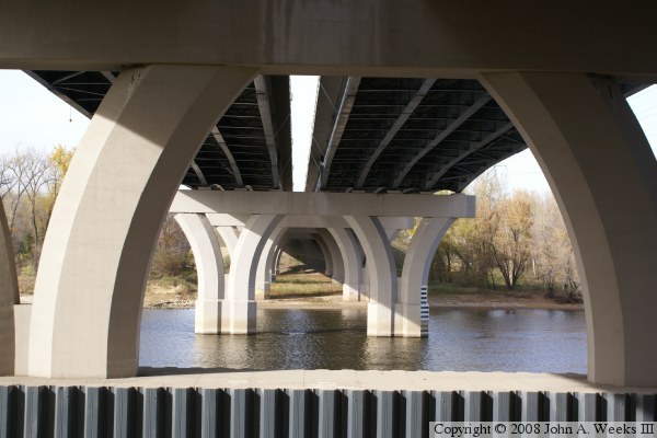
These two photos were taken directly under the Lexington Bridge. The photo above gives a view of the details of the metal cross-braces between the girders. In the photo below, we see that the two bridge decks are independent spans, but the piers are tied together. As a result, this is considered to be a single bridge.

I-35E Lexington Bridge
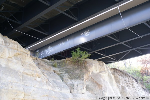
The photo above is the southern abutment of the bridge, which sits directly on the sandstone rock outcropping. This is one of the view places that this author has seen graffiti on any bridge in the metro area. The photo below is a downstream view of the bridge. Notice that there is a person on the opposite bank fishing. That area is part of the Lilydale-Harriet Island Park.

I-35E Lexington Bridge
The photo above is a view from the Big Rivers Regional Trail, looking west at the bridge. This photo shows that the first span of the bridge crosses not only the trail but also a very active Union Pacific Railroad line. The railroad line is the former Omaha Road tracks that use the Bridge #15 swing bridge just upstream. The regional trail is built on the old Milwaukee Road tracks that were bypassed when the Short Line was built between Minneapolis and Saint Paul.

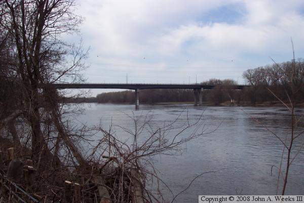
The photo below is taken from Lilydale Road downstream from the bridge. The river bank is lined with brush, making it hard to get a clear field of view for photography.


I-35E Lexington Bridge

Made With Macintosh
Authored by John A. Weeks III, Copyright © 1996—2016, all rights reserved.
For further information, contact: john@johnweeks.com